(Click slider photo to see caption)
David did very thorough research for our one-month trek across Frank Church and Selway-Bitterroot Wilderness summer 2025 in Idaho and Montana, seeking cleared trails. The two vast wilderness areas once boasted more than 4000 miles of trails, but now only major trails are kept open due to combined impact of dozens of severe crown fires (with related erosion, down trees, and explosive shrub growth) and greatly reduced federal agency funding for field work.
Advice from Forest Service district staff and the energetic and knowledgeable Ryan Ghelfi, executive director of the Selway Bitterroot Frank Church Foundation prompted David to drop many appealing but uncleared routes through the lake and high country. (Ryan both organizes nonprofit trail work and hikes in both wilderness—he and two friends were the only backpackers we encountered hiking through the Frank!) David’s final route only followed reportedly recently cleared trails and about 80 miles of boundary roads.
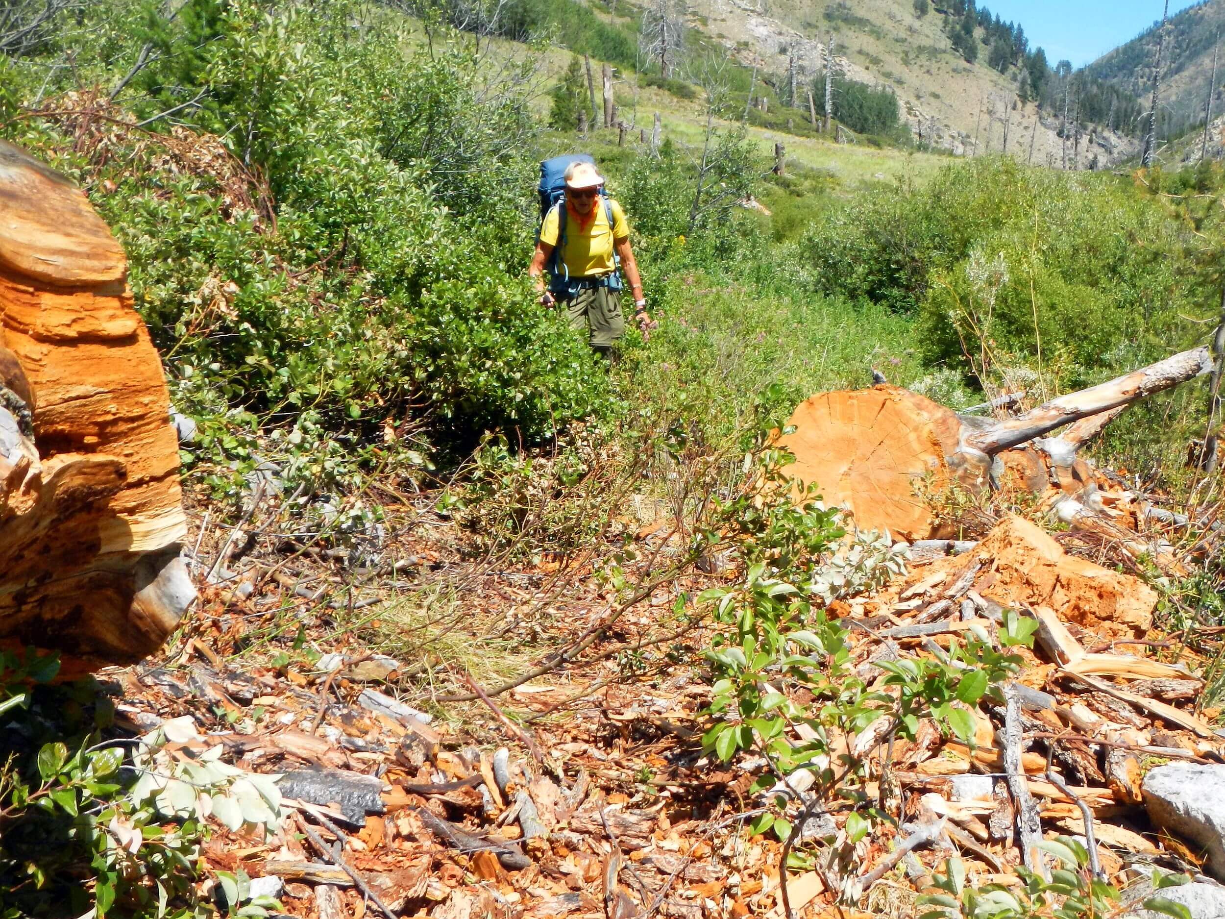
Even though 96% burned, we found fair trail on the Middle Fork Salmon River all the way from Marsh Creek to the Indian Creek Guard Station, our first fly-in resupply point. Forest Service or nonprofit crews had been through recently; only one section of trail south of Dagger Falls had post-fire ceanothus; further north, a volunteer crew had brushed and even re-routed a section of trail.
When we turned onto Pistol Creek to leave the river for high ridge country, we were told that a trail crew had come through just the week before. Great!
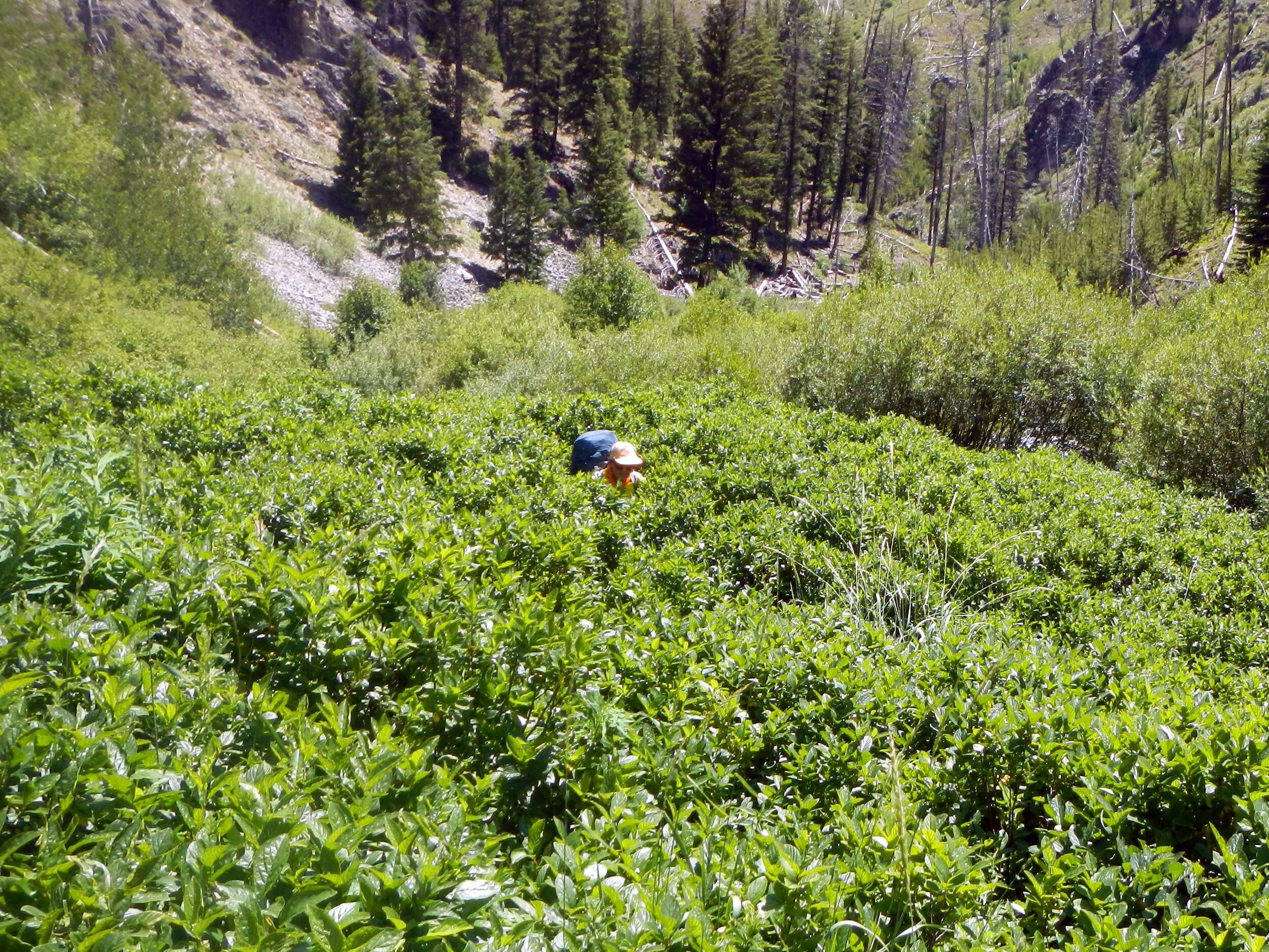
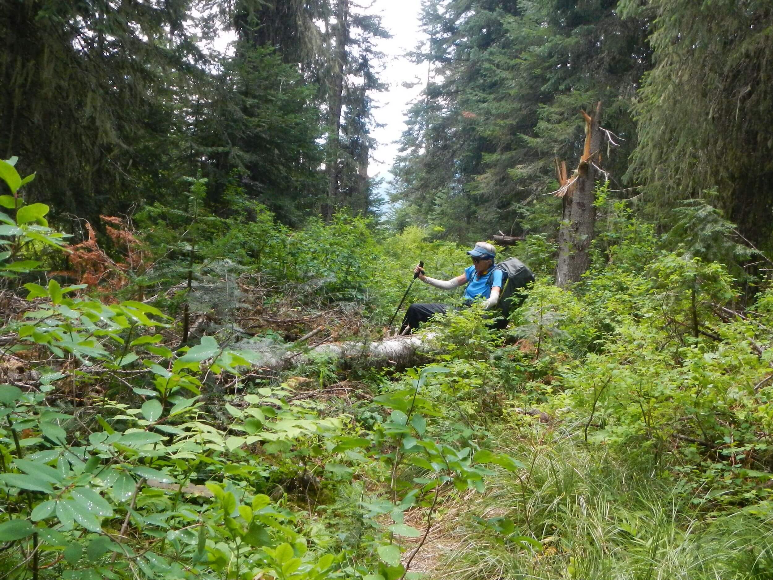
We saw cut logs and even some shovel work where trail was eroded on a side slope. However, a few miles up the heavily burned creek, I encountered chin-high brush in wet areas. On one brushy patch, I tripped on a hidden rock and fell face-forward off the trail down a side slope. David had to pull the backpack off me and pull me up from my waist onto the trail!
We were soon to learn that over-taxed field crews rarely cut brush on these wilderness trails—probably too labor intensive and time consuming with the non-mechanized clippers required by Forest Service “minimum tool” wilderness policy. Ironically, a fire crew with mechanized brush cutters and chainsaws could probably clear a good trail like Pistol in a couple of days. Unfortunately, fires are greatly stimulating brush growth; 73% of the trails and roads hiked in out 361-mi trek were recently burned.
I was knocked down and beat up by brush on Pistol and Bargamin creeks in the Frank Church, and White Cap and Tin Cup creeks in Selway-Bitterroot. Brush was problem between about 4500- and 6000-ft elevation (sometimes depending upon aspect) with more reasonable trails in lower and higher elevations.
The basin near top of White Cap had burned badly with down logs and some brush. Above that very nice going on switchbacks to Triple Lakes and a beautiful pass above.
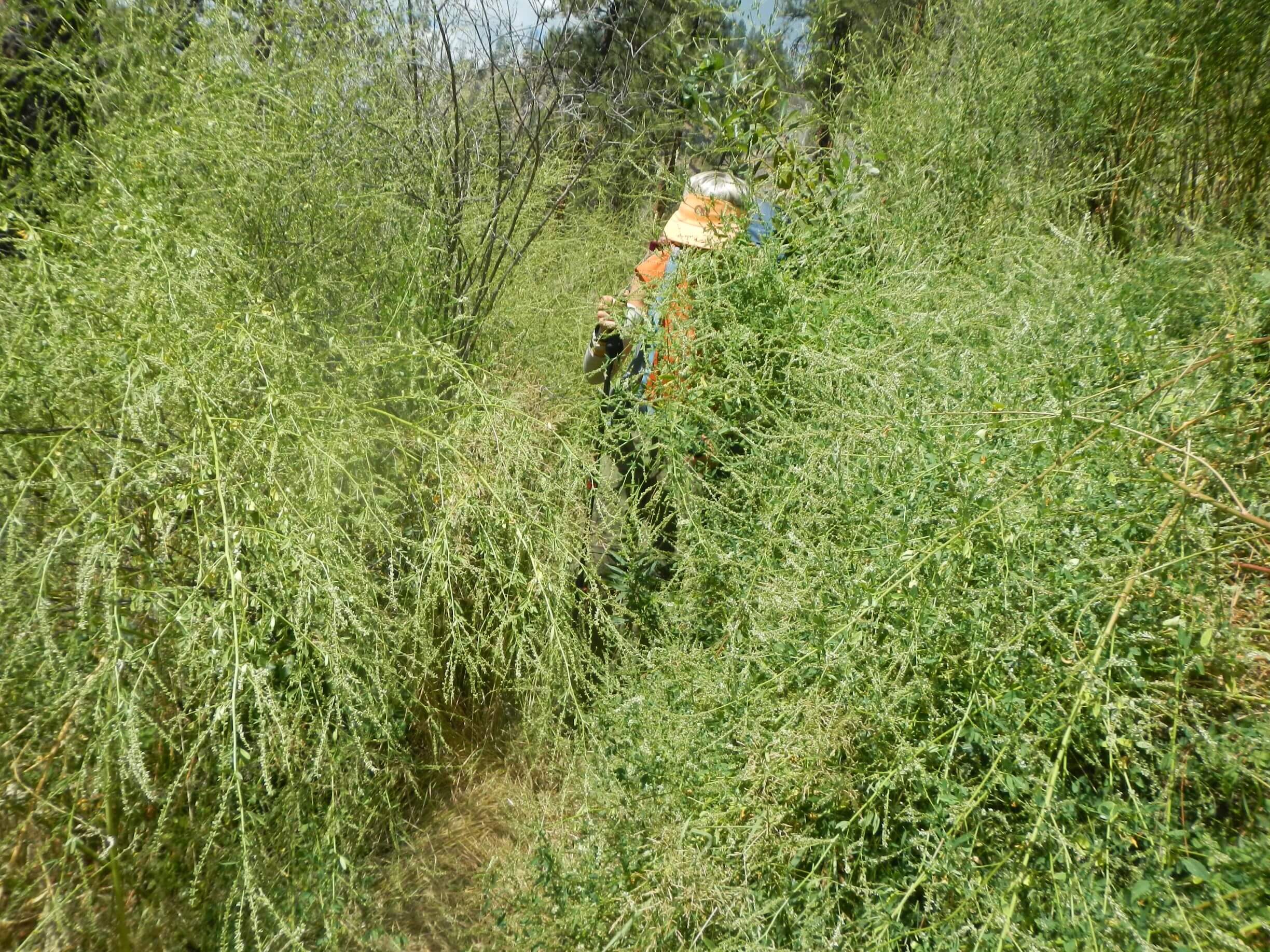
I had high hopes as we descended switchbacks to Tin Cup “Lake,” a big reservoir below. But last miles contouring around the lake were brushy again. At far end we discovered remnants of a dam and old road used to construct the dam (built in 1906 for water storage, breached in 1998 as safety hazard and recently rebuilt to restore summer flows and fisheries in the creek).
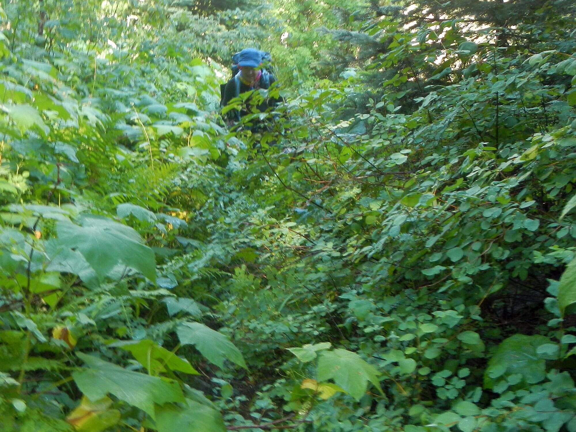
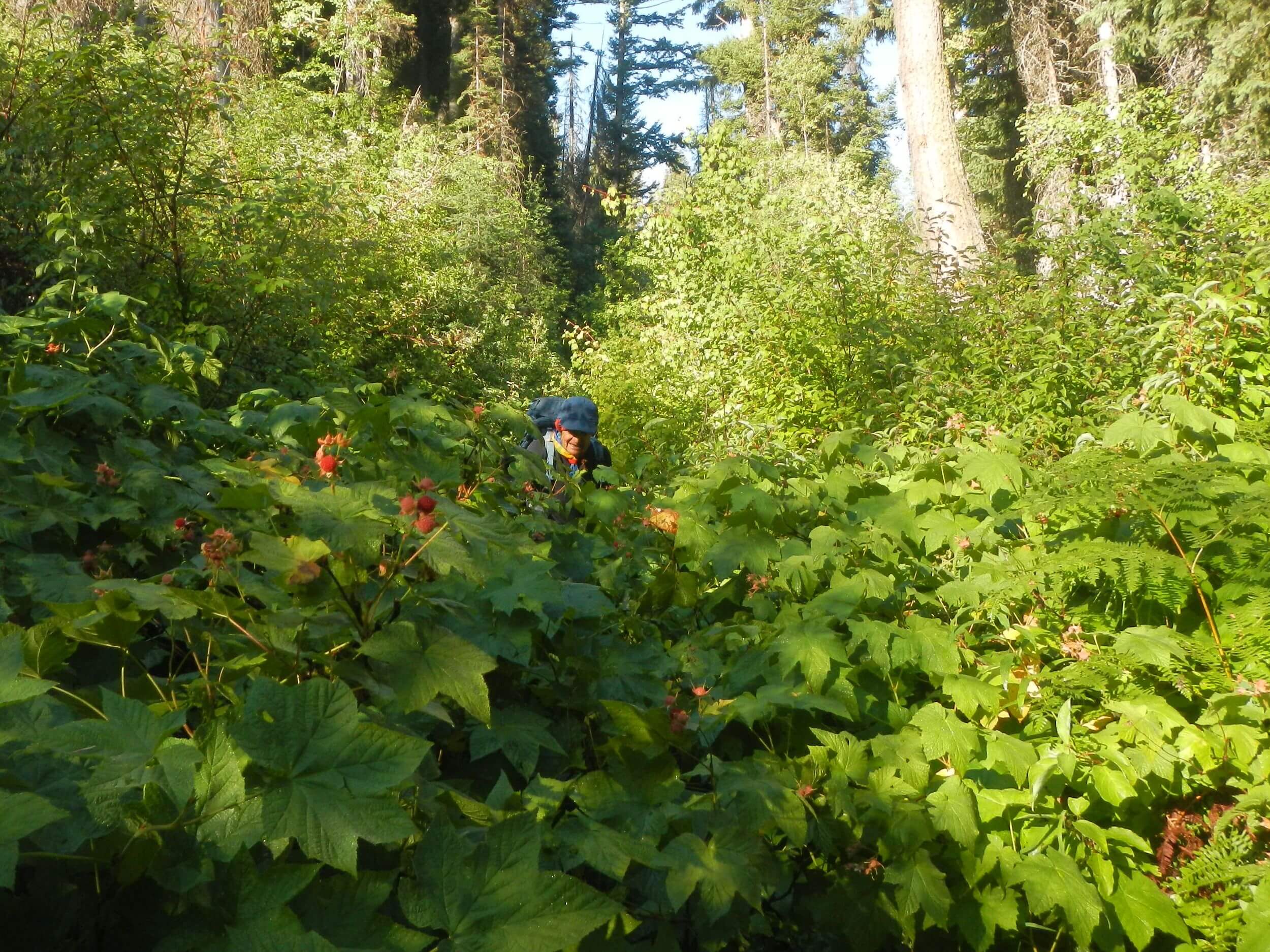
I hoped the road down would be wider with less brush but the road—used as recently as 2017 for work to rebuild the creek banks and improve fish and beaver habitat—soon narrowed to thin path through brush! Thimbleberry was one of the worst offenders, providing waist and chest high brush for tripping at every drainage crossing—but offering some consolation in the form of somewhat edible berries! Finding a campsite on steep slopes was nearly impossible, particularly in driving rain that met us early that evening. David settled for a somewhat flat area created by a decayed large tree.
Tread better and more road-like a few miles below the dam. Very little foot or stock traffic until about 7 miles down from the reservoir; a slick-rock area beside some very pretty falls on Tin Cup Creek. Crossing below this, the trail was more heavily traveled with little brush for the rest of the way out. We also started meeting afternoon day hikers and even a fire crew.
We had planned about 50 more miles hiking in the Selway-Bitterroot Wilderness north of Darby, using two loops up/down creeks assisted by a local outfitter who would drop us off and pick us up at trailheads. However, we expected more brush on lower elevation creeks.
So, we opted for two out-and-back treks starting at 6000-ft elevation trailheads—one into Carlton Lake basin west of Lolo and one into Holoway Lake basin west of Florence. These were facilitated by an outfitter who picked us up at our Vrbo rental near Darby and shuttled us to and from the two trailheads. Routes were selected from Selway-Bitterroot maps without help of Google Earth imagery nor local trail condition queries, but trails were good and brush minimal due to high elevations. Both had significant fire damage, later determined to be from the 62,000-acre Lolo Peak Fire in 2017 that burned 95% of our route.
We ended up with fewer miles and less traversing through Selway Bitterroot Wilderness than we had originally hoped. Also met lots more people—day hikers to Lolo Peak on first trek and combination of day hikers and backpackers on the second. But we had beautiful lake camps, some incredible views and, best yet, no more falls for me!