Offering tips on complicated information Apps
We use many websites for planning trips. All are listed here with introductory information. If you need more specific step-by-step guidance on how to use aids feel free to contact us at .
We use many websites for planning trips. All are listed here with introductory information. If you need more specific step-by-step guidance on how to use aids feel free to contact us at .
Google Earth is a workhorse that we use for many things. All our wilderness visit tracks are available for download as Google Earth kmz files. It is also invaluable for route planning and for displaying kmz files available from other … Read More
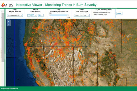
MTBS or Monitor Trend in Burn Severity is a website that benefits from the billions of dollars spent on fire control every year by federal agencies. The MTBS site includes a wealth of information on every wildfire in the U.S. … Read More
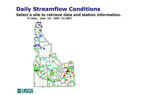
U.S. Geological Survey has a complicated website on water monitoring information that is scheduled to be changed within a year or so (we hope for the better). So we will not spend too much time trying to explain present system. … Read More