(Click slider photo to see caption)
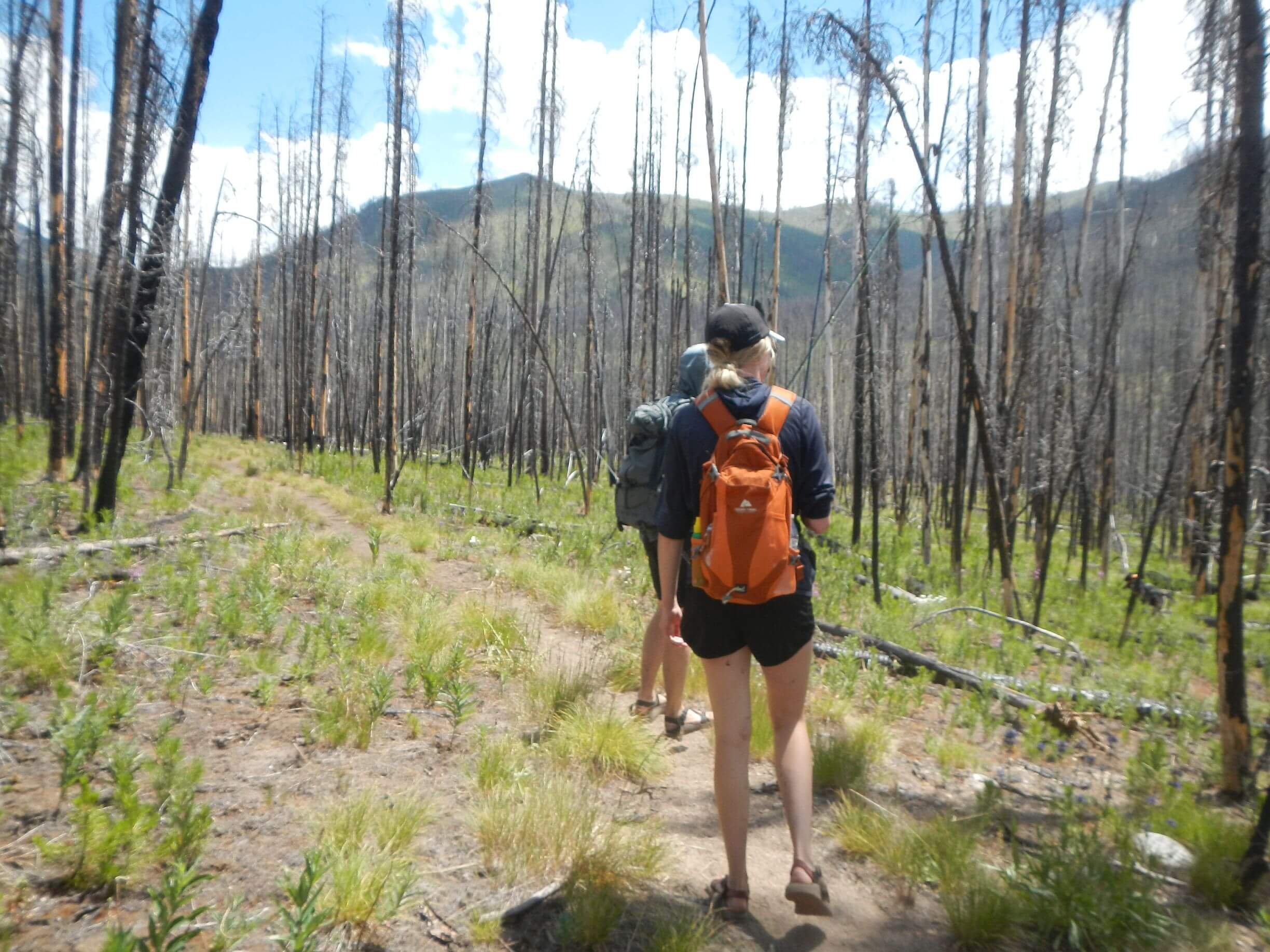
Wilderness was set aside “for the use and enjoyment of the American people” according to the Wilderness Act of 1964. But in hiking more than 300 miles through two of the country’s largest wilderness areas in Idaho and Montana, most people we met were not IN the wilderness but on the boundaries: river or road corridors not burned unusable trails.
With a combined 3.5 million acres, The Frank Church River of No Return (Frank) and the Selway-Bitterroot (Selway) wilderness “represent the largest unroaded block of land in the lower 48 states,” according to a Forest Service website.
David and I wound our way north through these vast rugged areas in July 2025. For the first 321 miles from Stanley Idaho to Darby Montana, we met 9 backpackers in wilderness (mostly near trailheads on short trips and 1 with a dog about two days from Tin Cup trailhead; we later learned he was lost). We also met a 7-member Forest Service trail crew who had backpacked from Chamberlain Basin fly-in airstrip.
But we saw 100s of people on rivers and on boundary roads—particularly the exempted Magruder Corridor Road between the two wilderness areas. Hiking along the Middle Fork and Main Salmon rivers, we constantly saw commercial and private boater groups. At Big Creek Lodge on edge of Frank Church, we met fly-in pilots and others who drove in on backcountry road as well as one backpacker couple who came up Big Creek from Bighorn Crags. A day earlier we would have met on the trail. Along rivers, we also met caretakers of beautiful “inholdings”—private land within national forest wilderness.
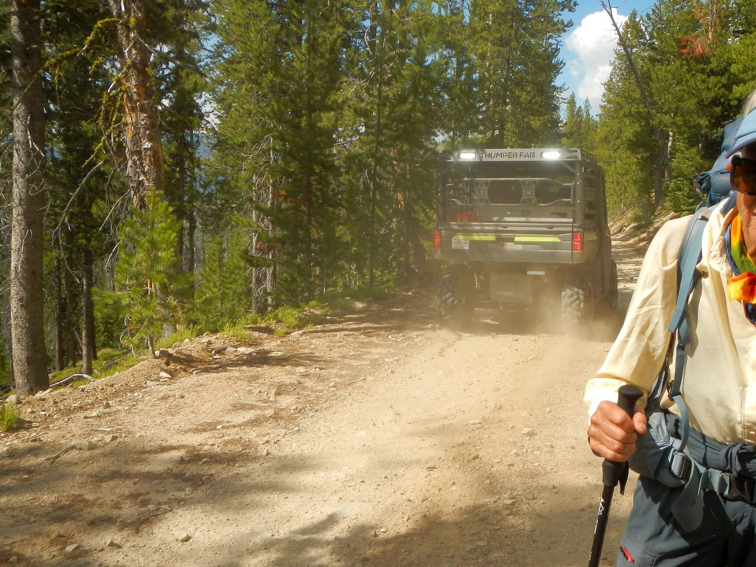
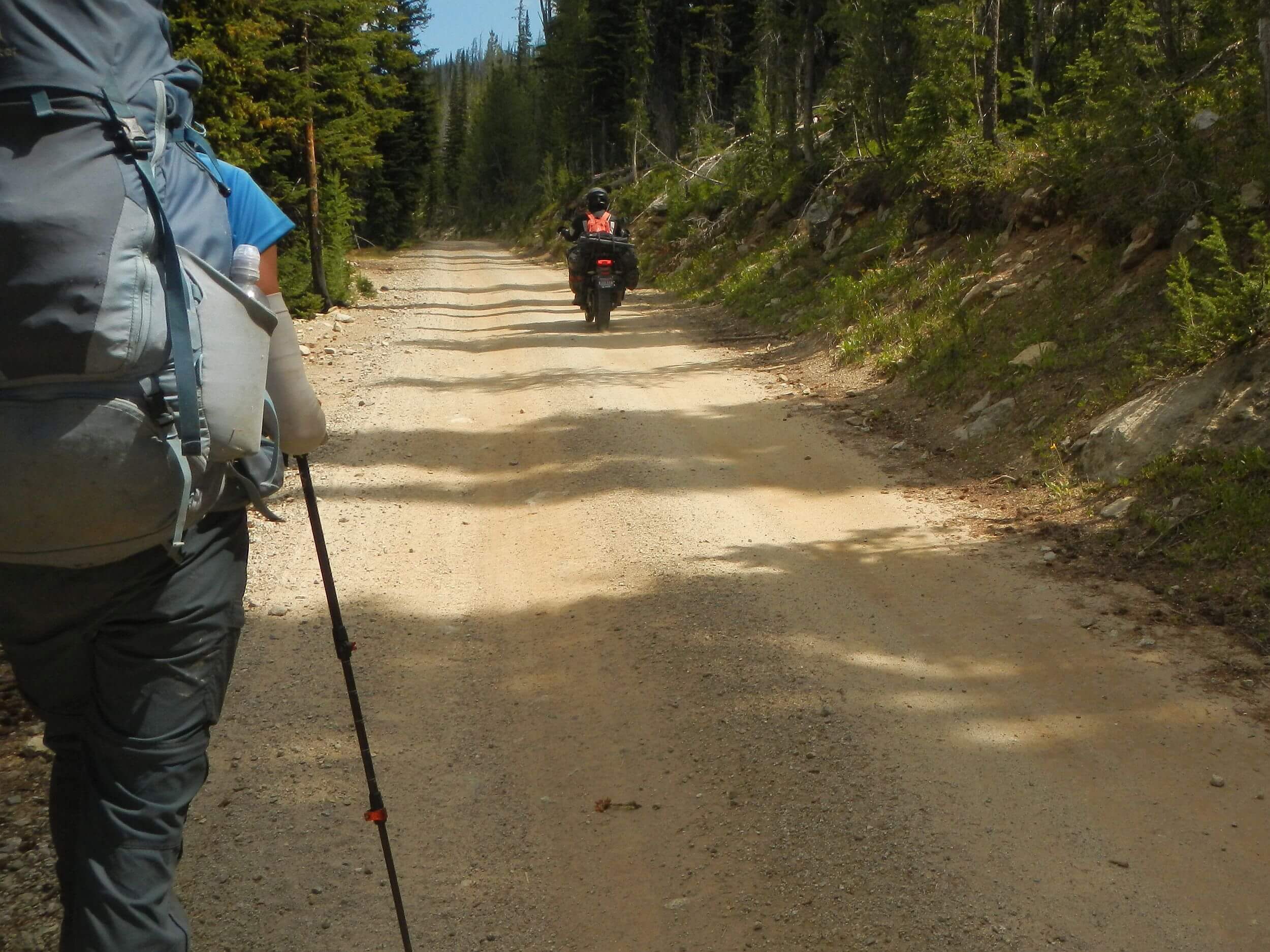
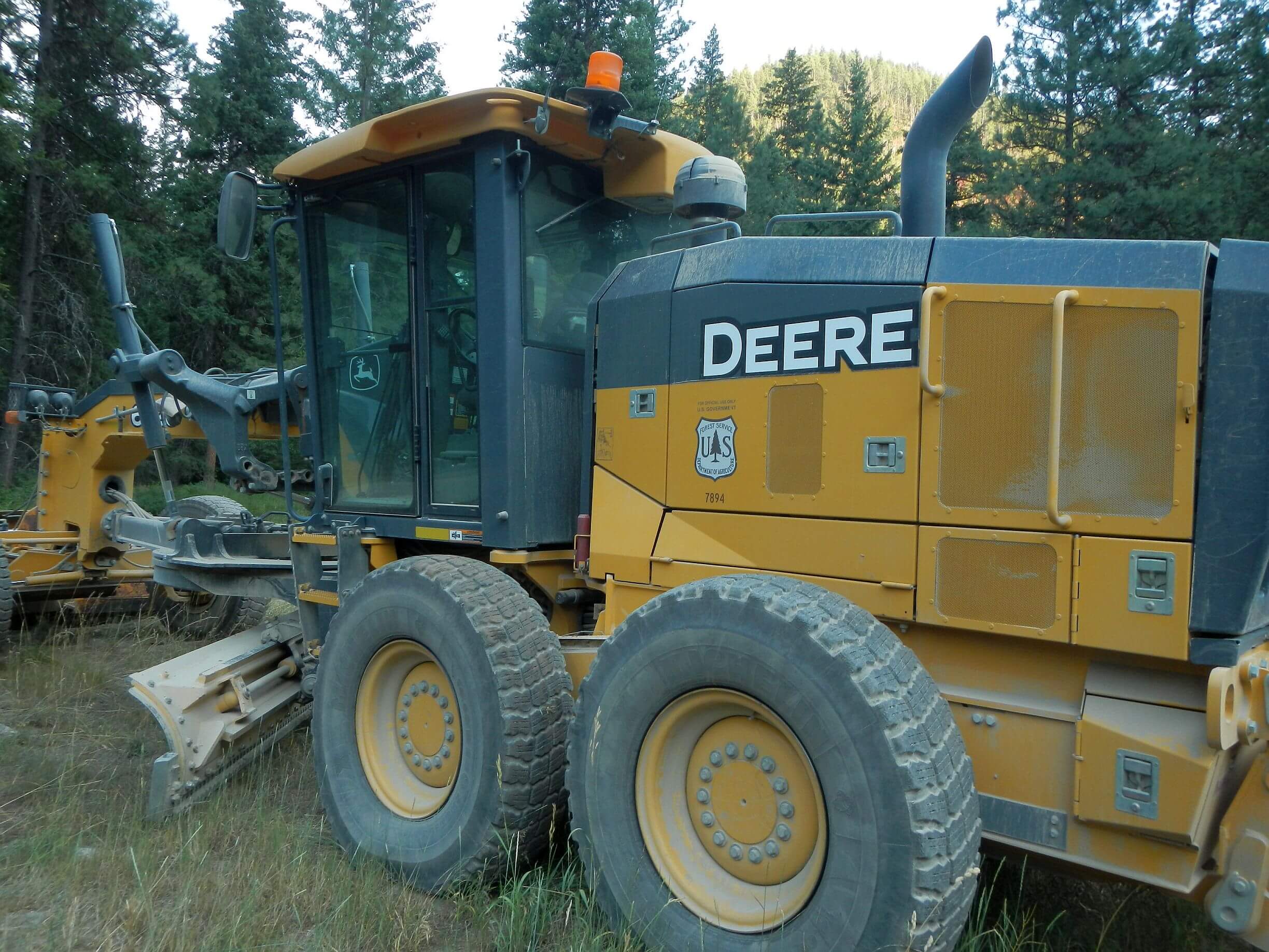
We hiked 54 miles of Magruder Corridor Road because Selway trails were in such poor condition (neglected after fires; we passed through boundaries of 41 fires that burned between 1987 and 2024). We met or were passed by dozens of UTVs and motorcycles, a few SUVs, and pickups, and 1 hardy mountain biker. Ironically, this “wilderness road” is kept in top shape by large equipment; campgrounds are well maintained with clean restrooms.
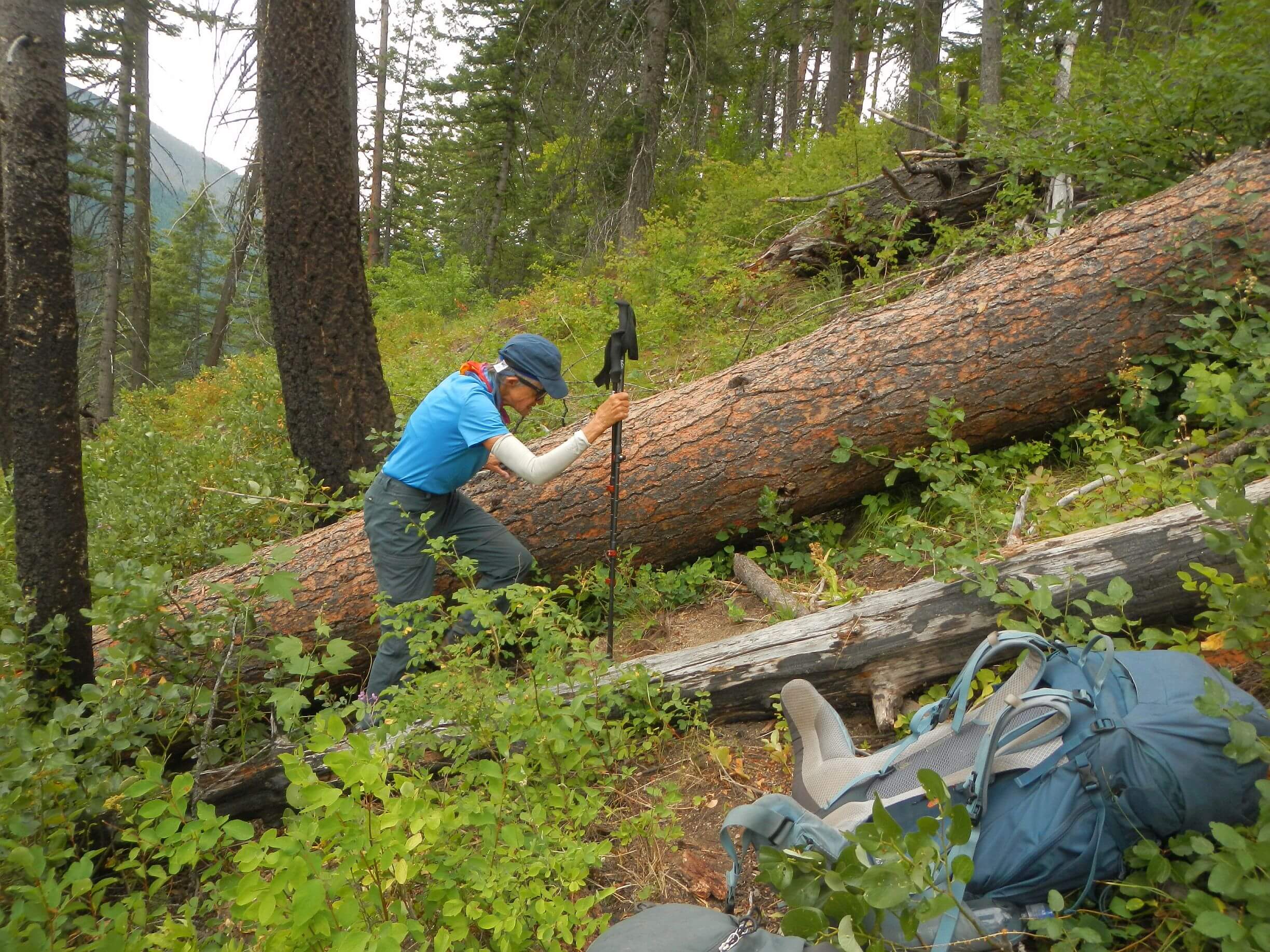
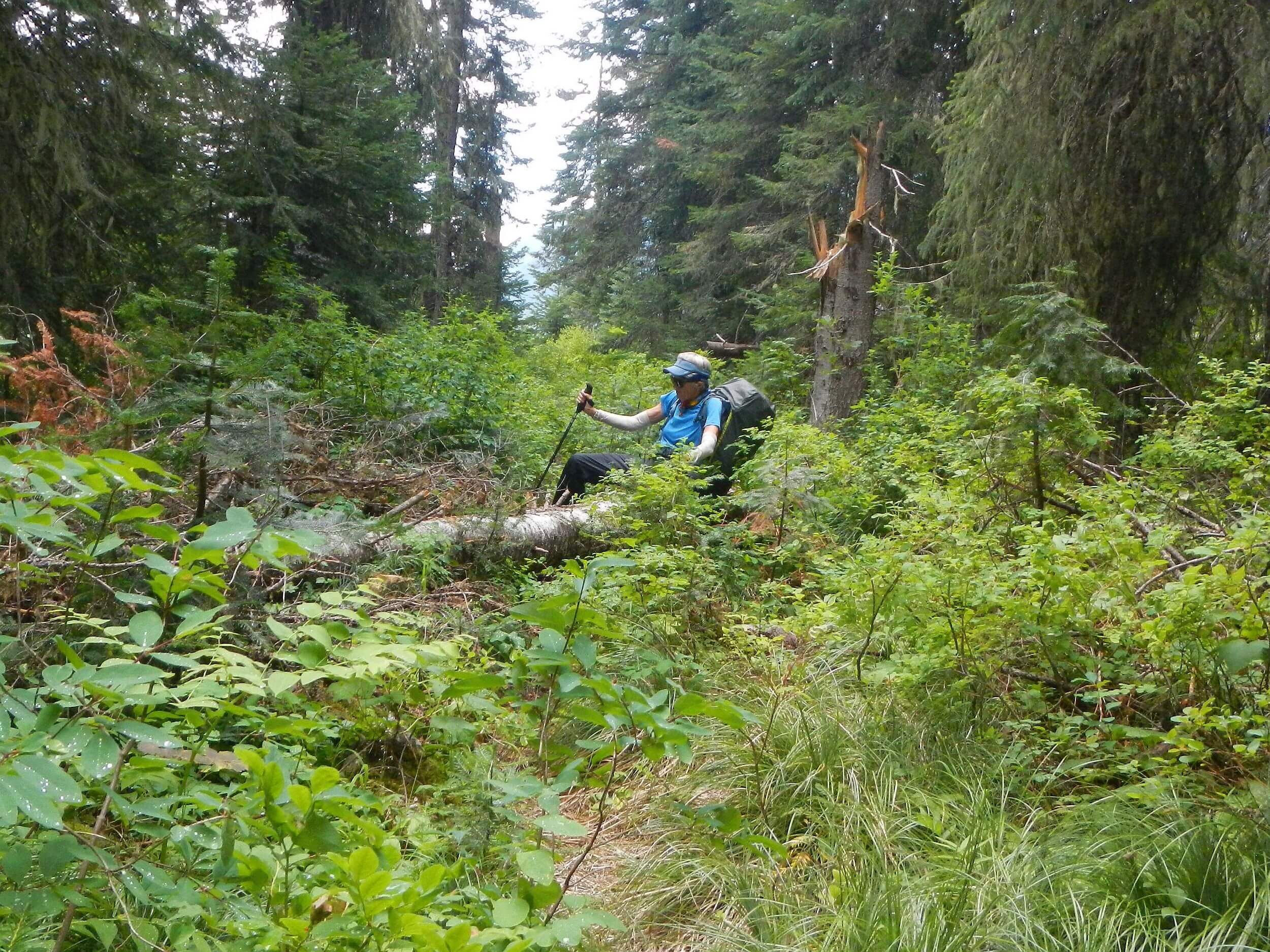
The few backpackers were on the few good trails; we saw no one on trails blocked by down logs and brush from multiple fires and reburning several areas. We think much of the 4000 miles of trails in the 2 wildernesses—many based on Native American routes and much built for stock use by the Civilian Conservation Corps (CCC)—have disappeared. This probably explains the lack of wilderness visitors.
River Corridors
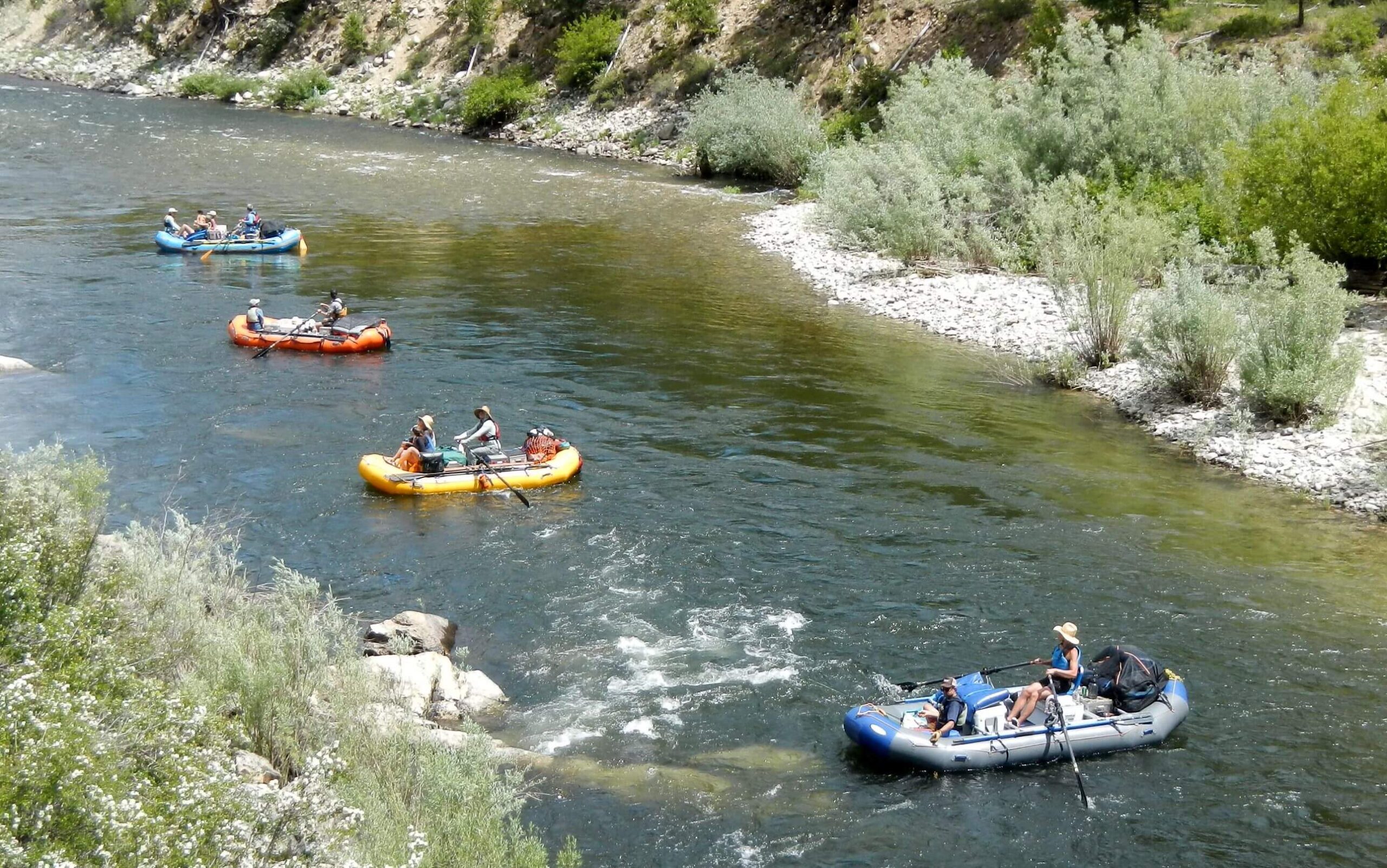
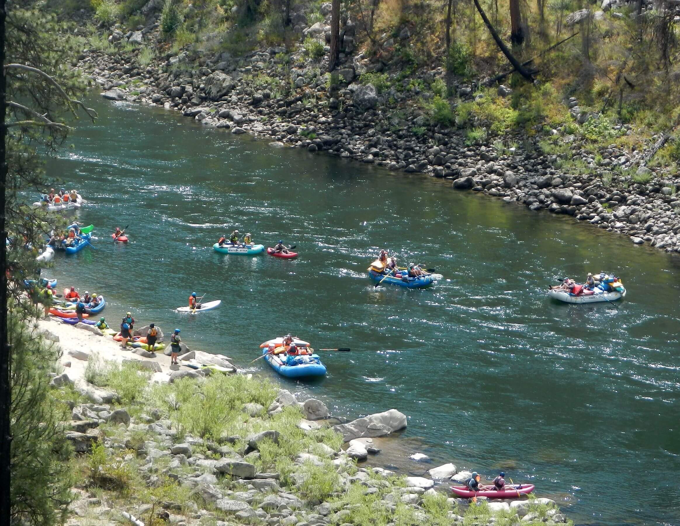
About 10,000 people yearly float the Middle Fork of the Salmon River and 10,000 jet-boat through the Wild section of the Main Salmon River. Both are Wild and Scenic Rivers flowing through the Frank. Forest Service issues a limited number of permits to commercial river outfitters and requires private boaters to use a lottery to secure river and campsite permits. A 2024 rafter’s website claimed 20,000 private parties applied for a permit through the lottery but only 361 permits were awarded. Still, we saw non-stop boat traffic when hiking river trails between about 10:00 AM and 4:00 PM.
Middle Fork Masses, Private Ranch
We saw people after our start at Marsh Creek, origin of Middle Fork. We had noticed a vehicle when we were dropped off at trailhead; on our second morning we met the owners,
two guys in for a couple days for fishing. Just before Dagger Falls we met a couple coming to fish with a psyched German shorthair pointer. We met road, lovely unused campground, and a few day visitors at Dagger Falls. After the falls, a van or bus full of rafters passed us every few minutes—on the way to the main put in for Middle Fork. Parking lot was crammed with vehicles. When trail was near the river, we saw colorful large commercial rafts and big boats crammed with equipment; flotillas of smaller craft, kayaks, and an infrequent single boater often with a dog perched in the bow. We gave up trying to visit hot springs when we saw several bathers, others on way to site and a whole boat camp on the river just below.
On Day 4 we hiked through the first private inholding (private land within forest) on out-and-back day hike to pick up resupply box at Indian Creek Guard Station air strip. We wound through Pistol Creek Ranch passing cabins, stables and air strip, former resort now with one owner. Friendly staff on ATVs directed us through road maze to forest land and a trail.
We hiked up Pistol Creek and saw no one for two days—I imagine the chest-high brush on some sections was a deterrent! When we climbed out of the canyon we joined road—and immediately met guys on UTVs. We were alone again two more days on barely discernible Summit Trail. On Meadow Creek Lookout Road, we soon met two motorcyclists.
Main Salmon: Inholdings and friendly outfitters
We met our next trio of backpackers on way to Chamberlain Basin air strip. (One directs a nonprofit group that maintains trails in both wilderness areas, not surprising he was out!)
A day out on well-cleared trail from Chamberlain (also route of Idaho Centennial Trail) we passed a trail crew camp (on last stream before ridge) then met the crew on 3rd switchback of 40 descending to Main Fork Salmon River (7 employees/interns from the Forest Service).
The famous Cambell’s Ferry Ranch, 85-acre ranch with pastures, orchards and cabins, is privately owned but operated as a historic site. The ferry, which in late 1800s transported miners across river to Thunder Mountain Gold Mine, was replaced by a bridge in 1958. Ranch owner was picking apples; she suggested camping across river on nice site (later we learned this probably was old field from historic Jim Moore Place. We heard the roar of jet boats (oddly, allowed on 80 miles of this Wild River surrounded by wilderness) but did not see them. We found nice flat of slightly burned pine on promontory overlooking river. If we had gone further up trail, we would have seen several historic cabins, a popular stop for commercial boat trips.
Trail stayed high on river bank the next day but eventually dropped down and met Big Mallard Creek Road—steep winding route from canyon rim. We saw cabins and junky vehicles near river and enjoyed solitude at picnic site at road’s end.
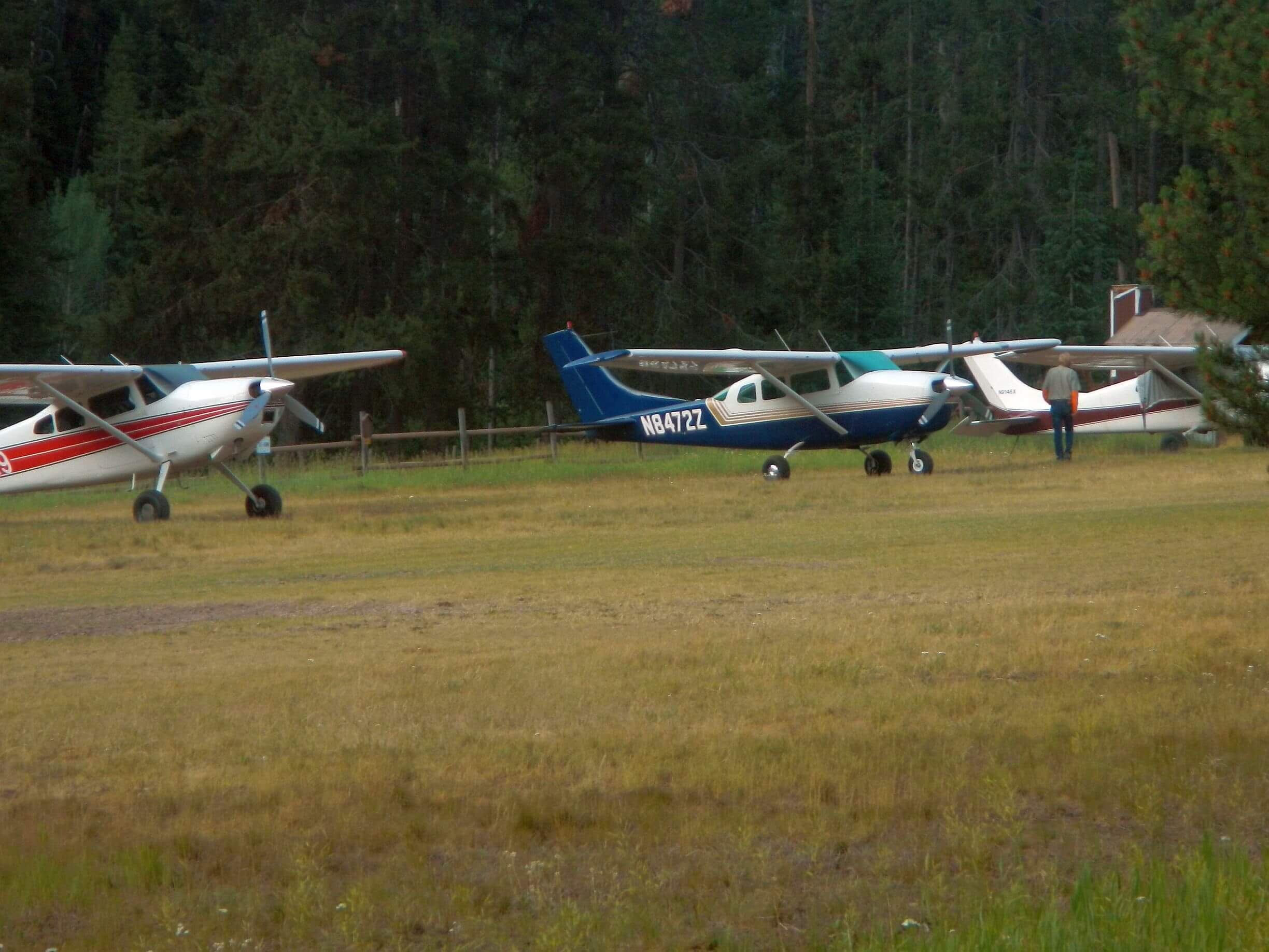
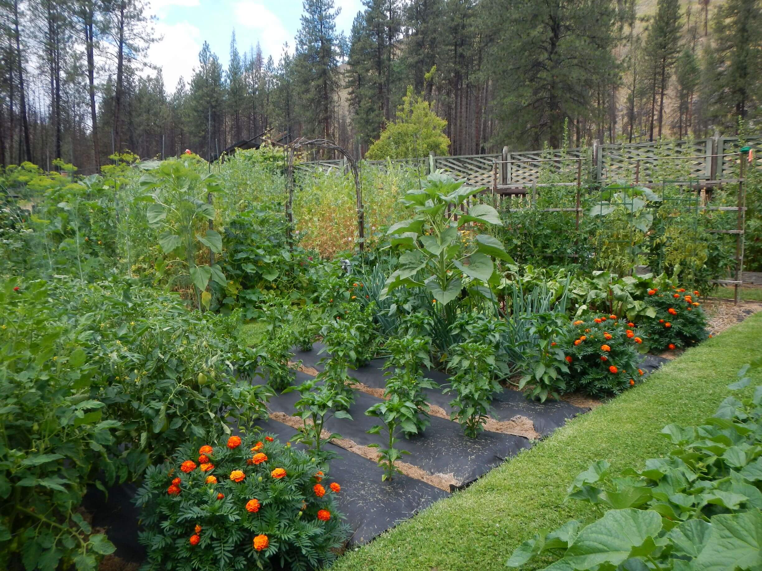
That afternoon we clambered up to large air strip flanked by several buildings. David thought it might be a rafters stop; on this hot day he was hoping for a store to purchase cold drinks, so we walked across field. No store. Yellow Pine Bar is a private inholding, but friendly caretakers Greg and Sue offered us cold lemonade on their porch! We also toured Sue’s incredible garden, with every imaginable vegetable that they canned, froze, or stored for their year-round food supply. They had been here for 18-19 years and on another ranch before that. David said we were picking up a supply box at Allison Ranch, a Christian camp with airstrip that burned down in the Elkhorn Fire of 2023. The caretaker Jim “will be working on the mill up the hill by the airstrip,” Sue told us.
Glad for her instructions as the heavily burned ranch was a maze of invasive weeds, brush, and grass. On far end we found road climbing to airstrip and small mill, where Jim and a couple volunteers were cutting planks. The caretaker personally logged and yarded the burned ponderosa pine, got a contractor to build the mill, and is overseeing a project to reconstruct the lodge and cabin over five years!
We wanted to camp near the ranch and unpack our box. A large commercial boat group had stopped at the big sandbar we had eyed on Google Earth imagery; now occupied with moored boats, long tables, stoves, chairs; milling people, river waders, and happily shouting teens. We camped on a little bench above. As I was cooking dinner, some guy kept calling up to us. “Do you want some dinner? Do you want some beer?” I called back, “No it’s okay.” But then he said, “Do you want me to pack out your garbage?” Well, yes.
A young bare-chested outfitter appeared in our camp, curious about our trip. When we brought our garbage down later that evening, he talked David into eating some beef stew and me into accepting a beer! He talked about how he enjoys being out on the river.
We also had a nice visit with Jim by his cabin, one of the few structures that did not burn in the Elkhorn Fire of 2023. I had packed a cheesecake mix in our resupply box which I brought as a dessert offering!
The next day we hiked two miles along river to Bargamin Creek, our route out. A large group of private boaters was just packing up for a day on the river. From footprints on this trail, it looked like many boaters hike a short way up the big, roaring whitewater creek. We saw no one further up the trail, which was rocky, brushy in spots with many downed logs—although a trails group had cleared it just two years before! After two hard days (including being lost an hour in baffling section of brush and down logs) we were glad to meet Magruder Corridor Road for 3 days of hiking unhampered by brush or logs.
Magruder Corridor Road: rich history, lots of vehicles!
David had chosen to hike 54 miles of this 101-mile road between Elk City and Darby because more interesting parallel trails through wilderness ridges and lake basins had not been maintained, and we were warned to steer clear! We enjoyed our first evening at Poet Creek Campground, a small creek side area we shared with three other quiet parties: two motorcyclists, a couple in an SUV, and another couple with a popup tent on their truck and a very curious German shepherd.
Magruder Corridor according to a Forest Service website is a “single lane mostly unimproved (road) offering solitude and pristine beauty as well as expansive mountain views”—apparently official name Nez Perce Trail FDR (for Forest Development Road). It was NOT primitive. Built by the CCC in 1930s, it was later engineered with long grades in the 1970s to accommodate logging trucks, as national forest officials planned to log much of the area south of the road. But when this area became the River of No Return Wilderness in 1980, (“Frank Church” was later added to honor the wilderness sponsor Idaho Senator Frank Church) this nixed logging plans and Magruder became the Corridor. The Selway-Bitterroot to north of the road was among areas designated in the original Wilderness Act of 1964.
Magruder mostly follows route used by Nez Perce Indians to traverse these rugged mountains on way to buffalo hunting grounds in Montana. It was named for merchant Lloyd Magruder who in 1863 with four companions were murdered by other white robbers who were pursued, tried, and hanged in Lewiston.
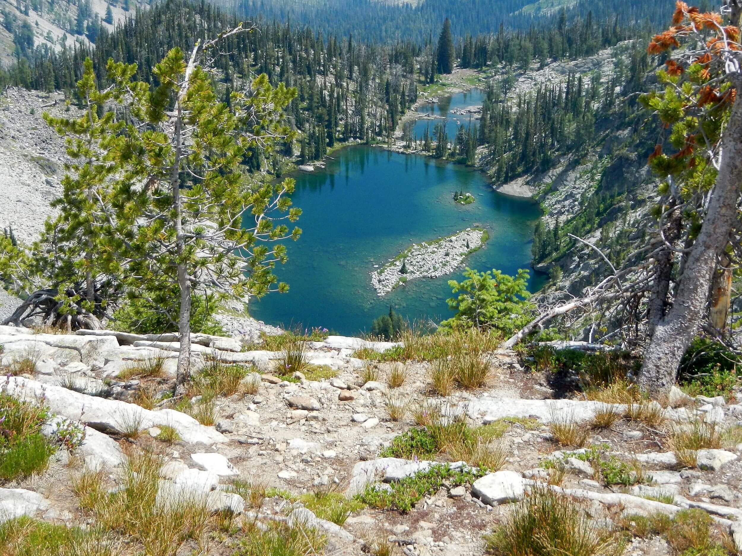
We didn’t miss logs and brush but found long grades (3-5 miles to climb or descend 2000 feet) tiring on foot. We met or were passed by many large motorcycles designed for dirt road travel, UTVs and some high clearance trucks or SUVs. Dry Saddle trailhead looked well used by hikers visiting high lakes along the ridge. On Bargamin, we went through 4-way junction for Cache Creek Trail that climbed to these basins, but David heard it was in poor shape. Wish we had saved time for a ridge hike to the lakes! At the saddle, we met a friendly family with UTVs who had traveled a 750-mile loop on back roads! On next grade, I saw lakes perched in basins across the canyon and again wished for more day hiking time!
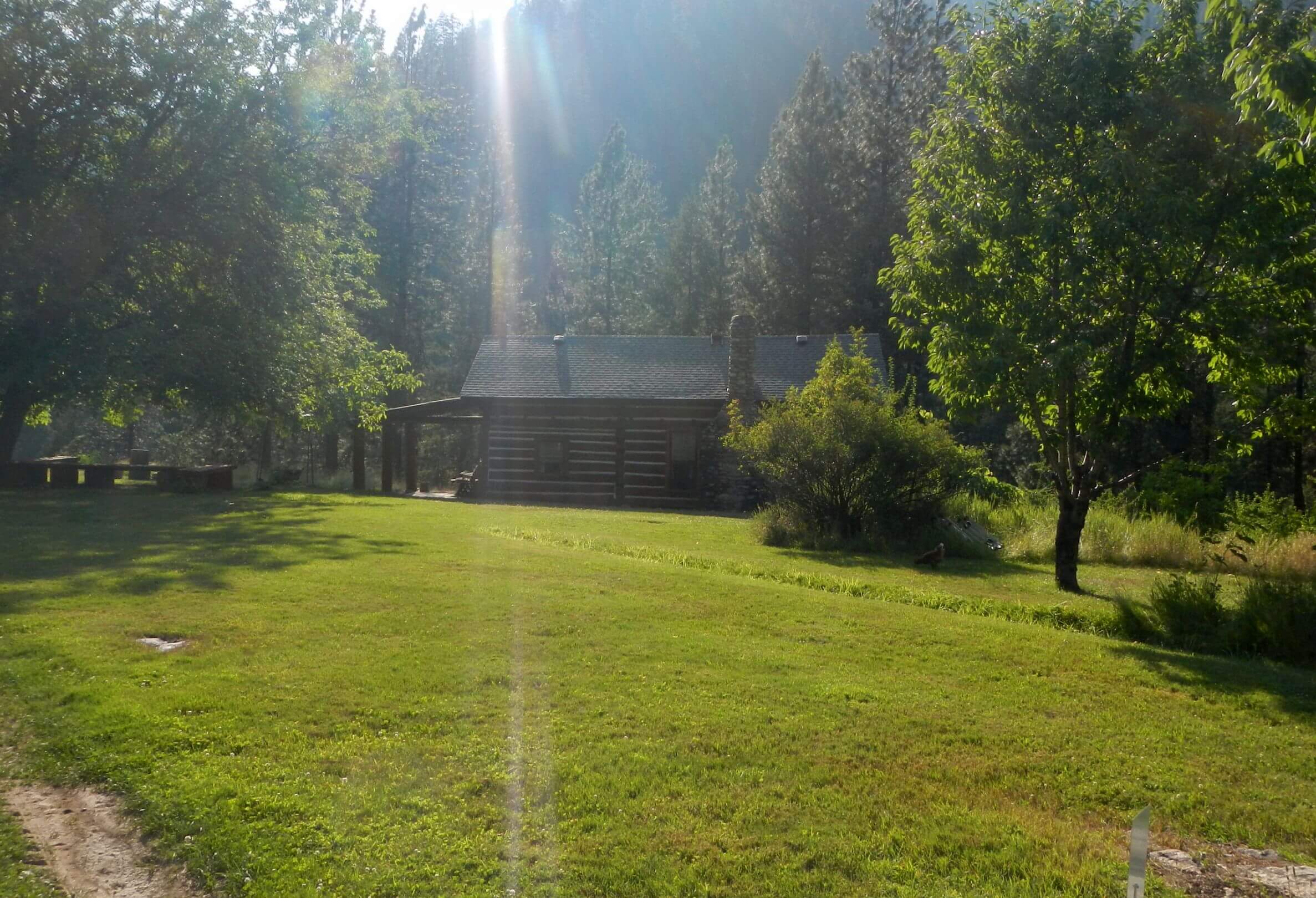
We stayed that night at Horse Heaven cabin, a site with large pasture off the main road available by reservation. Cabin door was locked(!) which was not mentioned in our Recreation.gov reservation. Luckily, a back window was not locked for David to crawl in and open front window for us. (We could not use door locked from outside). Inside it was immaculate and stocked with supplies and a giant fuel canister I used for dinner and breakfast which extended our own fuel capacity! I think ours was the only hiker entry in the logbook. The cabin was built as a Forest Service guard station in 1938. A signed creek trail (which according to my map winds its way all the way to the Salmon River) did not look used below the cabin spring.
Next day we passed Salmon Base Camp and what used to be main access trail from the Salmon River, likely not used anymore. We did long uphill slog to Salmon Peak Lookout trail, our first foot path in two days (6 miles round trip to lookout on burned ridge past colorful flowers, subalpine larch forest, and alpine lake basins below). On road we met cyclist with loaded bike (who had ridden 65 miles from Darby that morning and planned 50 more to Elk City!). We camped alone at Observation Point campground nestled in spruce-fir singed by 2 fires, with brand new composting toilet on the road. Roads, campgrounds, and toilets are well maintained by Nez Perce and Bitterroot national forest staff but not trails.
On long descent to Selway River, motorcyclists were not deterred by log that had fallen night before across the road. A Forest Service employee in big SUV coming to stock campground toilets seemed distressed when we waved her down to warn of the tree (we later learned she had no chainsaw in her borrowed vehicle and was worried about turning around on the one-lane road). Later saw an ATV speeding up the road with a chainsaw—help was on the way! At bottom we left main corridor and followed spur along the Selway River to Paradise, intrigued by men tramping in the river (likely doing fish surveys).
We were passed by UTVs, ATVs, and an infrequent SUV on the dusty road. No campers at Indian Creek CG where we stopped at 17th mile for day, washed clothes in the Selway (counting on hot shower next day at Paradise), and dried clothes on a bear-bag rope strung between trees. Next morning came a constant stream of UTVs—some overloaded with camping gear and family of four with all smiles. Apparently, Paradise Campground was the place to camp before a scenic “wilderness driving adventure” on exempted Magruder Corridor Road or Nez Perce Trail FDR.
After overnight break at Cameron Outfitters camp near Paradise (for sandwiches, steak dinner and great breakfast!) we headed up White Cap Creek Trail—saw no one all day, hit more chest high brush the second day and met our last backpacker on this leg of the trek (later we found out he was reported as lost!) Upper trail over pass was not too bad (although minimal camping area in the burned basin) but near Tin Cup Reservoir, it was cloaked in brush again with little sign of use. The road built to construct and improve the reservoir was hidden by waist high thimbleberry crossing every side creek. Road opened up about four miles from the trailhead; tracks showed hikers and riders coming up this far to scenic waterfalls on Tin Cup Creek. This use kept the road/ trail open from falls to the trailhead.
From our experience summer 2025 hiking through Frank Church and Selway-Bitterroot wilderness, visitors rarely use trails blocked by post-fire logs and brush, but flock to accessible river and road corridors. Most visitor use is by boat, airplane, or motor vehicle!