(Click slider photo to see caption)
In late August 2025, we visited the Wind River Range (Bridger & Popo Agie wilderness) in western Wyoming to see an area we backpacked in the 1980s, hike part of the Continental Divide Trail, and loop around the famous Cirque of the Towers which impressed us on our last trip in 1988.
As it turned out, we saw very little of the Cirque!
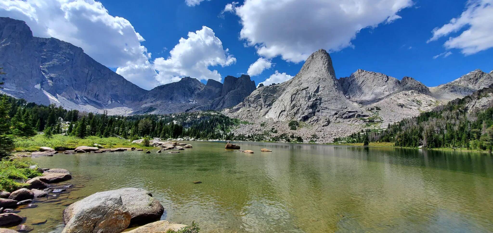
The Cirque of the Towers is the most famous and most visited part of the Wind River Range, popular with hikers and climbers. Its jagged granite spires and peaks 11-12,000 feet high along the Continental Divide are arranged in a semi-circle above Lonesome Lake. Climbers attempt some of the 15 craggy peaks with routes ranging from scrambling to very technical climbs.
Backpackers can loop through the Cirque from popular Big Sandy Trailhead on southwest end of the range. A 24-mile route follows Continental Divide Trail (CDT) briefly, climbs basins to Shadow Lake, scrambles over Texas Pass among the Cirque towers, descends along Lonesome Lake, climbs Jackass Pass, and follows route/trail to Big Sandy Lake and on to the trailhead.
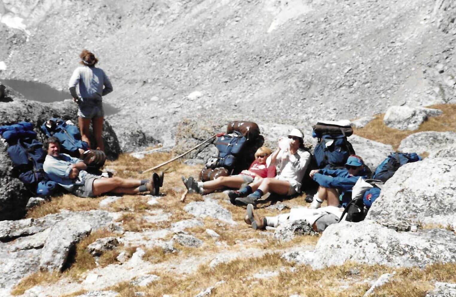
From our 1988 photos, we may or may not have taken scramble route over Texas Pass. The only thing we could confirm from old photos is that we passed by Lonesome Lake, passed Grave Lake on north end of Popo Agie, and probably traversed Hailey Pass across Continental Divide between Popo Agie and Bridger wilderness areas. All we remember for sure is meeting up with our Rambler hiking club friends from our university days. While they stayed in the Cirque area to climb and scramble, we looped further.
In the late 1970s and much of the early 80s we lived in Ogden, Utah, only a 5-hour drive to the Wind Rivers. I think we did two other treks but have no photos to prove it. David agrees to one visit when we hiked into the range from a westside trailhead and camped at a big lake. It started raining overnight so we fled back to our vehicle. As we drove towards the Utah border, we looked back and saw it was clearing on the Wind Rivers!
I recall one more trip from Big Piney area. We hiked up to the Continental Divide where we clambered on large flat scree rocks and were surprised to meet backpackers! We looped back down through lake country, encountering clouds of mosquitoes and using arms as windshield wipers as we hurried along. We camped on a dry, not so buggy ridge and hiked out the next day. David disputes this memory (although he remembers the high rocks and even meeting a trail crew in a buggy area) because we have no records or photos to prove it and I can’t prove it either.
Our visit in 2025 was a one-way trek from Big Sandy to Half Moon Lake Lodge near Pinedale, with a loop around the Cirque. We left Idaho in a rainstorm; welcome as both Idaho and western Wyoming had little rain from May to August! Only showers in Pinedale that evening but next morning we drove in rain to Half Moon Lake Lodge. We parked our vehicle and met Dominic, the lodge outfitter. The friendly red-headed cowboy from Utah made us breakfast and shuttled us to Big Sandy Trailhead.
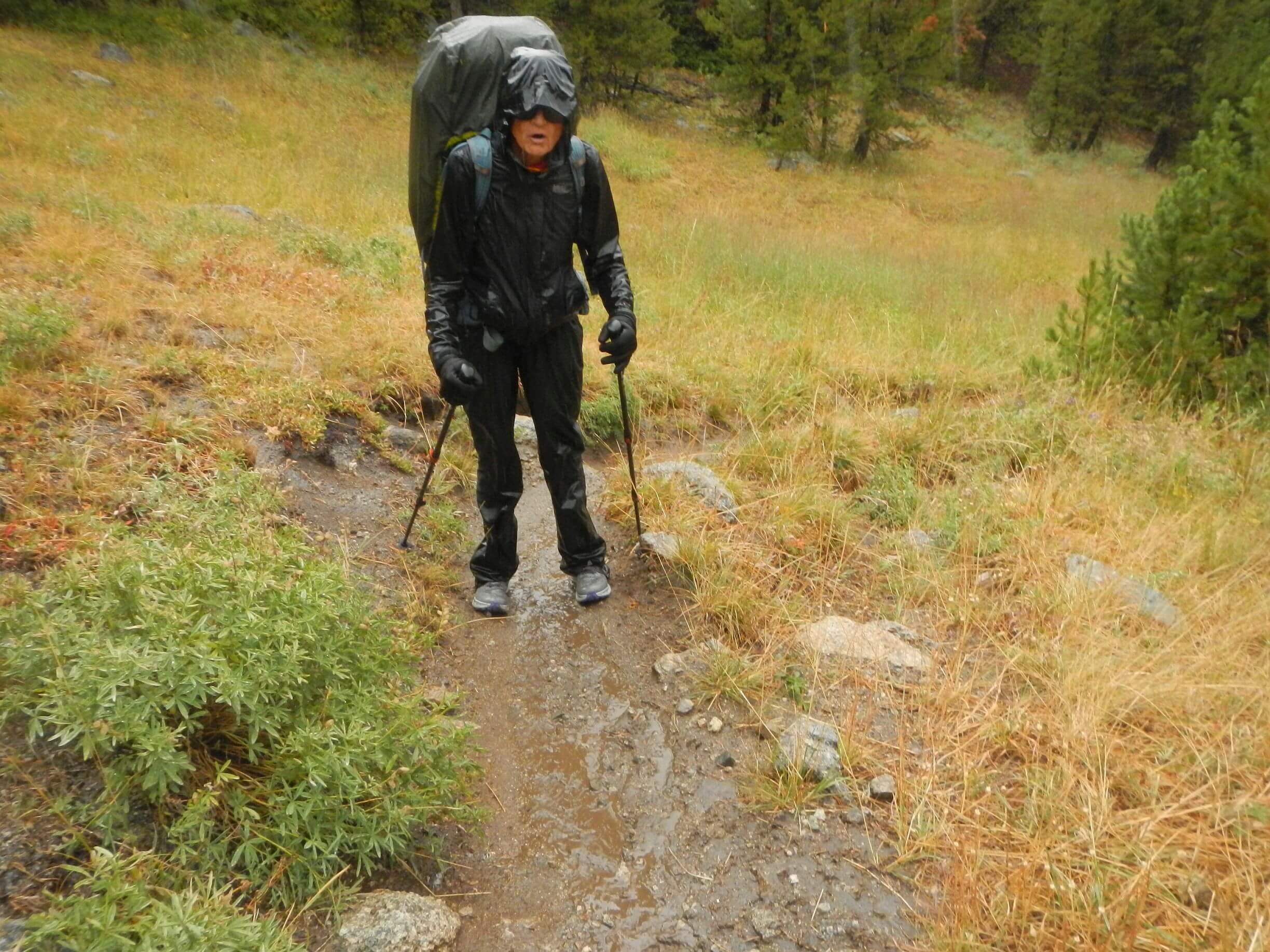
About 80+ vehicles there and we met probably 40 of the backpackers coming out, clothed in raingear or plastic and reporting hard rains in the high country. We wore raingear to start up the gentle 5-mile trail to Big Sandy Lake. As showers diminished, I stripped to t-shirt and shorts for about an hour. Hard rain returned as we took a break on far end of the lake; a small grove of spruce offered only minimal shelter.
Water made channels on the switchbacks and slickened rocky route above for treacherous clambering. We stopped a couple of miles short of Jackass Pass in a pretty meadow with nice campsite; David nixed further scrambling in the rain. After tent set up, another rainstorm hit, and we took refuge for an hour. It cleared for evening, and I made dinner viewing sunshine on peaks below.
Socked in the next morning but no rain for the climb up to North Lake and scree scramble along beautiful Arrowhead Lake. (The main trail climbs straight up a ridge, but a note scratched on the junction sign suggested: “Main trail is awful; take climber’s route,” so we did). We climbed steep trail to Jackass Pass, meeting a lone hiker with dog who was finishing long loop from Hailey Pass and four happy backpackers who probably came over from Texas Pass (since no tracks below). We descended to beautiful Lonesome Lake, meeting another cheery backpacker who said he’d taken a brief detour because “I had to climb Lizard Head.” When I later saw that steep pyramid, I wondered if he had ropes!
We had originally planned to camp at Lonesome so fortuitous we stopped short as several hikers told us E. coli bacteria had polluted it. (More on this later). I saw one tent in the basin far above the lake; if campers overused the area, we saw little sign of it.
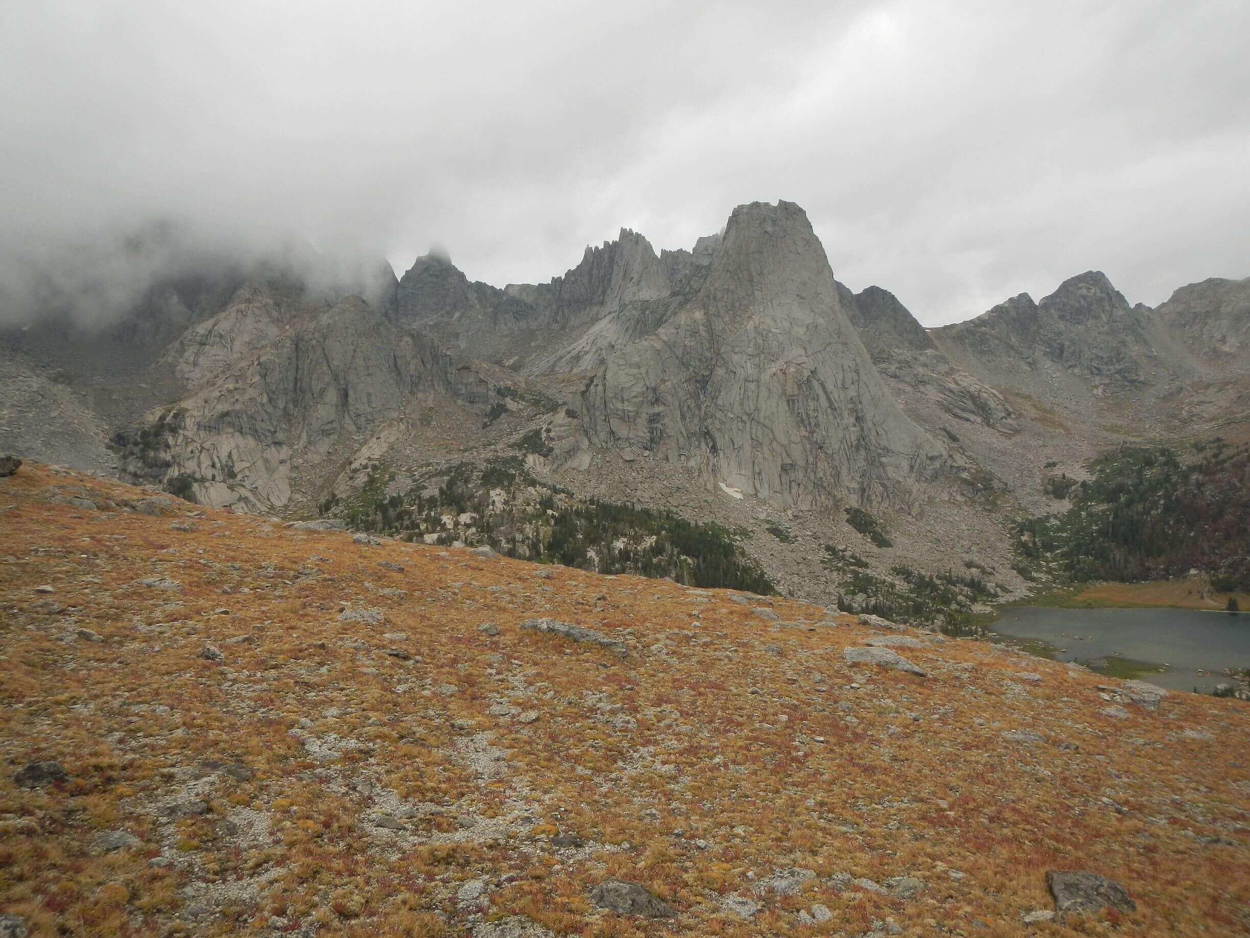
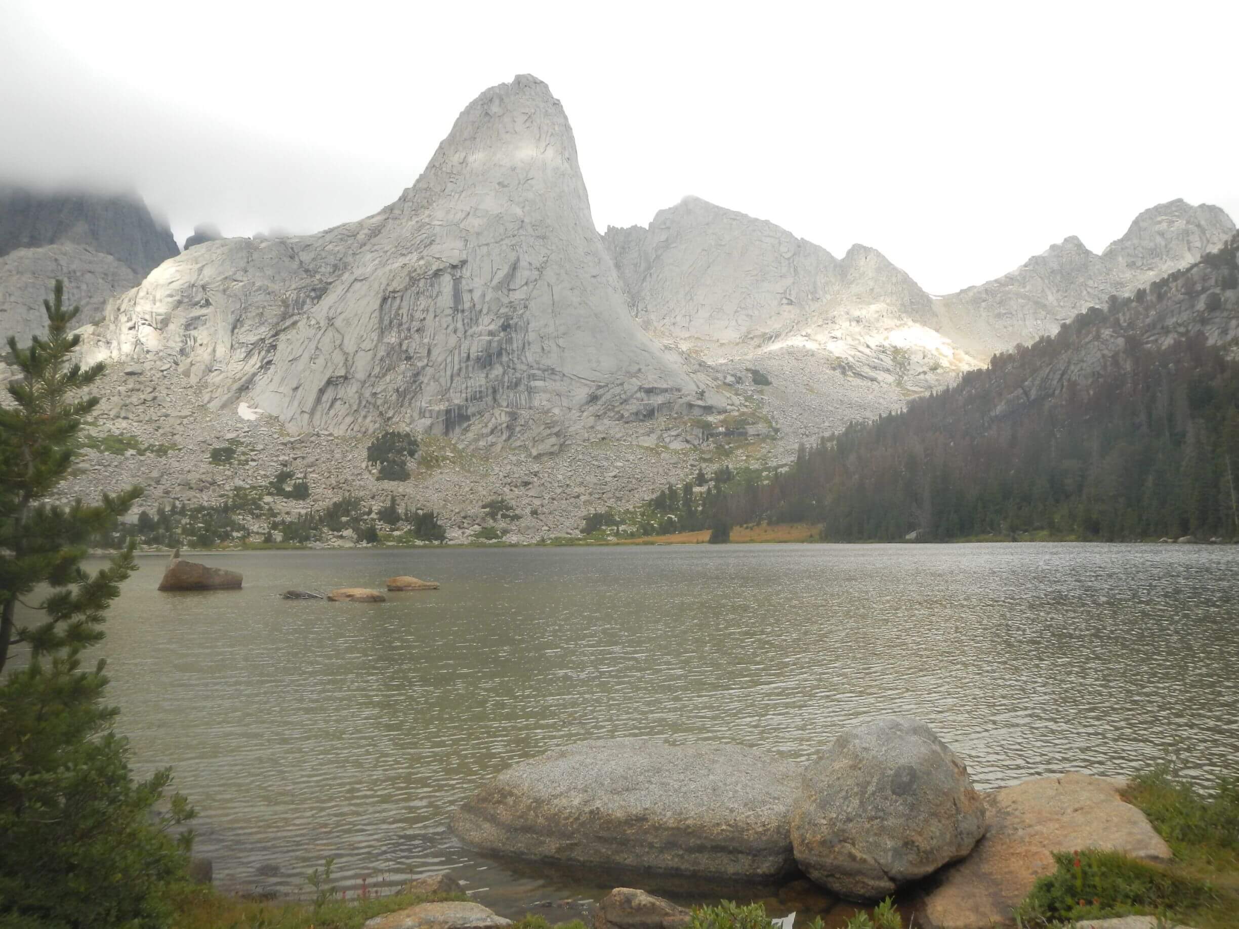
Most online pictures of Cirque of the Towers show them soaring above the deep blue of Lonesome Lake. The lake looked greenish to us that day with algae bloom and the famous grey towers were cloaked in clouds and mist, so we did not see them.
On the steep climb to Lizard Head Pass—which runs parallel to the Continental Divide at about 11,800 feet—we met several backpackers ecstatic about the views. After switchback climb the trail contours several miles with cloudy views of the grey ridge of the divide—but the Cirque towers were not visible, tucked away behind Lizard Head Peak. The peak looked quite technical to me, soaring above lovely Bear Lake basin. Once on top I was too chilled by the bitter headwind to appreciate the scenery—I just wanted it to be over!
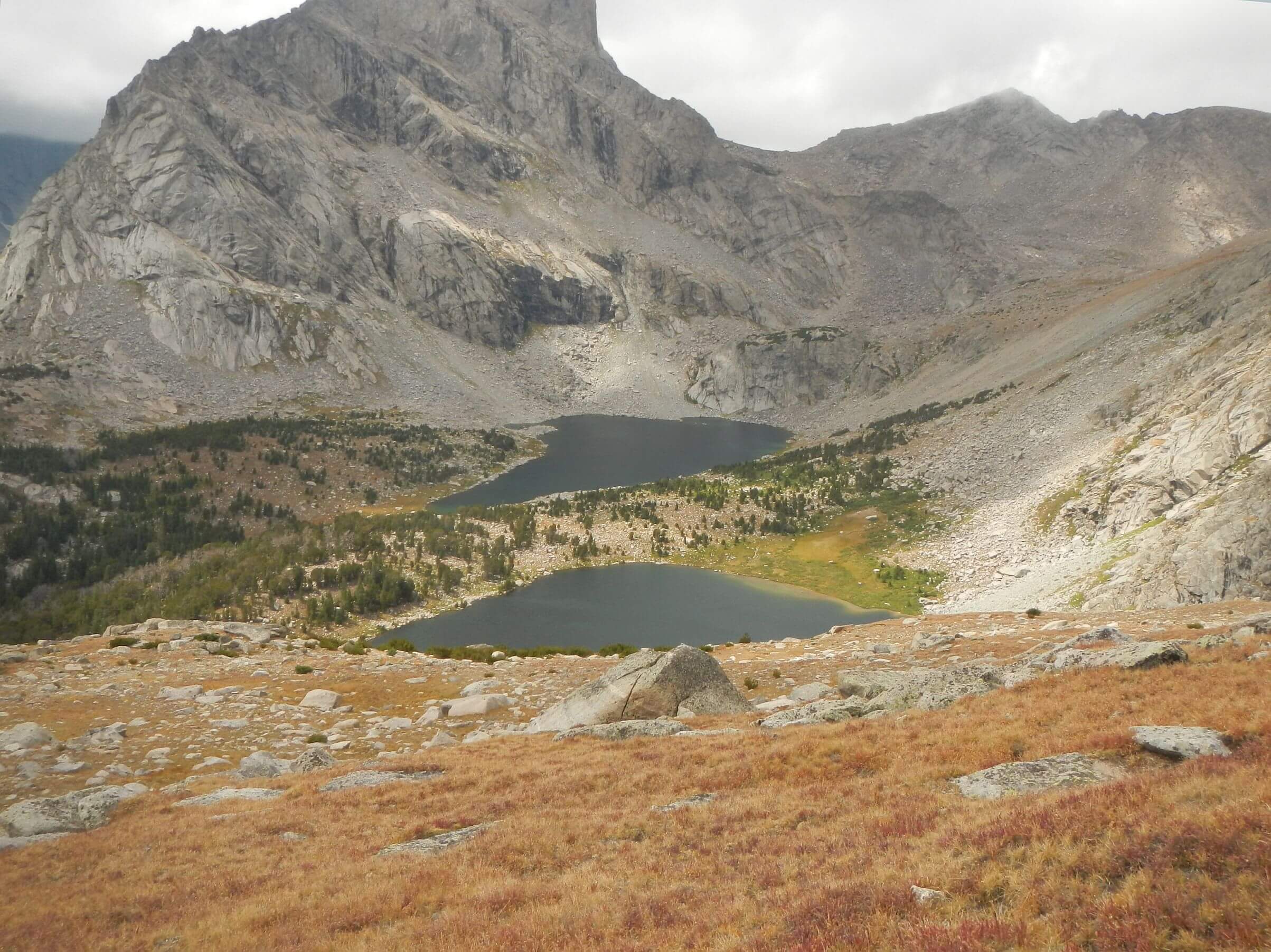
Day 3 was clear for viewing towering peaks around Valentine Lake, climbing Washakie Pass, descending to Skull Lake (where we set up our tent at far south end and day hiked to upper lake basin and junction with washed-out Hailey Pass Trail). On Day 4 we joined CDT for long strolls on high plains beside giant lakes and steep climbs over several passes. From my map, the rugged towers we could look back and see from the pass between Washakie Creek and Cross Lake may have been the Cirque—only a rear-view mirror glimpse!
After our trip I checked with the Forest Service about the alleged E. coli contamination of Lonesome Lake. Evan Guzik, public affairs officer for the Shoshone National Forest, said the lake tested “off the chart” for enterococci, another bacterium that indicates fecal contamination, in a 2022 national study. This past summer the Forest Service and Wyoming Department of Environmental Quality cooperated on sampling E. coli at Lonesome Lake with five samples taken over six weeks during the heavy use season July through August. Results should be known by winter 2025-2026, he said.
Signs prohibit camping within a quarter mile of that lake but there is no other ban.
I would still like to revisit the Cirque of the Towers. Maybe next time we will try the Wind River High Route an alternative route to the CDT which starts at the north end of Wind River CDT at Green River Lakes and heads southeast for about 80 miles of off-trail and on-trail travel ending at Big Sandy. It crosses the Divide four times and nine passes between 12,200 and 11,500 ft—six off trail and three on-trail. On the east side of Divide it traverses trailless lake basins in the Popo Agie Wilderness. Guzik said you see fewer people on that side.
The high route ends with a Cirque of the Towers loop. And maybe it will include that section of flat scree rock on the Divide from our earlier visit to the Wind Rivers that I recall and that David does not! I would love some validation for my memories!