(For above slider, click photo & caption will appear below) Every year 1.5 million people visit Summerhaven, a village near the top of Mount Lemmon in the Santa Catalina (Catalinas) mountains. Most drive the winding Catalina Highway Scenic Drive from Tucson, also called the General Hitchcock Highway and other names. Some ride up on bicycle, stopping for a treat before the 25+- mile, 5000-foot descent.
A few come on foot. About 400 hikers pass through Summerhaven north or south on the Arizona Trail (AZT) which crosses many mountain ranges in the state. The majority pass through in spring—from the Mexico border to Utah. Fewer come southbound in November or early December.
We also hiked into Summerhaven, but not on the AZT! In early December 2025 we arrived at 9:30 p.m. after a long hike day starting at sunrise on the rugged Sutherland Trail onto Mount Lemmon Trail at sunset and descending long winding Observatory Road from Lemmon in the dark.
I have wanted to hike “backside” of the Catalinas since my student days at University of Arizona in the late 1970s, when I first visited Samaniego Peak and noticed the westside trail system including Sutherland, Samaniego, Canada del Oro and Red Ridge trails intersecting old jeep roads on the west and northern side of the Catalinas. I hiked many Catalina trails with the UA Ramblers (hiking club), mostly up the front range facing Tucson.
My only westside visit in 1973 dropped down Romero Canyon with another hiker, crossing private land and a gate and hitchhiking back to Tucson on Oracle Highway. The proposed Rancho Romero development there sparked opposition from Tucson residents with 1974 legislation, private land purchase and exchanges, and a state park in 1983.
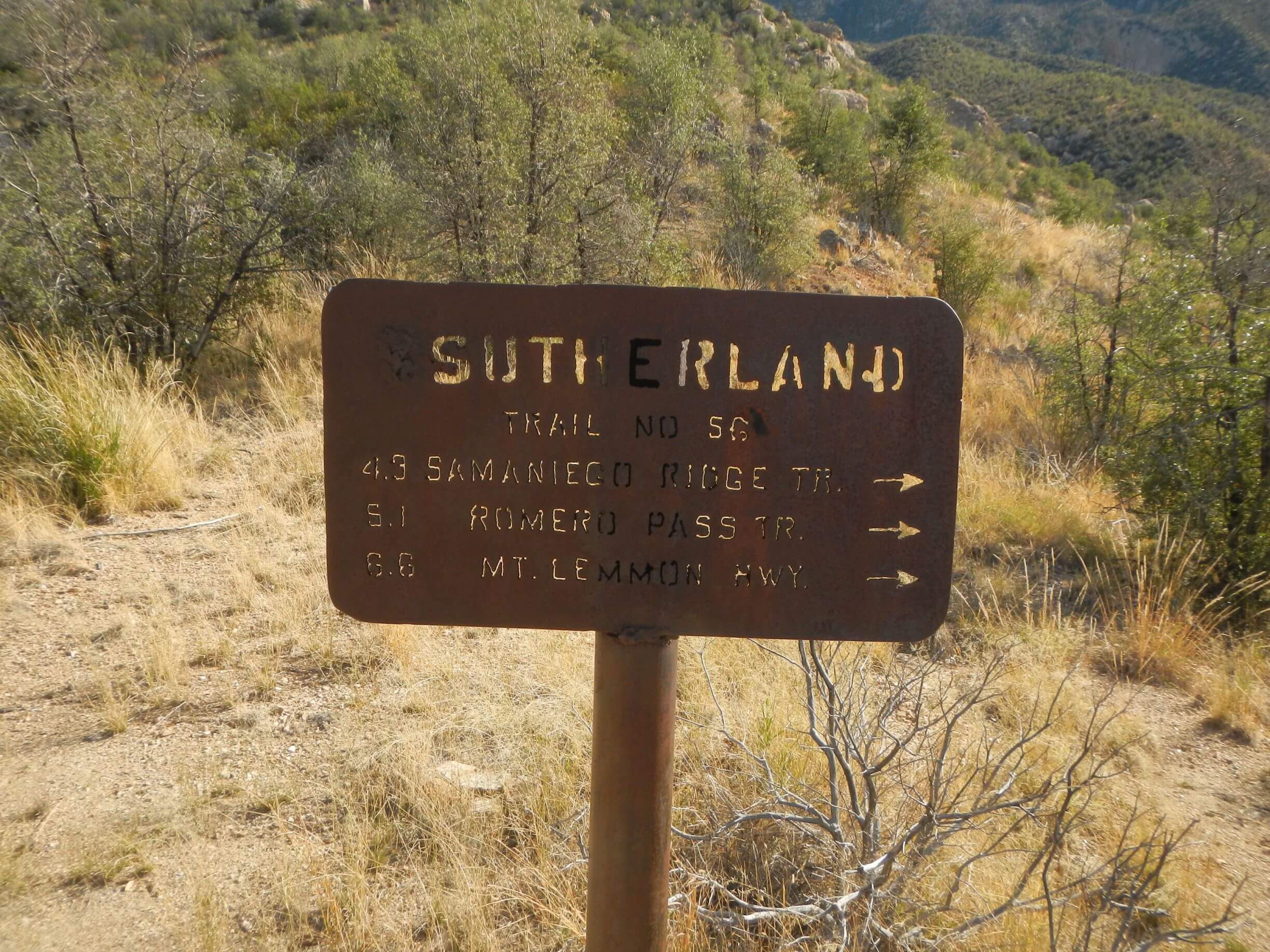
Sutherland, which climbs steeply up to join Canyon del Oro Trail on Mount Lemmon ridge from Catalina State Park, was badly damaged in the Bighorn Fire of 2020. The Forest Service plans to remove it from its trail system in its final Santa Catalina Trail Plan of 2023, due to heavy fire damage and minimal use.
In November, a UA student friend who is in the current Ramblers told me she and friends hiked Summerlin to the ridge and back in a day! I was determined to check it out.
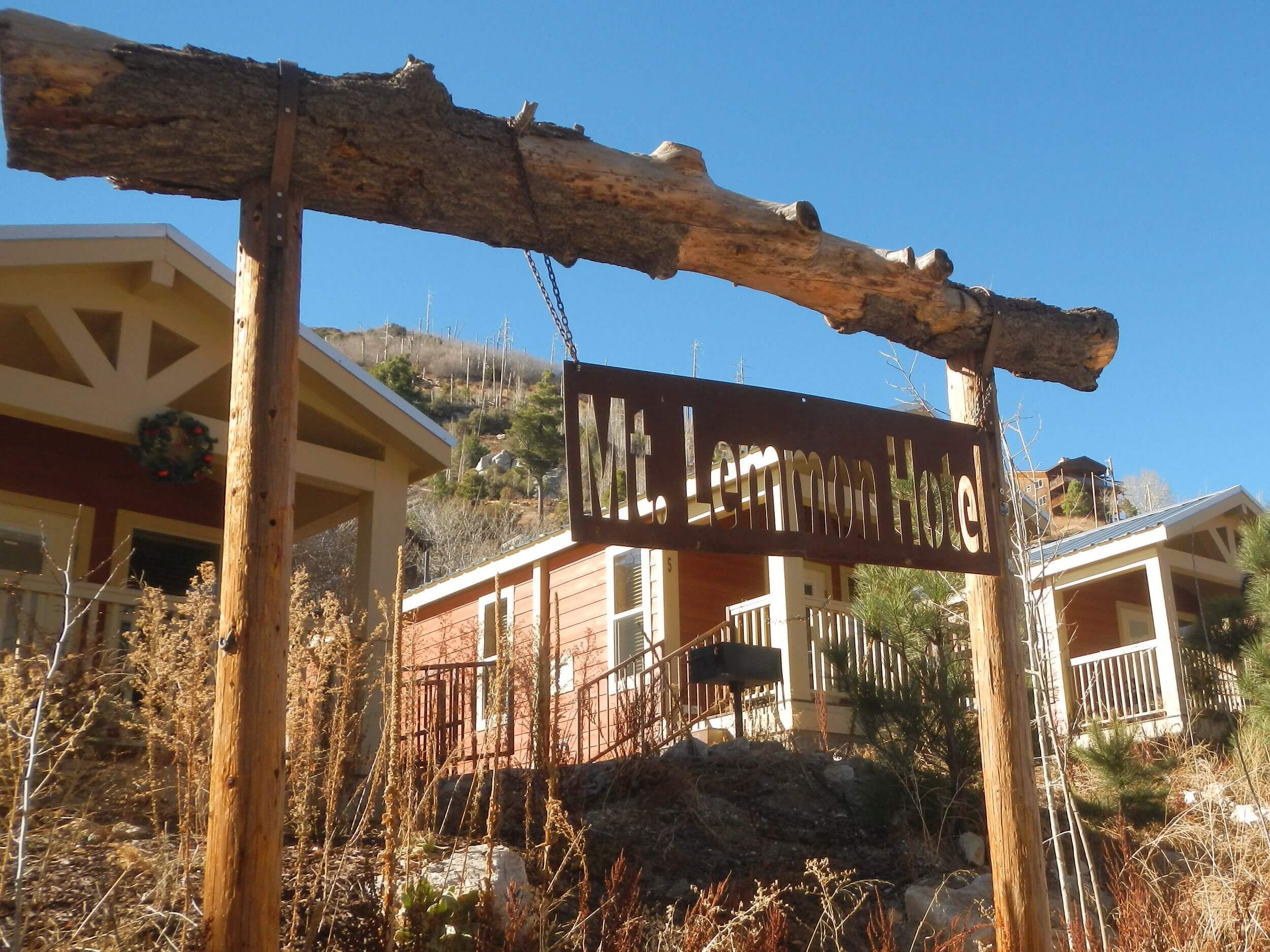
I could hike but not carry a backpack as I was recovering from shoulder replacement surgery (arthritic shoulder made worse from fall on dry slick soil backpacking Catalinas in 2024 ). So, David made reservations for two nights at Mount Lemmon Hotel, cabins we’ve used in the past. He brought his backpack with water, food, and clothing; and I had a day sack.
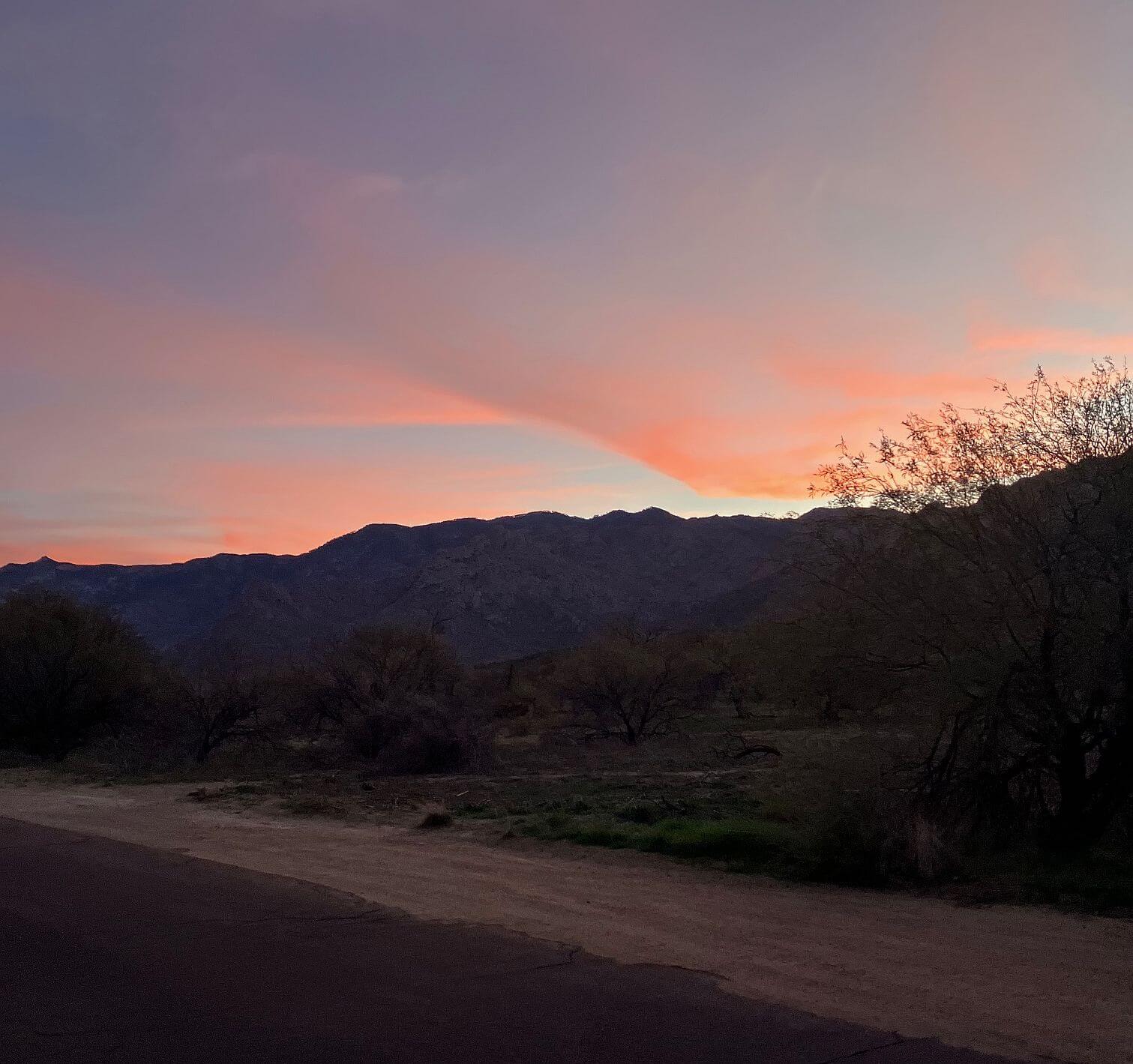
We left our vehicle at the large Catalina state park main trailhead parking lot (having bought two 24-hour “day permits” at entrance and posting on our windshield) around 7:30 a.m. December 17. Sunrise colored sky as we hiked 2.6 miles of Canyon Loop and Sutherland Connector trails to meet actual trail—eroded steep powerline road made with bulldozer.
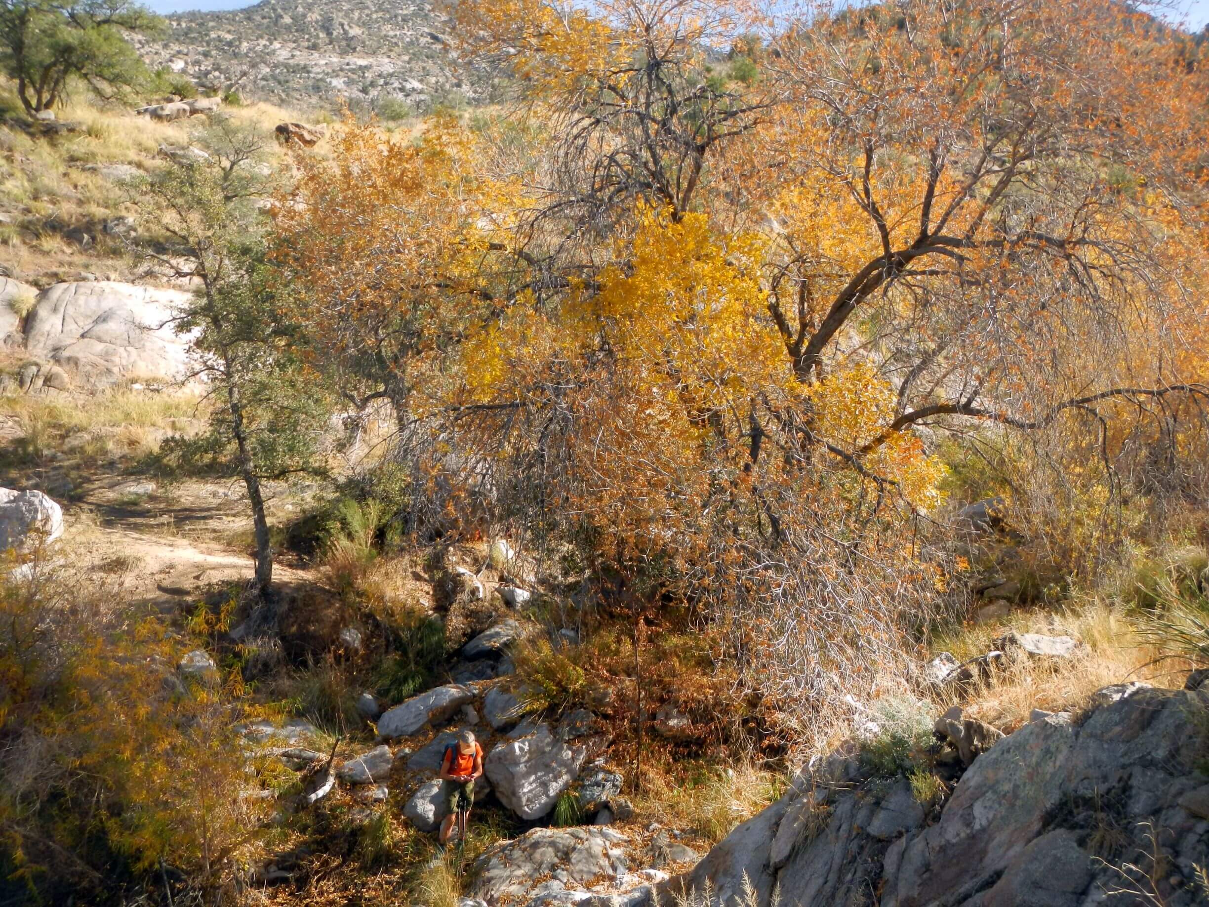
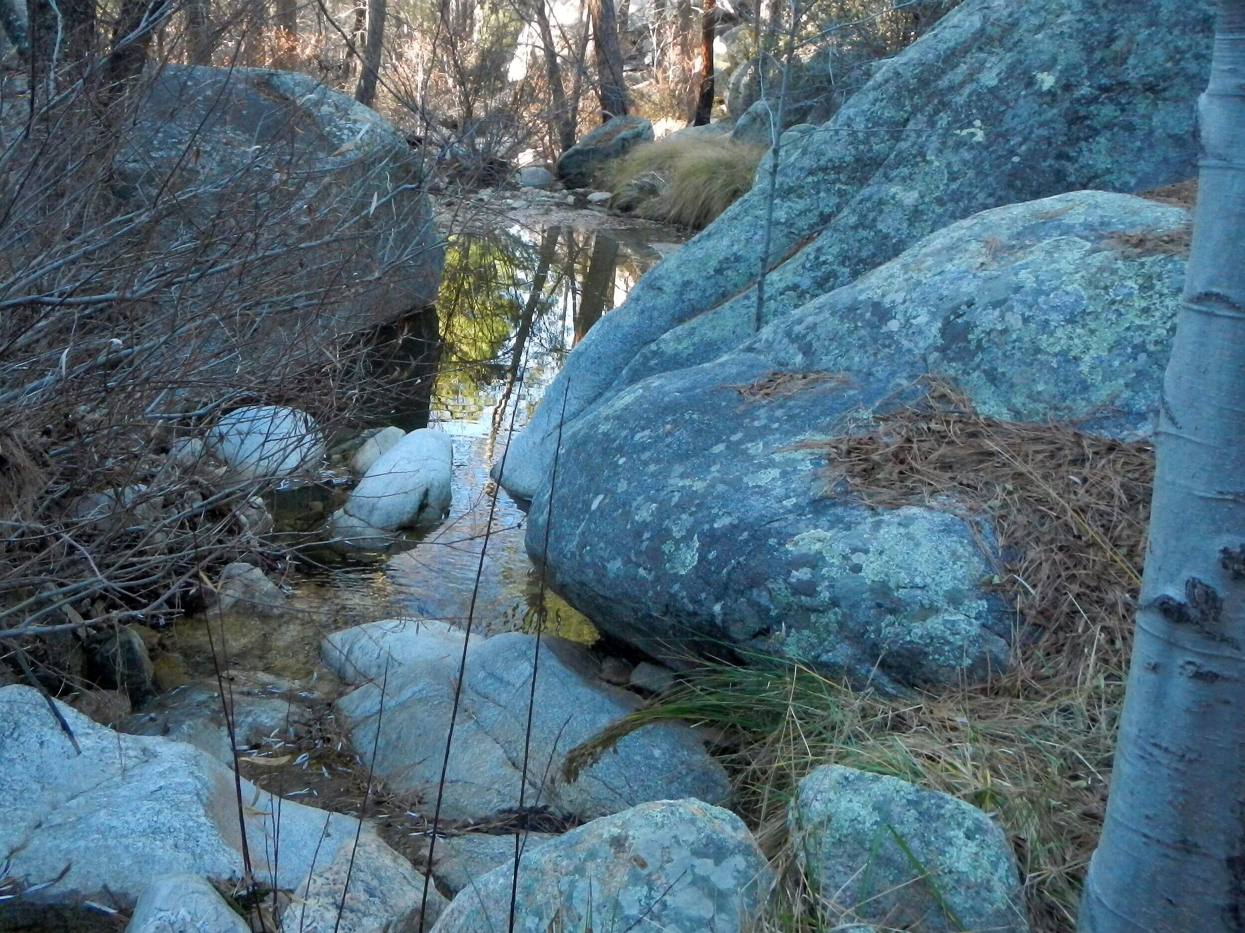
A couple miles up, we crossed Cargodera Canyon—with trees upstream decked out in golden fall colors—and left the road at old Sutherland Trail sign on trail contouring along a side canyon then switch-backing through Pusch Ridge Wilderness south of the powerline ridge. We skittered down a washed-out drainage crossing where David filled up from pools. Good thing he did; we were nearly out of water by end of long day.
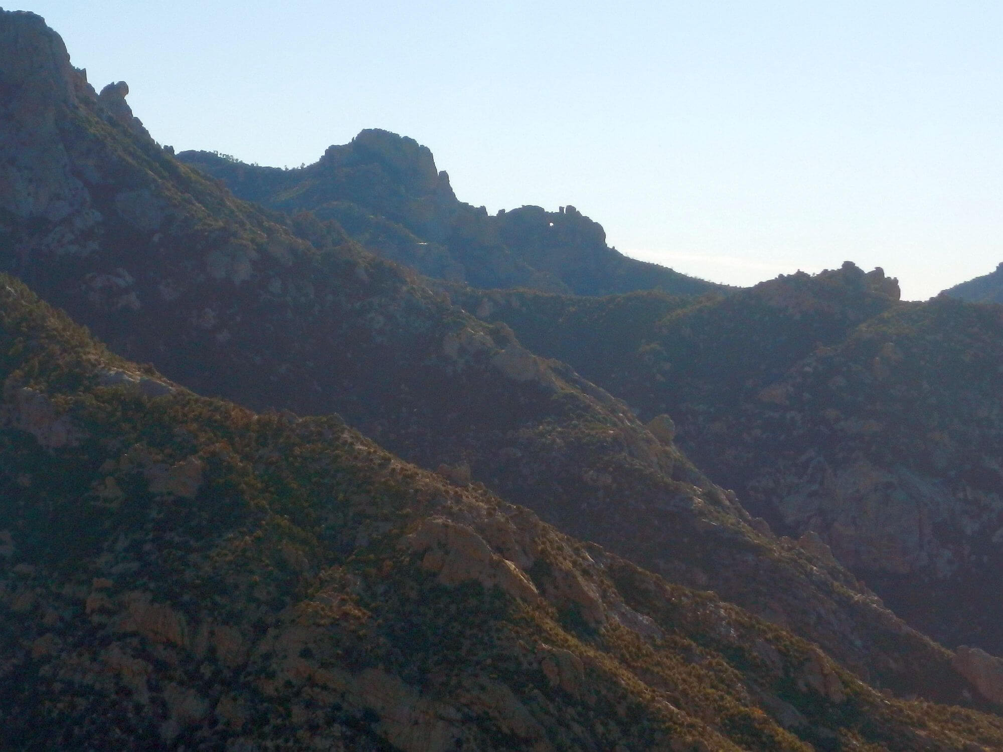
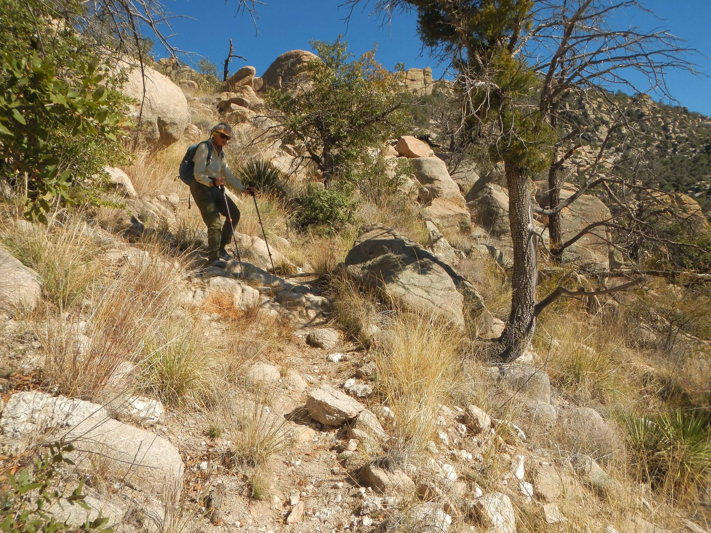
Fair trail with great views of Oro Valley below until we got to a saddle and apparently the burn scar of the Bighorn Fire. A barely discernible route climbed straight up—through many brushy areas and multiple routes, often marked with rocks by previous hikers. Our pace slowed as we made several false starts and backtracks. Finally, we met powerline road on ridge for easier going until a final half-mile heavily burned section where we lost trail in heavy brush, clambered over burned down logs and finally reached junction with Canada del Oro Trail on main ridge at sunset. The previous 3 miles took 3 hours!
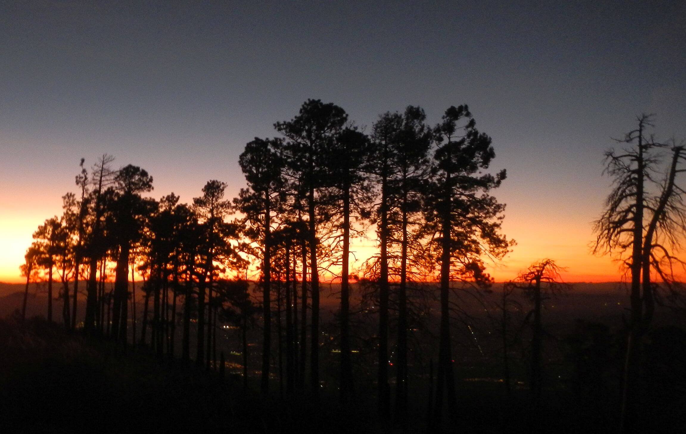
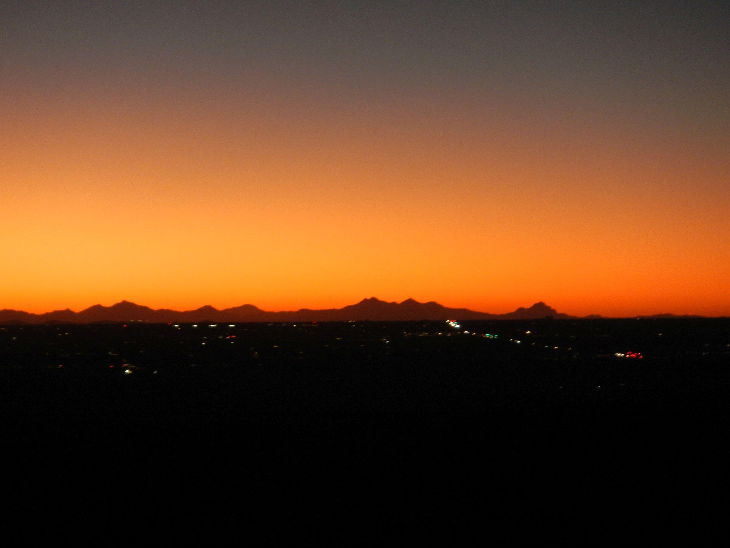
We followed roller coaster road in increasing darkness. Sunset red-orange glow outlined pine tree grove and lights of Tucson twinkled far below. We put on headlamps and made our way along Mount Lemmon Trail and road to a parking area. We never saw the lighted towers on Radio Ridge; our road circumvented the top and ended at a parking area near end of paved Observatory Road winding down past Lemmon Ski Valley to Summerhaven.
In the dark, we chose winding 3-mile road as safer option than shorter trails. Recent snow had hardened to ice in several sections which I crept cautiously across. At 9:30 pm we got to our reserved cabin about a half mile into Summerhaven!
Food accommodations were long closed; but David had packed freeze-dried dinner and desert expecting an after-hours arrival on our 16.9-mile route! The “hotel” cabins have stocked kitchens and bath; it was a backpacking luxury to heat water on a stove and eat dinner on dishes at the table. Hot shower also very welcome and unusual for a “backpack.”
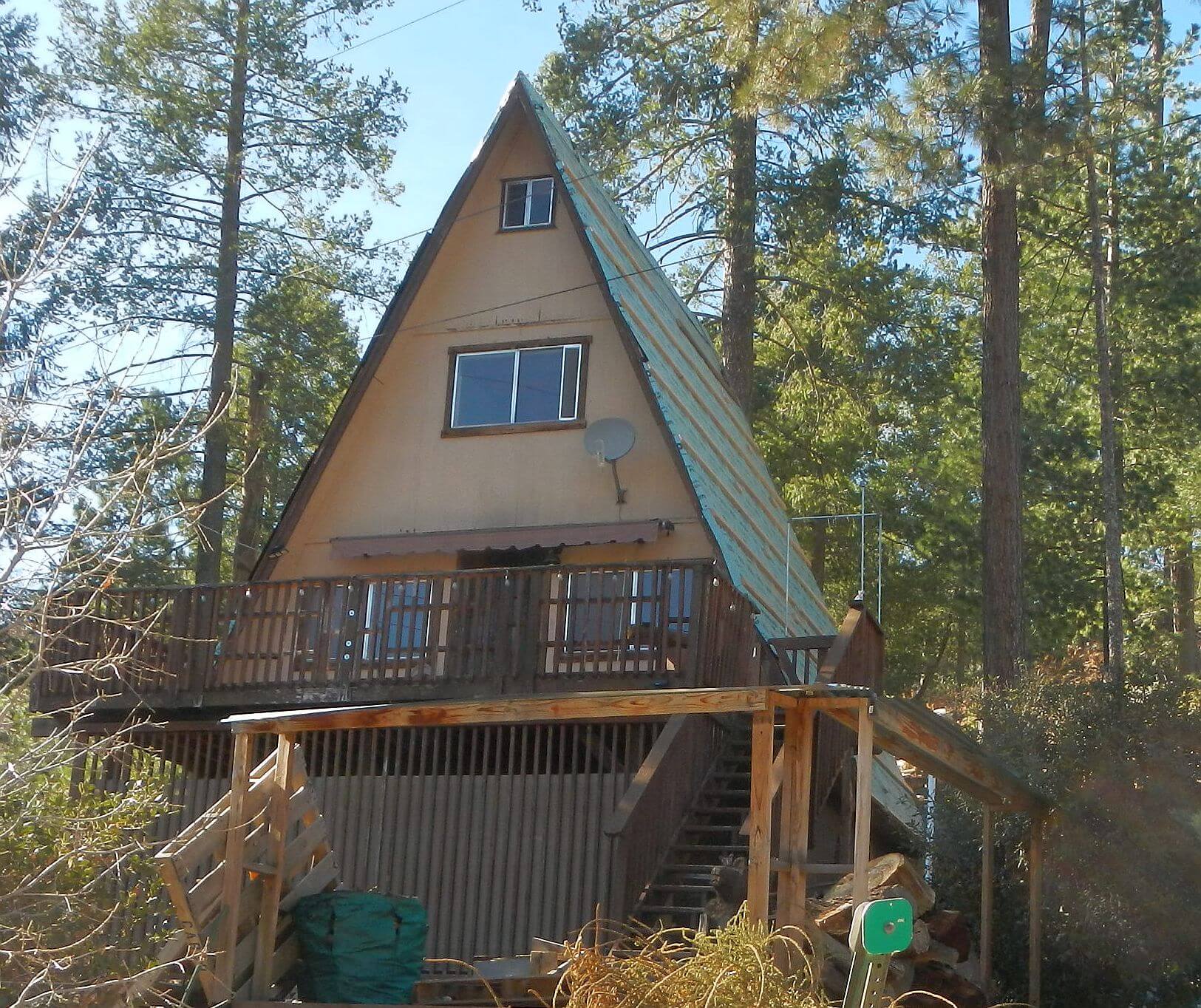
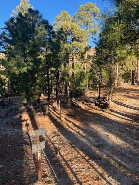
On our “zero day” in Summerhaven we slept in, ate breakfast at next door hotel restaurant, explored steep sideslope roads to view rebuilt summer houses—most much more grandiose than the modest cabins I recall from 1970s. Maybe some generous insurance settlements after the Aspen Fire of 2003 burned 340 structures to the ground. We hiked up Carter Canyon Road to Mint Spring trailhead—the trail which we planned to depart on, part of the Arizona Trail (AZT) route.
A car passed us and young people tumbled out on a side road. I told one guy standing around, “you should go up the trail; there is great view of Summerhaven.” The group headed to the trailhead but then we saw them headed back down; apparently fudge and other treats at the Mount General Store had more appeal than a hike. The store, popular resupply stop for AZT hikers, has good history on its website of Mount Lemmon, Summerhaven, and the rebuilding after Aspen Fire.
We also stopped at the store, buying burritos and sandwiches to cook for breakfast in the cabin. Then we hiked over to Sawmill Run Restaurant and got burgers to go. We ate breakfast about 11 and were not yet ready for another meal at this place which closes at 4, so we planned to reheat burgers in our room later. I had once inquired about the early closing time and learned that some of the staff commuted from Tucson! At 3, the restaurant had a nice crowd of day hikers and car visitors.
We rose before light the next morning, stretched, cooked breakfast, packed and were on the road for another sunrise. Had Mint Springs and the Wilderness of Rocks trails all to ourselves that morning along with steep switchbacks down Mount Lemmon Trail. Since I had slipped and fallen on very dry soil on the last 2 trails last year I was very cautious!
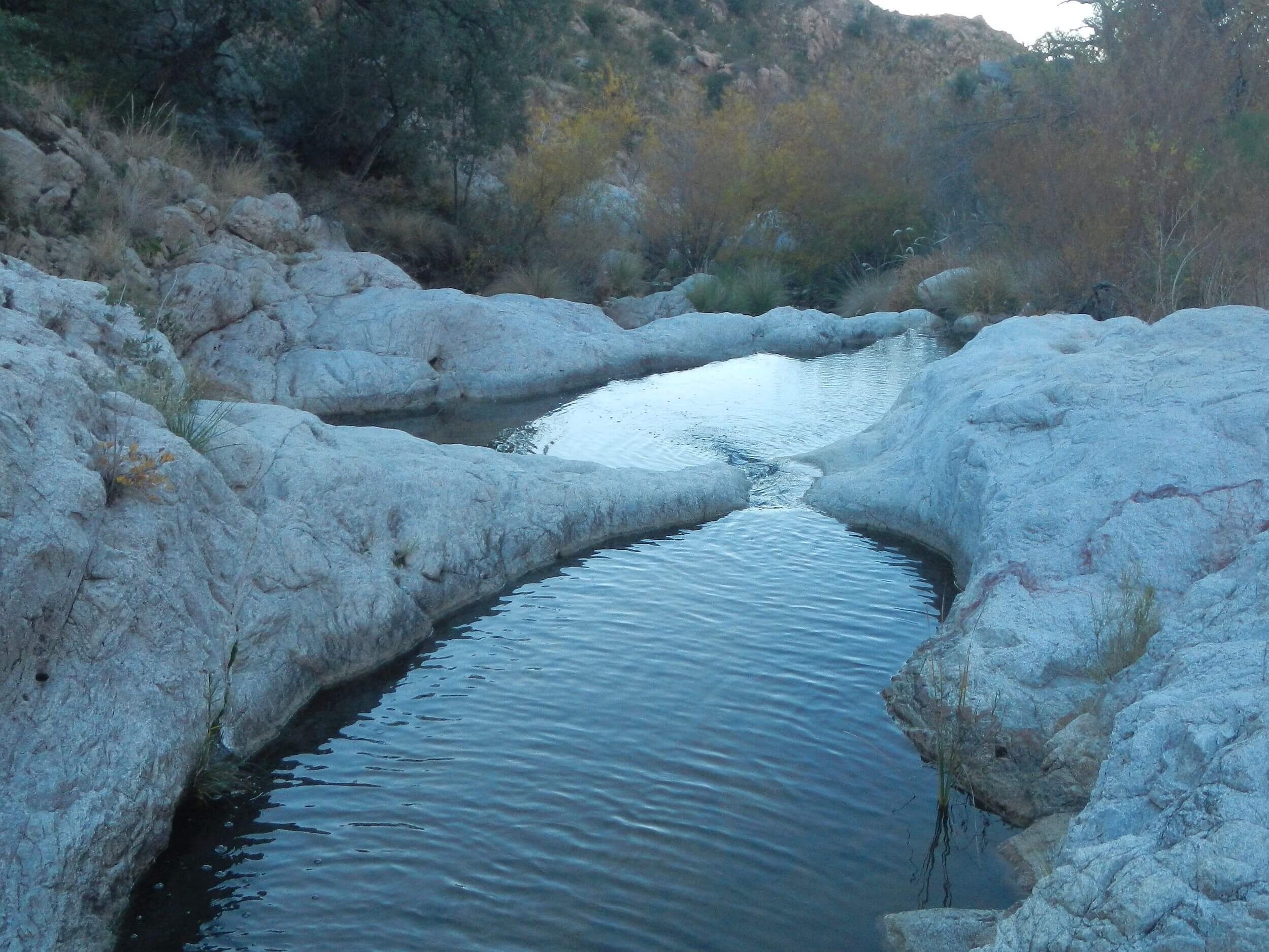
Romero Pass Trail had been rebuilt and brushed by non-profit Arizona Wild crew in spring 2023 but in late 2025, trail already cloaked in brush and down trees. Trail swung back and forth down a dry canyon until we crossed to a campsite where a spring began, feeding a waterfall, small pool, steeper waterfall and deep pool at foot of cliff. Romero Pools also had lots of water. From there, heavily used trail climbed a ridge then descended in eroded switchbacks with steep rocky pitches to clamber down. (Later we felt like we had done hours on a Stairmaster!)
On a 16-mile return on better trails, we still were hiking park trails by sunset and got to our vehicle just at dark.
I checked back with my student friend later who had inspired our Sutherland hike. For a November hike her group left the park at 7 a.m., got to ridge view of Summerhaven at 4:30 p.m. and back to park at 8:30 p.m. “We were so tired we ran most of the way down.”
Jogging down a burned brushy trail and steep rocky powerline road is not my remedy for tired legs—but no doubt 20-somethings have a bit more bounce than 70-something oldsters! We were pleased we got to the top almost as fast as our inspiring young friends! I wish the Forest Service would flag the Sutherland Trail instead of abandoning it!