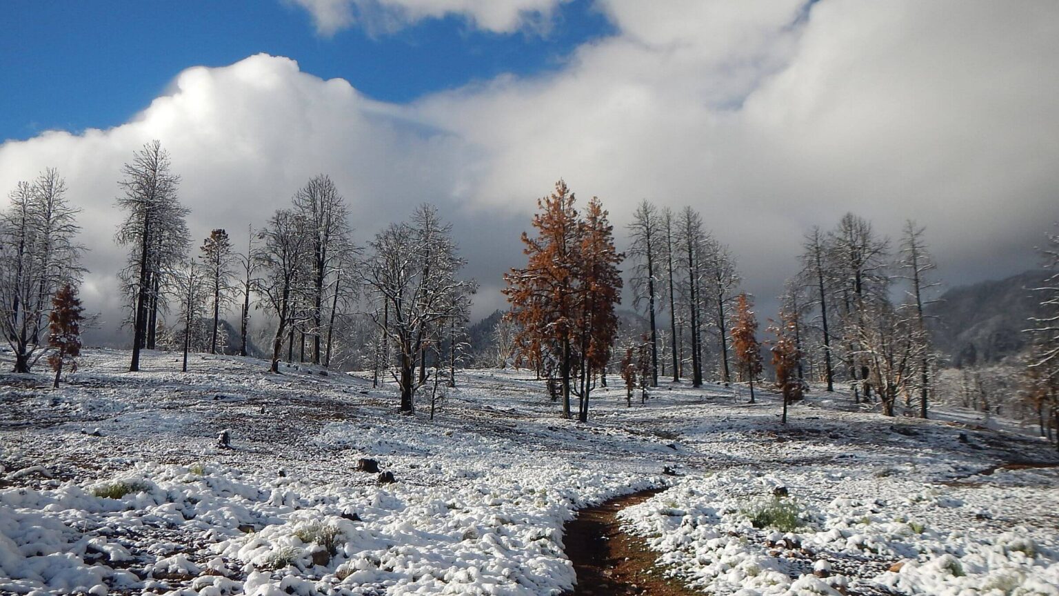
 Snow mitigated 2025 Forsyth Fire scar at trailhead (Day1)
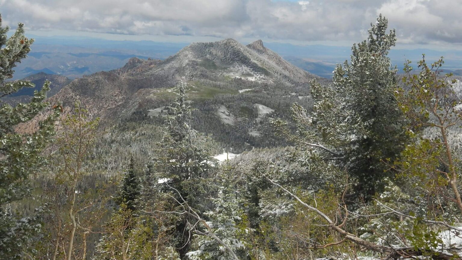 View back to Saddle Mountain on Summit Trail (Day1)
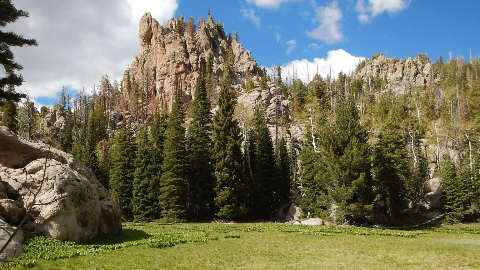 Middle Fork Santa Clara River headwaters (Day2)
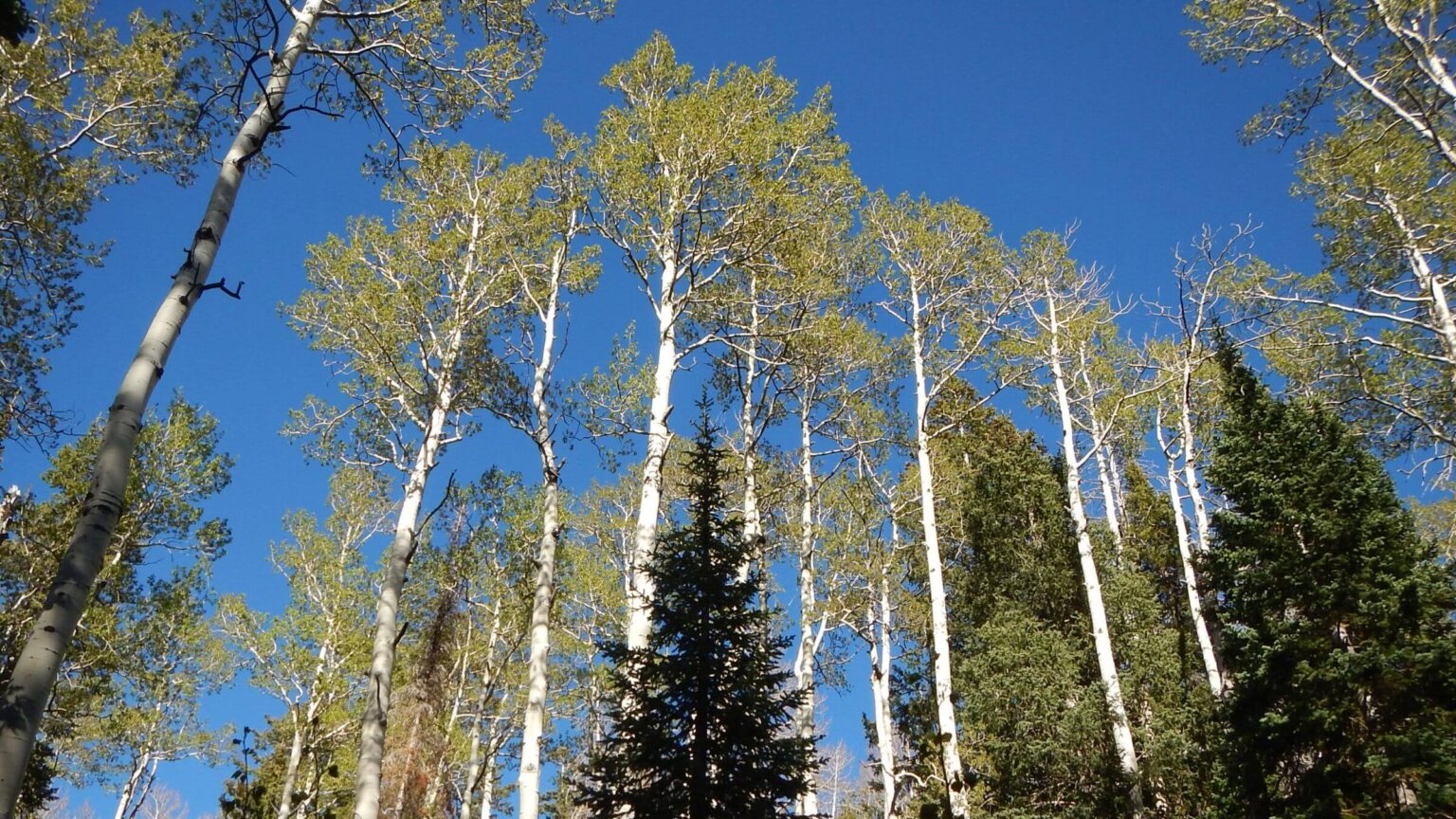 Aspen & spruce-fir forest (Day2)
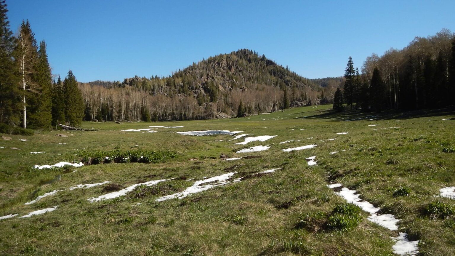 Whipple Valley (Day3)
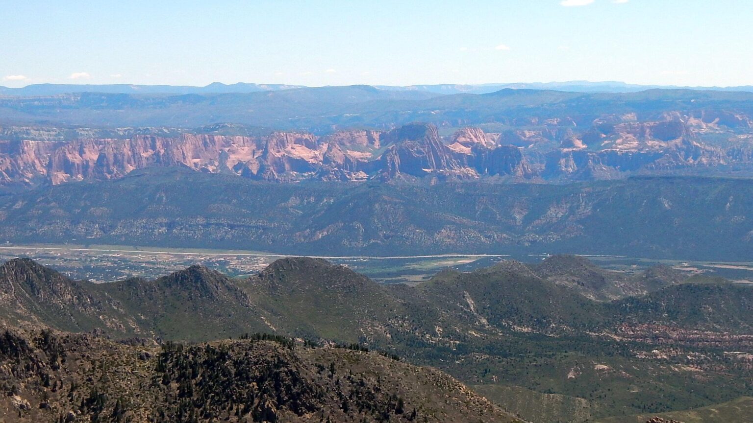 Kobab Canyons view into Zion National Park (Day3)
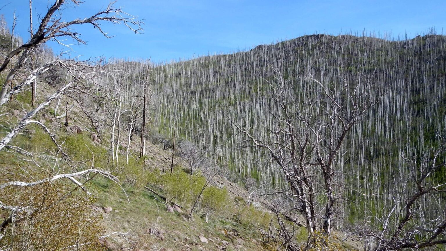 Aspen recovery within 2018 West Valley Fire (Day3)
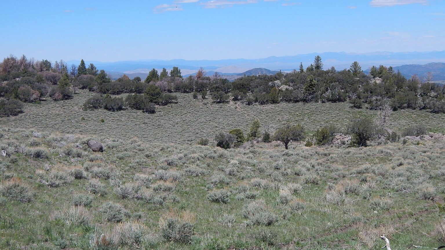 Sagebrush, Mountain Mahogany & Limber Pine woodland (Day4)
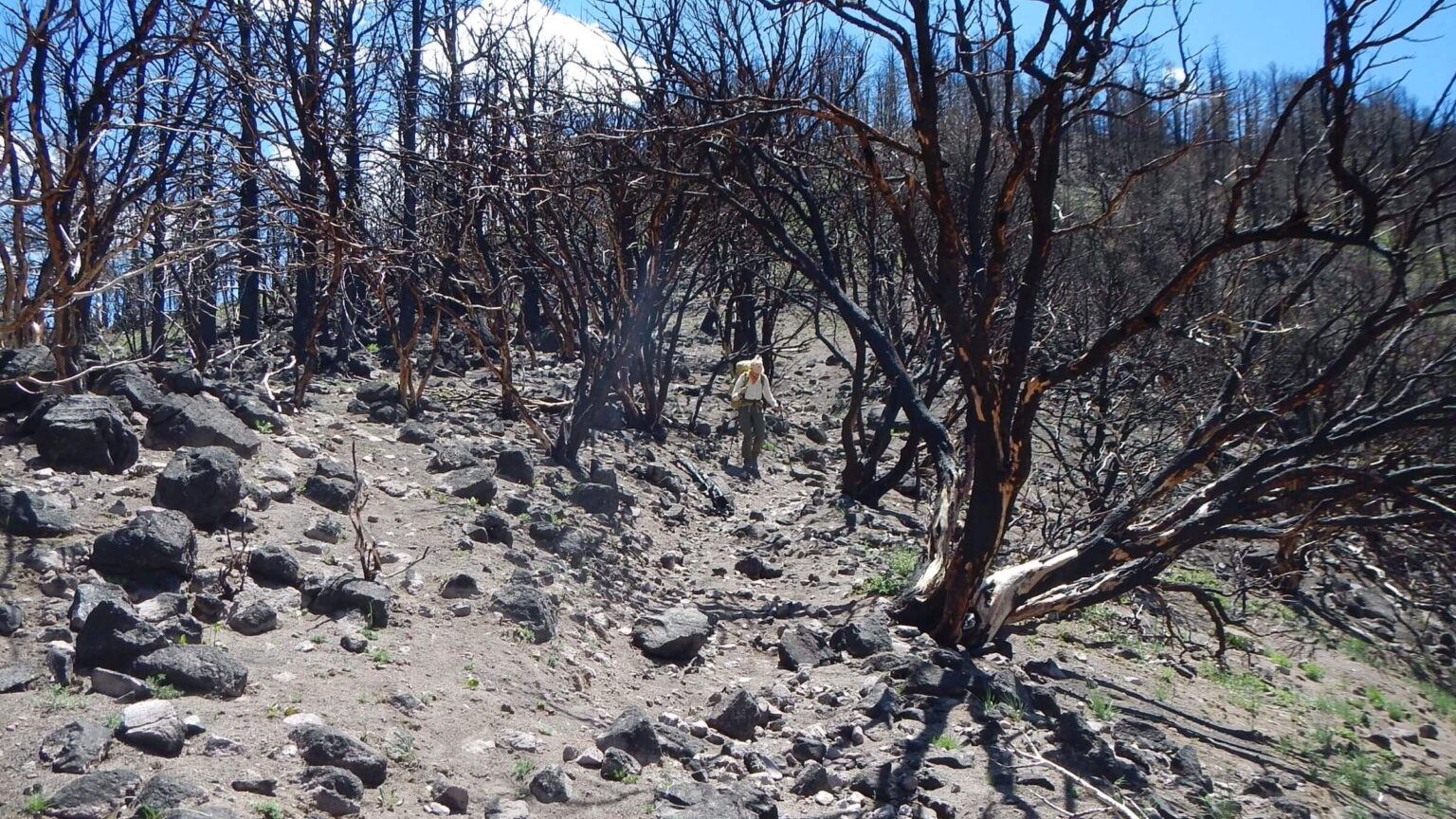 Extreme Forsyth Fire vaporized organic matter, altering volcanic soil (Day4)
Snowy Surprise Chills Piney Ridge Revisit
I have wanted to revisit the Pine Valley Wilderness in southern Utah since we moved back to the West in 2016 after previous visits in the 1970s and 1980s.
As “snowbirds” with a summer place near Sun Valley, Idaho and winter home in Tucson, we sometimes have passed below this 10,000-foot ridge of pines and valleys soaring above Interstate-15 in southern Utah on our biannual southern and northern “migrations.” But our fall pass by was often just after a chilly trip in Idaho or neighboring state that made me eager for desert climes, while spring has always been too snowy in mid to late May.
The 2026 drought year in the West seemed the perfect time to revisit. Utah and Colorado had minimal winter snow. Forest Service snow depth map showed only snow patches in Pine Valley Wilderness in early May. David found an Airbnb rental in Pine Valley and owner let us reserve the nights before and after our 4-day trip.
The 2025 Forsyth Fire had severely burned 16,000 acres and demolished some Pine Valley homes; the recreation area and easiest access on Whipple Trail was still closed. But a Forest Service trails manager said our proposed loop up Forsyth and Summit Trails and back on Water Canyon would work; those trails were open and we would skirt worst of recent fire damage. It was all go.
We planned a 37-mile loop along 10,000-foot crest of the Pine Valley Mountains (Summit Trail) with return on trail and road, starting and ending at our Pine Valley Airbnb.
We made the trip but an unseen climate “surprise”—probably compliments of climate change—made conditions a lot more difficult than expected! A wild windstorm that followed us from Arizona completely changed the environment and our Pine Valley visit in four hours overnight!
Pines, meadows & lost trail
The pines and towering red rock pinnacles of Southern Utah were my family’s summer getaway during my teen years in Las Vegas, NV. We had moved there for my dad’s work at the Nevada Test Site (now called Nevada National Security Site [NNSS]). We drove up to the cool higher elevations of the Dixie National Forest and adjacent national parks for hiking and fishing.
Pine Valley Mountain Wilderness was designated by 1984 Utah Wilderness Act along with 11 other wilderness areas for a total of 750,000 acres protected. Pine Valley Mountain encompasses 50,000 acres, the second largest wilderness in Utah (High Uintah Wilderness is largest.) Elevations range from 6,000 feet to 10,365 at summit of Signal Peak, skirted by the Summit Trail.
A mountain island surrounded by desert, the wilderness has several lush meadows (up to 50 acres in size) and, before several fires, beautiful forests of spruce-fir at highest elevations and other species as elevation decreased—including aspen, white fire, limber pine, ponderosa pine, and pinyon-juniper-mountain mahogany woodland. Much remnant forest remains along out hiking route. On clear days, Zion National Park is visible to west across Interstate-15.
Unfortunately, six fires since 2002 have burned almost the entire wilderness area. The largest in June 2025, Forsyth Fire, burned 16,000 acres, destroyed 14 homes and 4 outbuildings; closing Pine Valley Recreation Area for rehab work. Next two largest, 2018 West Valley (12,000 ac) and 2009 Mill Flat (13,000 ac) fires burned and reburned north end (check Fires on map below for detailed locations).
The Summit Trail follows Pine Valley Mountain crest north-south about 18 miles; 8 other trails climb to the crest. Dixie National Forest website claims 151 miles of trail in area including surrounding non-wilderness on the forest.
In spite of fires, trails were fairly good. Summit Trail was on Forsyth fire boundary in and out of burn; all large open valleys along trail were unburned. The 2018 West Valley fire left brushy trails but down logs had been cut out except for most recent blowdown.
Visit statistics: 4 days, 37 mi hiking, at 1.6 mph, with 475 ft/mi of average elevation change.
Go to map below for more information on trailheads, daily routes, mileages, elevation changes, and photos. (Click on white box in upper right corner to expand map and show legend with NAVIGATION INSTRUCTIONS.)
show more
My love of hiking was furthered at the University of Arizona where the UA Ramblers hiking club introduced me to backpacking. Back to Vegas after my freshman year, I soon cajoled a family friend, Bill, to accompany me on backpacking trips. Our first was to Wheeler Peak area (Nevada) and second was to the Pine Valleys. (Later that summer we had a third backpack as two of the adult chaperones for a church youth group trip to the Sierras).
We took I-15 to St. George and on to Pine Valley Recreation area, parking my Mustang at the Whipple Valley trailhead. A long climb brought us to beautiful green Whipple Valley. I think we pushed on to Mill Flat. I recall boiling water on our fire for a “teakettle dinner” that night and awakening the next morning to Bill already having the fire started and coffee made! (Bill, geologist at Nevada Test Site, caught a bus around 5 a.m. every weekday for transport to Mercury from Las Vegas.)
I have few memories other than the green valleys and lush forest. Going down the switchbacks, 40-year-old Bill told he had to keep moving or his knees would “lock up.” At age 19 I couldn’t relate but in my 50s I found myself “working around” knee pain hiking until relief from recent joint replacement surgeries. My other memory of that trip was a persistent hornet at the trailhead.
David and I moved to Ogden, Utah in 1979 where we lived about 16 years, (with 2.5 years in the middle from 1980-83 for graduate school at Colorado State University in Fort Collins). Our 1980s Pine Valley visit probably occurred after 1983 and before 1986 when our daughter, Michal, was born but we have no photos or notes on the trip, only vague memories.
We likely came in from northwest near hamlet of New Harmony. I had hoped for a loop parallelling Summit Trail on the crest using lower elevation trails through rangeland shown on the maps I had (1980 Dixie National Forest Map and a 1980 U.S. Geological Survey 1:100,000-scale topo map of St. George area) then returning on Summit Trail.
I know we lost trail soon after dropping down. (Current maps do not show trails any further than Browse Guard Station so they may already have been nonexistent in the 1980s.) I recall finding trail climbing steeply to the crest and then hiking a ridge trail which seemed rather mellow at the time. (Summit Trail certainly didn’t seem mellow in 2026!)
Arctic Surprise in late May
On our way to Pine Valley for our 2026 return, high winds buffeted us at every stop as we drove north through Arizona, west across the Arizona Strip and along scenic Highway 18 from St. George north. We turned onto curvy road to Pine Valley—settled by Mormons in 1855 for a sawmill that supplied wood for a school in St. George and organ pipes for the Salt Lake City Temple.
Today, the hamlet of homes scattered along mountain slopes and along a few streets in the valley numbers about 355 permanent residents and up to 1400 in the summer; many in second homes for St. George, Las Vegas, and California visitors. We brought our bags and backpacks into elegant Settlers’ Cottage (which included yoga mat, art supplies, and a sketchbook). After organizing food and gear for morning departure, we hiked up the road almost a mile to check out Forsyth Trailhead.
Wind from the south was hard and hostile; David retrieved porch-swing pillows from yard before going to bed and I saw (in the yard next door) a tarp swelling with wind and whipping violently around. Weather report called for a 4-hour storm later that evening. We went to bed. I listed for rain pounding on the roof but never heard it.
The next morning, I looked out the window and understood why sound of rain on roof. The valley was cloaked in snow!
The storm had deposited about 2 inches snow in the valley (more throughout mountains) and dropped the temperature into the low 30s. We bundled with turtlenecks, cotton shirts, stocking caps and gloves, ate breakfast, and set off. Snow already gone (from radiant energy) on road and the first mile of gravely Forsyth Trail winding its way uphill through blackened pines and woodland. A lightning struck tree in this grove had ignited the fire in summer 2025.
Trail soon entered Forsyth Canyon with beautiful mixed conifer and aspen untouched by the fire. But snow was not melted in the canyon or on the Summit Trail climbing steeply around a mountainside between Burger and Signal (highest in the wilderness) peaks, and the deeper depth provided a tiring slog.
At the first flat, 9800-ft elevation Further Water, we were already tired after 9 miles climbing and plodding. David eyed a snow-free forested nook at head of valley with evening sun out of main wind flow for an early camp.
Green valley with running water was mostly snowy with corn lily (skunk cabbage) poking through white layer, probably as shocked by winter’s return as we were. We donned raingear—I added a wool sweater to my ensemble—for camp. It had been cold and windy all day—neither one of us had removed any of our layers, what we typically would wear for Nordic skiing!
After dinner and clean up, I was more than anxious to crawl into the tent! So cold that night my water bottle froze almost solid. We stayed in the tent until we saw sunshine outside.
Condensation froze the underside of tent fly, outside ends of sleeping bags, and ground tarp, so we packed everything across valley for drying in breezy sunshine. A wind gust caught a plastic garbage bag (used to cover a pack at night) inflating and sailing it high into a tree top. Fortunately, wind kept bouncing it to lower branches until David could flip it to the ground with dead tree pole. Got off at 10 a.m.
After nasty contour on icy north slope snow and a summit we descended to Deer Flat, green and snow-free, and I wished we had camped there, although David said there was not a decent flat area except in open valley.
Burned trees & sunny meadows
Undulating trail gave us another short mileage but tiring day (8.9 miles). Trail made four ascents and descents between 10,000 and 8,800-foot elevations in and out of Forsyth burn scar. Climbs were steep and descents usually gentle contour through the woods; what might have usually been a pleasant relief bopping down needle-softened trail was not enjoyable because it was snowy in the trees, and snow was melting and slippery on icy old snow beneath it. Snow sometimes formed couloirs which were quite scary to cross.
On our second 10,000-foot peak we hit the Forsyth burn scar and took a brief break among rocks and black stumps. Trail down was mellow switchbacks with so many down logs that David kept dropping straight down the slidy slope. Pretty, snow-clear meadows at head of Right and Middle forks of Santa Clara River.
A last descent to head of Hop Valley was snow-free but very long; then a rather brushy climb. On the warmer day, I had removed my stocking cap but just stuck it under the shoulder strap of my backpack. Near the top I realized the cap was gone! I headed back down a quarter mile but thought I probably lost it further back and also knew David would worry about me if I did not follow him so I turned back.
Sure enough, I heard him yelling far above me. Meanwhile he had found a spring and stopped to fill up with camp water. By the time I reached him it was nearly sunset.
We soon reached a boggy flat area, where many rounds from fire crews apparently cutting and bucking up several trees anticipating a fire run that did not come. (On one high point on the Summit Trail within the wilderness, the fire crew had completely cleared old-growth Douglas fir for a new helicopter landing site with table-sized large round stumps. It always surprises us how the Forest Service allows fire crews to use chainsaws in wilderness during fire—using an exemption in Wilderness Act prohibitions on mechanized equipment “except as necessary to meet minimum requirements for the administration of wilderness” but does not use this exemption for opening and maintaining fire-damaged trails after fire is over).
We took a short hike to check out camp possibilities on ridge above us—it was sunny but windy with no flat areas so we returned to camp in trees on edge of the bog.
Not quite so cold night and water bottle in the tent did not freeze. But sun was late coming to our forested camp; one ray on my backpack; nice for packing! Again, a short drop brought us to a beautiful sunny meadow and after the wet bog, I wished we could have hiked a bit further for a nicer campsite.
North Valley was long, mellow, and green. On into Whipple Valley, the Whipple Valley Trail joined from the bottom although no sign marked the junction. Most snow had finally melted and I enjoyed a couple miles of flat dry hiking.
A final climb on Summit Trail; David pointed out a camp in trees near top; he had been told a trail crew camped here and thought there was a spring nearby, but we did not find it. After this last high point, a long descent into aspen and willow-lined intermittent creek (running well) badly damaged by West Valley Fire of 2018 (started by abandoned campfire). Eight years later, dead treefall was in full swing and brush head high (even lost trail once) although we saw evidence of much recent log clearing.
I was relieved to find last half mile open to Mill Flat, burned twice in last 17 years. I remembered a larger opening, but Bill and I probably went further along the valley which widens out. Bushels of phlox along the trail and outfitter’s camp at junction of two creeks.
We went back to marked junction for Water Canyon Trail. Steady climb through burned and recovering aspen from West Valley Fire to a ridge, eroded slippery descent to aspen flat along a creek. We camped back into side canyon of Bare Valley, large marshy flat ringed by dead trees and stumps with multiple cow trails and periodic poop piles, but still pretty.
Rainy tent, drop into burn scar & road trudge
Foiled again by condensation! Like first night, inside of rainfly coated with ice overnight; when sun hit tent (strategically located on west side of valley for early sun) it immediately melted and started “raining” on us. David got up, removed the wet fly, and wiped down the tent to stop the “rain.” Once again we had a drying session before we could start out. But David just wiped off the air mattresses and packed some things at bit damp, expecting to clean and dry gear at Airbnb that evening.
First few miles were quite nice, hiking along Bare Valley then gentle climbs to cross two drainages—Second Water and First Water. Both had burned but nice pine grove and creek in Second Water. It might have been nicer camp with less condensation in the trees had we pushed on further.
A break on last ridge then descent into Hell on slidy volcanic soil between black and white trees—Forsyth Fire had burned so hot that fine branches and bark were completely burned, and now bark sluffing after a single winter exposing white wood. With all soil organic matter burned, trail already had significant erosion even with driest winter on record. When trail left ridge to contour, I hoped for improvement, but it was worse! Rocky and slippery then an eroded trench. Finally old road along washed-out creek; road mostly wiped out by flooding.
We picked our way across a flat below a hillside through torn up branches—apparently some sort “rehab” mastication by the Forest Service. Trail again but tracks of large vehicles on the side. Seven miles from camp, we came to trailhead, kiosk, and a register. Many day hikers had recently come up this horrible trail!
Major dirt road climbed up hill above Grass Valley Reservoir to join Grass Valley Road descending to Pine Valley. Soon after seeing homes dotting the hillsides, we met the paved Pine Valley Road for last 1.3 miles to our cottage.
Tired, I stopped on a large rock to rest by the pretty 3-story Pine Valley Chapel, a historic meeting place built by Latter Day Saint settlers in 1873. Two blocks more and I collapsed in comfy chair on the porch of our rental.
Unfortunately, cloudy sky had already shaded yard nixed cleaning a drying gear. When David got around to dealing with sleeping pad a couple weeks later he found some mold!
show less
Google Map
(Click upper-right box above map to “view larger map” and see legend including NAVIGATION INSTRUCTIONS; expand/contract legend by clicking right arrow down/up.)