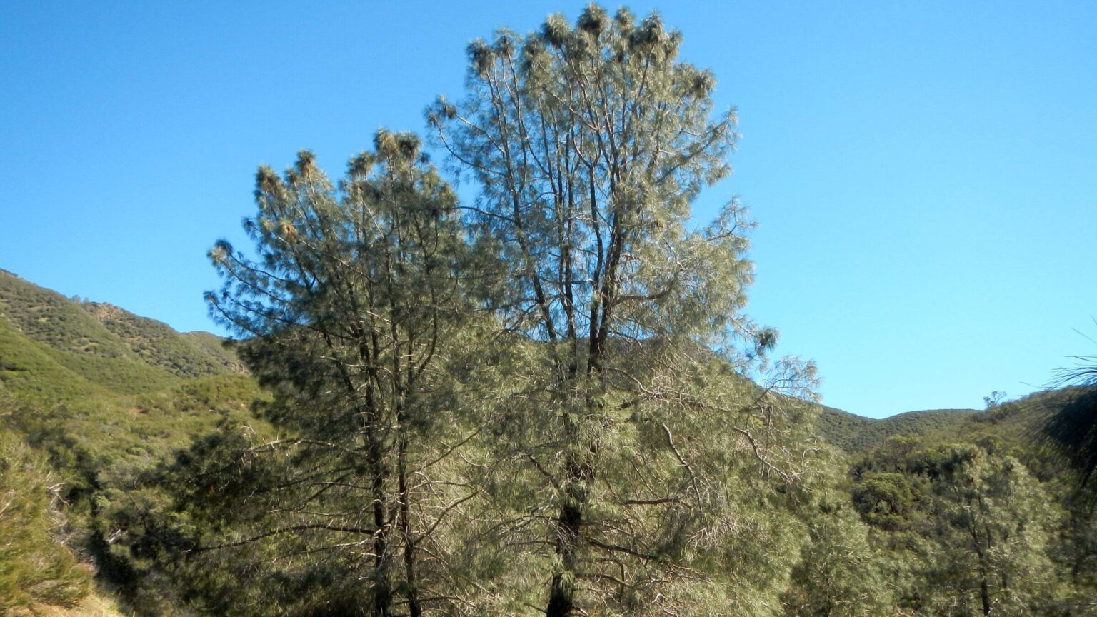
 San Rafael: Coulter pine (Day01)
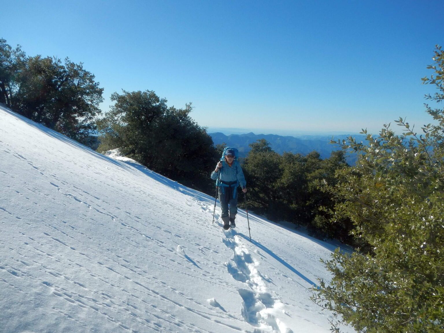 San Rafael: Traversing San Rafael Mountain (Day02)
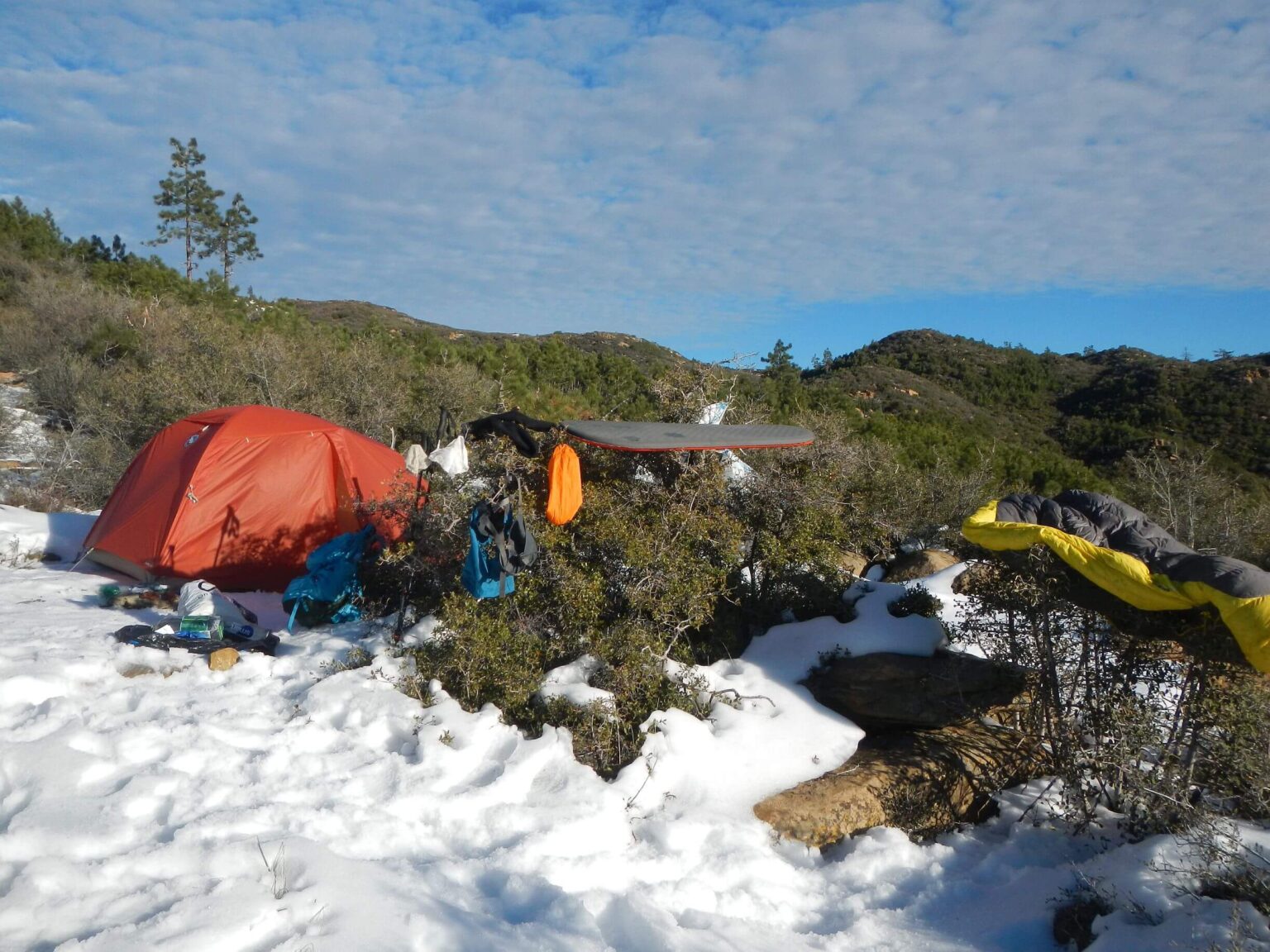 San Rafael: Drying gear from overnight condensation (Day03)
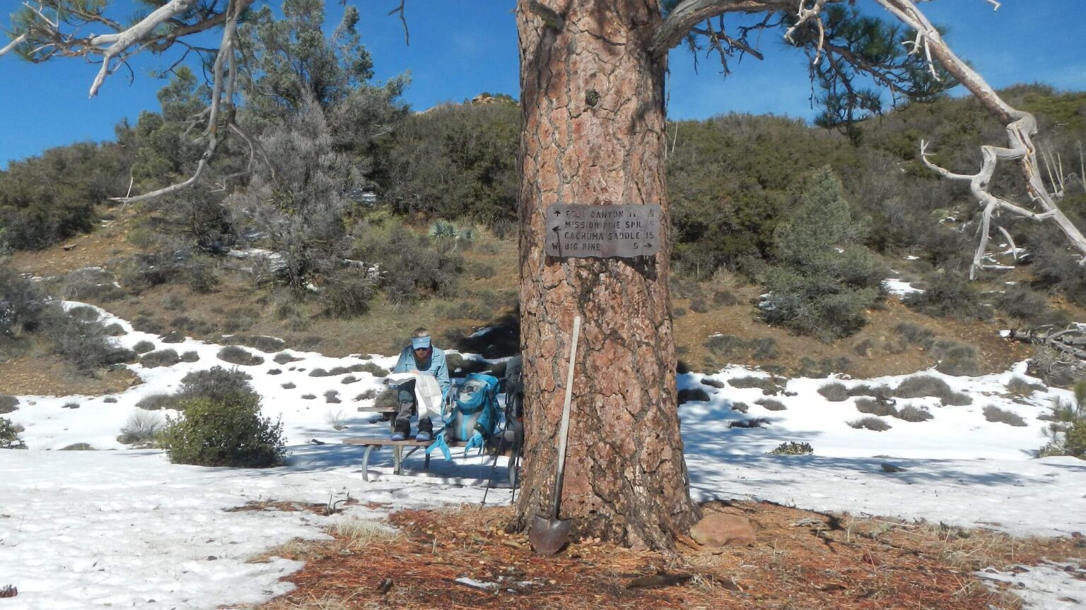 San Rafael: Mission Pine Basin, Santa Cruz trail junction (Day04)
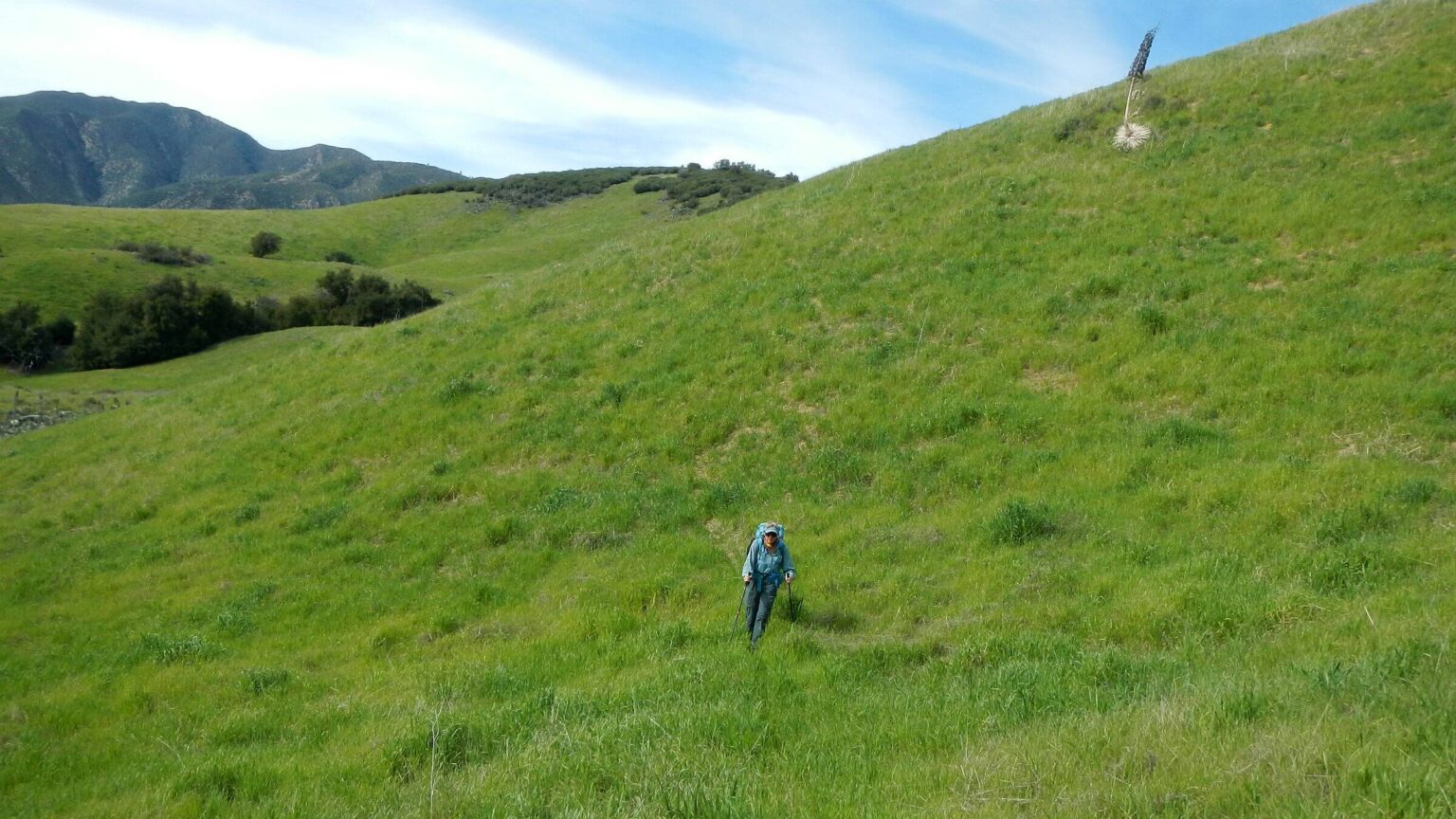 San Rafael: Just outside wilderness boundary (Day05)
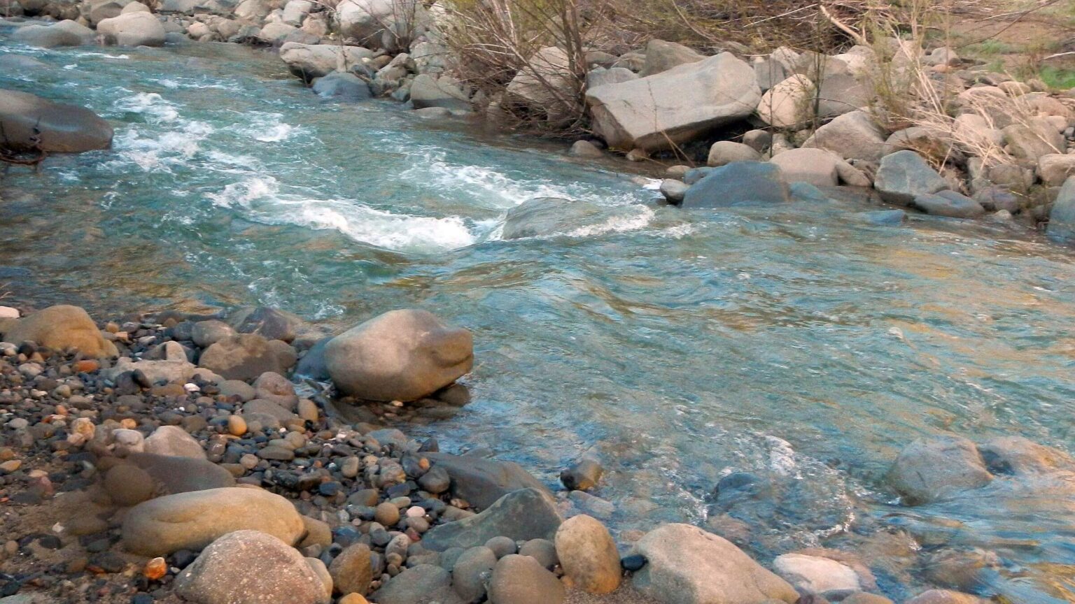 San Rafael: Crossed Santa Cruz Creek (Day06)
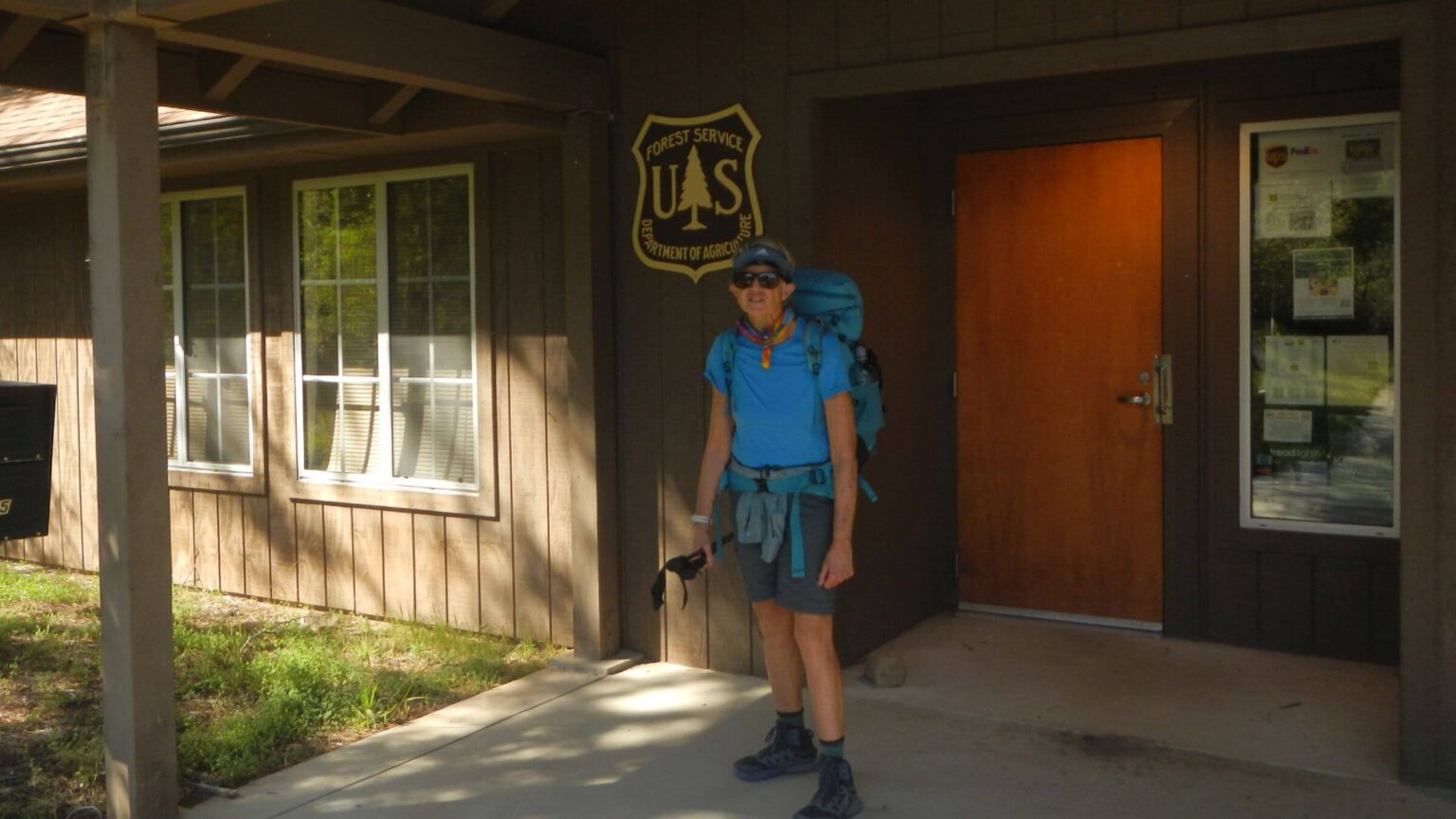 Santa Barbara Ranger District: Cindy’s office memories (Day07)
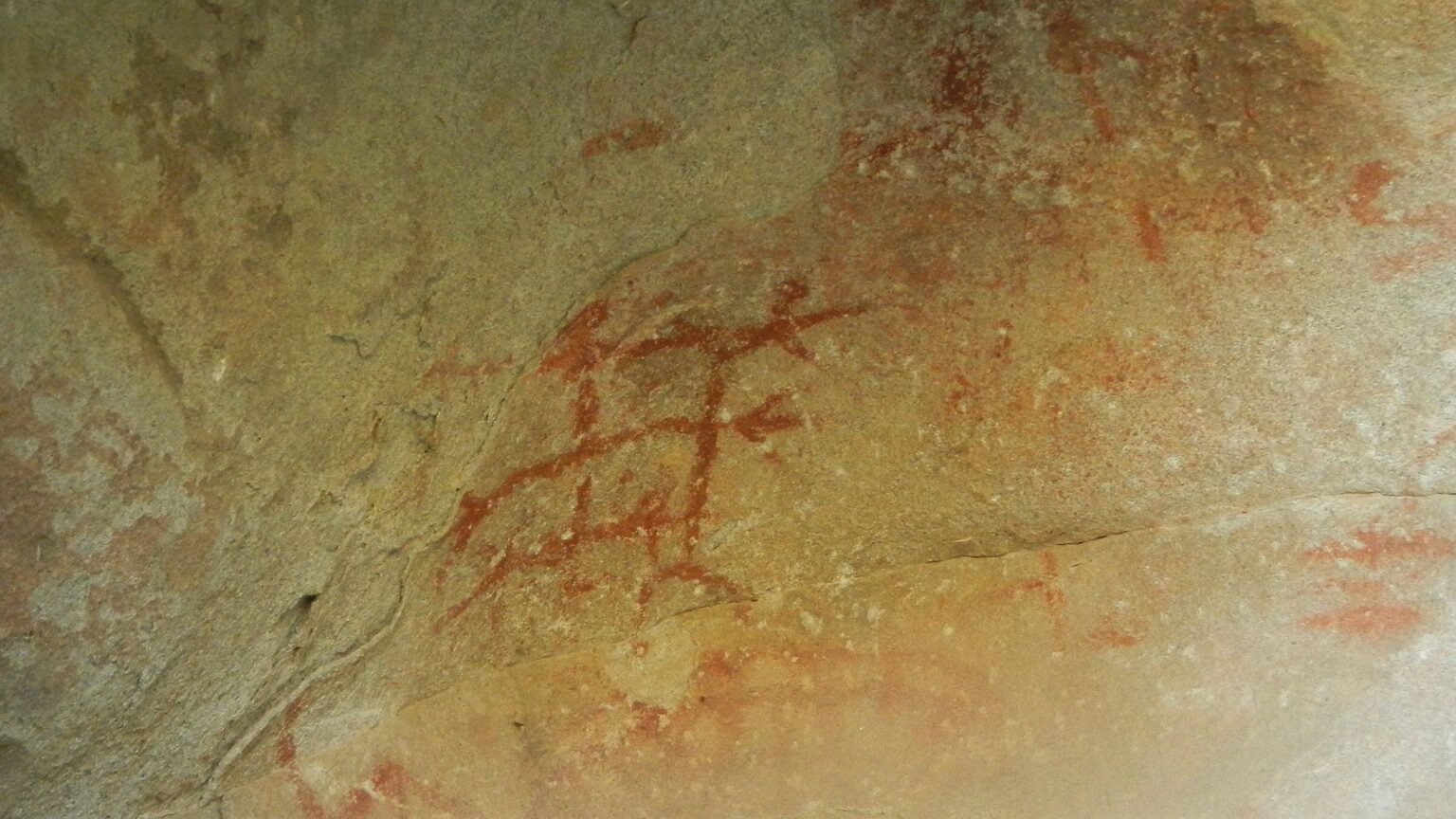 Dick Smith: Chumash rock art (Day08)
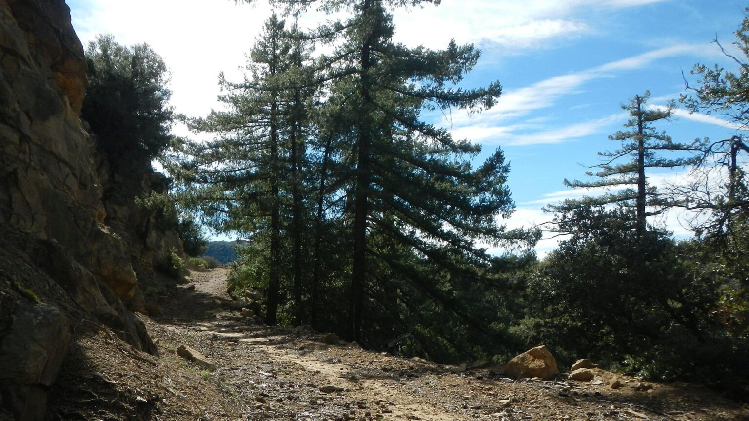 Dick Smith: Buckhorn/Big Pine wilderness corridor road (Day09)
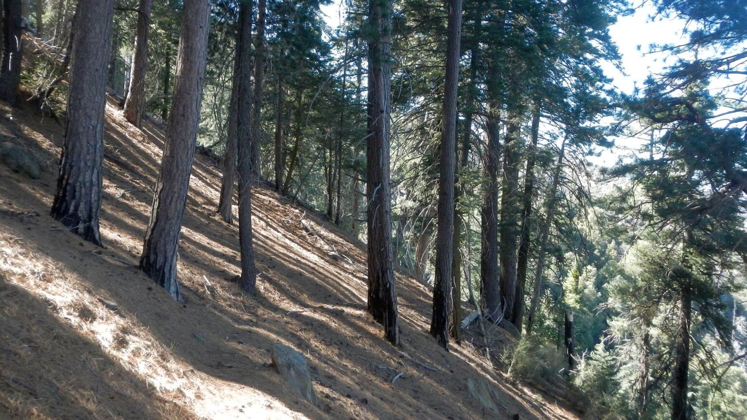 Dick Smith: Old-growth forest, Madulce Trail (Day10)
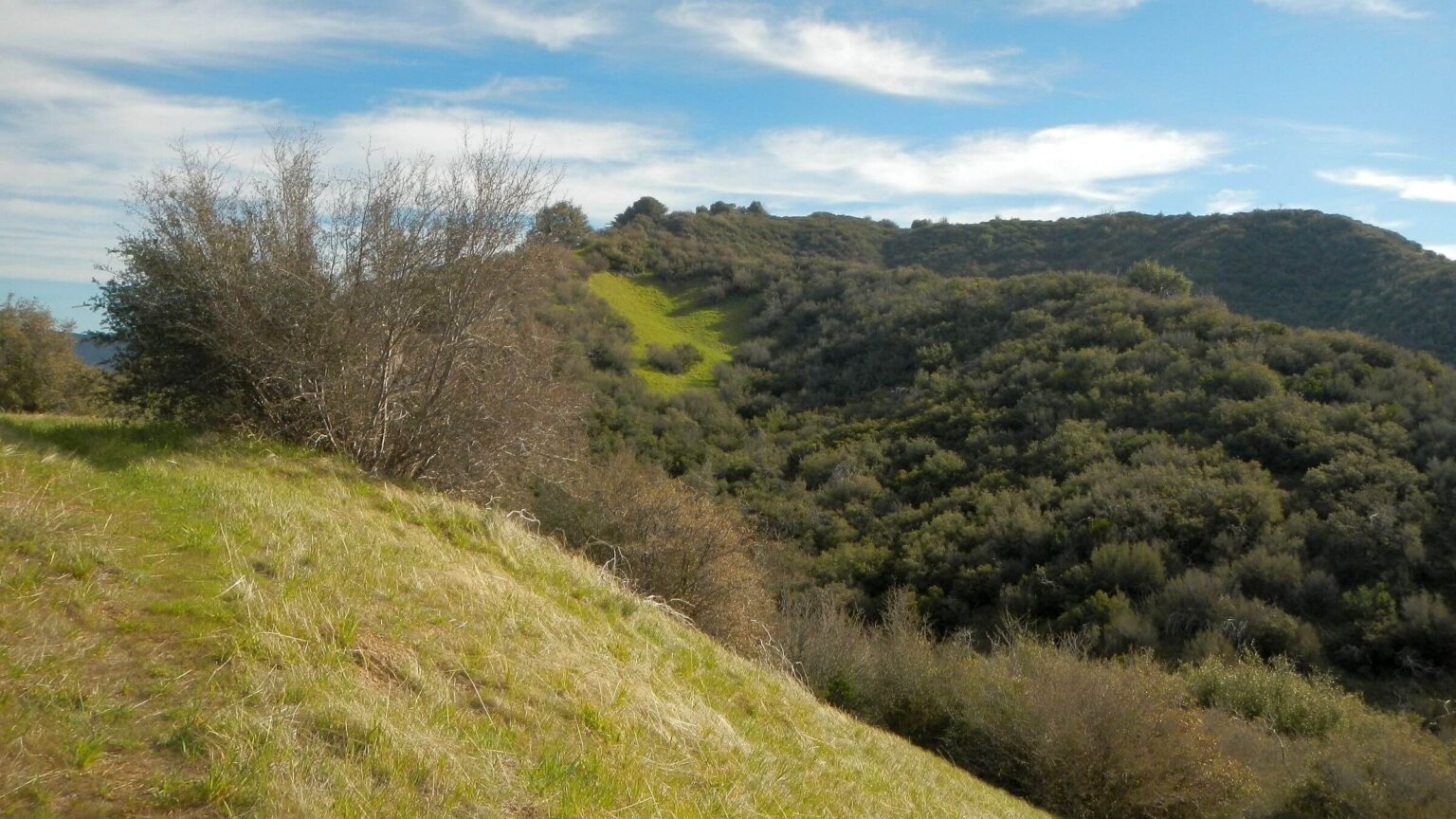 Dick Smith: Dropping into Santa Barbara Canyon (Day11)
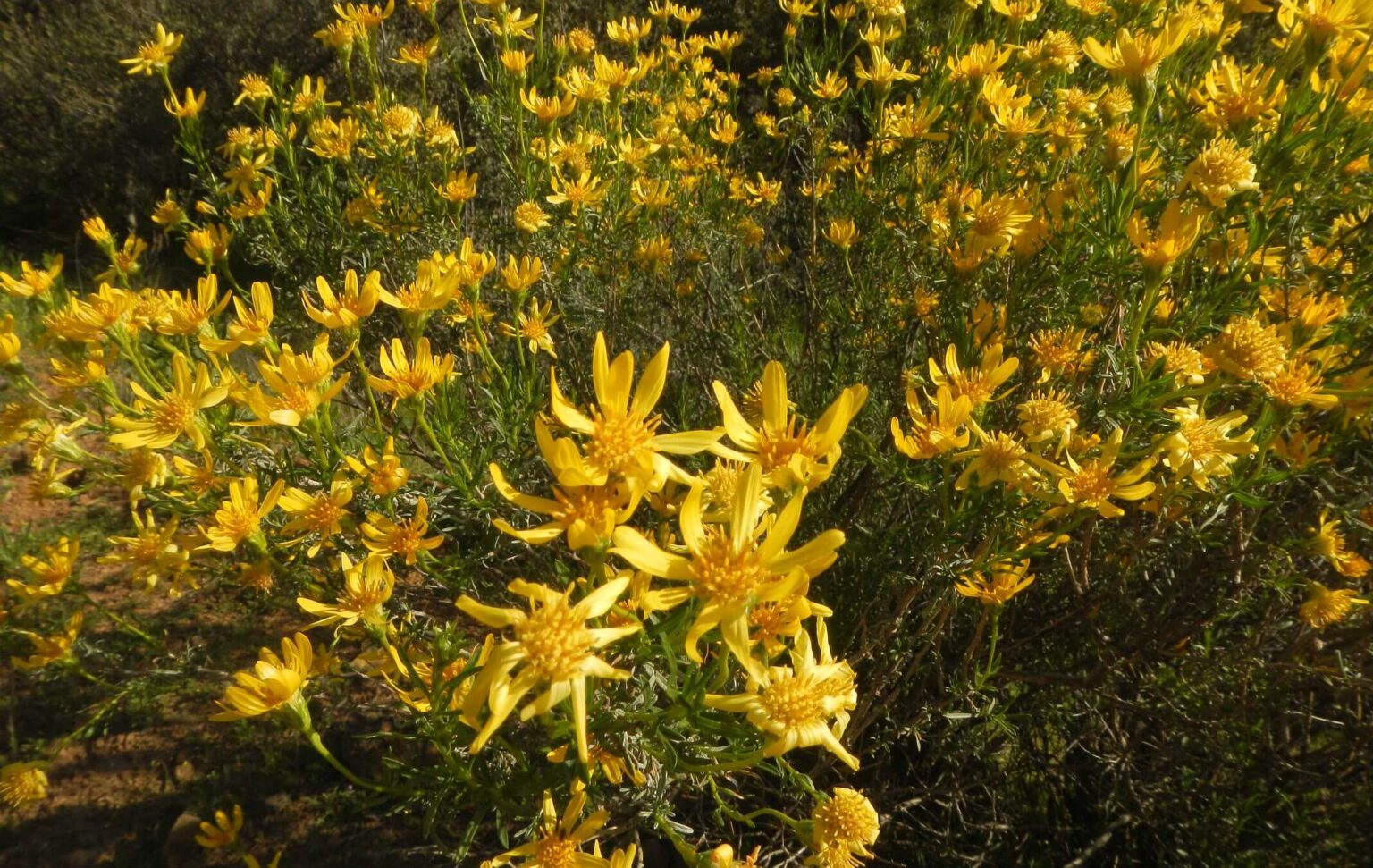 Dick Smith (outside): Narrowleaf goldenbush (Day12)
LPF Return: wind & snow hamper ridge route
After fording high water on our 2025 trek across Los Padres National Forest after three days’ rain, I was determined to avoid creeks and rivers on a planned 2026 return.
I also wanted to hike through Santa Barbara Ranger District (SBRD), which was skipped on the Condor Trail trek, to observe recovery 18 years after the Zaca megafire torched most of the district. Of particular interest was pine country that I found blackened right after fire.
We started at Cachuma Saddle and followed jeep road and trail on ridges of the San Rafael mountains. We dropped initial planned start on Upper Manzana Creek because area had had twice its “normal” rainfall and we had even driven through a big storm on our way from Arizona. Manzana Narrows sounded like a bad idea!
Our planned route was starting on SBRD using road (closed to motor vehicles) and Mission Pine Trail to Big Pine Mountain, on to Madulce and Santa Barbara Canyon trails to pick up resupply (in bear canister of food stashed before trip), then loop back over ridge to return via Buckhorn Road and Santa Cruz Trail to Los Prietos Ranger Station.
I pushed for SBRD revisit because the area was special to me—I was District Ranger there right after the Zaca Fire. I had driven some of the backcountry roads including Buckhorn for various projects but had only visited wilderness twice on foot—both trips shortly after the fire and recalling mostly burned black soil, black stumps, and down logs. How was it now?
The weather forecast was ominous just before visit—a big rainstorm hit as we drove to the South Coast from Arizona. But storm would be over for our hike with mostly clear forecasts for next 10 days. Much better than 2025 when we learned rain would hit 2 days into our trip; but did it anyway because of preplanned shuttle and family/friend visits afterwards.
Showers in Palm Springs on Interstate-10 and driving rain through San Bernardino and Redlands. Heading north on I-215, I could see snow-capped peaks towering through the clouds—10,000-foot ridge of the Angeles National Forest. Well, our highest elevation on the LPF was 6,800 feet and I was told snow in that country melted fast!
Next morning we left our hotel and drove west along the mountains, pleased at clear skies and sun despite cold. We drove up Santa Barbara Canyon where we would hike a few miles to leave a bear canister with resupply food. The intermittent creek was running knee deep at the paved crossing. We bundled to hike up road near Santa Barbara Canyon junction where David hid the canister. A colder return into the wind.
We drove northwest along Sierra Madre Mountains, high above Sisquoc River canyon, whose backbone we had followed on road previous year after bailing from flooded river. The 6000-foot ridge was white with snow! Well, it was northeast slope and we would start on southwest slope.
After a cold outdoors “beer garden” dinner of brats and beer in resort town Solvang and big pancake breakfast next morning, we drove busy highways, glad to turn off at Santa Ynez road to my old district office. Our shuttle was waiting and we were whisked off to Cachuma Saddle where we began a nice dry hike up the unpaved McKinley (Cachuma) Mountain Road.
As it turned out, we had few deep-water crossings but post-storm winds and precipitation in frozen form were among many “surprises” on our trip—both unpleasant and delightful.
San Rafael and Dick Smith Wilderness areas are among 154 wildernesses in California, but their combined 262,000 acres ranks them in largest 20. They encompass San Rafael Mountains—part of the California Coast Range—that rise to 6,800-ft Big Pine Mountain. With 8 more wilderness areas, the 1.8-million Los Padres National Forest (LPF) is almost half wilderness.
Significant wildfires have torched these areas in 21st century—the 2007 Zaca fire burning 240,000 acres from July 4 to October 29 is largest.
Santa Barbara Ranger District (SBRD) includes part of the two wildernesses and is special to Cindy who was Santa Barbara District Ranger in fall 2007 through early 2009—where she dealt first-hand with Zaca post-fire effects. Trip aimed to revisit SBRD wilderness to examine vegetation change 18 growing seasons after fire.
Diverse wilderness vegetation ranges from chaparral shrubs to oak-juniper-pinyon woodlands, some grasslands, and conifer forests at highest elevations and in steep north-exposure canyons. Highest elevations and canyons include relic tree species like incense cedar (click outside photo to return); only in wettest areas surviving from last Ice Age when more widespread in California. Bigcone Douglas-fir (also called bigcone spruce) is found only in southern California coastal mountain ranges. Coulter pine—with huge cones exceeding 10 lbs.—just found in California and Mexico coastal mountains. These ecosystems are critical habitat for endangered or threatened species including California condor, spotted owl, bald eagle, California red-legged frog, and arroyo southwestern toad.
Trails were trashed by Zaca Fire; chaparral brush species are main culprit at all elevations, even replacing burned conifers on drier sites. Nearly 200 miles of wilderness trails were well-maintained in 1970s with campsites offering picnic tables and piped springs. But Forest Service (FS) funds/staff for field work decreased in 21st century as catastrophic fires increased. With 25 million people living near this narrow band of coastal forest, recreation and wilderness should be priority but Cindy found that most staff time/funding went to outdated irrelevant agency protocols and that her budget was controlled at higher levels.
Some wilderness trails restoration continues through Los Padres Forest Association (LPFA) in collaboration with the FS. LPFA does trail work, staffs agency visitor centers, and offers maps/info on trail conditions, but they work mostly with volunteers that cannot fully redeem FS’ statutory responsibilities. Check LPFA website for camp and trail information; some camp photos outdated. Hikers can use 125 miles of roads—on wilderness boundaries or “exempted” within wilderness—many closed to motor vehicles.
Our wilderness visit was planned to traverse SBRD wilderness on San Rafael Mountain crest (pine country) with loop past Madulce Peak into Santa Barbara Canyon where resupply bear-canister placed. But snow (from storms just before trip) thwarted continuous trip. We dropped off ridge at Santa Cruz Trail to complete end of planned trip to Los Prietos Ranger Station; then drove back to Santa Barbara Canyon (to pick up bear canister) and looped via Buckhorn Road and Madulce/Santa Barbara trails. Most snow above 5000 ft elevation had melted by then.
Visit statistics: 12 days, 86 mi hiking, at 1.9 mph, with 400 ft/mi of average elevation change; 54 miles were on roads (closed to vehicles) at over 2 mph pace, while trail hiking (31 mi) in snow or fighting brush was near 1 mph.
Go to map below for more information on trailheads, daily routes, mileages, elevation changes, and photos. (Click on white box in upper-right corner to expand map and show legend with NAVIGATION INSTRUCTIONS.)
show more
Post Storm Wind Surprise
“Sundowner” winds up to 100 mph that rush from hot dry coast range down into cooler coast areas often carry deadly fires into southern California coastal cities. During my brief tenure as Ranger, I oversaw the Gap Fire and Tea Fire, both which hurtled down the front country and threatened towns (respectively) of Goleta and Montecito.But we experienced strange winds doing just the opposite on first night of our LPF revisit.
We had hiked about six miles up McKinley Mountain Road and stopped for the night on a ridge saddle pullover beneath “Hells Half Acre,” a geologic feature of stone towers and bridges on the ridge above. Only a mild breeze when we crawled into our light tent about 8 p.m.
Later that night, a huge gale came roaring up from valley below with 40+ mile per hour gusts flattening my side of the tent on top of me. I woke David (sleeping soundly on the leeward side). He slipped on his boots, went outside, and rigged the tent’s guy ropes to 3 fortuitously placed shrubs to stabilize tent. (He had stopped packing the stakes for guy ropes because he never used them). He returned to the tent shivering and bleeding (cut by extra rocks he had gathered to reinforce existing stakes—he had neglected to put on his gloves!).
We prayed several times for the wild winds to stop but (unlike for Jesus) they did not. So, David prayed we could go to sleep and we did! We woke to sun and light breeze. Tent held up! But blowing dust had damaged zippers on our tent (which we had just sent away for zipper repair!) openings and sleeping bags!
We learned after our trip that complex topography of the San Rafael Mountains can also create nocturnal upslope flows as the atmosphere adjusts, particularly following a cold front (like prior storm). These winds can accelerate over ridges, causing strong, gusty, and sometimes very dry conditions (as we found in dusty tent with sticky zippers next morning).
Bad zippers continued to plague us throughout the trip. Towards the end, David stitched some broken zipper gaps on my side of the tent, so we both awkwardly used his side for entering and leaving the tent—particularly annoying for midnight bathroom breaks! The zipper on his side also failed so it was loosely tied, not zipped shut. Luckily, it was too early and cold for mosquitos! After our trip, sleeping bags went to the dry cleaners and the tent—which had just returned from Big Agnes Tent Company with zippers repaired—once again went to Big Agnes which mercifully some offered credit on new tent and expressed sympathy about wind on first day of trip).
Snow Surprise: slow going
We had nice road climb for about a mile, then crossed to north slope and hit snow. It had thawed, then refrozen to ice. I crept along in two frozen set of tracks.I soon met the track-makers coming down—two guys with light backpacks and European accents who seemed much more delighted with the snow than I was. They said they had camped “on San Rafael” but I was not sure what they meant; they also confirmed the night wind.
McKenzie Spring camp was just below the road. It looked like the two hikers had passed through here but no sign of a tent site. Two tubs contained beautiful spring water; we filled up.
Another mile of slow snow plodding. We decided to drop below snow on “Santa Cruz Fire Road” shown on my map (and GPS map) dropping down ridge at end of McKinley Road and start of Mission Pine Trailhead. David spent half hour looking for road start but found nothing promising in the snow. We saw the road on distant ridge, but it looked snowy and likely to be old cat track unused for decades.
So we start on course taking Mission Pine Trail, following tracks behind San Rafael Mountain on north slope pine forest. Snow had collected on treetops, melted in the sun, turned to ice, and then dropped as icy balls on trail, making for slippery hiking. Climbing a high ridge, we lost tracks and the trail; David followed GPS route into a basin. After passing tracks heading up spur trail to a peak and confusing zigzagging tracks, we just broke our own trail in the snow.
We followed GPS track to flat spot at sunset after only 6.3 miles for the day! We tromped down knee-deep snow for winter tent site, pitched tent, and went to bed without dinner, planning to perhaps use a picnic table at Mission Pine Springs camp the next day.
We woke to sunshine and tent dripping from condensation. We were not packed until 10:15 AM after drying tent/sleeping bags on rocks and tree branches around camp. We soon passed a sign for Mission Pine Springs in seemingly wet boggy area but never saw the camp. We made last night’s dinner in a sunny clearing on ridge; I sat on my pack on snow berm.
The trail undulated along the ridge, sometimes offering splendid views of Santa Ynez Valley, the coast range, and the Pacific Ocean beyond. It was pretty obvious most of the way, and GPS helped when we missed it. As day wore on, snow melted for even slower going: we stepped into holes and often sloshed through “trail rivers” or cautiously dropped off steep rocky pitches.
We camped on another snowy flat about 0.7 miles short of Mission Pine Basin. After late start we only made 5.4 miles! Another wet tent and an hour to sun-dry gear in the morning before we sloshed along multiple streams on what had been the trail.
Mission Pine Basin was clear dry camp under big pine tree with picnic table! I wish we had made it there!
Going less than 1 mph, we decided time for change. Instead of a 17-mile snow hike to Madulce Camp, we dropped down upper Santa Cruz Trail. New plan was to hike down to Los Prietos, pick up our vehicle, drive around the mountain, and continue trip on the other side.
Santa Cruz surprise: snow-free but face-slapping brush
I was pleased to view snow-free ridges as we dropped down the south slope. But a mile down well-built trail switch-backing into the basin we met something worse: head-high springy thorny brush—chaparral whitethorn (well named with long sharp thorns—there is also a high elevation mountain whitethorn species, ensuring that these excellent post fire nitrogen-fixing shrubs are everywhere to impede any mammals attempting to use trails!). Thorns poked right through my hiking pants and the sharp oak leaves tore at arms even in long sleeves, while chamise, manzanita and other brush slapped me in face; loose gravel beneath my feet set me on my butt.I recalled that after the Zaca Fire, my recreation and trails staff said we had to move quickly to brush trails before chaparral took them back! It had won on the Upper Santa Cruz Trail. David, in the lead, also kept finding ticks on his pants legs! (From then on he insisted on “tick check” every night in the tent—we often found ticks on David but not on me! We later learned that certain body chemistries are indeed “tick magnets” like high levels of carbon dioxide exhaled, odors, heat, and other factors.)
After two more miles at 1 mph—much like snow slog but more painful(!)—we were relieved to drop into the Coche Creek basin. Still brush but no thorns. David skipped rocks across Coche Creek while I waded in my boots and waterproof Sealskin socks. We crawled up creek slope and found much better trail contouring above.
A leaning sign marked Grapevine Trail which looked good at start but was 7 miles to Buckhorn Road and we knew it had not been cleared for some time. We had initially planned to hike Grapevine into Santa Cruz on our original route from Buckhorn Road but had no need to do this now. Kellogg Camp had not been used for awhile, but nice spot to camp in the oaks.
Next morning, trail along Coche was not too brushy and the multiple crossings were not too deep (starting in morning helped because snow melt from above slows at night). The next set of pleasant wonders were patches of wildflowers blooming along the creek, then beautiful Flores Flat, a wide green valley and camp in big oaks with picnic table and shovel. Nice surprise because it was a barren black wasteland when I saw it in 2008! The trail climbed to a saddle where Santa Cruz Fire Road was supposed to meet it. No sign of road on brilliant green grass cloaked ridge.
David called early camp at Santa Cruz Guard Station under huge oak trees. It was a lovely spot with water, and there were no decent campsites on next four miles of steep Santa Cruz Jeep Way out of the canyon. We also hoped roaring Santa Cruz Creek might be a bit lower and clearer in the morning (it was). The old jeep road crossed right after two branches of the creek met; a waterfall a mile upstream on one probably added velocity.
Santa Cruz camp had a trail register in the middle of the meadow. It was full of posts from LPFA volunteers who have used the cabin in recent years as base for brushing and maintenance on the trail section that passes through Flores Flat. This might explain less brush on hike from Kellogg!
A few hardy hikers had braved coming up lower Santa Cruz trail, complaining of heavy brush, washed-out side canyons, and ticks! We were glad we planned on jeep trail and longer route on Buckhorn because we were warned to avoid the lower trail. Someone had also dropped down Upper Santa Cruz in 2022, said it was awful and they even crawled. We hiked trail down below camp to take a look at creek crossing for lower trail. Less velocity down-stream but that would not help us upstream at road crossing closer to narrows and waterfall.
Next morning, David crossed the roaring creek first; at deep spot near end, he faltered slightly. Observing this, I accepted his offer to return and transport my pack. I followed him; when I hit thigh-deep torrent, I could not move my pole against the current! Not wanting to repeat last year’s float trip, I grabbed back of my pack and was towed by pack animal David across the high rushing water to shore. He said he didn’t even notice his hitchhiker.
After nice contour around the canyon with good views of Santa Cruz trail (but not of the cabin hidden in the oaks; I only could see the wooden [locked] toilet closet), the jeep route headed straight up a ridge making 7-8 steep runs of about 400 feet each. David’s GPS measured climb at about 800 feet per mile! Road had not been used by vehicles in years; so now only fit for OHVs (but a locked gate at Buckhorn road prevents even those). Santa Cruz register had been signed by several mountain bikers who enjoyed wild ride down but were not excited about the climb back.
Buckhorn Road had severe damage (I later learned it had been closed since 9 atmospheric river storms battered the Santa Barbara front country in 2023; causing $300 million worth of damage) with boulder-size rockfall and head-high plants growing head high in some areas; only mountain bikes wiggle through now.
Another pleasant surprise on this dry stretch of ridge road: water! At turn off to Happy Hollow Camp, we noticed a big cylindrical concrete tank with dish on top sloped to center grate. It turned out to be a rain cistern, full to the brim, allowing David to filter water for lunch; very fortuitous since later intermittent stream planned for lunch spot was not running. (We had seen a similar tank on McKinley Mountain Road but did not know what it was.)
Hiking along a ridge, I saw the Santa Cruz Trail below us winding up and down along valleys. This well-designed National Recreation Trail has never fully recovered from Zaca Fire with serious erosion on the “40 Mile Wall” where it crosses several side canyons.
More pleasant surprises from wildflower bouquets and flowering pipestem clematis shrub along the road. I will let the map pictures below tell that story. The rains (in snow form) hampered our pine country hike but inspired verdant meadows and floral displays down lower.
After a night at Hidden Portero—roadside camp in wet meadow with spring funneled into nearby tank—we finished descending Buckhorn Road, passing lone camper drinking morning coffee at a roadside picnic table. Perhaps a backpacker using roads and trails? We also met mountain bikers coming up and were passed by others coming down. After fording Santa Ynez River, we walked road to our vehicle parked in front of the closed (on a Friday!) Los Prietos Ranger Station.
Dick Smith Visit: Trip in Reverse
We were able to change motel reservations and stayed in Santa Barbara mid-trip instead of the end, meeting good friends for dinner and a walk along the coast. Next morning we drove around the mountain, stopped for breakfast in Ojai, left our vehicle at Santa Barbara Canyon locked gate next to a beautiful ranch at the end of the road. We got permission from 92-year-old Fred Reyes, ranch owner, to park on his land. The Reyes family has ranched in the Cuyama Valley since 1850s and lent their name to Reyes Peak (although the Chumash called it “Opnow” [Pine Mountain]).Another vehicle was parked by gate. About a mile up, we met the British driver who had some archaeology experience; he pointed out Chumash petroglyphs hidden in honey-comb rock alcoves and elaborated other area artifact ventures!
We hiked up to our bear canister with food for rest of the trip. David had left a paper towel roll in a plastic bag beside canister; it had been carried away from canister into an opening, with big teeth marks through plastic half-way into 3-inch roll. Maybe mountain lion playing?
We camped a mile beyond canister drop on green flat just before another gate. Intermittent stream was running well, and opening was perfect for viewing nearly full moon.
Hiking northern Buckhorn Road went okay; most snow was gone from the high country—we saw patches on north slopes near ridge. We met two happy mountain bikers finishing an overnight trip with camp near Painted Rock pictograph site at top of Sierra Madre Road where we had also camped in 2025; like us, they found pools in the rocks.
We were surprised to see heavy cattle tracks in dried mud near Sierra Madre turnoff—apparently someone had come up and driven their stock out of the mountains, maybe during the heavy rain and/or blizzard of the week before! On the 2025 trip we saw a herd of cows and two ominous bulls below junction with Sierra Madre Road and the Painted Rock site. Despite fencing, cows had really spoiled that feature.
Trip highlight was Alamar Camp near top of Buckhorn Road and a mile below Big Pine Mountain. AllTrails and LPFA posts showed a barren site burned by Zaca Fire, but now 15-year-old pine had created a beautiful camp.
We took brief morning hike down Upper Sisquoc Trail to check out Upper Bear campground where we had originally planned to camp. It was cold, dark, snowy, and brushy with much deadfall. Now I am glad we skipped Upper Sisquoc last year! We had noticed mountain bike and hiker tracks on the road—the hiker had signed Sisquoc register claiming overnight trip from Santa Barbara Canyon to Pine Mountain. After hiking the very poor Madulce Trail above Santa Barbara, I wondered if he had actually come up much faster Buckhorn Road.
Spur trail to Madulce Peak was eroded on south side of ridge and brushy on north. After a 1/3-mile struggle, we gave up on planned day hike to peak on what had been a good contour trail to the former lookout.
After peak spur, trail dropped down beautiful open old-growth pine forest for a mile but then met vicious chaparral on the ridge trail with a few down tree messes to climb up and around. David had to stop to hold back high brush while I squeezed close behind, I was not strong enough to move out it of the way on my own! Both of us had bleeding arms from thorns despite long sleeves! And David picked up another tick for the evening tent check!
I added a little drama and delay when I reached into my pants pocket for my cell phone—and it was missing! I had last used it to snap a photo of old phone line (from lookout to guard station, both long gone!). David was ahead, stopped holding brush and yelled wondering where I was; I got distracted and somehow did not slide phone back into my pocket. We backtracked at least half a mile; David, forging ahead, found my phone below the old line (At least it was speedier slipping through brush without backpacks).
Trail improved along Madulce Creek. Thanks to phone search delay, we were still one-tenth mile and a creek crossing short of official Madulce camp half-hour past sunset but found nice camp in big oak with odd metal boxes, fire circle, and shovel. We enjoyed our first fire of the trip at chilly camp on creek. The official camp on down was less inviting, an open flat where former guard station had burned in the 1990s and area reburned by Zaca Fire.
The Santa Barbara Canyon Trail, cleared and rerouted by LPFA in 2025, was pretty good. We saw high piles of brush the volunteers cleared. Brush had already started regrowth, but wide clearing will keep trail open for at least a few years; although nasty roses attacked us at every creek crossing. The intermittent creek was about 2 feet deep in places, still crossable, but high-water mark showed it was impassible flood after right after recent storms. Glad we came later than our originally planned trip—we would have happily left snow but then encountered crossings more than 3-feet deep on the Santa Barbara “intermittent” creek.
We camped just above Cox Flat (on national forest) in woodland grove off a side road, then next day hiked 3.5 miles along bright green meadows on the creek below red rock cliffs at end. More pleasant surprises from new wildflowers and hills decked in yellow narrowleaf goldenbush.
After last creek crossing to our vehicle, David declared no more revisits! I am glad I got to tour part of “my” old district with a walk through the San Raphael Mountains, views of ocean far below, camping in new pine regrowth and revisiting Buckhorn Road on foot!
show less
Google Map
(Click upper-right box above map to “view larger map” and see legend including NAVIGATION INSTRUCTIONS; expand/contract legend by clicking left arrow down/up.)