 2026: Pre-existing authorized or “excepted” roads facilitated water drops (Day1)
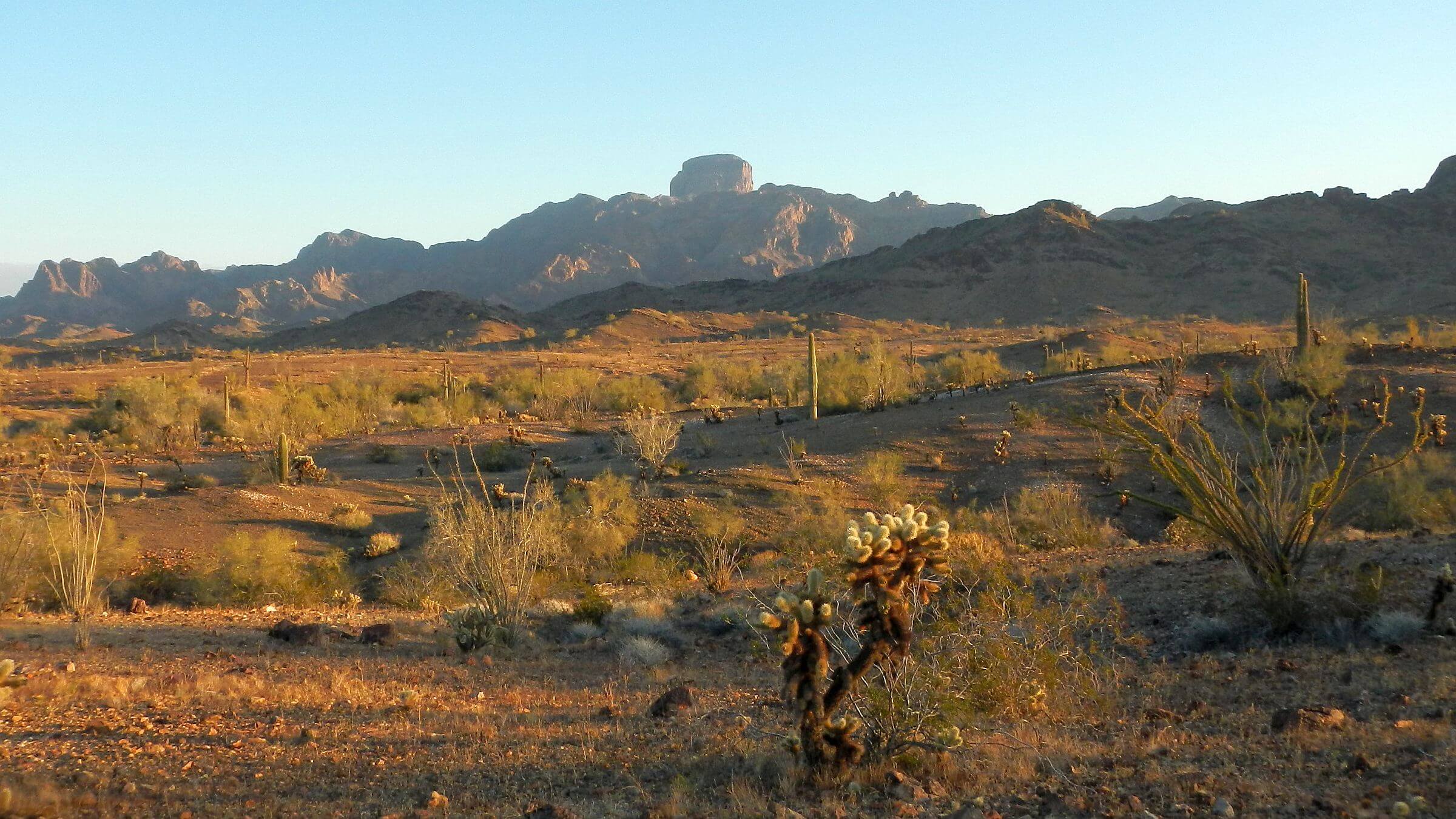 2026: Trip circled Castle Dome Peak (Day2)
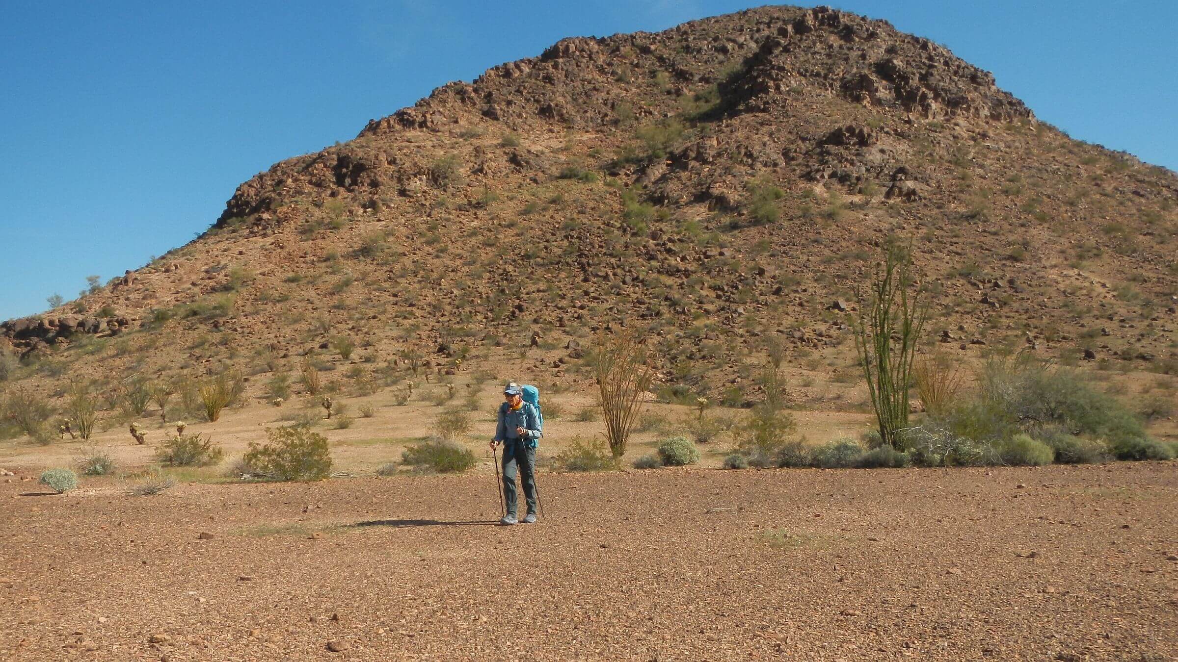 2026: No trail needed for desert pavement (Day3)
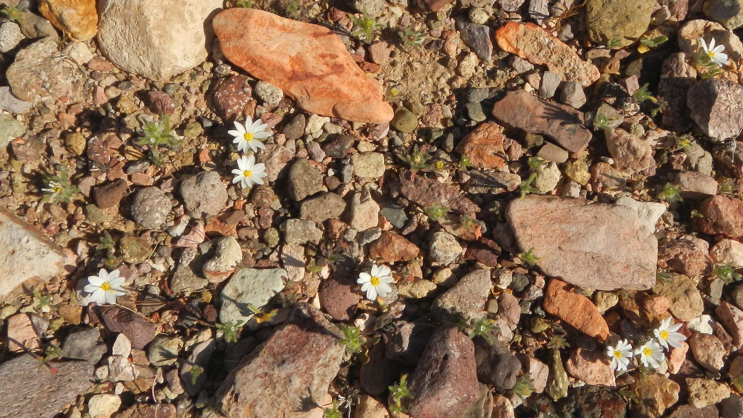 2026: Mojave Desertstar (Day3)
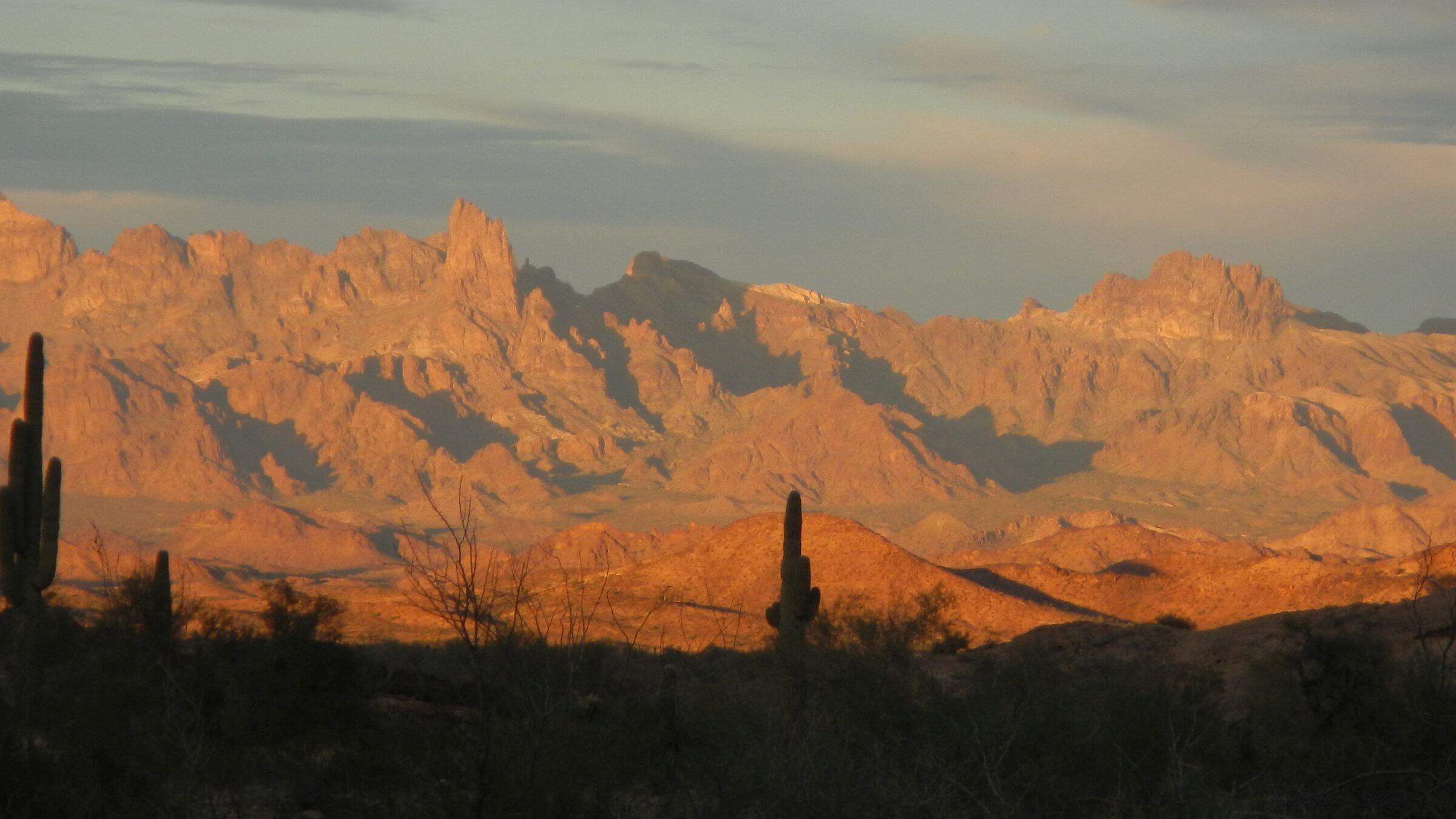 2026: Sunset, Castle Dome Mountains (Day4)
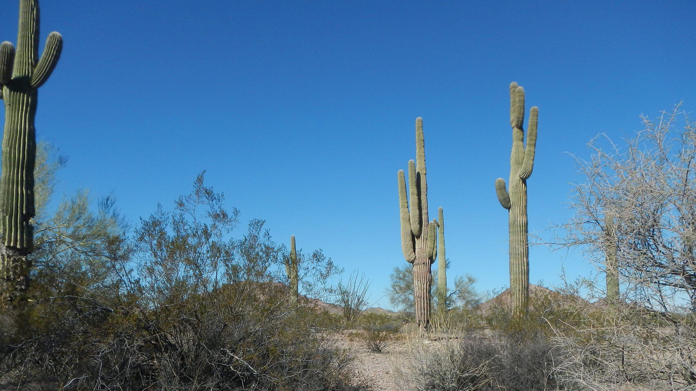 2026: Saguaro cactus in Sonoran Desert (Day5)
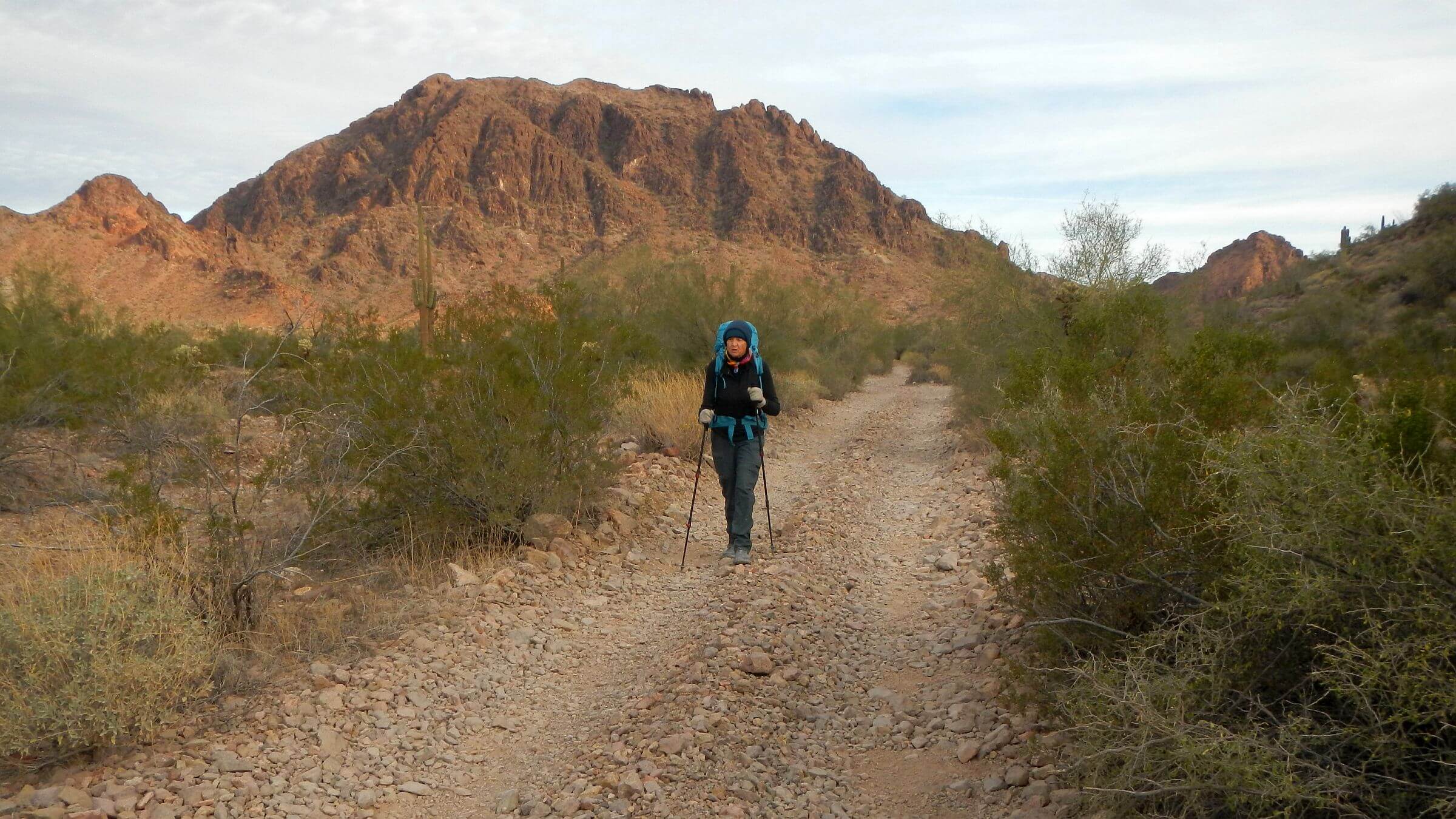 2026: Leaving wilderness on “excepted” road (Day6)
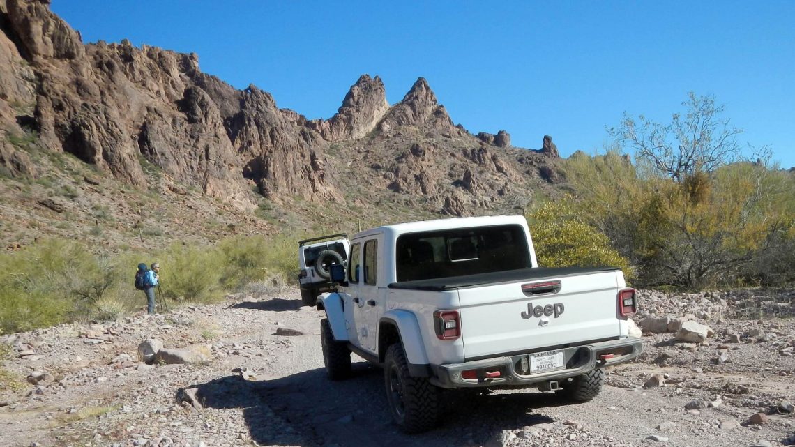 2020: Queen Canyon Road open to vehicles (Day1)
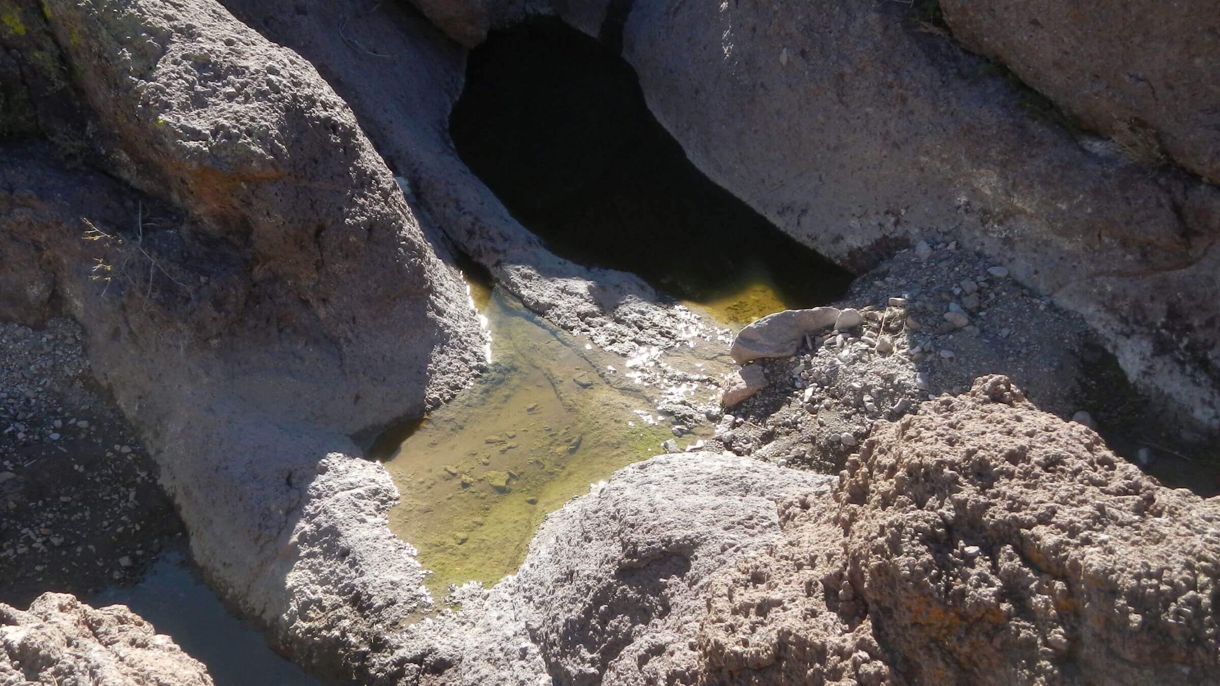 2020: Squaw Tank (Day2)
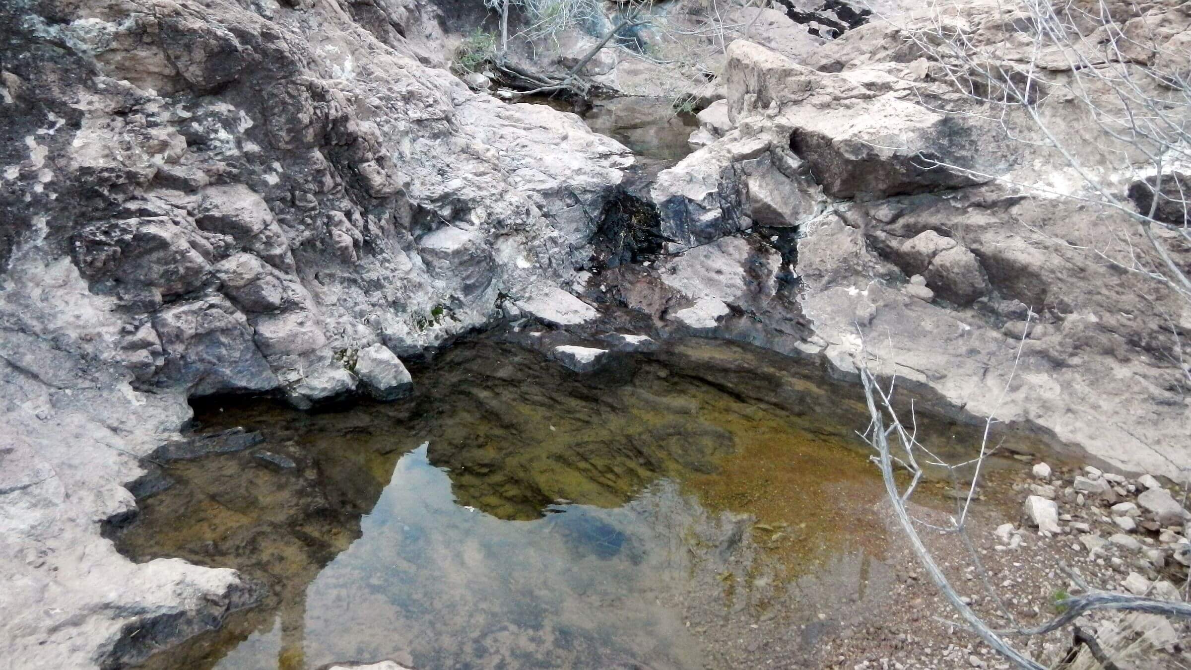 2020: Red Hill Tank (Day4)
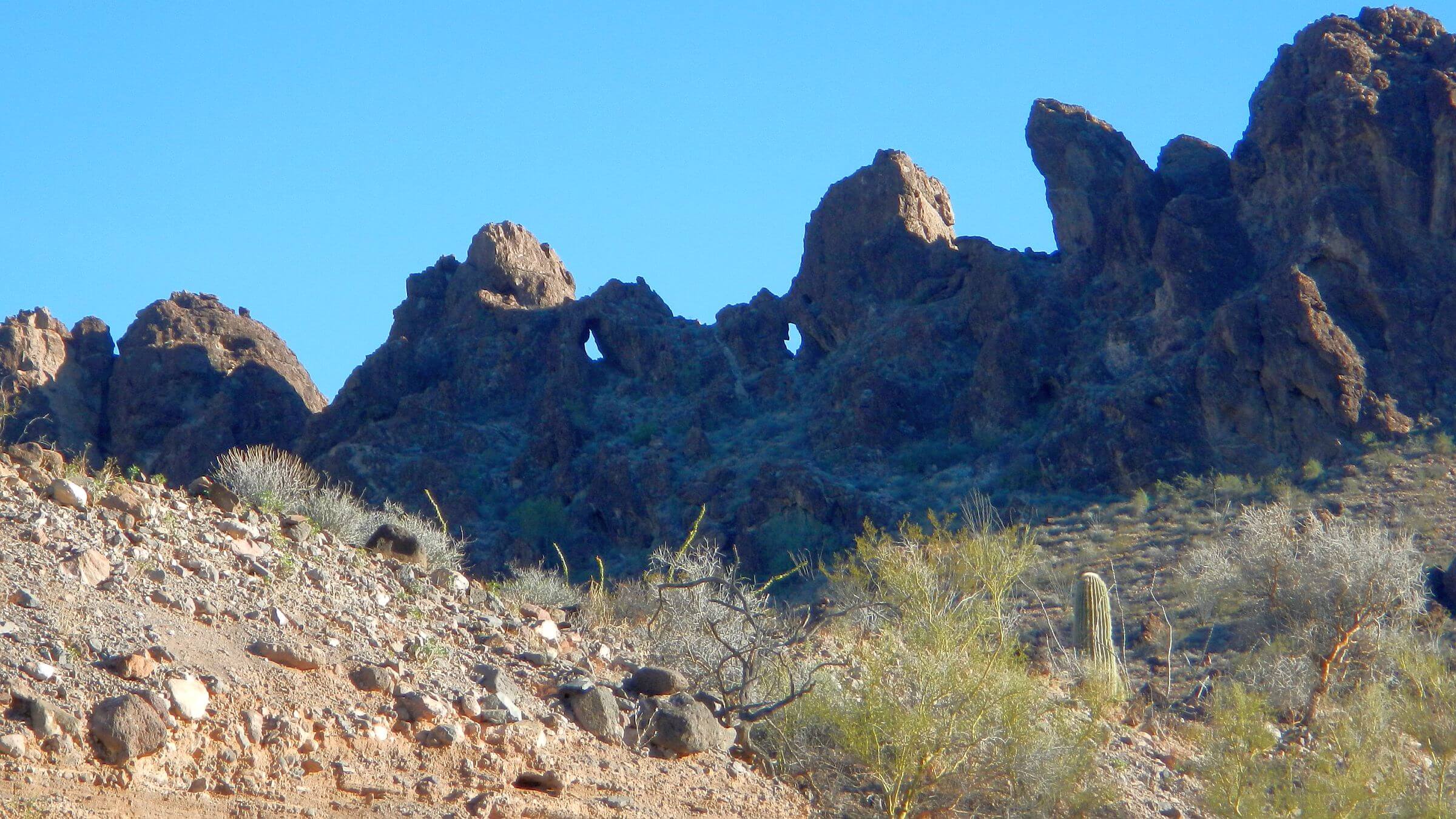 2020: Owl Head (Day4)
 2020: Probably remnant of old tank along Wilbanks Road (Day5)
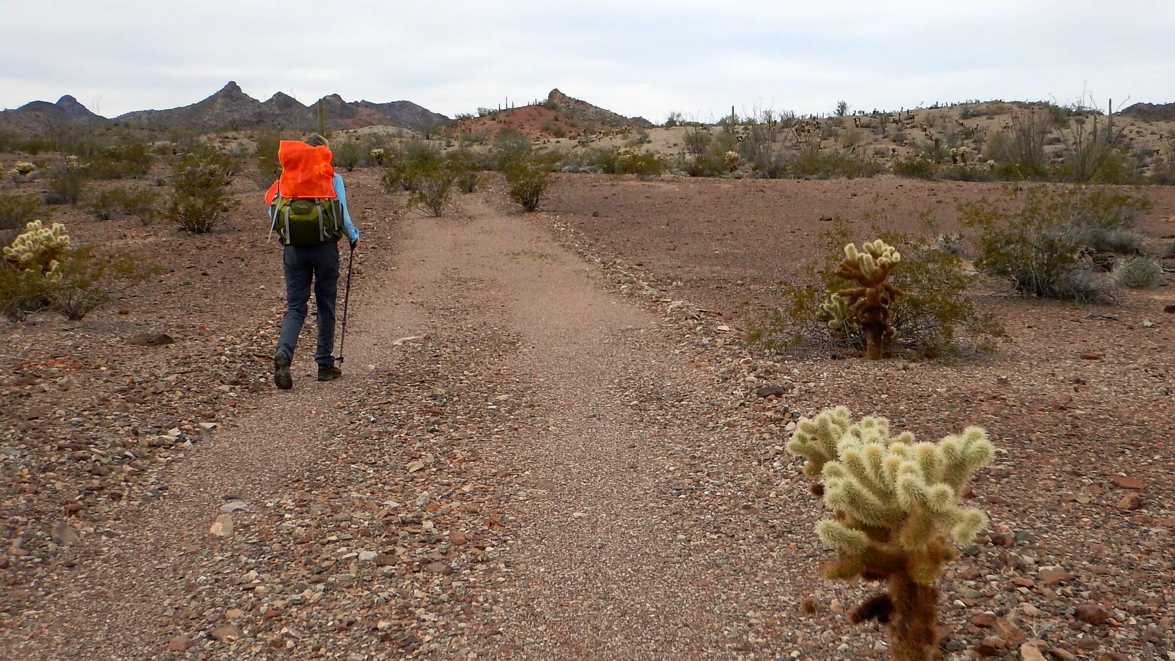 2018: Roads closed for decades still visible for hiking (Day1)
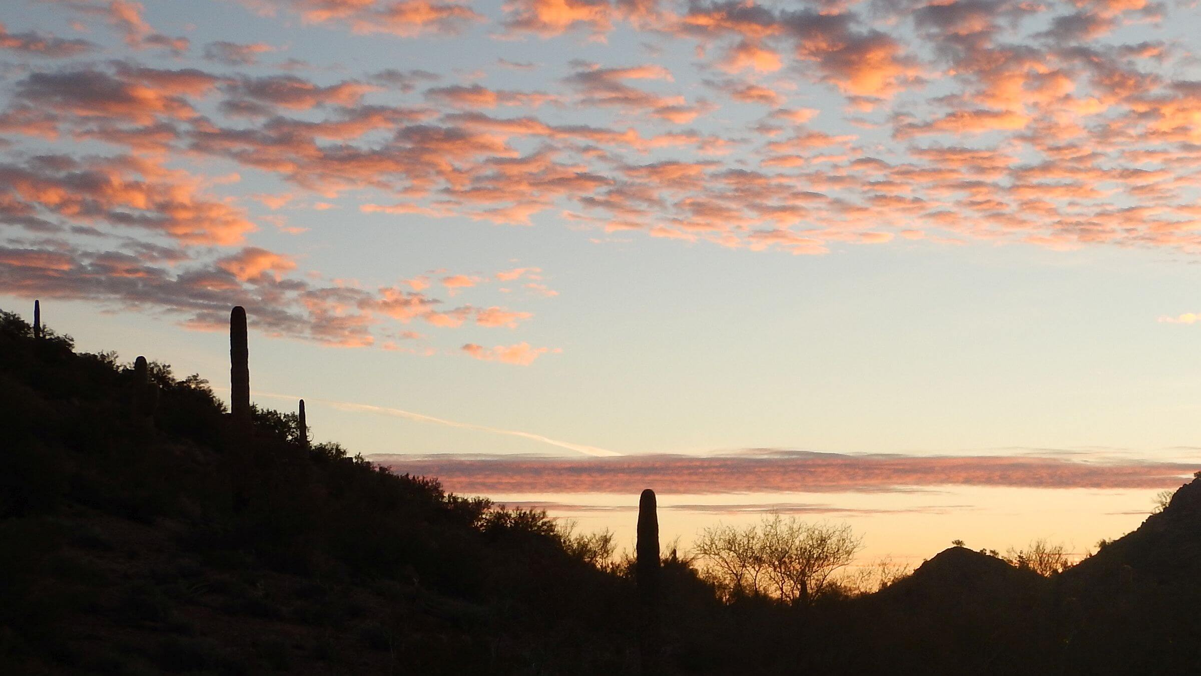 2018: Camp near Wilbanks Road (Day3)
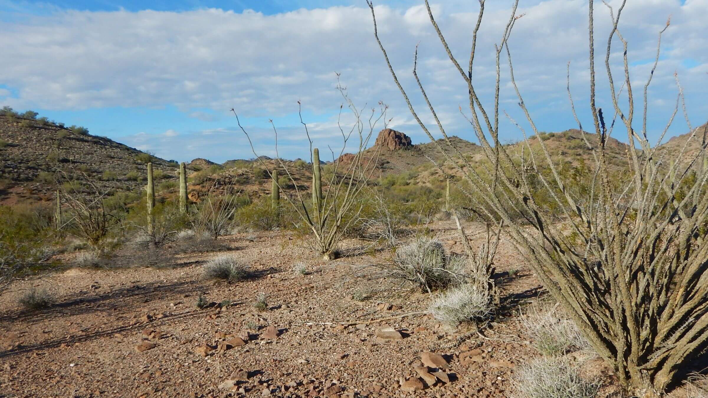 2018: Castle Dome in background (Day4)
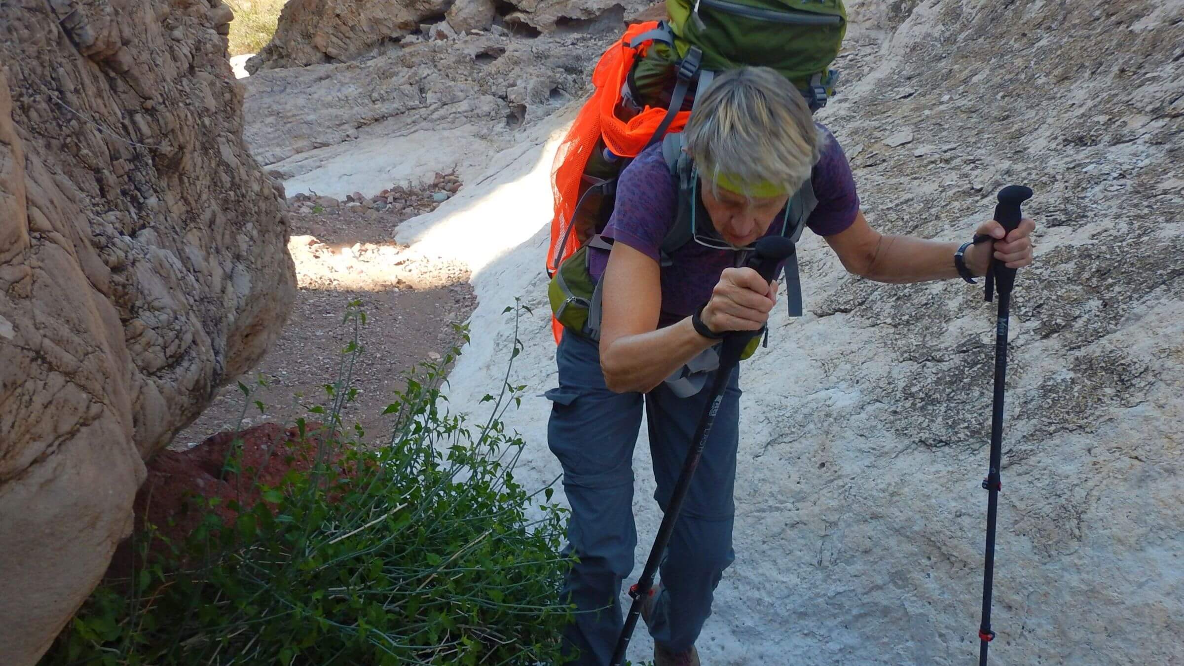 2018: Yaqui Wash (Day5)
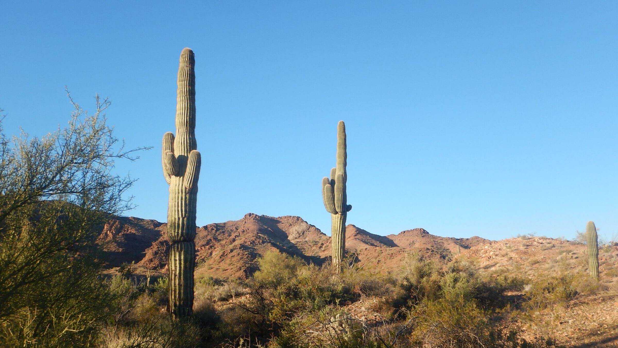 2018: Saguaro near McPherson Pass (Day6)
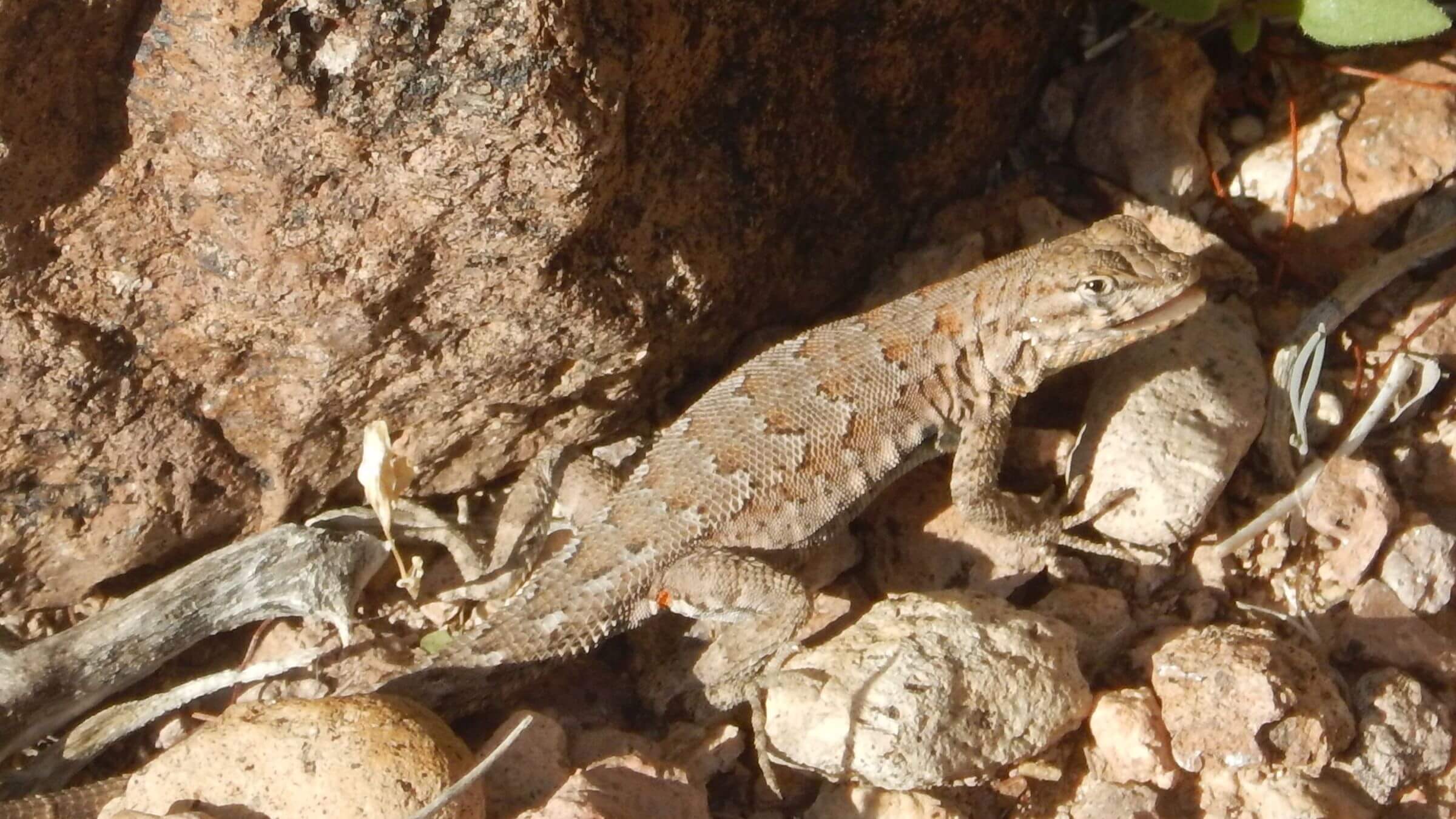 2018: Side-blotched lizard (Day7)
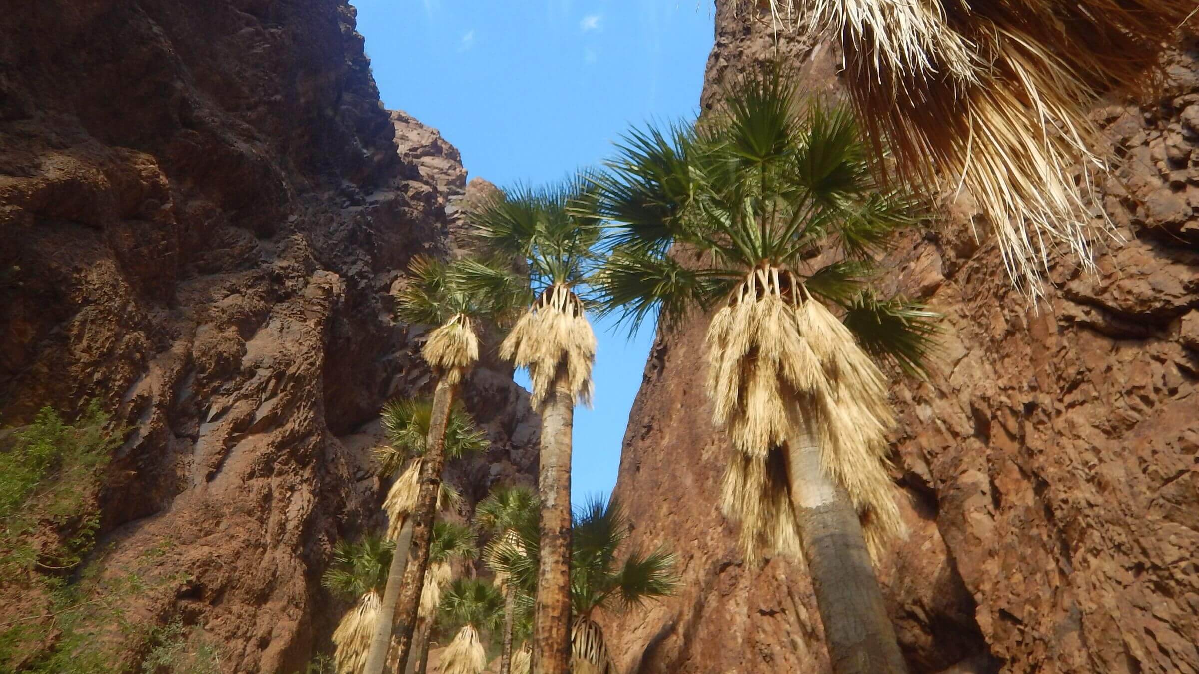 2018: California fan palm, Palm Canyon (Day7)
Vast “vehicle-friendly” wilderness
Alone in wilderness quiet, we broke camp and hiked cross-country—over a hill, into a wash, and over another ridge into upper Red Raven Wash while skirting overhanging mesquite trees. A hawk dived down—maybe hunting a jackrabbit, the main wildlife we saw in Kofa Wilderness. David spotted a tawny figure loping on ridge above us. Maybe a cat, from big paw print in nearby wash.
Crossed a ridge with rough descent into Burro Wash to follow gravelly vehicle ruts. We needed water for breakfast but no pools as we trudged down. David’s GPS showed trail up to a tank nestled in a side canyon. High Tank 7 featured deep pools protected by a shade structure and a log dam. Wood must have been packed in on roads kept open to maintain wildlife tanks.
We had just finished breakfast when we heard jeeps roaring up the wash. People piled out of two vehicles, greeted us, and headed up the trail to the tank—only trail we found in this wilderness (besides 1-mile Palm Canyon trail on west side) and apparently a day trip destination.
On roads we soon were passed by roaring UTVs. We saw vehicles most of the time on our January 2020 backpacking loop through the wilderness! A previous visit in 2018 followed refuge roads in a rented Jeep but met fewer motorists. (We learned why later).
Large Wilderness Named For Mine
The name “KOFA” is from King of Arizona Mine established early 1900s in center of area; old tracks and mining sites remain. Kofa National Wildlife Refuge was established in 1939 to protect Arizona’s largest desert bighorn sheep population. Most was designated wilderness in 1990, the second largest in Arizona. (Largest is Cabeza Prieta, another wildlife refuge made wilderness in the same law.)Kofa is filled with concrete dams, windmills, wells, and water tanks, some built for earlier ranching and mining. Some have deteriorated; others are maintained by refuge staff for wildlife water needs. Multiple roads are used by refuge staff.
Kofa Wilderness is Arizona’s second largest (500,000 acres) and managed by U.S. Fish & Wildlife Service (FWS), for desert bighorn sheep and pronghorn (antelope). FWS maintains only one mile of trail into Palm Canyon, but much rolling terrain and sparse vegetation is amenable to cross-country hiking.
About 240 miles of primitive road crisscross the Kofa; 38 percent on wilderness boundaries, and 62 percent cherry-stemmed (legal within wilderness). FWS uses roads to manage tanks and wells for wildlife water; they are also open to Jeeps and Universal Terrain Vehicles (UTVs).
This narrative covers 3 visits from most recent to earliest; lead story is anecdote from 2020.
2026 visit was 6-day backpacking loop in southern end, circling Castle Dome Peak. We rented UTV one day to place a resupply (in bear canister) and water for drier than usual winter conditions.
2020 visit was 6-day backpacking loop in northwest end of wilderness, connecting open and closed roads with cross-country routes and using Squaw Tank, High Tank 7, Red Hill Tank, Wilkinson Seep, and a few rocky-canyon pools for water. See map photos for details.
2018 visit was “check-out” driving 92 miles of road through heart of the wilderness with 5 short backpack trips packing water on FWS advice. However, we found Kofa offered ample water in rocky washes, tanks, and seeps if a visit followed good rains within past month or two.
Visit statistics for 3 trips: wilderness hiking over 19 days, 182 miles at 2.4 miles per hour and 200 feet average elevation change per mile.
See map below for detailed routes, mileages, elevation changes, and photos. (Click on white box in upper-right corner to expand map and show legend with NAVIGATION INSTRUCTIONS.)
show more
2026 return: surprises good & bad on 3rd Kofa visit
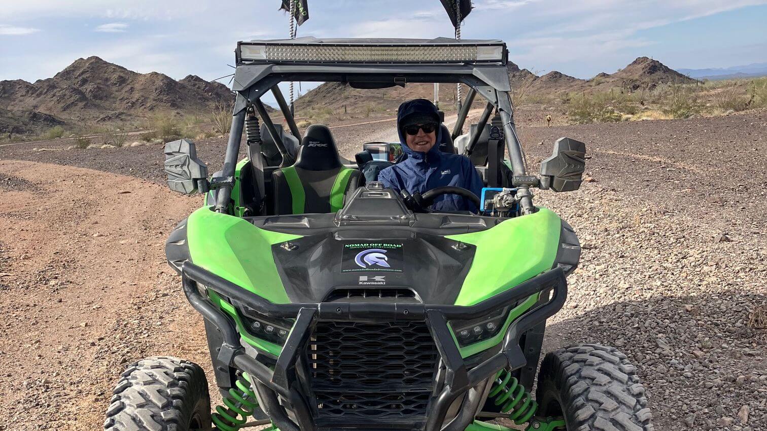
I wanted to loop around Castle Dome Mountain, looming over southern part of the refuge near Yuma. Our talks with a helpful FWS wildlife biologist revealed some accessible water sources, but not enough in right places for camp water on 6-day trip. He also suggested an alternative to our plan to leave our vehicle parked on McPherson/ Castle Dome Road during our hike: we should park on the “workaround road.” Only later did we understand!After drive from Tucson and overnight stay in Yuma, we took Highway 95 north and turned northeast on Castle Dome Mine Road. At Kofa refuge entrance we met Randy from Nomad Off-Road Adventures, the only UTV rental company in Yuma. Randy and his wife are winter migrants from British Columbia.
The small emerald green two-seater SxS (for “side by side”) was stripped down with not even a windshield. We donned raingear over hiking clothes to break the wind. After David took an orientation ride up the road and back with Randy, he turned us loose.
Other than wind chill, the UTV ride was a pleasant surprise.
These rigs have incredible shocks and stability. We had bounced around on the rutted gravel road in our small SUV; driving twice the speed in the UTV felt like a paved road. David, who grew up riding “dirt bikes” (off-road motorcycles) in the Idaho desert, soon adjusted and was flying along at a terrifying 40 mph on the Big Eye Mine Road up and down washes and contouring around hills with views of Thumb Peak and Thumb Butte.
We left gallon water jugs at end of Big Eye Mine Road where we hoped to camp the first night of our backpacking trip. On way in we passed a base camp for a FWS crew from the refuge, and then met them along the road. They were pulling invasive buffel grass. We hurried back down the 18-mile road. When it forked to Castle Dome Mining Museum (may be slow to load, offers tours for fees) we got our second surprise of the trip,
We were set to drive over McPherson pass to place water drops and a resupply on other side of the range. But the refuge road was closed with a gate and no trespassing sign! It wasn’t closed when we drove through it in 2018.
We later learned that Allen and Stephanie Armstrong, who own the Mining Museum and land around it, had closed the road where it crosses their land in 2019 after spats with FWS about public access. We would have to drive two miles back and take the “Castle Dome Bypass Road” the FWS had built after the closure—the “workaround road” our FWS friend had mentioned!
This was true ORV road, much rougher than the road it replaced but no problem for the tough little UTV. It even crept down a three-foot rock wall in a wash we crossed, the only time David used 4-wheel-drive! After stashing two more “water drops” and a bear canister for resupply later in our trip, it was close to 4 p.m.
Our original plans for first night camp and vehicle parking were thwarted by road closure (we did not wish to drive workaround road in our SUV); so David wanted to ask museum volunteers where he could park safely. He drove at breakneck speed (alarming his passenger) to get back before museum closed at 5 PM. We made it but learned we could not park or hike anywhere on the private land—which was likely not marked on our current Garmin map because of recent land swaps; but we were told of a good place to park off Big Eye Mine Road and also warned landowner had patrols looking for trespassers.
We met Randy at the Kofa refuge entrance and returned the UTV, then bumped back up Castle Mine Road, pulled off on Big Eye Mine Road and camped in a wash, sheltered by large mesquite tree from the evening wind. A fabulous sunset lit clouds pink and orange for an hour.
Jeep routes, washes & over the ridge
In our tent at predawn, we were serenaded by big pack of coyotes close to camp. We set off early on nearby closed roads hoping to be off private land before anyone stirred; when roads ended, we set course for distant Blue Rock Tank canyon which David hoped to use to traverse ridge between us and planned camp at end of Big Eye Mine Road.As we left old road for a winding wash heading mostly towards the ridge, I kept an eye out for a gentle pass to cross. Following his GPS track, David made abrupt turn and we scrambled up a steep brushy side canyon to a cement dam wall. I crawled up rocky sheep route up and around the wall. On the other side, Blue Tank was a silted in dam. We continued up the wash to a steep pour-off. David scrambled up to check out his route to the top while I found a sunny spot.
Much later David inched down to report his route was doable. I looked at the first pitch—choice of a chimney overhang or sketchy side slope with sheer drop. I was two months out from shoulder replacement surgery; surgeon had said backpacking probably okay. But rock climbing?
Nope. I said the ridge looked gentler to the north and suggested we go back down and try another route. David looked at route on GPS map and agreed it might work if no steep pour-offs. We dropped back down Blue Tanks wash then continued on larger wash that soon turned towards the ridge. No steep drops in this wash which ended in gentle slope to a saddle; only difficulty was slippery pellet-like soil. Not trusting my scrambling arms, I left my pack for David to ferry up. He scrambled ok but ran into some dense cholla and got a few spines in his leg. From saddle fairly easy working our way down to an endless gentle wash. At the head we saw a building—the Big Eye Mine Cabin. A register in the cabin indicated ORV enthusiasts had visited that day. Road descended to our water drop and planned camp at end of Big Eye Mine Road.
Roads, ridges & beautiful tanks
Next morning I met FWS crew parking at road’s end. New crew from day before. “Could I ask a favor?” I said to young woman in a brown FWS parka and pants. Brow furrowed. I asked if they would pack out our depleted water jugs. That was ok. (Maybe she thought I wanted a ride out!)We took a closed road with side trip down to Adam’s Well—we’d been warned this beige metal tank apparently used by miners maybe contained arsenic. No spout anyway! Past gate and road closure sign, we followed sandy wash and road, cut across desert pavement, and followed Castle Dome Road with views of the Dome looming behind. Side road to Figueroa Tank revealed deep well shaded by shelter roof which kept algae out, perfect for camp water. We camped on down in opening between tall shrubs near turnoff to Little White Tanks. Tank had nice pools but lots of algae, glad we filled up at Figueroa.
Next day was 9-mile road hike to our bear canister, breakfast, then along a brushy wash on a closed road (where we found pickup illegally tucked in a side wash—maybe a deer hunter?). We then followed sheep route up a side canyon to ridge. Near top I left pack for steep scramble up; David brought it up. Nice sheep trail down ridge but sudden cliff required skitter into canyon below; then sheep route in and out of wash and over rolling hills to Horse Tank Road. Dropped packs at road end and hiked road to the most beautiful natural tanks yet. Late that night we heard several vehicles; perhaps hunters hoping to find deer at the tanks? No one the next morning.
David suggested we cut across to next road on GPS route; but we were surprised to find old road on wilderness boundary. It paralleled King Road below us a mile to north; we could see dust clouds from vehicles and were glad to have our own private route. On down we found illegal UTV tracks and newly crushed vegetation, suggesting first time road used in years.
When we reached the main road, I donned t-shirt and zipped off pants to shorts for first time all trip! We retrieved bear canister, then hiked on towards McPherson Pass with final mile slog on deep sandy wash I had not noticed in the UTV! David wanted to send our empty jugs back with a vehicle and tried to flag down a pickup truck; driver just sped up. A troop of UTVs coming the other way waved but did not stop. At the pass, GPS led us to McPherson tank, a concrete trough on flat above wash with ample water (FWS contact was unsure) but algae. Another great sunset on red rock formations.
Out of the wilderness: more Castle Dome views
Very cold next morning for 9-mile trek out; I started in turtleneck and wool sweater, wishing I had left my puffy vest on! We met quartet of friendly UTV couples and saw a jeep ahead of us stop for couple to walk a side road. I saw Castle Dome looming behind us, sometimes obscured by side ridges. A jeep was parked at a canyon marked as Castle Dome Peak trailhead for a scramble route, apparently relocated after McPherson Road was closed. Around the bend we saw a tent—our first campers since the FWS and probably the climbers getting early start.After 8 miles we left road and followed GPS cross-country one mile directly to Big Eye Mine Road and our vehicle. I could see the Mining Museum buildings, but David hoped we were off private land. We were pleased to find our vehicle without smashed windows or gas siphoned!
We saw only a few motorists on our 2026 revisit and no backpackers.
2020 Visit: Sharing Wilderness with Jeeps & UTVs
Meeting jeep group at High Tank was one of many motorist encounters on our second Kofa visit in 2020. Fall 2019 had provided good rains in Arizona, so we thought we could do a backpacking loop without vehicle support. (In our first 2018 visit we relied on refuge warnings about scarce water and drove through in a Jeep with short overnight forays, packing water). FWS biologist thought we’d find enough water in springs and canyon potholes. Most of our loop would be in western and northern parts of this wilderness.Our 2020 trip started on Palm Canyon Road, passing informal “snowbird” (winter visitor) camps. We left our vehicle at a pullout and scrambled north, crossing washes and rocky desert for 2.5 miles to Kofa Queen Road. On this route along a wide wash into the mountains, we met many day-use jeeps. We dropped our packs at Ten Ewes Canyon, where a good route marked with stone markers (cairns) climbs to Signal Peak, highest in wilderness at 4877-feet elevation.
Day hike to Signal was unsuccessful; we started too late and turned back halfway. We camped in a flat across from “trailhead.” A vehicle woke us the next morning: early morning peak-baggers parked across from camp.
We hiked road to old Kofa Queen mine site: a welcome road closure. We were alone all day on a closed jeep route to a small pass, a brief descent to a wash, and then a sheep trail to Squaw Tank: beautiful pools among rocks. A slog down a wash brought us to the Wilbanks Cabin and windmill (we did not find an open tank), then to Wilbanks Road over Bighorn Pass. We camped near some potholes that also had water in 2018. At sunset, a pickup clambered up the wash, parked awhile, went on up the road, then returned after dark.
After our cross-country trek to Burro Creek, we were on High Tanks Trail and boundary roads and saw many vehicles. Next day we got water at lovely Red Tank pools and hiked a lesser-used road where we saw three vehicles total, including a bow hunter’s jeep parked near fenced but dry Jasper Spring (FWS had warned spring might be dry).
We soon turned off on a closed road that looped back to Wilbanks Road with no vehicles or tracks. Back on Wilbanks near Owl Head formation, a fleet of UTVs raced down Alamo Wash past us. We camped near Wilkinson Seep, which had water but was not filled to brim as in 2018. Potholes a little further up the wash offered better water.
Next morning, we saw only one vehicle, a pickup truck on Wilbanks Road. We saw no one else once we turned off into the wash we came in on. However, on far side of the low pass into Kofa Queen, a jeep group had illegally reopened the closed road; they had forged a route past the closed gate up an old jeep track and added rocks and logs to assist vehicles in washed out areas.
2018 First Kofa visit: jeep traverse & 5 short backpacks
For our first visit to this remote area, we played it safe. We had been told by a refuge contact not to expect much water. So we rented a Jeep Wrangler Rubicon and drove south from the refuge’s Interstate 10 entrance along east side of Kofa. Our plan was to use closed roads and washes to make short overnight trips into the heart of the wilderness, packing all the water we needed.We didn’t need the water. Heavy October rains left pools in potholes, filled Wilkinson Seep, and launched early bloom of cactus, brittlebush, and poppies.
Interestingly we saw few people either in the wilderness or on the roads. We saw one hunter vehicle parked by Wilkinson seep (It was December, hunting season for desert bighorn sheep) and met one Jeep group near Engesser Pass a few miles east of the King of Arizona Mine.
We later learned our solitude on the 2018 visit, multiple motorists in 2020 and a few in 2026 were factors of weather, location and marketing. Wilbanks Road, a cherry-stem (exempted from wilderness) north-south route through heart of the wilderness (built by ranch family in the 1930s) is open to motorized vehicles and popular route. However when we visited in 2018, the heavy fall rains had created a washout on south end of Wilibanks so vehicles could not drive through.
Wilbanks part of OHV Loop
In 2020, Wilbanks Road was open. We saw evening hunters near the seep and encountered UTVs rushing down Alamo Wash, which Wilbanks follows for several miles. I also recently learned that Wilibanks and two other roads we hiked in 2020 are part of the official Kofa OHV loop maintained by Arizona State Parks.We did our 2026 and 2018 trips on eastern and southern ends of the wilderness. Not only are these areas more remote, but a restricted military area in the southeast also prevents through traffic and there no fewer loop routes in these areas.
The 2020 hike looped the northern end of the refuge which is very close to Quartzite (where up to two million migrant “snowbirds” from colder northern states reside in winter, in mobile-home housing tracts or Long-Term Visitor Areas [LTVAs] on public land) so its roads and washes are popular with UTV and Jeep recreationists.
Bighorns & Backpacking
Although desert bighorn sheep are the main beneficiaries of Kofa Wildlife Refuge, we saw none during our three visits. We used their trails on all 3 trips. (On the 2026 trip we saw a large mule deer buck bounding up the sides of a wash one morning. Perhaps the illegal vehicle and tracks we saw were deer hunters!)The sheep are hard to spot because their grey-brown color is great camouflage against rocky steep terrain. Waiting patiently for a view with binoculars near water sources in early morning and evening is probably best way to see them, but we rarely sit still on our hiking trips. Our Kofa visits have been in winter with cold mornings, and we often wait for sun on the tent to get started—perhaps long after wildlife have moved through the area.
On our 2026 trip, camped around the corner from the road to Wild Horse Tanks, we heard a steady procession of vehicles coming and going that night. Perhaps people seeking a night view of sheep or other wildlife at the water source.
The view opportunity might be random. On an afternoon in late fall 2019, friends of ours hiked beyond the one-mile trail into Palm Canyon and heard loud clashing from bighorn rams fighting. (The next day their group also successfully climbed Signal Peak—we did not!)
Kofa would be relatively easy to manage for both sheep and backpackers. Old mining routes and sheep trails over passes could be marked with cairns and a few loops created. Viable tanks (some improved, some natural) could be marked on a map for reliable water after favorable weather conditions. Big tanks maintained by FWS for wildlife could include a spigot for hikers.
To make the area more hiker friendly, FWS could close Wilbanks Road and other cherry-stemmed roads to public vehicle use, allowing administrative use only. That’s probably unlikely as Wilbanks is part of an official OHV route. With increasing winter “snowbirds” in the area, could UTV/ jeep use overwhelm this remote refuge and the wildlife it is supposed to protect?
In queries with Kofa Refuge officials, we got the following official answer which I have somewhat paraphrased: Public use impacting wildlife is a concern. Vehicle use in sheep habitat is rather limited by terrain. Hikers can access higher quality sheep habitat but the amount/intensity of hiking in wilderness areas is assumed to be pretty low.
The refuge, set aside for wildlife, is on public land which is accessible to the public. The refuge provides public information on wildlife and public education on how to minimize impacts called “Leave No Trace”.
Sheep populations have been increasing over the past decades. Drought, disease, and predation are expected to have a much greater impact on the sheep population than the relatively small numbers of remote hikers. However, if data indicated a management change such as seasonal closure was warranted, Kofa officials would consider it.
show less
Google Map
(Click upper-right box above map to “view larger map” and see legend including NAVIGATION INSTRUCTIONS; expand/contract legend by clicking right arrow down/up.)