 Jan: Growler Mountain (Day1)
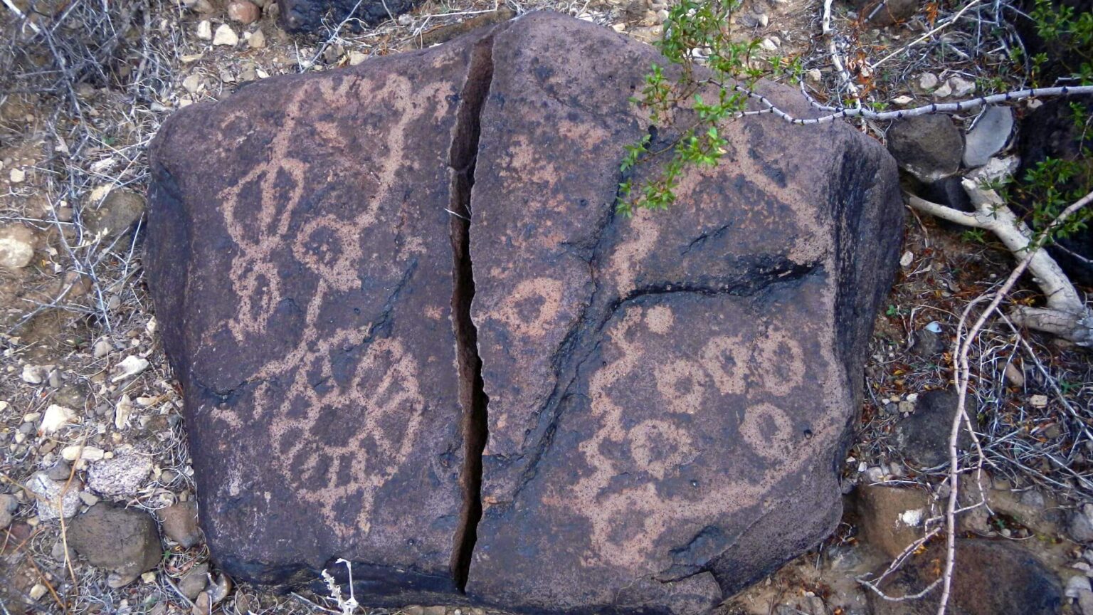 Jan: Petroglyphs, Charlie Bell Well (Day2)
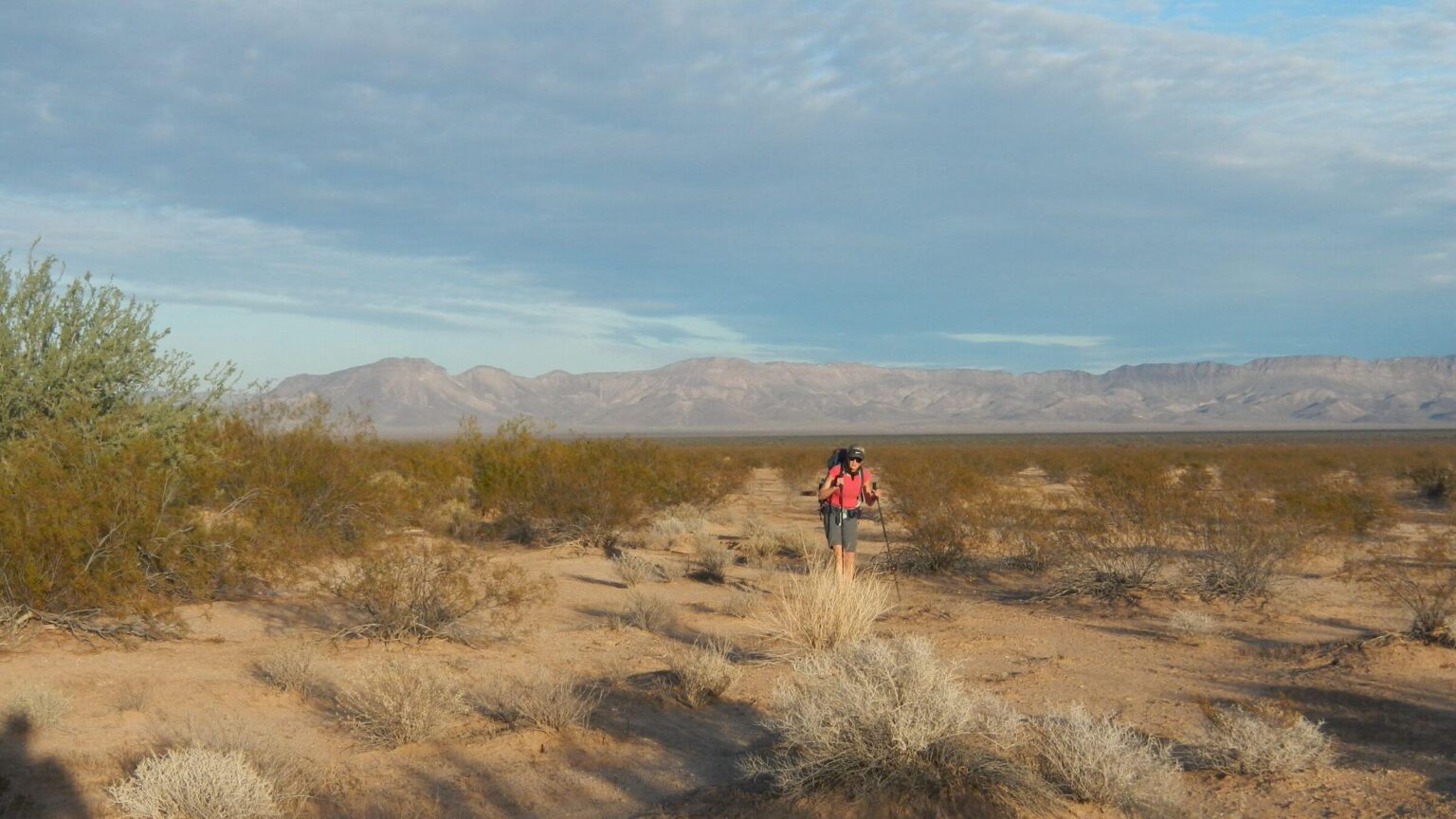 Jan: Growler Valley (Day2)
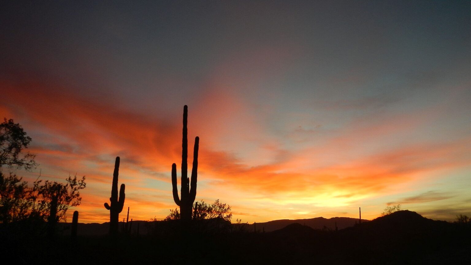 Jan: Sunrise near Granite Tank (Day3)
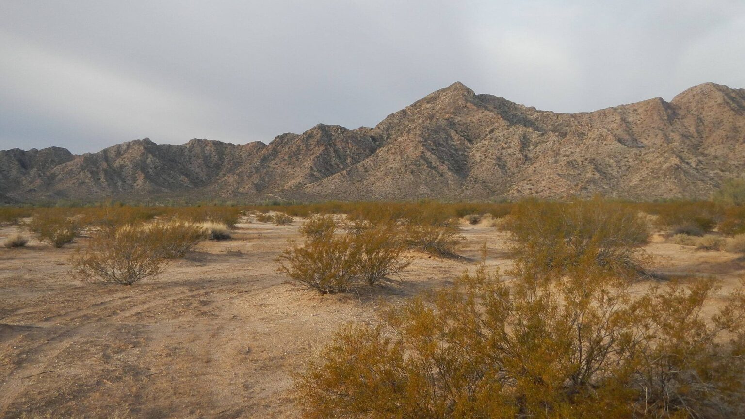 Jan: Granite Mountains (Day3)
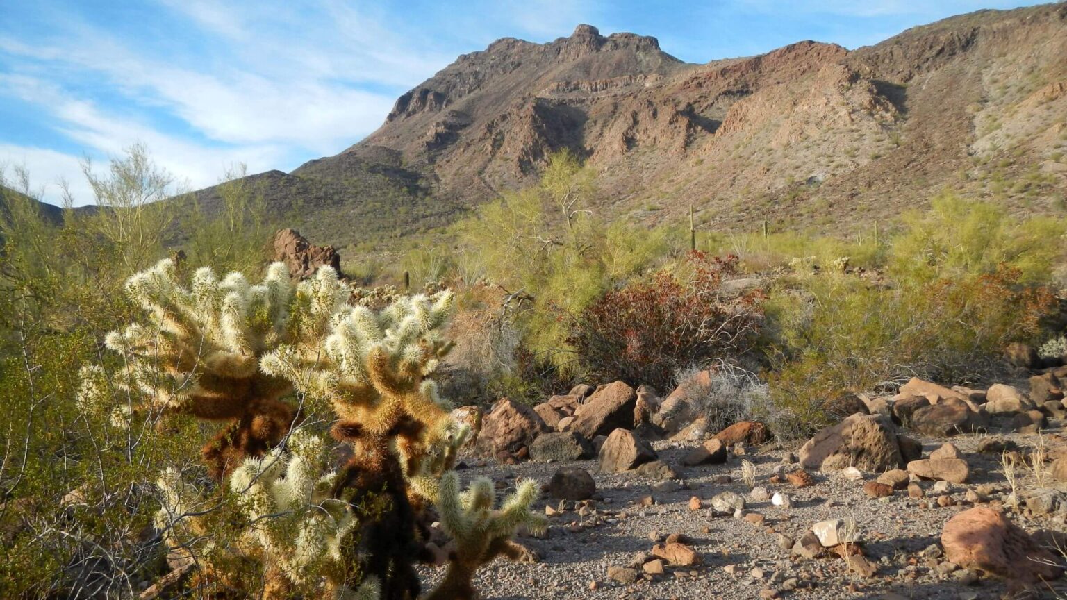
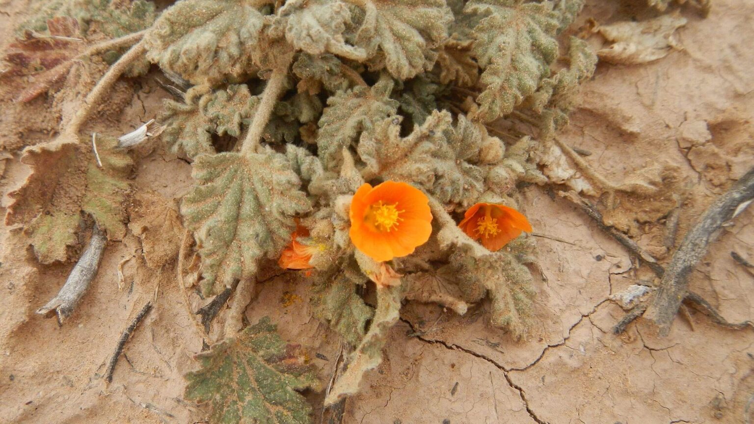 Jan: Coulter’s globemallow (Day3)
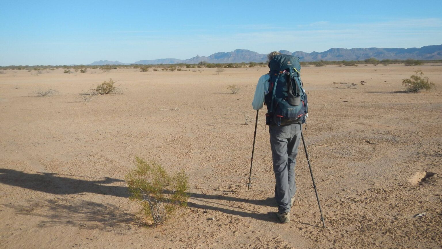 Jan: Sighting on Sheep Peak—horizon point on left (Day4)
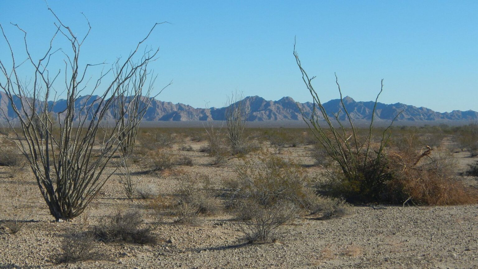 Feb: Sierra Pinta Mountains across valley (Day7)
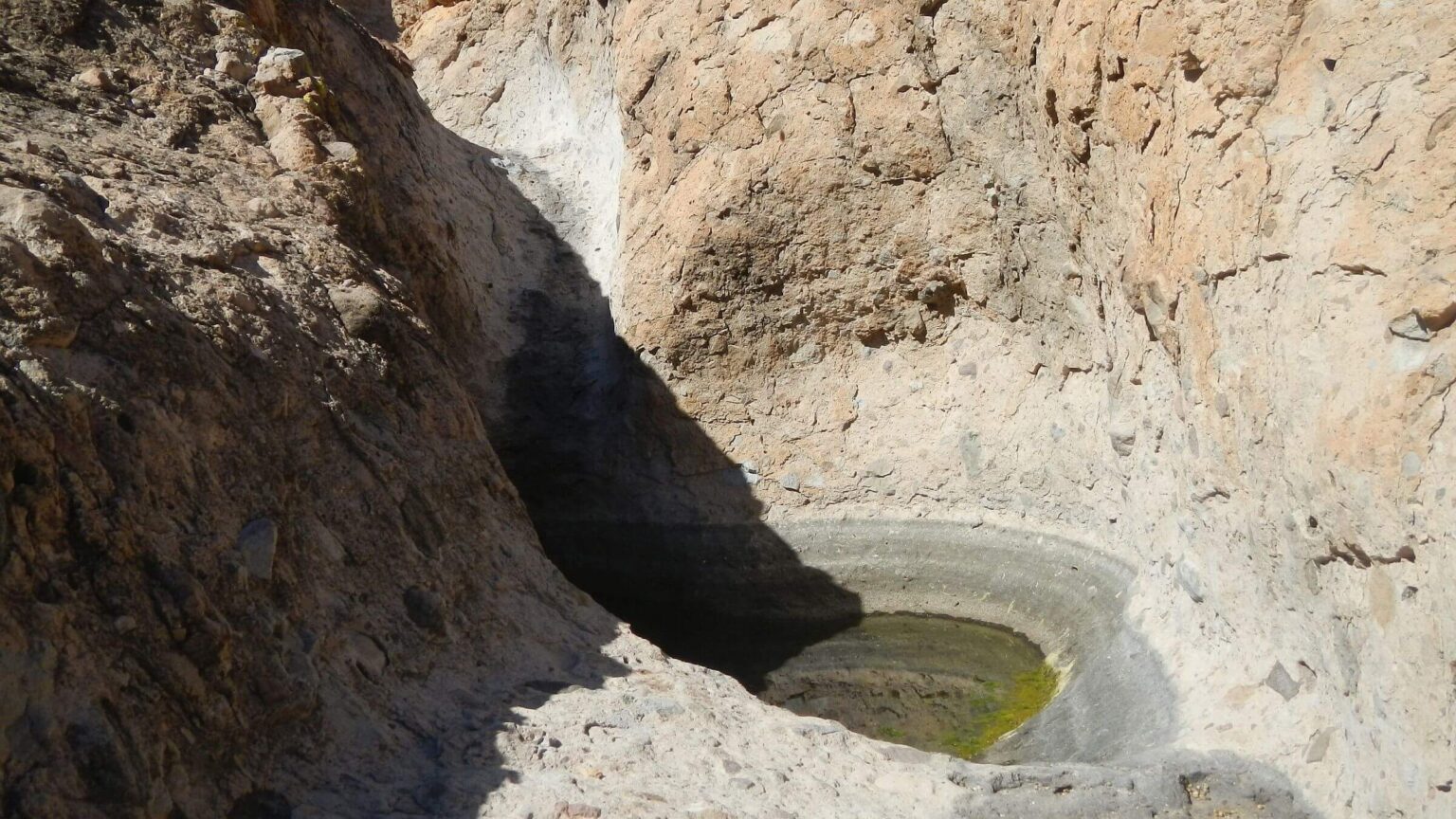 Feb: Cabeza Prieta Tank (Day8)
 Feb: Cabeza Prieta Mountains (Day8)
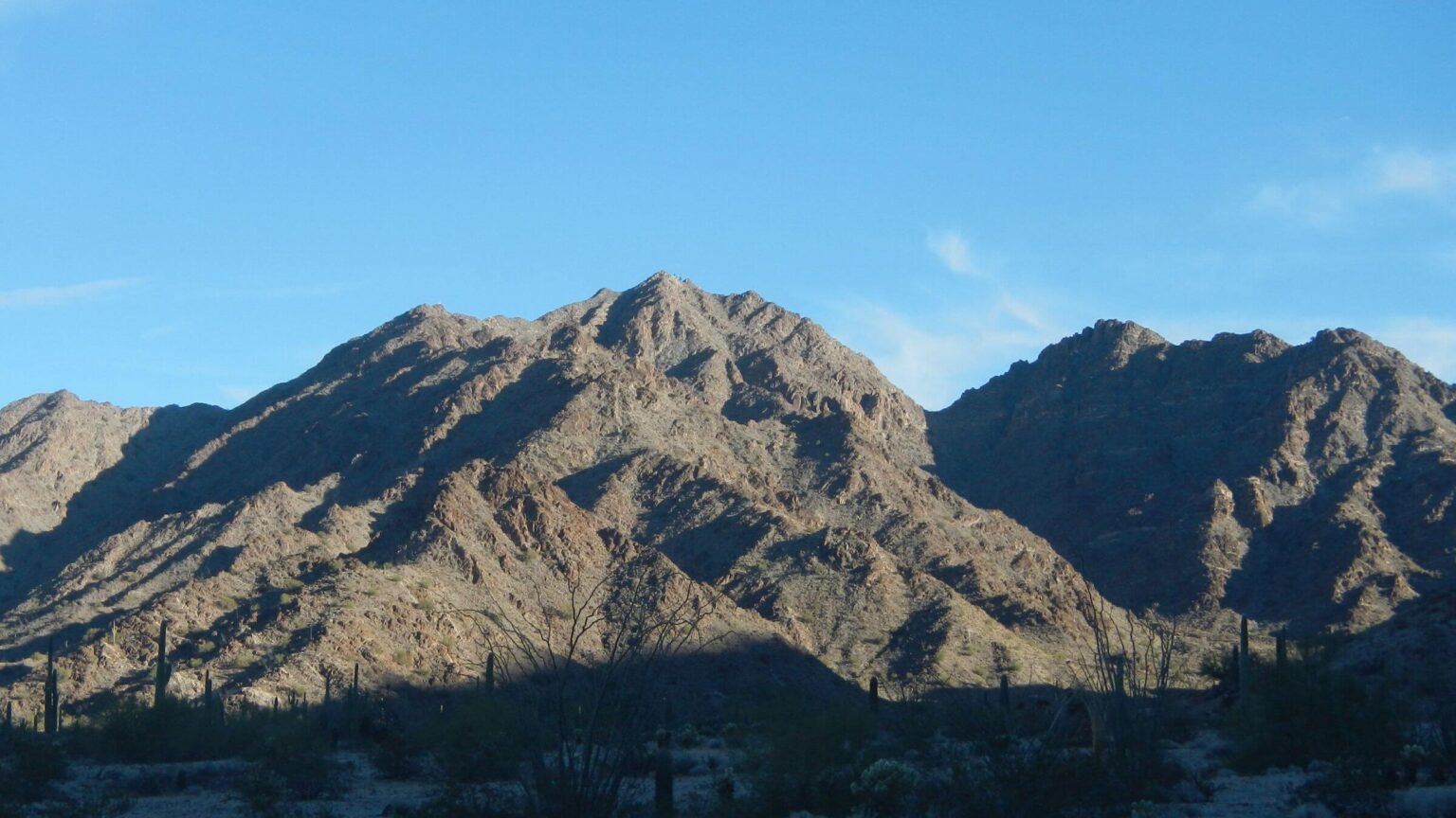 Feb: Buck Peak area (Day9)
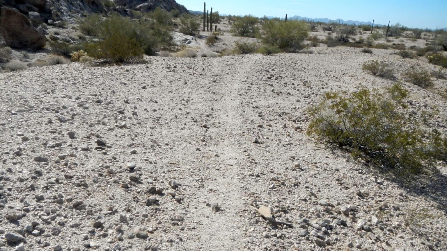 Feb: Migrant trail, western toe Buck Peak range (Day10)
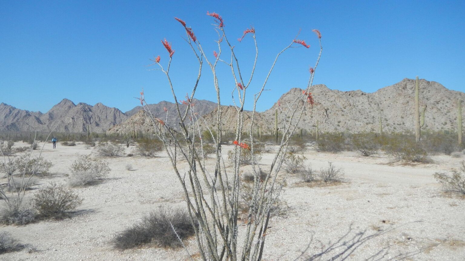 Feb: Ocotillo bloom below Buck Peak range (Day10)
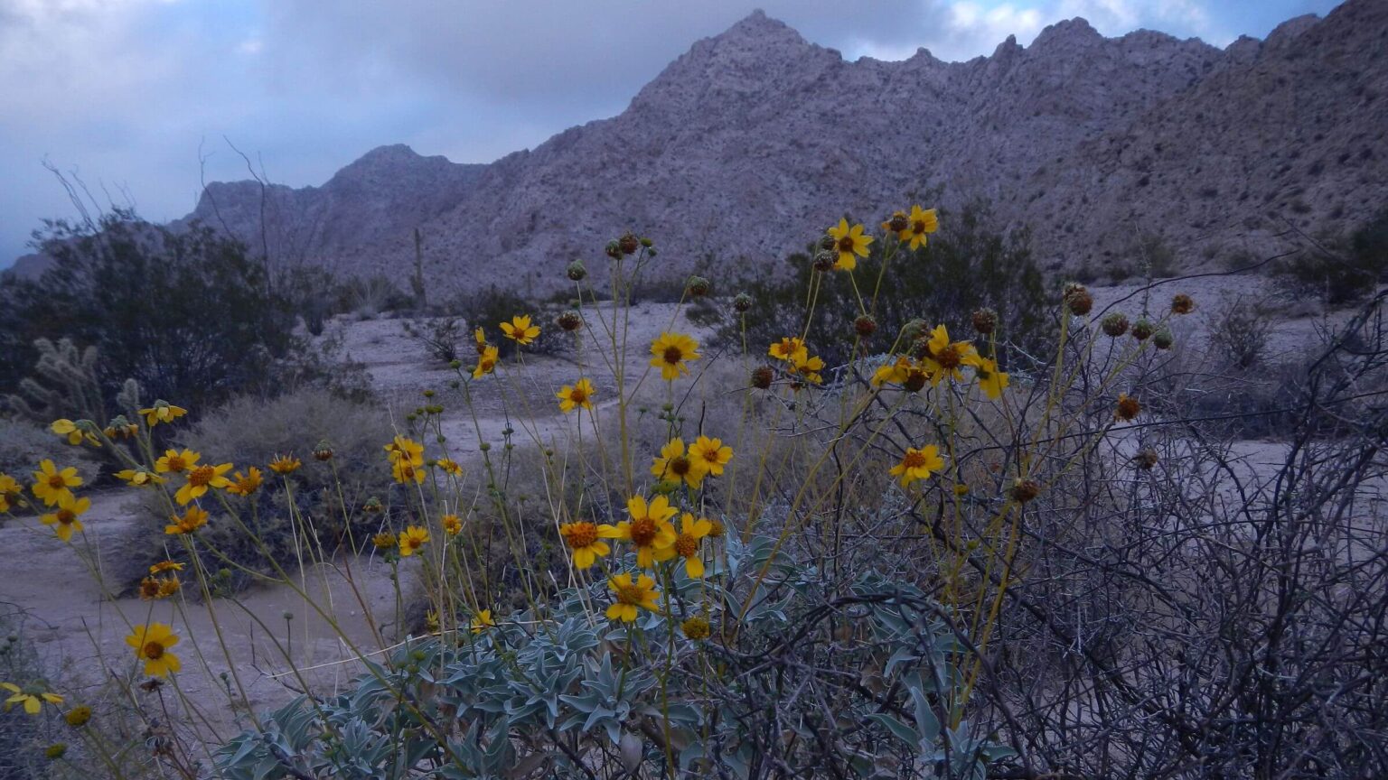 Feb: Brittlebush bloom (Day11)
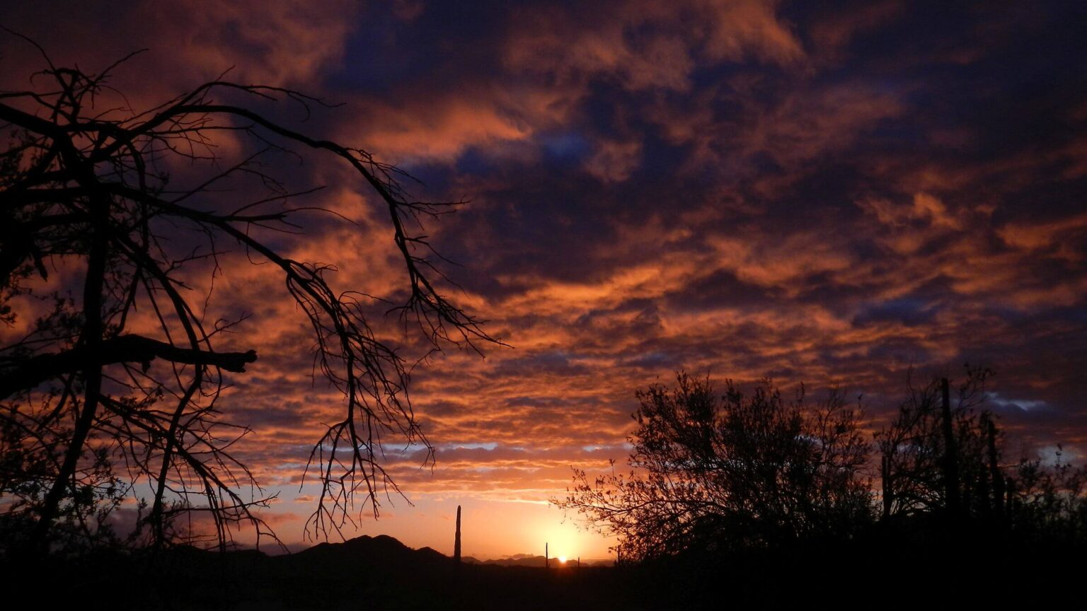 Feb: Stormy sunrise (Day12)
Hiking Tank to Tank in Arizona’s largest wilderness
I awoke in predawn dark to two owls calling—varying pitches indicating desert courtship. My mouth was dry, but I took just a sip from my bottle.
We were 14 miles past our last water stop in Cabeza Prieta Wildness, with about a half a liter of water between us. A long day, a dead-end jeep track, and cross-country over lava rock had ended with camping an hour short of our planned stop at the next predicted water source.
Cabeza Prieta Tank was 1.5 miles up the road and half-mile or so up a steep wash. If tank was dry, we might be in trouble.
Next tank was at least 12 miles by road. If this was dry, next might be also. Safest option might be hiking back to Senita Tank, where we had filled up previous morning. But we could not hike all day with no water.
We could ask for help: either pushing the SOS button on our Garmin inReach satellite phone or hiking back about 6 miles to an emergency beacon maintained by U.S. Border Control to rescue (and catch) thirsty illegal migrants.
No alternatives sounded appealing.
After we packed up camp and trudged up the road, I wondered if it was such a good idea to spend a week backpacking in a drought year in dry Sonoran Desert on the Arizona-Mexico border, an area infamous for deaths of migrants trying to illegally hike north to Interstate 8.
In January we did a multi-day loop trip between three tanks a Cabeza Prieta FWS official said were viable. They were.
This longer trip, just a month later, was planned around five tanks he said were okay. What if he was wrong?
We had talked a month ago, and no rain since then. Desert was dry. Our last water stop, Senita Tank—an artificial tub provided by the FWS—was only half full and the natural tank in the rocks was dry.
Soon we parked our packs under a palo verde and clambered up a sandy, rocky, brushy wash.
Nimble David got past the low dam first and dropped into a natural pit. “We’re not going to die!” he announced. The pool might not last until summer, but it was plenty for us.
Hiking the refuge wilderness—800,000 acres of lower Sonoran Desert—is an unmatched winter backpacking trip, if you know where the water is.
Many unprepared travelers have died of thirst in this vast, beautiful but potentially deadly desert wilderness.
Cabeza Prieta Wilderness is Arizona’s largest (800,000 acres) administered by U.S. Fish & Wildlife Service (FWS) as part of a wildlife refuge. The refuge office is very helpful for water sources and other information. Refuge has no maintained trails, but roads and flat terrain facilitate hiking “tank to tank.”
Entrance permit is required since refuge is within Barry M. Goldwater Air Force Bombing Range, and live ordinance and infrequent sonic booms are among the hazards/features; permit protects Air Force from liability. (Refuge website https://www.fws.gov/refuge/cabeza-prieta has instructions for obtaining permit.)
Public access from three roads into wilderness from Ajo, Tacna, and Wellton. A guide gives directions. High-clearance 4WD vehicles are needed. DO NOT visit this dry, desolate area without checking in with FWS and reading material on preparation.
Avoid this area in summer months with high temperatures up to 100 degrees in eastern upland section and 120 degrees in lower western part. Many migrants die trying to cross this vast area. Cabeza Prieta offers good winter hiking—but pack all necessary water or identify viable sources with FWS.
Water management for wildlife is key FWS focus. Refuge has tinajas (“clay jars,” or natural pockets below waterfalls) or tanks both natural and improved (see tank map). In the 21st century drought, FWS has brought in various containers for holding transported water. FWS rates all water as non-potable, but we had no problem with filtered water (using filter that removed all material 0.4 micron and larger). Some sources had slight discoloration or a mild taste, probably from salts (as salt molecules much smaller than 0.1 micron).
We visited Cabeza Prieta twice in winter 2022 from east and west sides of wilderness.
January visit was five-day backpack into Growler Valley between Growler and Granite mountains, accessed by 15-mile Charlie Bell Road from Ajo; this road was fine for our small Sports Utility Vehicle (SUV).
February visit was seven-day backpack around and through Cabeza Prieta Mountains. Access was 44-mile El Camino del Diablo (Devil’s Highway) from Wellton; also fine for our small SUV (western section had been recently graded).
Visit statistics for both trips: 12 days, 111 miles at 2.4 miles per hour, with 100 feet average elevation change per mile.
Go to map below for more information on trailheads, daily routes, mileages, elevation changes, and photos. (Click on white box in upper-right corner to expand map and show legend with NAVIGATION INSTRUCTIONS.)
show more
Desolate Desert Wilderness has rich human history
Cabeza Prieta spans desert landscape ranging from 700 to 2800 feet in seven rugged mountain ranges and broad valleys dotted with sand dunes and lava flows. Rainfall averages 3 inches on west side and 9 inches on east; winter temperature highs are in the 70s but rise to 100 degrees or more most days from June to October, too hot for safe or comfortable hiking.Refuge is home to about 300 wildlife species, including 50 common species like desert tortoise, lizards, rattlesnakes, wide variety of birds, bobcats, javelina, bats, coyotes, bighorn sheep, and endangered Sonora pronghorn (commonly called “antelope”).
Cabeza Prieta means “dark head” in Spanish, named for a black lava-topped peak on a granite dome near refuge’s western boundary. Jesuit missionary explorer Padre Eusebio Kino may have named it, as he crossed the area several times between 1699 and 1701. In 1774, Spanish conquistador Juan Bautista de Anza pioneered a 130-mile route from Sonoita, Mexico to the Colorado River crossing near Yuma, Arizona, known as El Camino del Diablo (the Devil’s Road). Hundreds died along this route because they failed to plan for adequate water or were unaware of water sources used by earlier human inhabitants. The 1849 California Gold Rush only increased traffic.
Indigenous people were better suited to the area than gold-seeking Europeans. They collected cactus fruit, desert annuals, and mesquite beans, and hunted desert bighorn sheep and small game. Near Charlie Bell Well, presumably a natural seep in past, more than 3400 petroglyphs have been dated to Archaic period (8000 BC to AD 500). Shell artifacts indicate jewelry made in the area.
Area was set aside as game range in 1939; in 1941, it was also designated for U.S. Army Air Corps use to train World War II pilots. Many natural tanks were enhanced by FWS in 1950s to improve water supply. In 1975, area was renamed Cabeza Prieta National Wildlife Refuge, the third largest in the United States. Cattle grazing was eliminated in 1983.
In 1990, most of the refuge became wilderness, with interior roads closed to public driving but used by FWS. Since refuge shares 56 miles of border with Mexico, it is a northbound corridor for job and relief-seeking migrants and drug runners; Border Patrol uses roads and makes dozens of All-Terrain-Vehicle (ATV) tracks on fragile soils throughout wilderness, chasing trespassers.
Previous desert trips entice more exploration
In January 2018, we developed a taste for Sonoran Desert hiking with short backpack in Organ Pipe Wilderness administered by National Park Service. We used a water drop and pools found in one basin for a four-day trip through this mostly dry area. Organ Pipe is adjacent to Cabeza Prieta; El Camino del Diablo passes southwest through the monument on its way to the refuge.That December we also did our first of two visits to Arizona’s second largest wilderness, the Kofa north of Yuma, also a wildlife refuge for desert bighorn sheep.
Neither wilderness was particularly hiker-friendly. Organ Pipe Cactus National Monument, although 90 percent wilderness, is a traditional park with scenic drives and a big campground; wilderness backpacking is allowed but not facilitated away from road corridors. Park staff warned there were no reliable water sources and advised against “water drops” that might be confiscated by Border Patrol.
Kofa Wildlife Refuge seemed managed for wildlife, hunters, and 4WD vehicles legal on nearly 250 miles of roads that bound and bisect wilderness. Well tanks had a pipe and guzzler for wildlife but no spigots for humans. However, visiting in two wet years, we found ample water from potholes and natural tanks.
We planned our Cabeza Prieta visit with caution—but we were pleasantly surprised.
Refuge website said office was closed (COVID-19 restrictions), but a “contact us” staff email yielded a friendly response from a deputy manager who answered every question, identified viable tanks, and encouraged us to visit. Tanks even had a spigot. With planning, there was sufficient water for a short exploratory visit.
January visit: Loop From Charlie Bell Did Not Disappoint
We chose shortest access road for our first visit: 15-mile Charlie Bell Road from Ajo, parking about a mile short of road’s end and hiking desert pavement alongside rocky road to a pass where a gate marked wilderness boundary. Tower with a blue flashing light (and a button to push for help) was “emergency rescue” station installed by Border Patrol. Border Patrol officials say the stations were installed to reduce migrant deaths, although non-profit groups like Humane Borders and “coyotes” who transport migrants for a price view them suspiciously as traps.After a short, steep drop from the pass down a canyon, we found a metal tank at Charlie Bell Well: an old windmill converted with solar panels for pumping water. Tank had a spigot. We camped on a flat above a wash in palo verde and ironwood trees. Famous petroglyphs and an old gravesite were on a hill just above the well. (This chatty video was best photography we found on petroglyphs; we recommend muting sound.)
We learned the hard way (14-mile hike) that roundabout roads in flat desert often featured deep sand from vehicle use; better to hike adjacent firm desert. We found Granite Tank (by headlamp) housed in rugged mountains: an amazing, concrete-engineered tank hewn out of rock into side of a steep wash with steps leading down to a deep pool of water. That night I could see blue flashing lights from Border Patrol stations in the valley.
Next day we left road and headed straight for Red Tail Tank—easy travel by GPS across flat desert with minimal vegetation. An actual metal tank had replaced what was a natural seep in a drying mesquite bosque now dotted with tree skeletons. That night I heard a lone coyote barking above our camp in a maze of mesquite.
Having learned the drill, we sighted on distant Sheep Peak at end of Charlie Bell Canyon for our 10-mile return trip. Other than two big wash crossings, hiking was easy; we arrived back at our first camp just in time for a gorgeous sunset.
February visit: Looping the Cabeza Prieta Mountains
The water scare occurred during our second visit—a longer one circling in and out of Cabeza Prieta Mountains starting from Tule Well on El Camino del Diablo.After a dry camp short of the tank and a tense morning, we were relieved to find water in the Cabeza Prieta tinaja (natural tank), and more in an engineered tank in an adjacent wash. On return trip, we followed trail we found along canyon side instead of clambering down the wash.
From there we hiked road to Cabeza Prieta Pass, and took a “shortcut route” through the mountains avoiding longer loop on the road. We found a trail mostly used by sheep and probably migrants.
At mouth of a broad valley we found Halfway Tank, a nearly dry pool in an engineered structure with a roof; there was also a supplemental guzzler that Arizona Game & Fish and FWS had developed in 2006 according to the plaque.
Next evening we had one more “dry tank” scare. Our route called for out-and-back hike to Buck Peak Tank, with more than a day on to Buckhorn Tank. We left a water stash in a big ironwood tree (at beginning of out-and-back) for a dry camp on following day en route to Buckhorn.
David was a little confused with his GPS route planning, and we hiked road a couple miles out of way before taking more direct route toward the tank, but this meant crossing dozens of washes below toe of mountains where they were quite large—very annoying and tiring for Cindy! We finally joined Buck Tank Road, turning back into mountains for a cold, shady hike into the wind. Just at sunset we found the tank in a sandy wash. It was dry.
Discouraged, I sheltered from wild wind in a big ironwood to don warm clothes while David explored the area. He had noticed a road taking off in the wash we crossed. A few minutes later, he was back with his new favorite greeting: “We’re not going to die!”
Wildlife agencies had excavated another guzzler at end of the road, same as at Halfway Tank. We never did quite figure out how these worked; we were later told that an underground tank with supplemental or rainwater filled the guzzler.
On our return trip we stayed closer to toe of the mountains, where wash crossings were less onerous. We followed a definite migrant and/or wildlife route in many places, while ATV tracks on every wash plateau indicated Border Patrol pursuits. To our relief, our water stash was not disturbed by either Border Patrol or migrants, and we made a nice “dry camp” in a wash a few miles down the road.
Cat tracks, burned cactus, and rain
We saw limited wildlife in the refuge (jackrabbits, quail, a few birds, and lizards), but on our last couple days on road, we saw large and small pawprints, for what appeared to be a mother bobcat and kittens also trekking “tank to tank,” probably by the previous night’s full moon. (However, kittens usually born April to May; perhaps extreme drought and heavy summer monsoon in 2021 affected bobcat life cycle.)We also smelled smoke and found burned cactus along the road; apparently migrants had started a fire to keep warm. We were only about five miles from the border with Mexico; perhaps on a start-up route for many illegal crossers.
Buckhorn excavated tank was dry, but we filled up at another FWS “water tub” with a storage tank piped to a wildlife guzzler.
That night, intense winds rocked our tent. Shortly after we got up, it started raining! Not forecasted. We were glad we had followed our usual habits and packed rain gear and pack covers—which, until that morning, seemed unnecessary.
Returning to Tule Well, we saw the only people for either trip: a couple breaking camp across the road.
show less
Google Map
(Click upper-right box above map to “view larger map” and see legend including NAVIGATION INSTRUCTIONS; expand/contract legend by clicking right arrow down/up.)