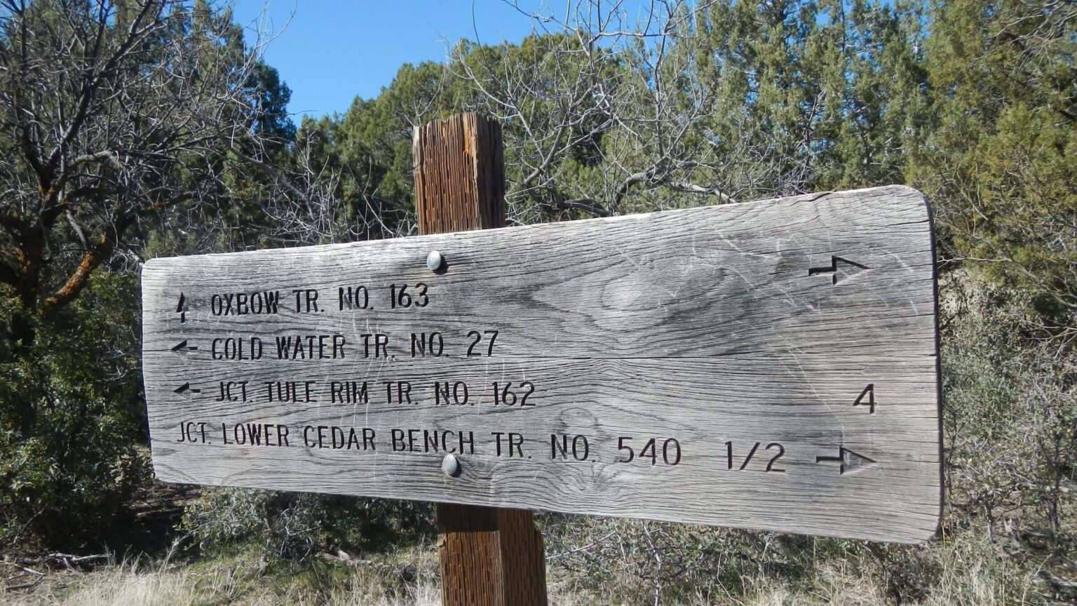
 Trails well signed (Day1)
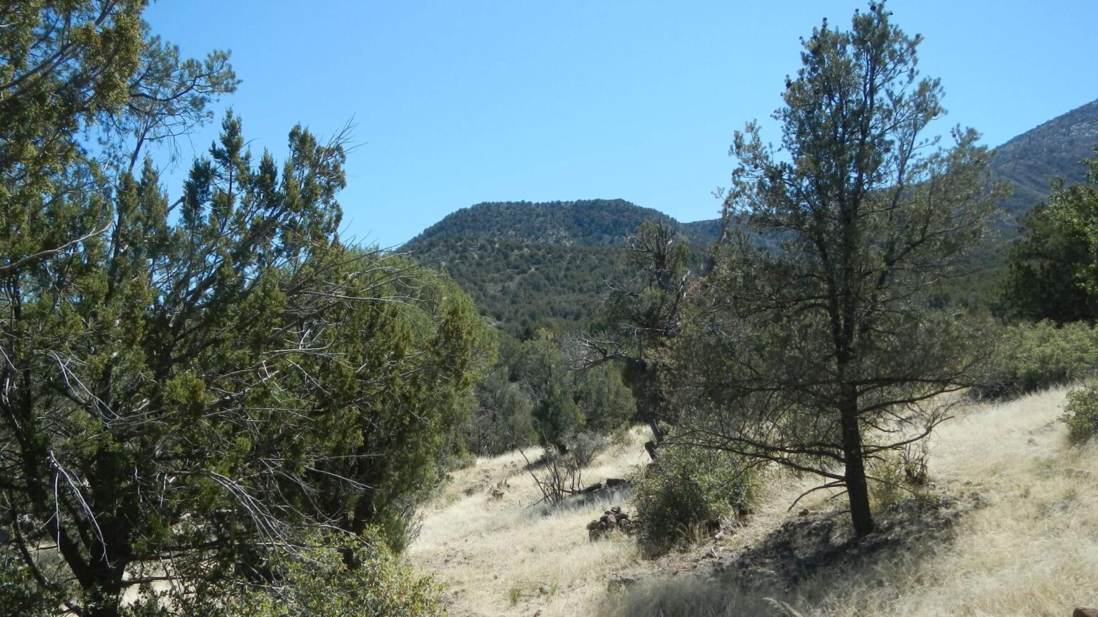 Verde Rim background (Day1)
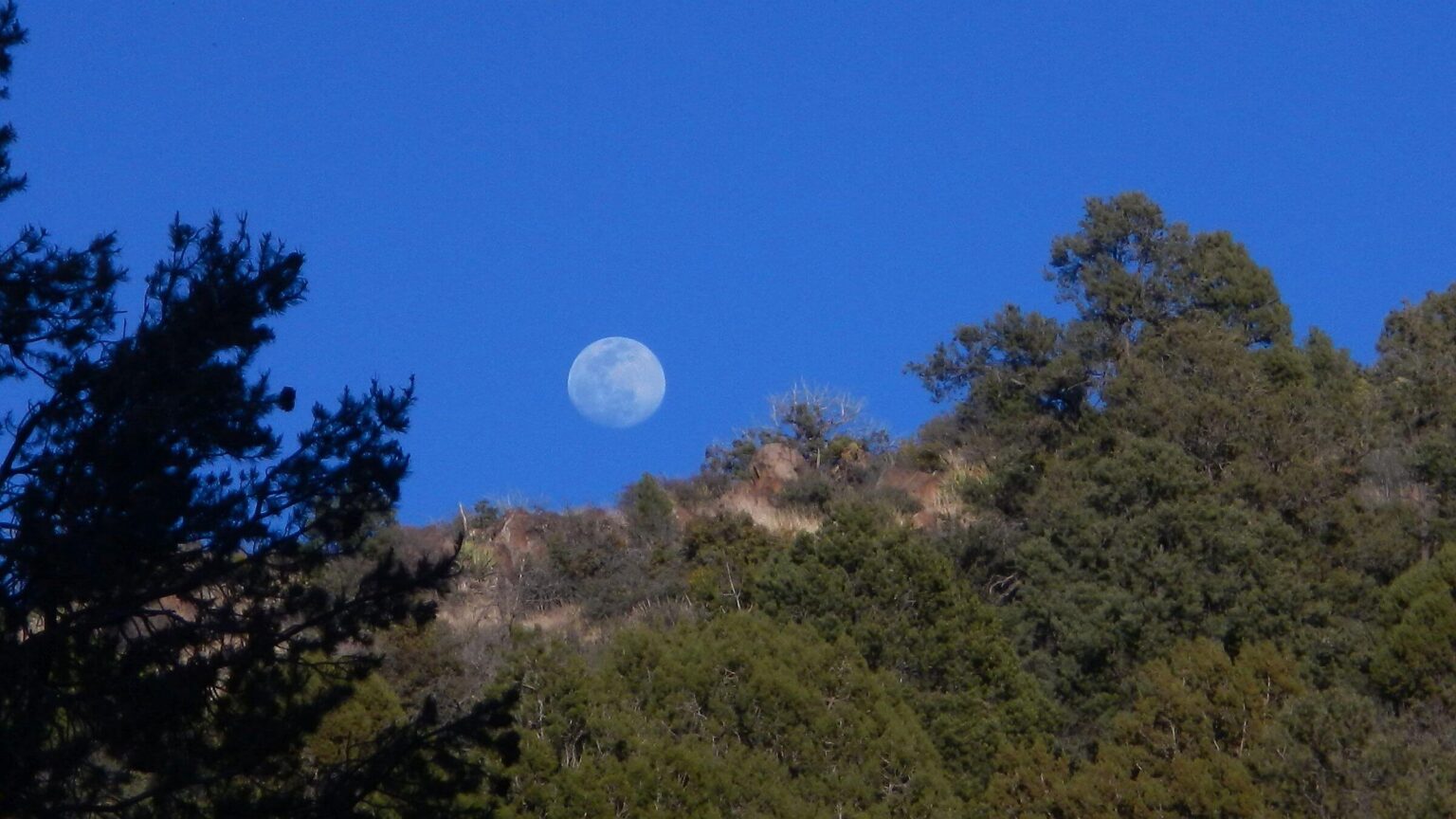 Nearly full moon (Day1)
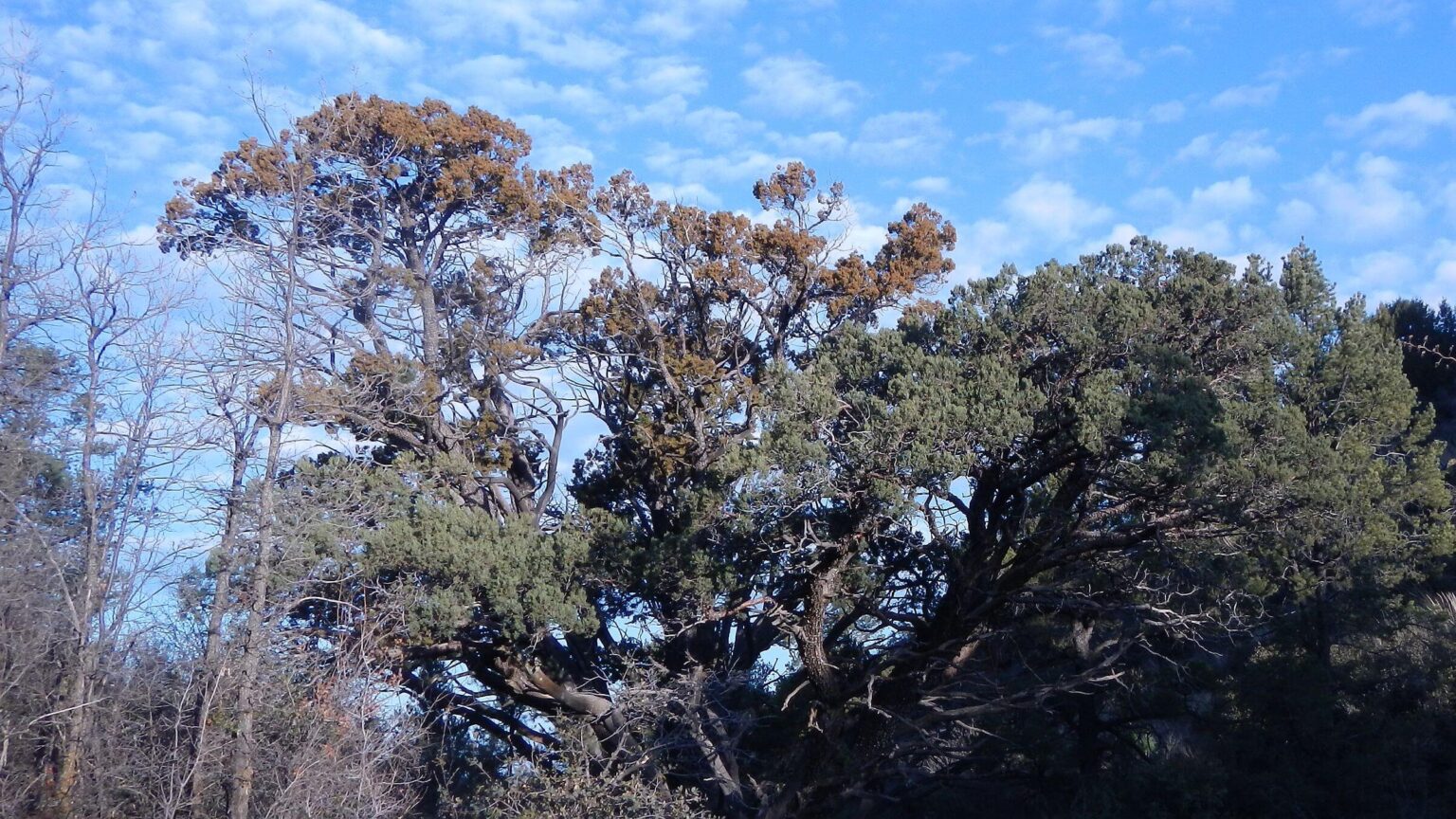 Large alligator juniper topped with yellow pollen; Gambel Oak at left not leafed out yet (Day2)
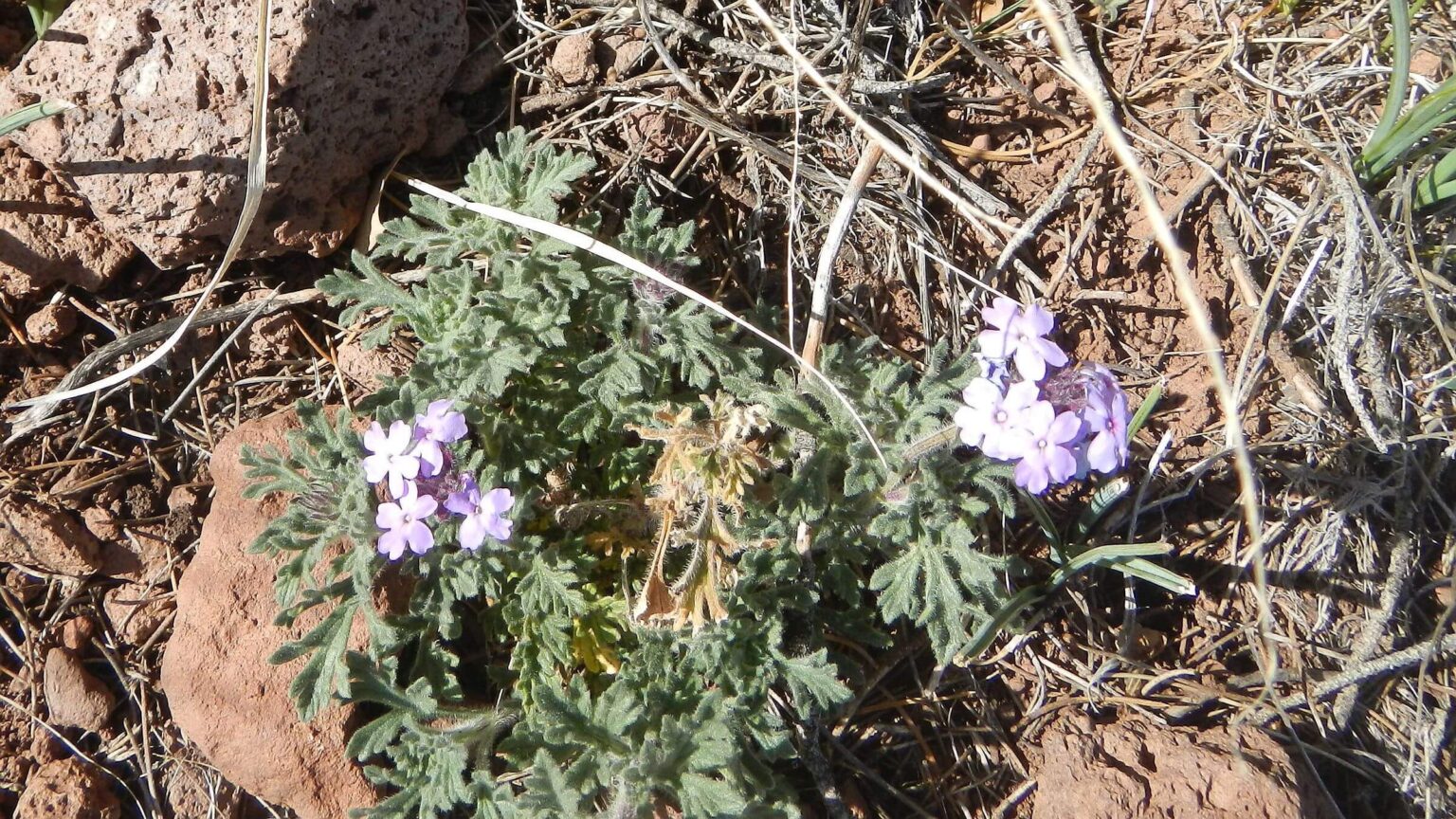 Southwestern mock vervain (Day2)
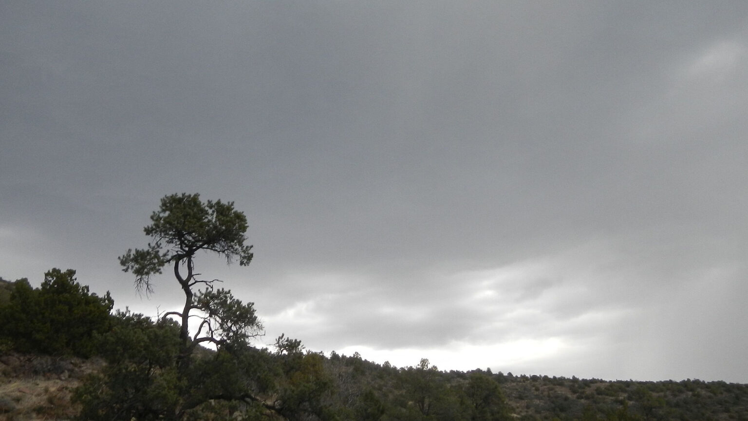 Hail storm looms (Day2)
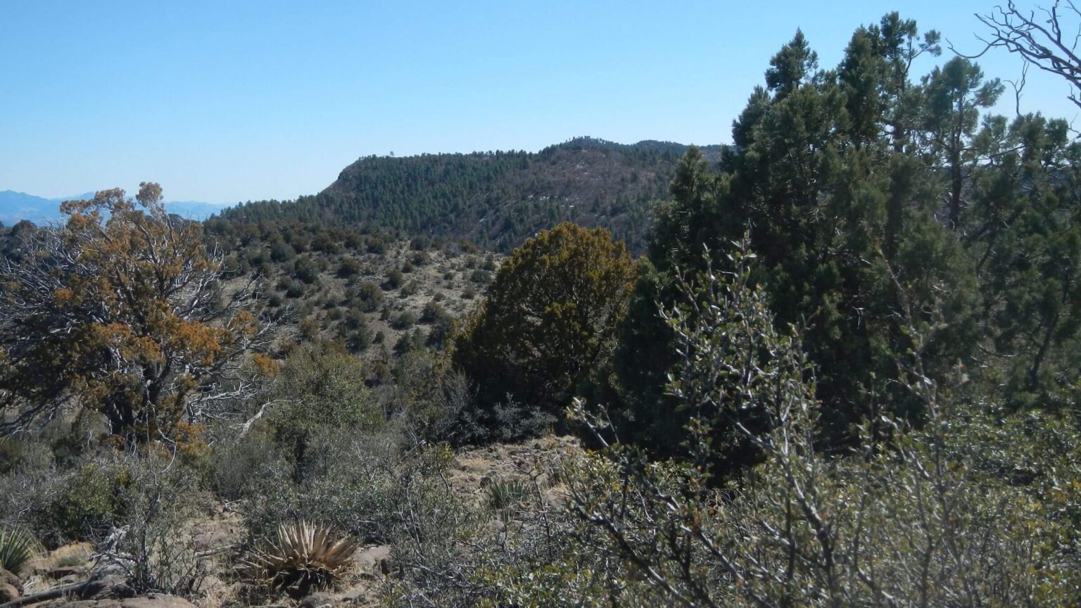 Pine Mountain Wilderness in background (Day3)
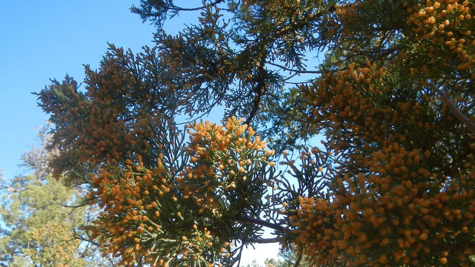 Close-up of alligator juniper cones (Day4)
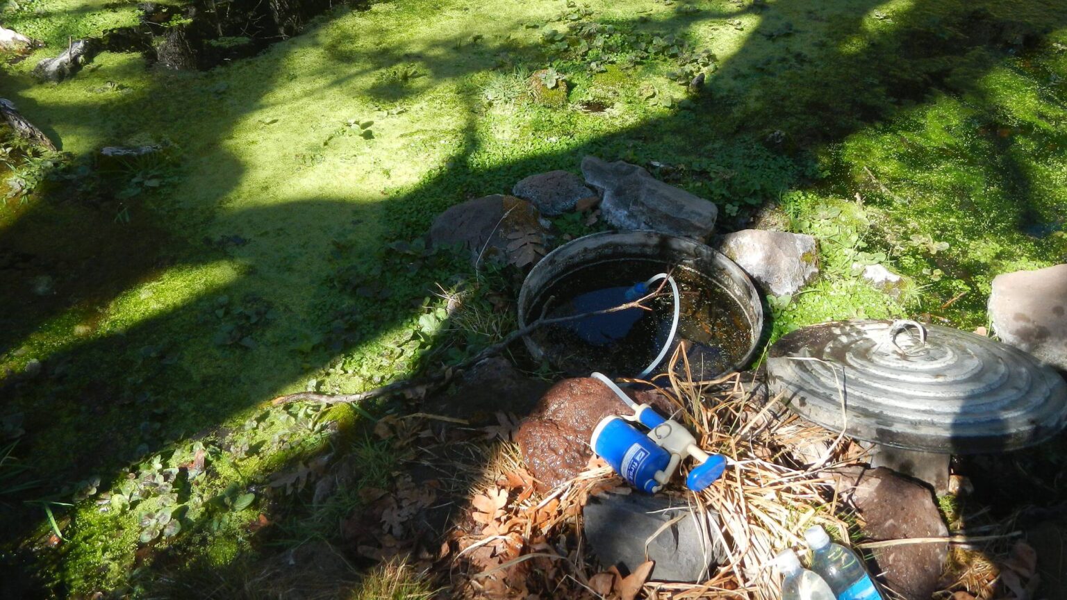 Cold Water Spring had bottomless trash can to keep covered area free of aquatic plants (Day4)
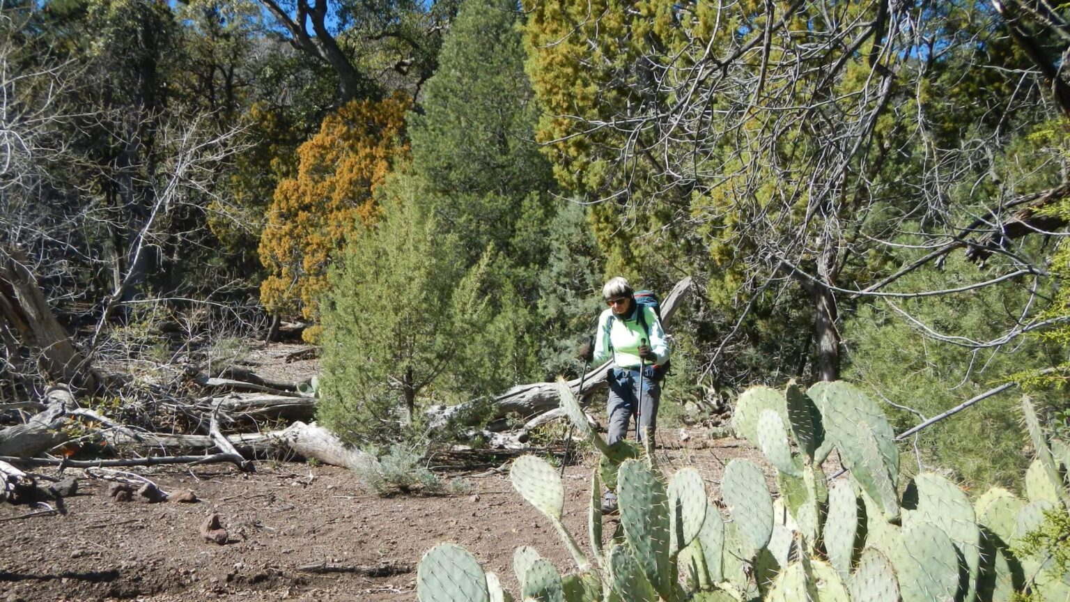 Diverse woodland thrived in flat areas (Day4)
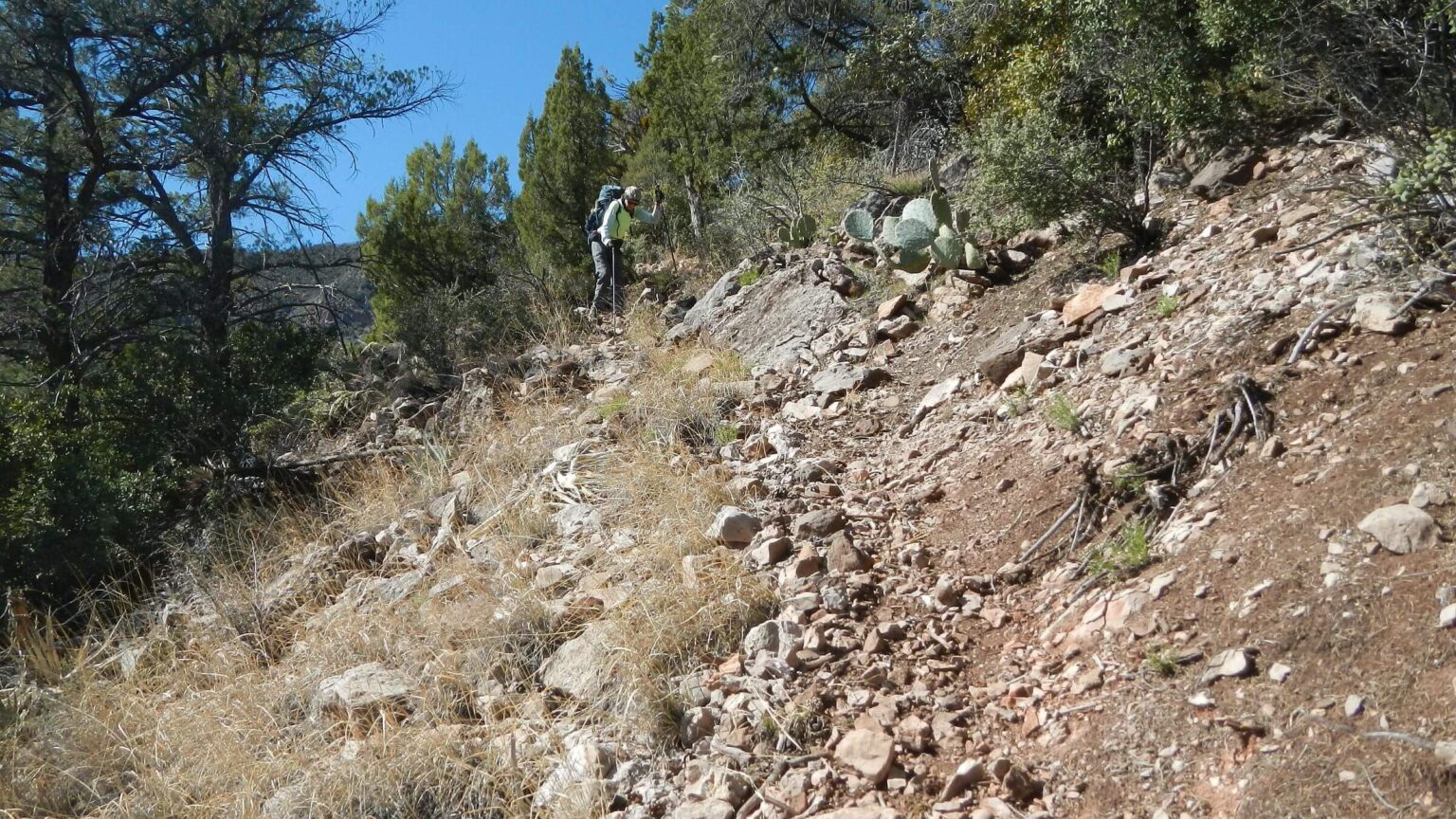 Steep and/or rocky trails prevailed almost entire trip (Day4)
Rough Trails Ensure Solitude and Drama in Remote Wilderness
As we researched a trip to Cedar Bench Wilderness, we were delighted with Prescott National Forest personnel who were familiar with trails and gave advice on best access.
As we hiked up a rocky road climbing steeply from the Verde River and turned north at first junction to contour around drainages on the Oxbow Trail, we were pleased to find large stone cairns (rock piles) marking the trail.
However, similar cairns led me astray and provided the first of many “drama moments” on a short but difficult visit to this rugged rangeland in central Arizona.
In a dry year, David was happy to find water in the Billy Tank drainage. We had heard that Gap Creek and Cold Water Spring were the only dependable water.
As David stopped to filter water, I continued up the trail, following cairns out of the wash and up and around the next bench. The trail came to a flat area where two marginal routes dropped into the next drainage. I stopped to wait for David, who had the GPS. I did not have a map.
David never came. Returning to the drainage, I found a huge cairn on other side of drainage just after where I had turned off. I had taken the wrong trail and David, who usually hiked faster than I could, was ahead of me, no doubt racing far ahead to “catch up!” And trail was too rocky to leave much hiker tracks.
Planned Figure Eight Loop for Two Small Wildernesses
Cedar Bench and Pine Mountain Wilderness are small wilderness areas lying in a northwest-southwest boomerang shape along the Verde Rim—on Cedar Bench and astride 6,814-foot Pine Mountain.Original plan was to enter Pine Mountain from west via Salt Flat trailhead on a backroad from Interstate–17, the closest access from Phoenix. Our hike would cross Pine Mountain, loop around Cedar Bench, and finish loop around Pine. Our Prescott Forest contact said the road to Pine Mountain might be too rough for our small sports utility vehicle (SUV) and steered us towards a better backcountry road from Camp Verde to east side of Cedar Bench on the Verde River.
Cedar Bench Wilderness is a small parcel (16,000 acres) along a northwest-southwest “bench” between the Verde and Agua Fria river drainages south of Camp Verde, Arizona. Elevations range from 4,500 to 6,700 feet with vegetation of saguaro cactus in lower elevations near Verde River and rising through mountain-mahogany and oak chaparral, and up to pinyon-juniper and Gambel oak. We saw very large alligator juniper, many nearly yellow due to prolific pollen year.
Cattle grazing dominated past use with many earth-built tanks. Spur cow trails were distraction in flatter areas, and healthy grass forage was minimal. Cattle seemed main trail users although none were encountered during our hike.
Cedar Bench boasts eight trails of 32 miles; the three we hiked had signs and large stone cairns but were hard to follow due to rocky terrain, brush, and disappearing tread. Perhaps past overgrazing (and subsequent erosion) was cause for so many rocks on trails. We met only one hiker—a lion hunter—on our way out—and saw recent horse tracks on Cold Water Spring Trail.
Cold Water Spring was best year-round source; Government Spring at head of Gap Creek was running well but required hike down rough 3/4-mile washed out trail dropping 400 feet (and then back up). We also found water in Billy Tank drainage and in few other tanks/seeps even after dry winter. Area best for early spring hiking; too hot and dry for summer or fall; but we found surprising amount of north slope snow at 5,000 feet.
After two days of drama from misleading spurs, trail-finding, temporarily lost GPS, long slow hiking days, and pulling into camp by moonlight, we abandoned plans for a figure-eight loop with adjacent Pine Mountain Wilderness and hiked out a day early. We will leave Cedar Bench to the cattle—the main user of this scenic but relatively inaccessible area.
Visit statistics: 4 days, 28 miles at 1.5 miles per hour with 450 feet average elevation change per mile.
Go to map below for more information on trailheads, daily routes, mileages, elevation changes and photos. (Click on white box in upper right corner to expand map and show legend with NAVIGATION INSTRUCTIONS.)
show more
So, we switched our trip starting in Cedar Bench—which worked better anyway because only reliable water in Pine Mountain Wilderness was Nelson Place Spring near trailhead; this fit better with doing our trip “backwards.”
Reunited for a Rough Hike
I trailed David up a pebbly track for about an hour; I started calling his name again when I heard a faint whistle above me. He had finally reached some soft trail soil and did not see my tracks, so came back thinking maybe I had gotten off trail somewhere.The rest of the afternoon was a steep switchback climb, contour along rocky ridge and steep drop into Gap Creek for water for camp and next day water. Government Spring was flowing well where we filled up. Oxbow Tank area appeared flat enough on map for good camping. But slow trail resulted in headlamp stumble on rough brushy path to tent site on sand bar just below tank. A rock twisted under my left ankle in dark, causing a sharp pain in my hip. Almost full moon rose above our sandy wash camp.
The next day was worse. After a junction and fence, Tule Rim Trail was rough, rock-strewn, and often lost in brush and invasive weeds. Then it became thin track contouring below Tule Bench, a brushy rockpile cloaked in icy snow in spots. Cattle, the main users, had created many side trails. David took some of my weight and ferried my pack on roughest spots; on one snowy, muddy crossing he lost his balance with unwieldy heavy pack and slid on his side in the mud.
At our first short break, David realized he had lost his GPS—a disaster with such poor trails! He found it after hour of searching; finally recalling where he had last used it. (When he ferries my pack, he usually puts GPS in his pack to avoid double measures; GPS had popped out of his pack pocket when he swung it up after one such “ferry.”) Late in afternoon we rounded a big canyon with steep drops and backtracks where we lost the trail. Grey clouds built to the west; we were pelted by two violent hailstorms for the last mile. Despite raingear we arrived cold and damp at Cold Water Spring close to sundown. We had hiked 6 miles in 10 hours!
Regroup: Base Camp and Day Hike
We agreed the figure eight loop of Pine Mountain was not feasible; we were going too slow, trails too rough, worse snow expected on 1000-feet higher Pine Mountain, and too limited water to alter our trip. So, we slept in, arose at 8 a.m. with sun on the tent, hiked the quarter mile back to Cold Water Spring for water, made breakfast, packed up my pack for a “day sack,” hung the rest of our food in “bear bag” in a big juniper tree, and took off for a day hike. Cold wind coming up the drainage followed us to the bench.It took most of the day to clamber up steep trail outside wilderness to old powerline road (where David cleared some brush with clippers) to Tule Mesa, and hike Dugas Road to Pine Mountain Wilderness trailhead and back. We overshot the trailhead, not marked, perhaps to discourage sign shooters. A vehicle track led to a fence where we found a hiker portal, cairns, and a trail.
We were short of wilderness boundary and didn’t have time to follow trail to see if entrance signed. The fast road hike was a pleasant change; trail seemed better on the return although we lost it once.
Back in camp, surprisingly tired after our 7.5-mile out-and-back, we enjoyed a still night and rise of a giant orange full moon on the horizon.
Out of the Wilderness
After our second leisurely morning and breakfast at Cold Water Spring base camp, we dropped 850 feet the first mile. Only saving grace was more soil than rocks for the descent. Trail continued to junction contouring around many drainages, dropping down and climbing onto talus field tables. A few nice mellow areas around old cattle tanks.I had forgotten that the road out of wilderness—perhaps built by a small dozer with no sense of surveying for reasonable grade—also dropped steeply at times with many stony stretches. Near its end we met a young guy with a rifle and friendly young hound with a GPS collar and vest inscribed “Ridley.” He was hunting mountain lions. Had already killed two in the area.
This lawful use ended our trip on a sour note. I had seen cat tracks; would love to see one (alive).
The road dropped steeply at end to avoid a private inholding at Brown Springs Ranch marked with hostile signs. I got to our vehicle around 4:30 p.m.—six hours to hike 6.3 miles including road!
Trailhead inholdings, cattle overuse, unmaintained rocky trails, hunting, and lack of road signs pointing to wilderness seemed to sum up local contempt for this small remote parcel of rugged cow pasture also designated wilderness. However, our Prescott forest contact was eager for feedback, and mentioned continuing to work at clearing trails.
I would like to rent a Jeep and visit Pine Mountain Wilderness from the west end, doing “other half” of our planned figure eight. Stay tuned.
show less
Google Map
(Click upper right box above map to “view larger map” to see legend including NAVIGATION INSTRUCTIONS; expand/contract legend by clicking right arrow down/up)
Downloads
Links
- Forest Service information
- HikeArizona: Cedar Bench
- Rocky trail types classified
- Brown Springs Allotment tank cleaning project (within Cedar Bench Wilderness)
- Center for Biological Diversity on overgrazing Verde River allotments (see pp 120-154 on Brown Springs)