Fire effects overshadow trek through country’s largest wilderness
Idaho native David was drawn to Frank Church Wilderness (Frank) back when it was the Idaho and Salmon River Breaks Primitive Area(s). The Selway-Bitterroot (Selway), designated in original Wilderness Act of 1964, captivated him after fall weekend backpacking trip 2 hours’ drive from University of Idaho. Frank Church, last Idaho Democratic Senator, died of cancer in 1984, 4 years after he engineered the vast “River of No Return Wilderness;” his name was added later.
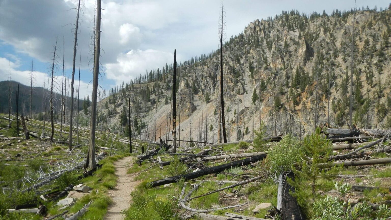
Many large fires have burned the two wildernesses creating difficult trail conditions. The Idaho Centennial Trail (ICT) goes through both but few people hike it; minimal online material is more about “macho” experience on roughest part of ICT than useful information. We wanted to find the best hikeable route, not compete for Internet fame.
Starting in September 2024, David began inquiring via websites and emails about backpacking this area. About 300 planning hours later on July 2, we left our Hailey house on a bus to Ketchum with backpacks, ate late lunch downtown then met a local outfitter for ride to Lola Creek Campground northwest of Stanley to start trek.
We could have hiked from our house (as we did for our first Idaho wilderness trek in 2016, but wanted to avoid 2-week repeat. We had so much trouble with fire-damaged trails in the Frank Church Mountains that David carefully planned route to avoid worst damage. But that missed more scenic trails in high country of Frank—instead, following a wilderness boundary road mentioned as alternative by several ICT hikers.
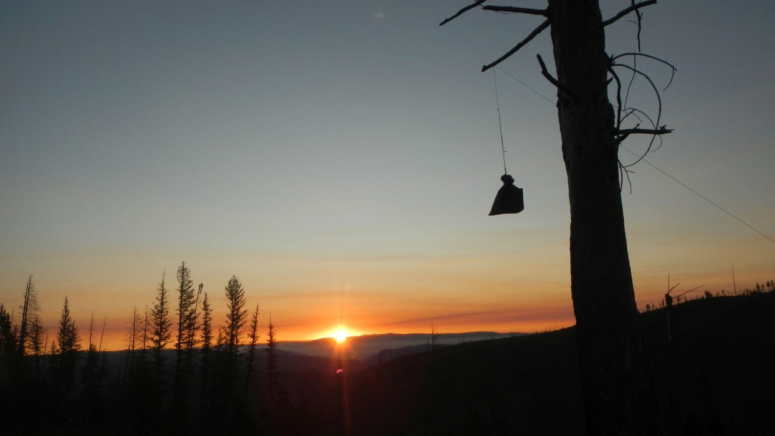
Although our 361-mile trek was dominated by fire effects, we eluded 2025 fire. On July 9, Big Bear Fire ignited in Frank Church near Salmon River while we weathered the loud thunderstorm in our tent (Day08, see 2025 Fire on map below). We saw smoke for several days, but fire was still 10 miles away when we left river. Later, lightning ignited spot fire high above us on Tin Cup Creek in Selway as we set up tent in driving rain and crashing thunder. Helicopters that night and next day brought in “rappelling” fire fighters; we even met a fire crew on the trail.
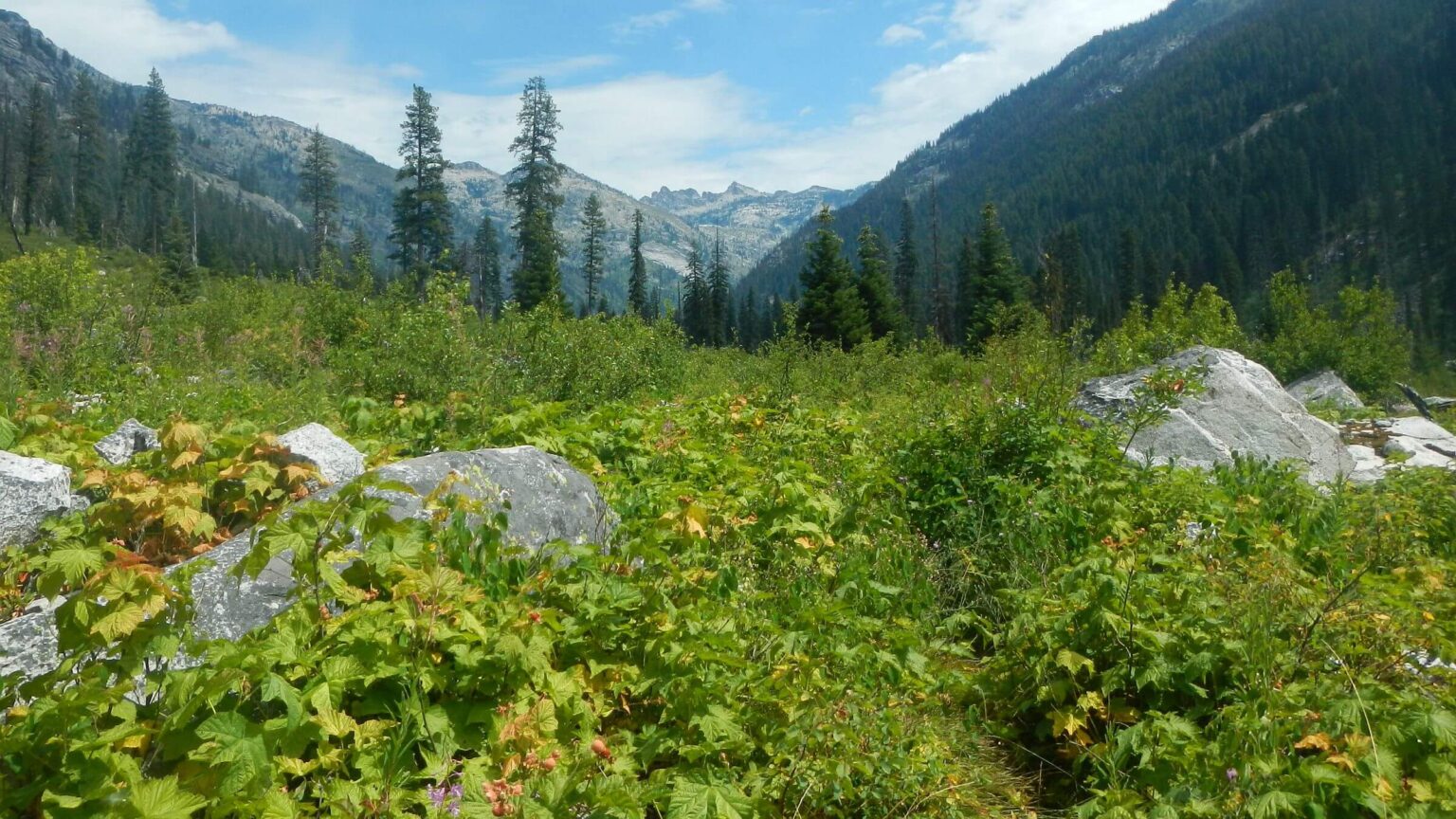
Other than miles of open canopy snags, the biggest fire impacts were chin-high brush to wade through in wetter areas and downed logs to crawl over or clamber around.
Brushy creeks prompted us to change our last segment through Selway on-the-fly using a map at a Darby restaurant. We initially hoped to do 80-mile Bitterroot Mountain backpack recounted in stirring video but switched to looping up and down through creeks after warnings of impassable trails. But I was ready to quite at Darby if more creek hiking, instead route change to only high country spared me from any more tripping over hidden roots and rocks in treacherous brush.
The trek covered 361 miles through Frank Church River of No Return (Frank) and Selway-Bitterroot (Selway) wilderness in Idaho and Montana, starting northwest of Stanley, ID and ending in Bitterroot Valley, MT. The wildernesses comprise 3.7 million acres—largest contiguous U.S. wilderness outside Alaska. Of 4000 miles of trails—many Native American paths improved for stock use—much is severely damaged by recent fires and more or less unusable for enjoyable backpacking.
We planned extensively to avoid uncleared trails, coordinate resupply stops, and limit hiking to 7 days between stops. We had previous experience struggling on almost non-existent fire-damaged trails on a 2016 trip through heavily burned Frank Church Mountains. We avoided Marble Creek from Middle Fork of Salmon (route of Idaho Centennial Trail [ICT]) because of multiple crossings; and took Bargamin Creek as reported best route out of Salmon River. We had minimal information on Selway trails or resupply stops, so defaulted to Magruder Corridor Road. See map below for our winding route.
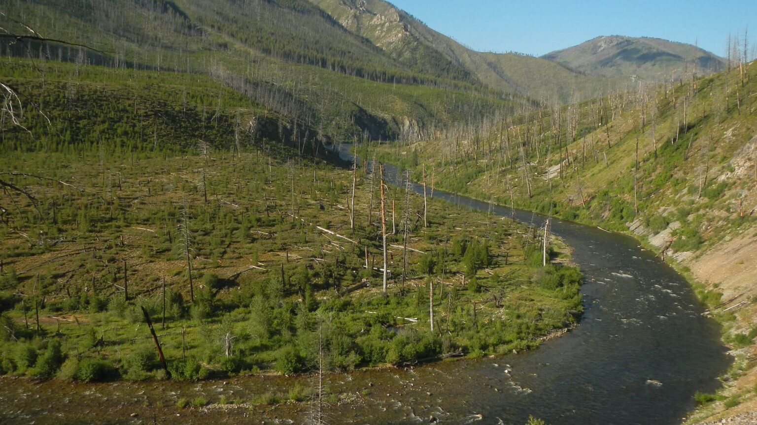
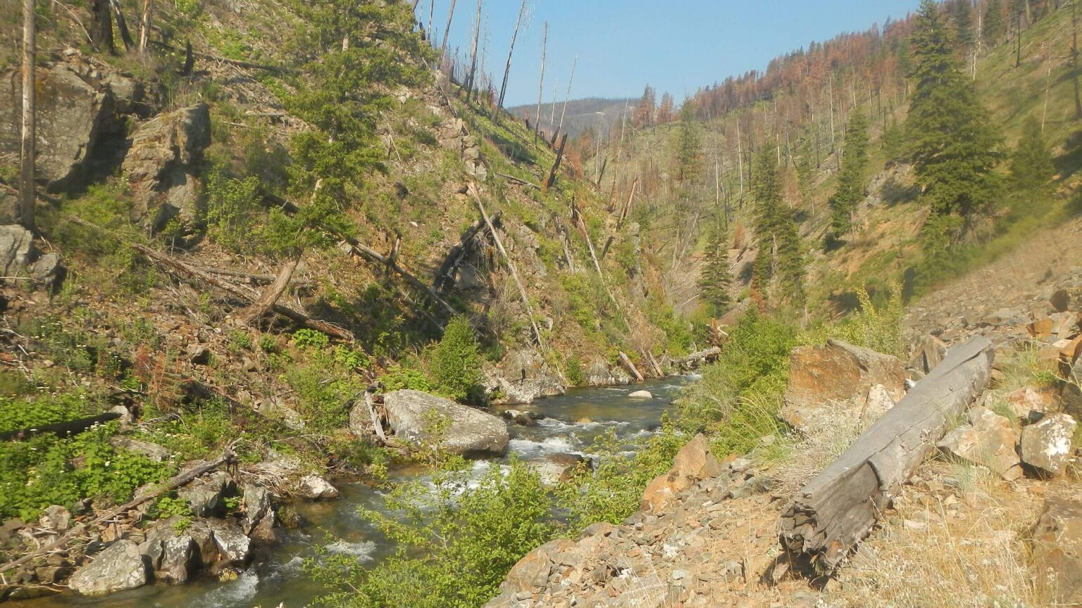
Almost 75 percent of our trip was within 41 fire perimeters, ignited between 1987 and 2024—most after 2000, including 7 mega-fires 100,000 ac or larger. We saw reburned areas where saplings and brush from previous fire carried the second.
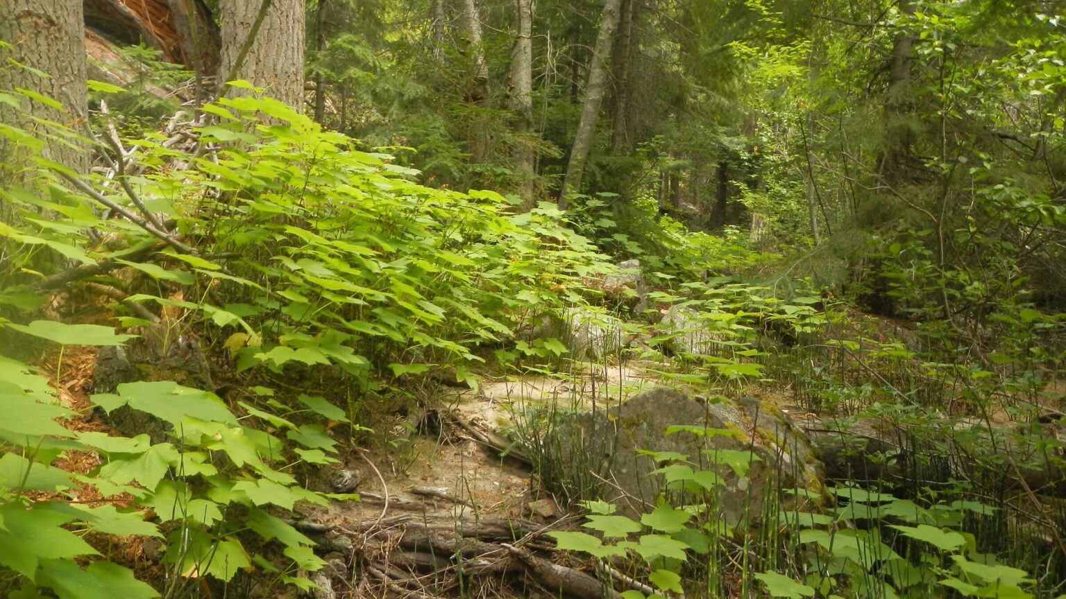
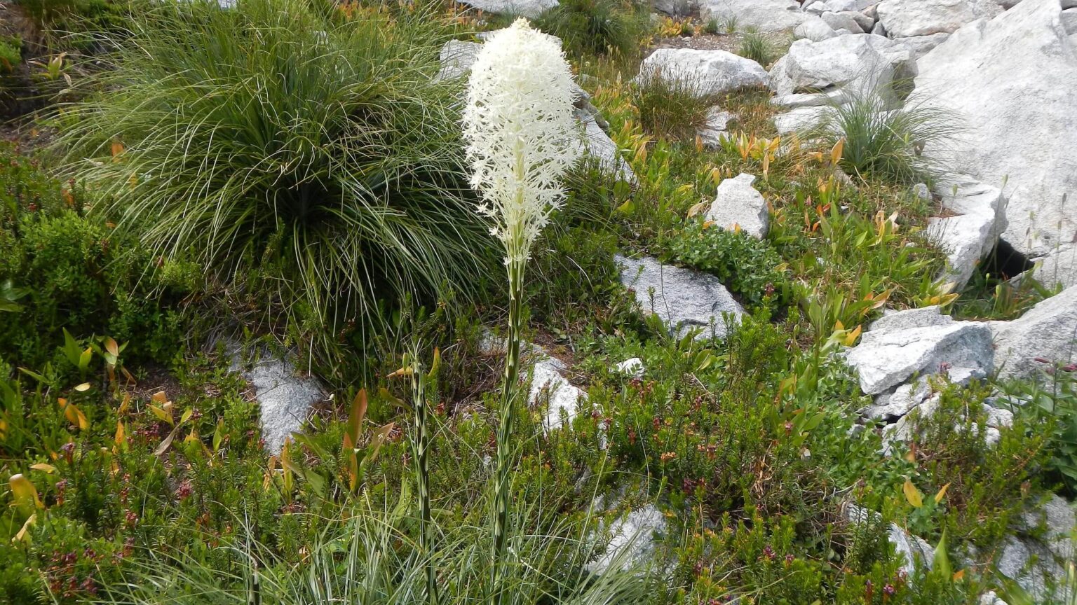
Forests (when not burned) comprised ponderosa and lodgepole pines, Douglas-fir, white fir, spruce-fir, and white bark pine in Frank Church wilderness. Selway transitioned to inland-maritime climate adding more wetter-habitat species such as western red cedar, pacific yew, and grand fir, and subalpine larch. Dense brush over-crowed many trails in burned areas in both wildernesses.
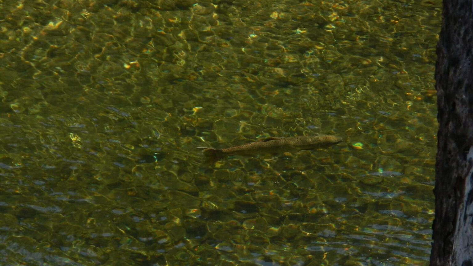
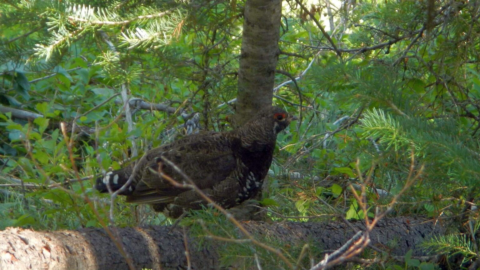
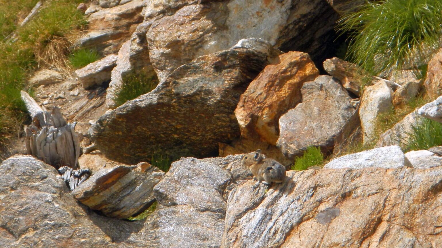
Wildlife seen included deer, grouse, steelhead trout, marmot, coney (pika or rock rabbit) and trading barks with young wolf on the move. We smelled but saw no elk.
Much solitude except on boundaries: Middle Fork & Main Salmon river boats; vehicles on Magruder Corridor Road and bush planes near airstrips (passed 7 in Frank Church). Camped alone except 2 nights (Middle Fork boaters & vehicles at Poet Creek Campground).
Visit statistics: 35 days (including 5 nights at resupply stops), 361 mi hiking, at 2.0 mph, with 350 ft/mi of average elevation change.
Go to map below for more information on trailheads, daily routes, mileages, elevation changes, and photos. (Click on white box in upper-right corner to expand map and show legend with NAVIGATION INSTRUCTIONS.)
show more
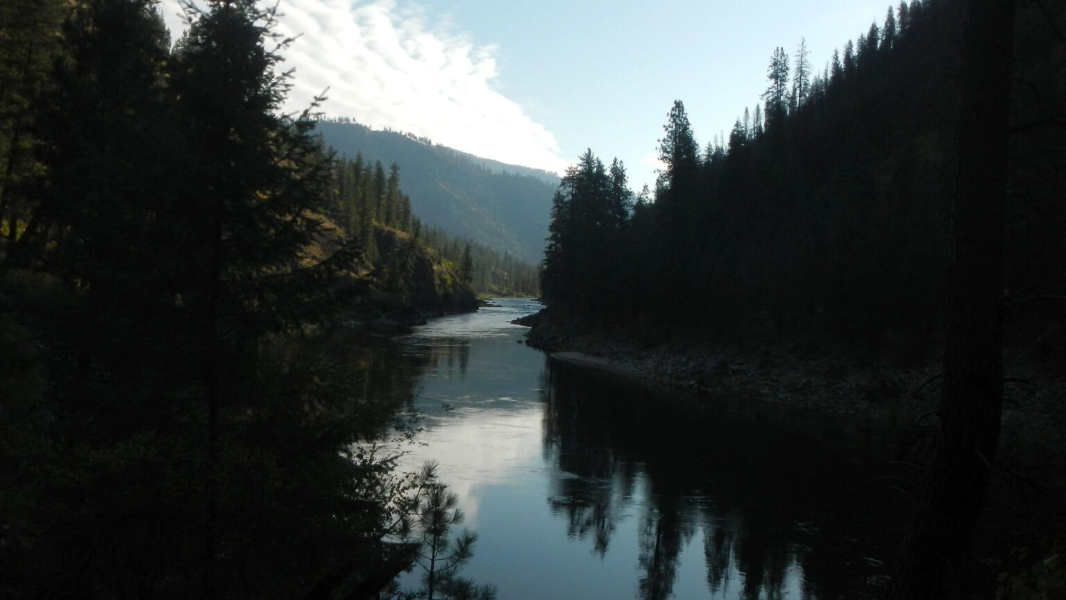
Good trail on the Middle Fork
We hiked through old burns with no trouble starting at Marsh Creek northwest of Stanley, which joins Bear Creek Valley to form headwaters of the Salmon River Middle Fork. Some annoying ceanothus blocked trail in a burn on Day02 of the trek, but volunteers had cleared most of Middle Fork Trail all the way to Pistol Creek, four days and 47 miles into our trip.After Dagger Falls, main launch point for floaters, we saw many private and outfitted boats of all colors and sizes, but few trail users on Middle Fork—we met 2 backpackers not far from our start and 2 day-hiking anglers with GPS collared dog near Dagger.
After vehicle chaos at Dagger parking lot, we had obscure trail to ourselves other than horse tracks ahead of us. We camped in grove of small pines in burned area above a side creek. Rain began that night and continued into morning. The Middle Fork Trail crossed several large side creeks—thankfully, most had a bridge. However, when we wound down to Rams Horn Creek, swollen by the rain, I saw what looked like wood piles far up the creek—bridge was out.
I was a bit spooked at the fast thigh-deep water (having been swept off my feet a few months earlier in a river flash flood. So, David took his pack across, returned and ferried my pack through the torrent. He then came for me—I gripped his hand as the current fought me and managed to clamber up the bank. We feared there might be more bad crossings but that was the only one on this segment.
However, four trips through the fast murky water put a strain on David’s right knee. He had been doing physical therapy for minor left knee problem and wondered if right was now weakened. A new injury early on a trip could be a disaster! However, a few inReach emails with physical therapist in Hailey offered some stretches to do in the tent and reassurance; he was fine after a few days of wrapping knee.
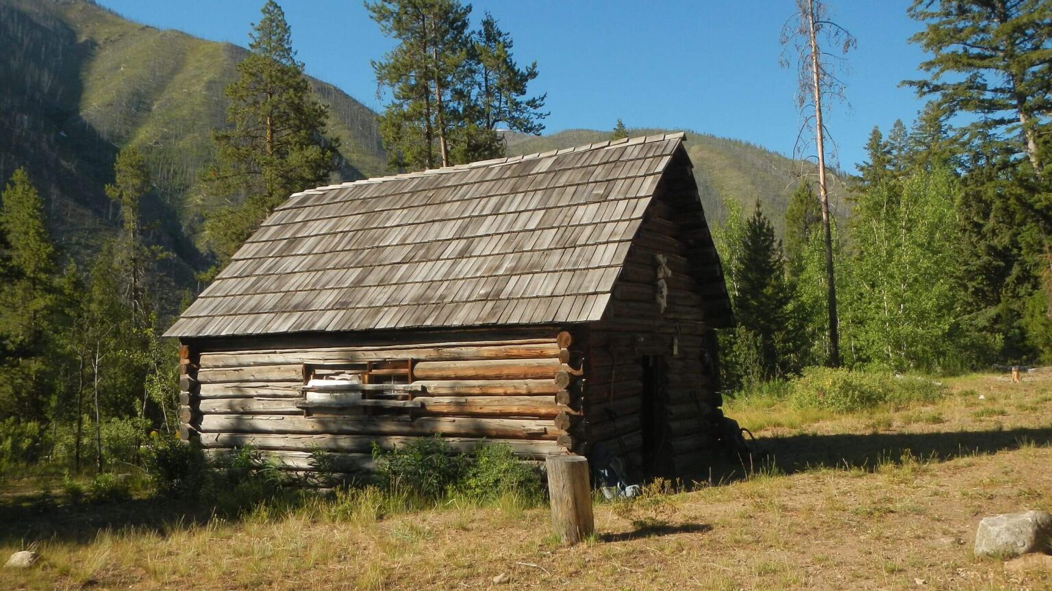
Skies cleared later and we dried our stuff on a scree outcrop on the river, waving at boaters passing by. Late afternoon we passed beautiful woods by historic Joe Bump Cabin but decided against camping when we viewed a sea of large green tents set up by commercial boat trip.
The Frank is famous for its hot springs, and we were looking forward to a soak at Sheepeater a little ways further. But we noticed several folks in bathing suits hanging around the hot springs, more coming along a side trail apparently from a boat camp further down river, and a whole raft of boats and tents right below the springs. We hiked on and camped on a burned pine flat we had all to ourselves.
Stopping at Pistol Creek turnoff, we hiked six miles round trip to retrieve a resupply box at fly-in Indian Creek Guard Station. Friendly staff on ATVs directed us through the maze of roads on private Pistol Creek Ranch. “The trail crew was through (Pistol Creek) last week,” the ranch manager told us. Good news. As we hiked through the ranch, we noticed two “spot fires” on hillside across Middle Fork.
The Forest Service wilderness guard at Indian Creek left our box in her office but was out trail running; our only greeting was raven who screamed at our entry, apparently demanding a handout. I noticed a large boat camp area on river below the guard station; no campers but many ravens strolling around apparently used to begging from generous boaters.
On the return, we saw several firefighters on steep slope across river attacking the fire. We assume they were rappelled in as Pistol Creek air strip across river wouldn’t have been much help. We camped at a beautiful sand bar at Pistol Creek mouth; on other side were several boater camps.
Pistol Creek Surprise
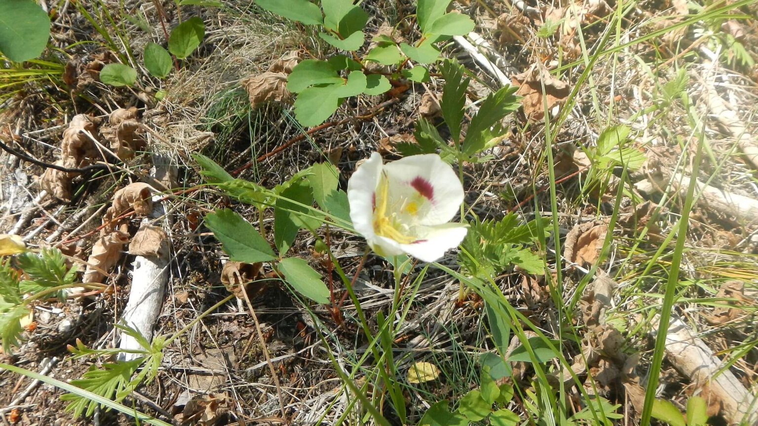
For next 2 days we saw no one on heavily burned Pistol Creek. As the manager had said, trail work was obvious—cut logs and even repairs on sections of the well-built trail. However, the crew did not clear the high brush in wet areas. I tripped on a hidden rock and fell face first off the trail. David had to pull me up by my backpack! We found this tendency to cut logs but not clear brush to be a problem along other creeks on our trip.We also missed what turned out to be our last chance at a hot springs soak. Midmorning we saw multiple elk routes dropping down to rock-lined pools on Pistol Creek. But it was chilly, so we passed on. David had seen more hot springs on maps in initial planning, but our final route did not pass any more.
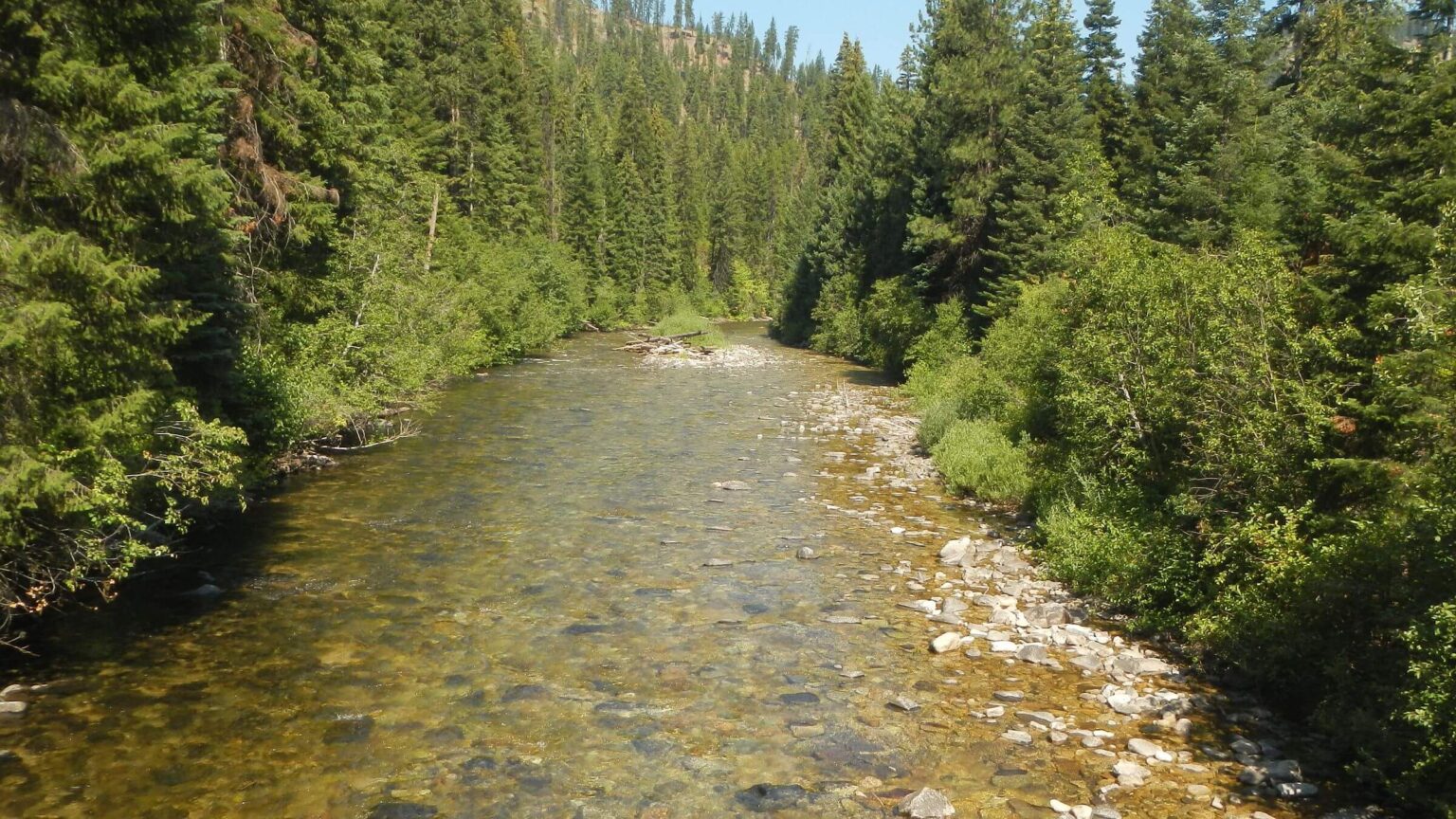
Further up the creek, a huge log jam (from post-fire flooding) made deep pools; at lunch break we noticed steelhead trout were idling in the still water. On up we camped in lightly burned pine with nice sandbar for first bath of the trip.
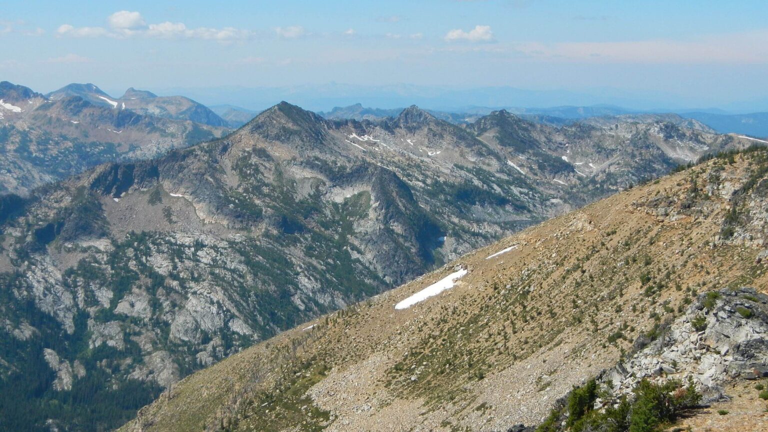
Next day we took a long steep contour out of the creek passing through more burned area. On top we met a jeep road and UTVs, then dropped off road into drainage to clamber over down logs, then contour along vague track of Summit Trail on wilderness boundary (had no information on it but assumed it might be better since closer to roads; it was not). We entered 2007 Cascade Complex burn scar (took several days to pass through a small portion of this 300,000 ac megafire). Lush camp at saddle had a few large spruce that survived fire, as expected from Google Earth imagery.
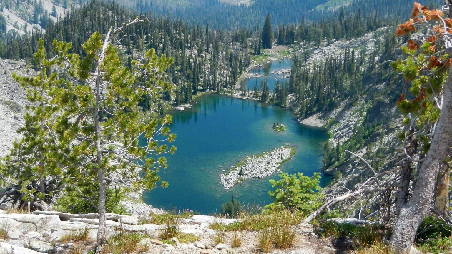
An outfitter must have also liked our saddle campsite, as logs were cut for rest of Summit Trail; offering gorgeous ridge views and a few large subalpine fir and whitebark pine that survived the fire. We descended near beautiful Pistol Lake; well-used trail from nearby road indicated campers. Trail alternated from good (switchbacks into an unburned basin) to sketchy, with small section on mining road. Views of Payette National Forest peaks to far west.
We passed through fields of wildflowers into grove and signed turnoff to Indian Creek Trail we could have taken from guard station (but were told trail was a mess from fires); tracks showed someone had used this trail. Trail screamed straight up 700 feet; from tracks, elk were main users. More up and down, burned flat with bunches of flowers and remnant trees, then climb to barren trailhead on Meadow Creek Lookout Road. We soon met two local guys on motorcycles.
More burns on way to Big Creek and beyond
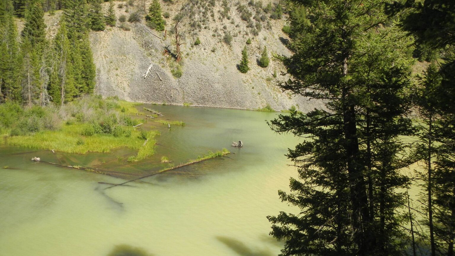
After trudging up and down hilly road we came to lightly burned forested outfitter camp but no water in tank so plodded on. We had planned to hike down a side road and camp on East Fork Salmon River, but the abandoned road was littered with downed logs. David dropped down a quarter mile and found pools at head of creek for our camp water. We saw threatening dark clouds on Frank Church Mountains to the east. We ended up camping on slightly burned piney roadside.Once in our tent, violent hailstorm hit. I saw piles of hail outside our tent, we passed washouts from the rain on the road, and Monumental Creek ran green from the runoff! Later we passed ugly greenish Roosevelt Lake; it was created by 1909 landslide into Monumental Creek that submerged Roosevelt mining town. We camped and washed clothes and ourselves at beautiful non-polluted Mule Creek (ironically its canyon was source of landslide over 100 years ago). (Thunder Mountain above Roosevelt was the last Western gold rush and there are many old mines above Monumental Creek.)
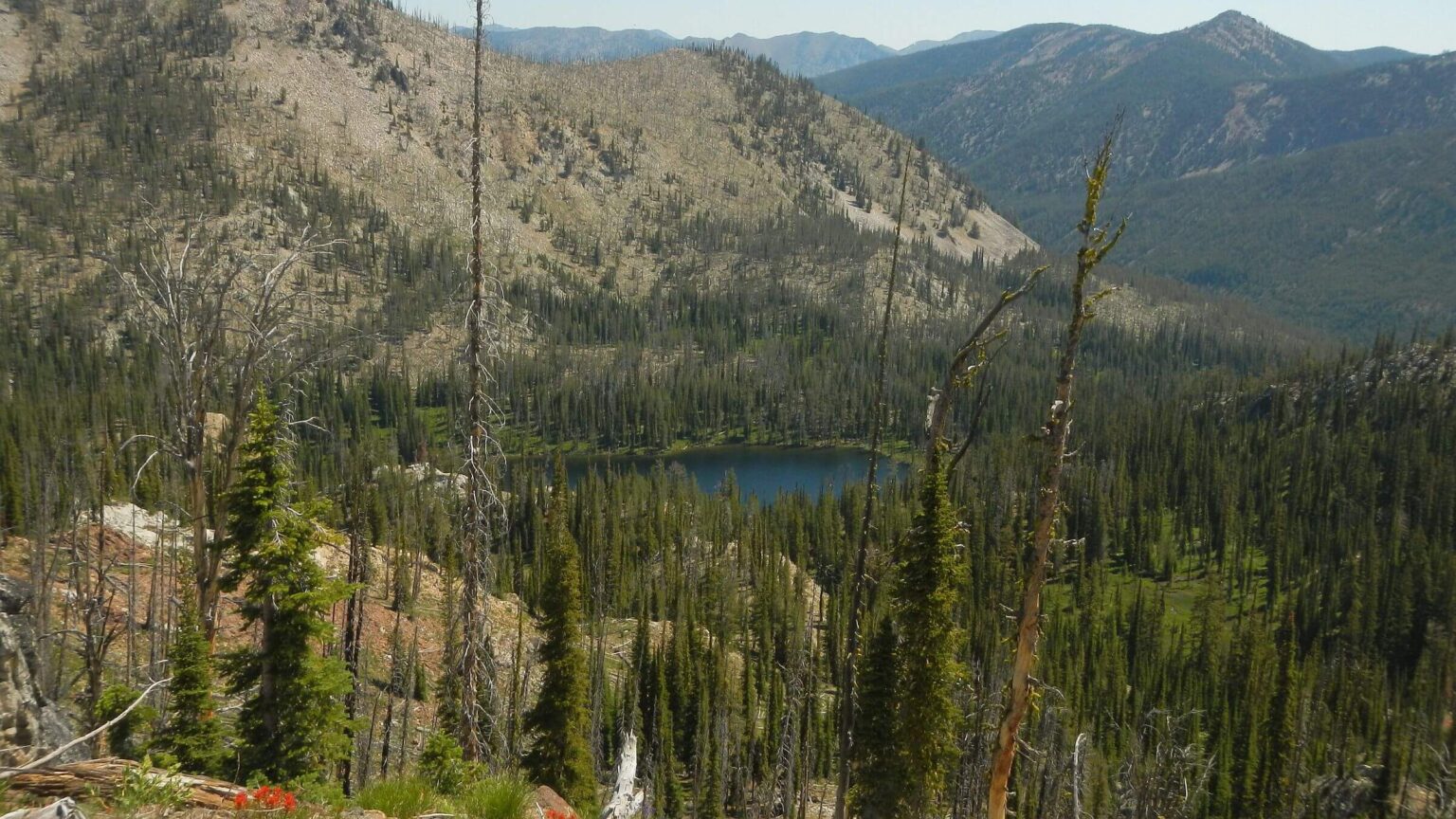
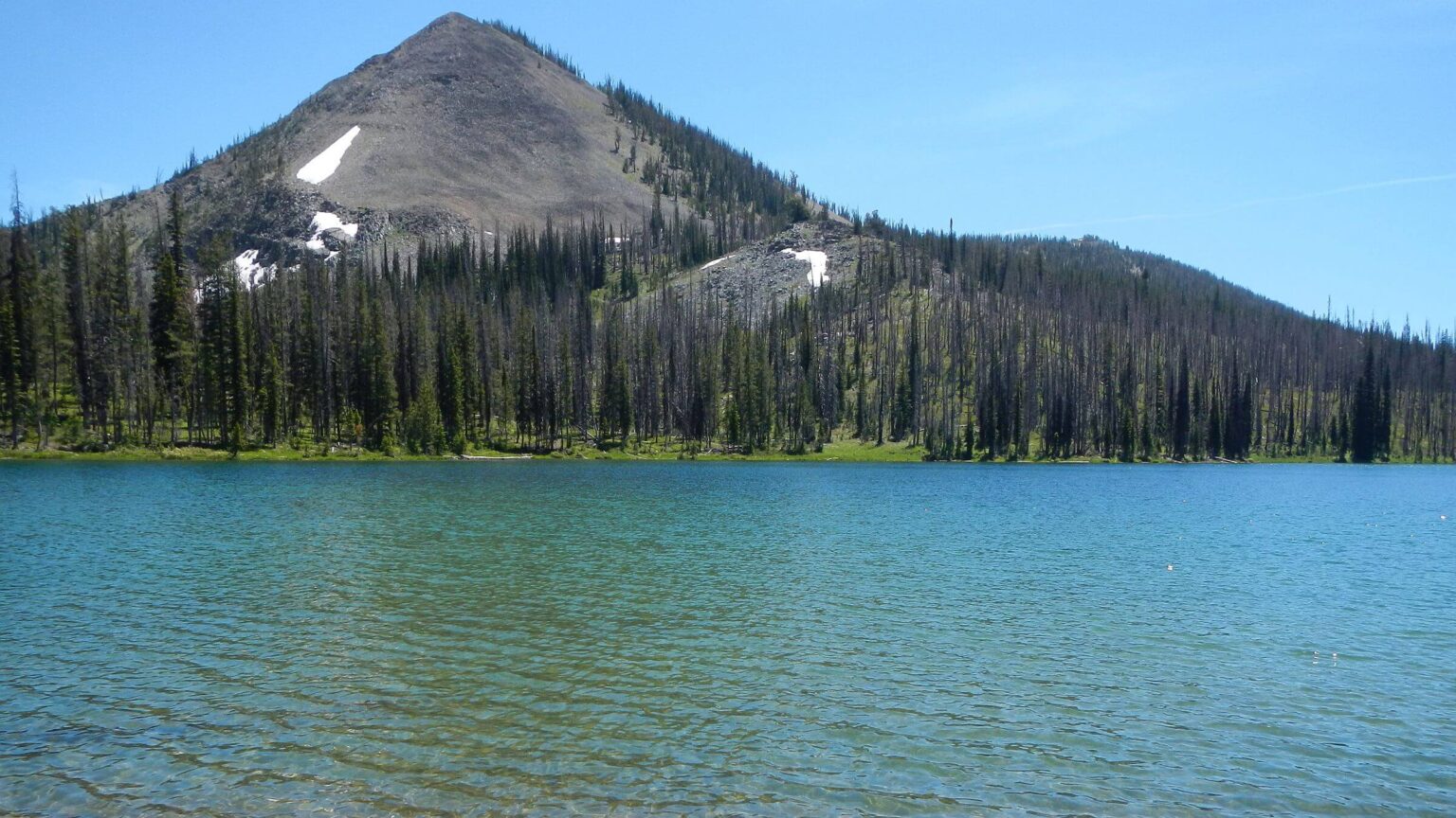
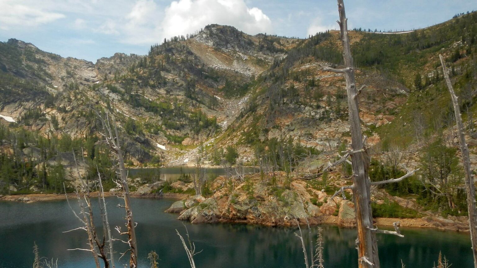
West Fork Monumental Creek Trail was hot sunbaked hike on area opened by 2007 Krassel and 2013 Thunder fires. David stopped to change batteries on his camera and heard barking. He saw a young wolf near creek below; when he “barked back,” the entire pack on the hill began barking and howling. On the trail above I thought it was hound dogs turned loose to track a cougar! Nice, unburned canopy further up and steep climb to Catherine Lake.
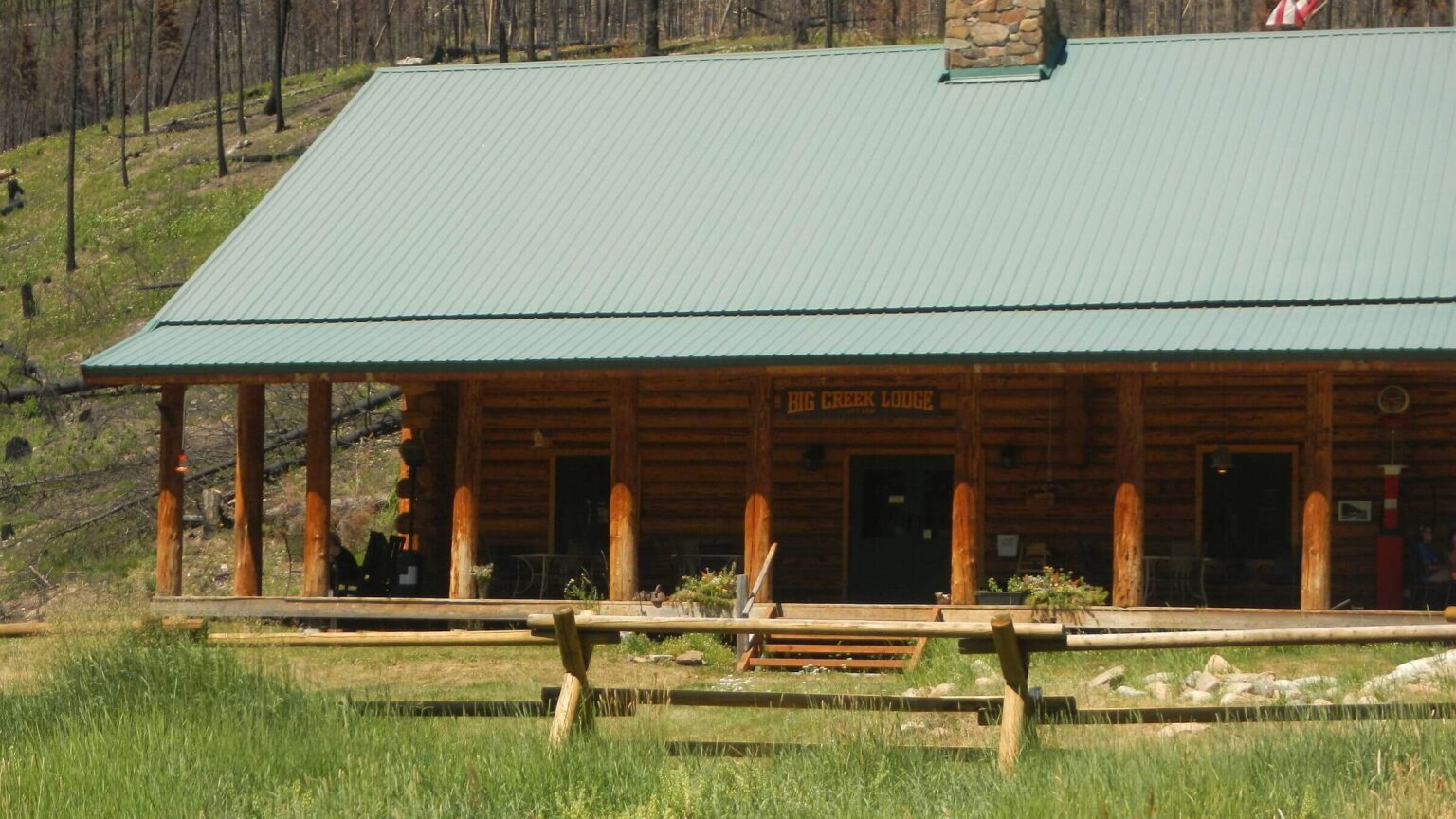
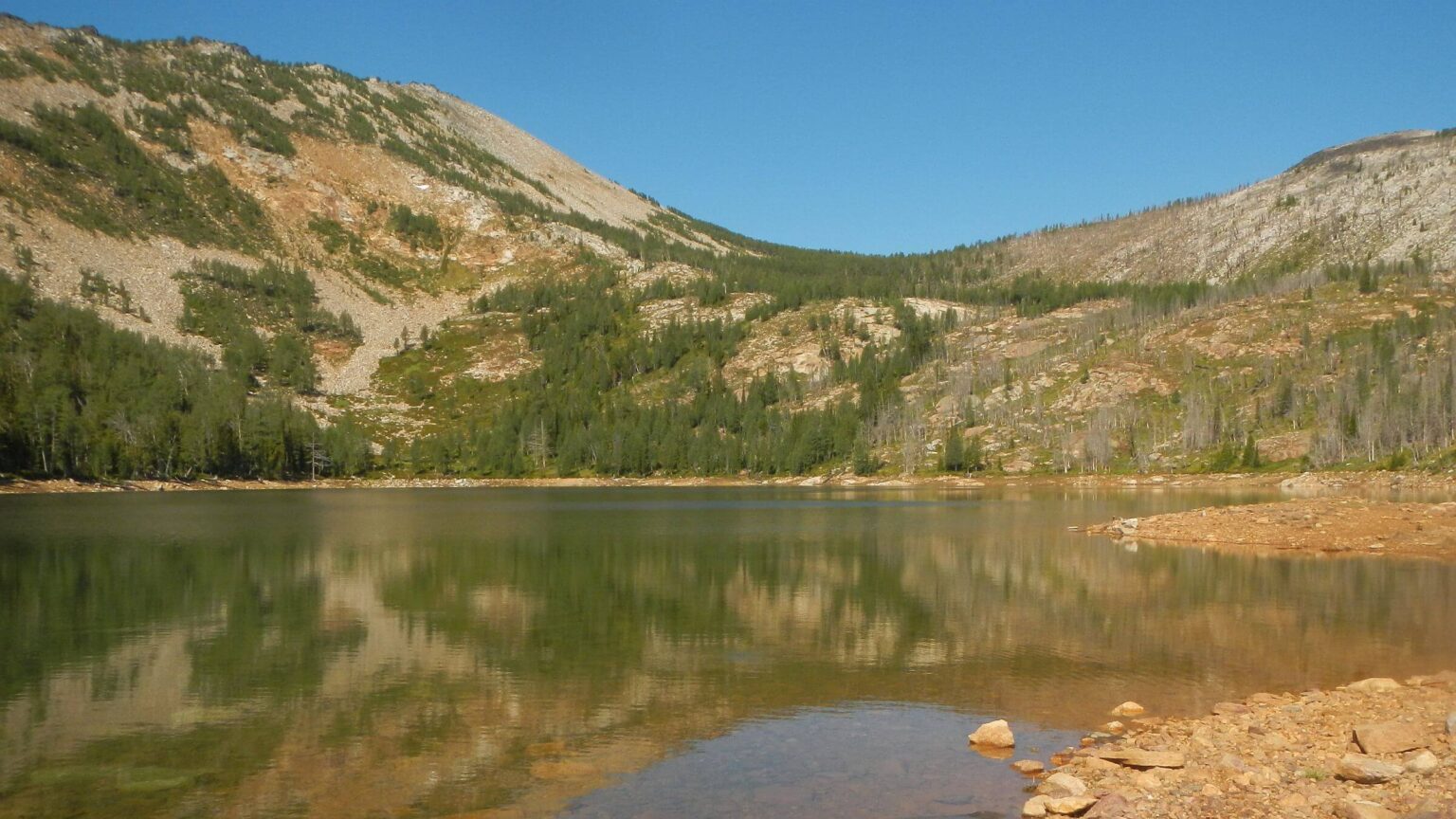
After the lake, trail meandered through alpine basins; we turned off on gentle switchbacks to Bear Lake, trip’s prettiest unburned lake. Nasty rocky climb from basin, sketchy contour, great views, and drop to camp at unburned Lick Lake. On road to our first stopover, Big Creek Lodge, we were surprised at blackened trees and slopes from Logan Fire of 2024, which stopped right at the lodge, burning one building. (Destroyed by fire in 2008, historic lodge was rebuilt with funds raised from Idaho Aviation Foundation (IAF) and help from Payette National Forest; the IAF operates lodge today.)
We shared the lodge with pilots and spouses and met one couple who had backpacked from the Bighorn Crags and up Big Creek. After our 2-night break we resumed hiking down road as small airplanes took off and flew over us; pilots coming and going after breakfast (morning is great time to fly and pilots have breakfast traditions at airstrip lodges). The Forest Service started air travel to remote Frank in the 1920s; 31 airstrips were permitted in 1980 wilderness designation. Big Creek air strip was originally part of Forest Service ranger station).
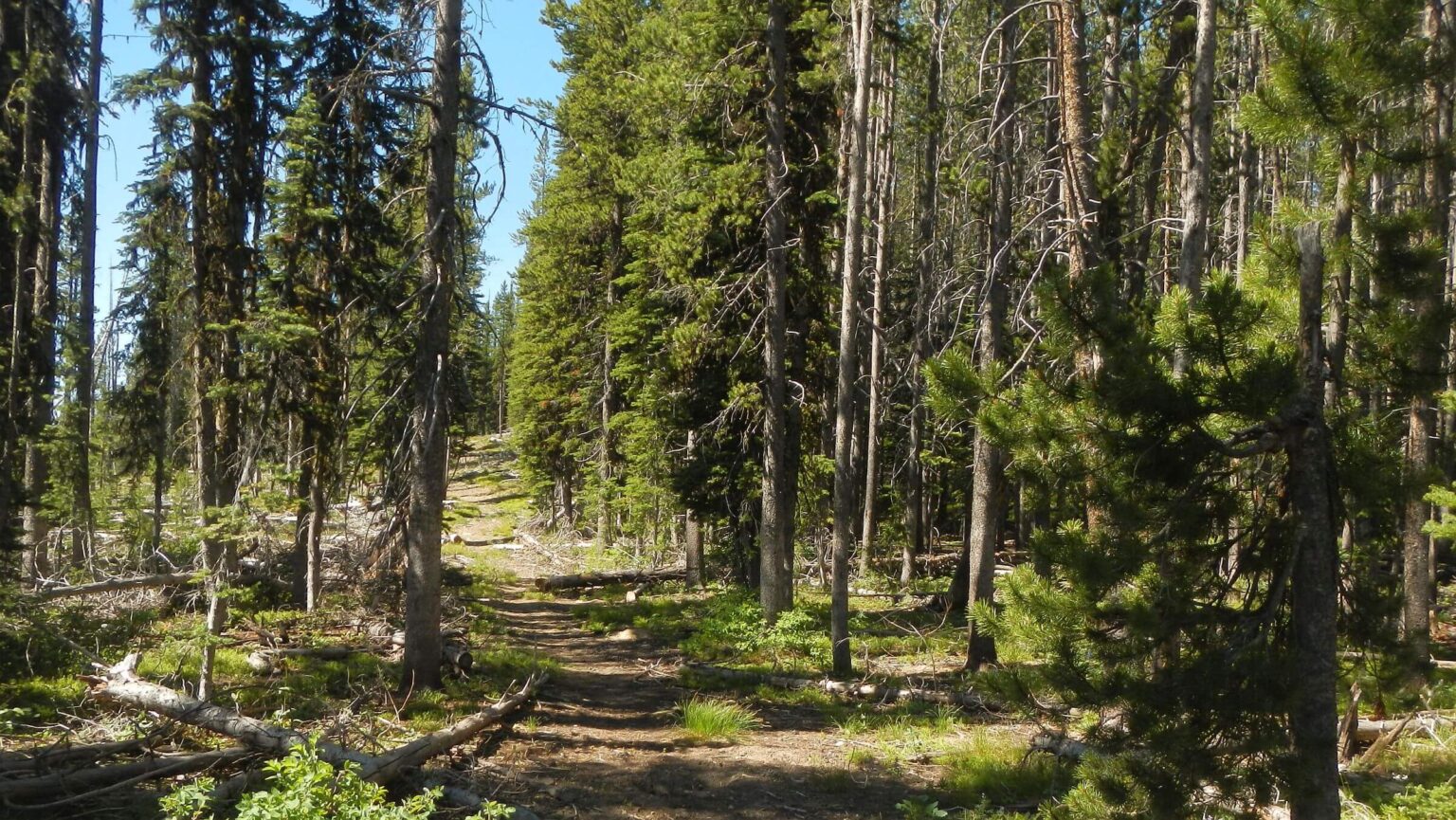
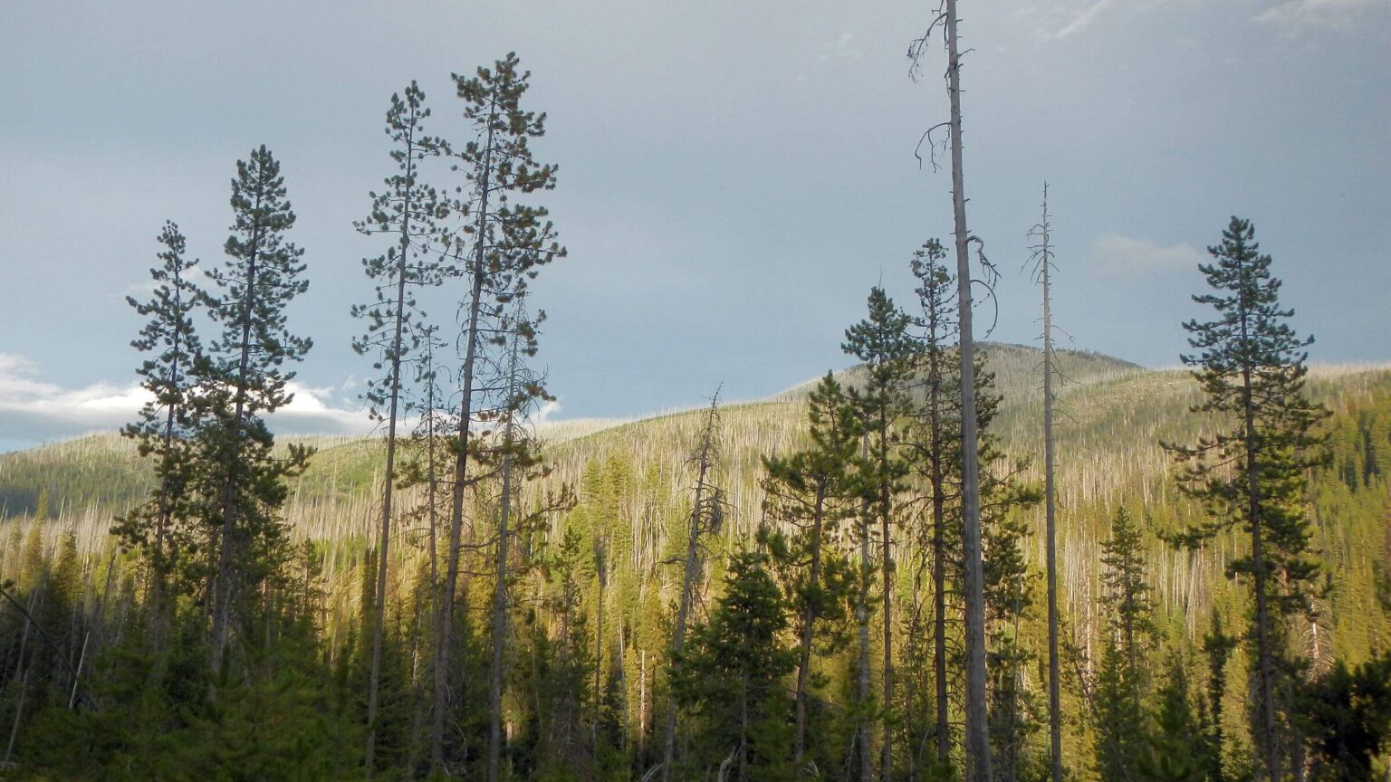
Logan Fire damage continued along Big Creek, up Beaver Creek and on steep trail to Raney Ridge—reburning previous fires (1st fire kills big trees but 2nd fire burns snags and logs creating moonscape in places). Our camps on the ridge and beyond Lodgepole Creek were in pockets missed by most recent fire.
I had noticed smoke inundating nearby valleys as we hiked ridges above Chamberlain Basin. Using inReach I asked our contact (daughter) to check Internet for information on area fires. She reported one on Payette forest to the west and also a Big Bear Fire on the Salmon. Using map, David thought she meant a fire in Bear Canyon, side canyon of Middle Fork Salmon we had hiked by in 2016 and 15 miles away! (We later learned that fire was closer, in a side canyon of the Main Salmon—ignited by July 9 lightning strike of same storm we saw as dark clouds over Frank Church Mountains and experienced as hail above Monumental Creek!)
We crossed badly burned Chamberlain Creek and hiked by black trees near Chamberlain Basin Guard Station; the guard station’s beautiful buildings were intact although no one was around. Also passed picturesque buildings of old ranch now owned by Idaho Fish and Game.
For a day we followed nicely cleared Chamberlain Trail up and over a steep ridge, passed a tent camp, and on third switchback of 41 to the Main Salmon, met the 7-person Forest Service crew working on the trail. Two were stationed at Chamberlain and others flew in there. Much of area down to the river was burned once or twice with some stark groves of dead Douglas-fir that had survived earlier fires but were blackened by 2023 Elkhorn fire.
Trekking Badly Burned Main Salmon
On the river we passed Campbell’s Ferry Ranch, a historic privately owned site. The ferry, which transported miners across river to Thunder Mountain Mine, was replaced by bridge in 1958. David hoped there would be a store to buy treats and soda pop; the friendly owner picking apples in her orchard said no store although she offered tours of this historic property to boaters. She suggested we camp in a flat “across the river.” After crossing bridge, we went down burned slope looking for “the flat,” before turning back to a trail junction with route up into open lightly burned area with a few young ponderosa pine that seemed to be an old field; trail continued but after 15.3 miles descending 5400 ft we were done for the day! Further on we would have seen old cabins from Jim Moore Place.Severely burned riverside was from 2023 Elkhorn Fire, ignited by a Forest Service trail crew’s poorly doused campfire. It made a 9-mile run up Main Salmon, threatening private ranches along the river and destroying seven cabins at Allison Ranch, a private Christian retreat center. A Forest Service investigation confirmed cause of the 26,000-acre fire, but the U.S. Attorney’s office in Idaho and the Department of Agriculture declined to pursue any criminal charges in the case.
Friendly caretakers (for that story see blog, “Main Salmon: Inholdings…”) at another private ranch told us about weathering the fire (with buildings wetted down and sprinklers running) and gave us directions to find caretaker of Allison Ranch (our next resupply stop). Good thing because we had not heard back from him since initial email and mailing our box. We had been told “you’ll find Jim up the hill.” All we saw was very brushy area but we followed sketchy route across brushy flat to a cabin with road going straight back up the hill. David climbed the road and found caretaker at mill near airstrip on hill and our box in an old barn on way to mill.
After we made our camp just beyond the ranch, on invitation we spent inspiring evening with Jim hearing about his long history in area. Jim’s cabin near river was one of few structures spared by the fire. He logged and yarded much of the burned ponderosa pine on ranch, got a contractor to rebuild a small mill near the air strip, and now is sawing wood to reconstruct the lodge and cabins over five years. (Six days later on our trip, the Big Bear Fire jumped the Main Salmon but only got within about 7 miles from Allison Ranch [see 2025 fire on map]; friends of ours were part of a boater camp that evacuated.)
Beautiful Bargamin Creek, a roaring flood of falls and whitewater we took leaving Salmon River, was reportedly cleared by a volunteer crew two years ago but it was hard to tell in places: we got lost once in fire brush (rare for us with GPS) and sharp stubs on down logs made some new marks on my legs! After an early camp, we continued up out and out of the creek to welcome road, but it took us 13 hours to do 13 miles!
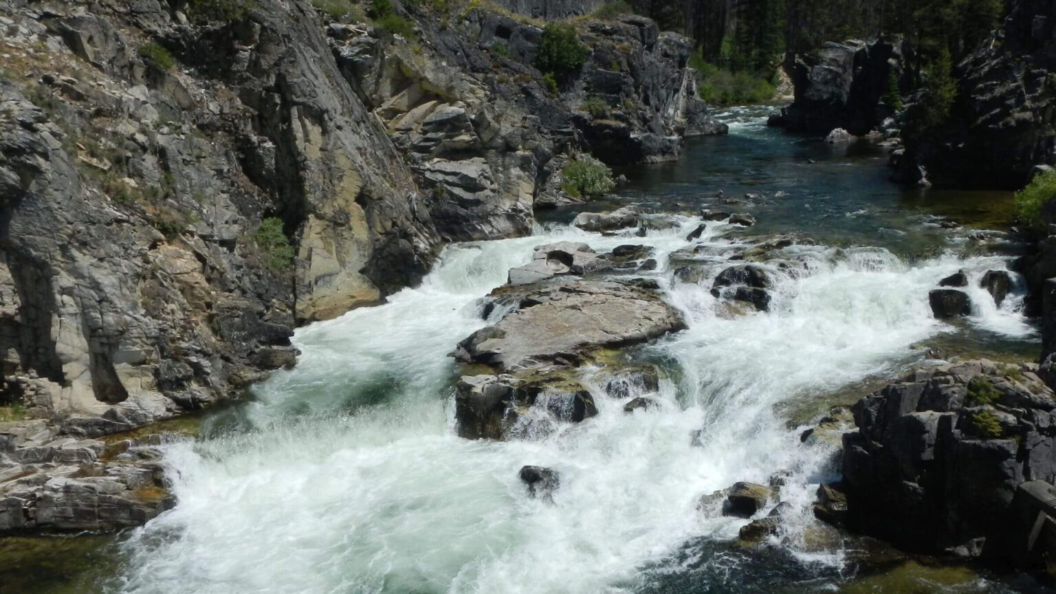
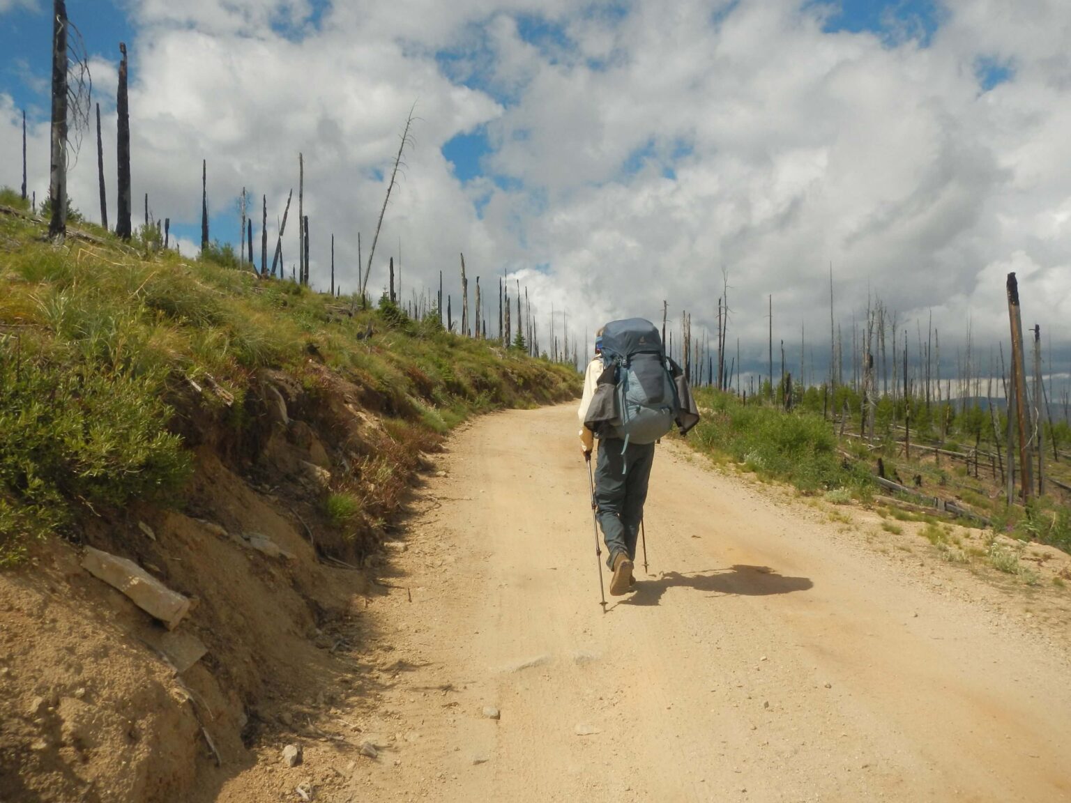
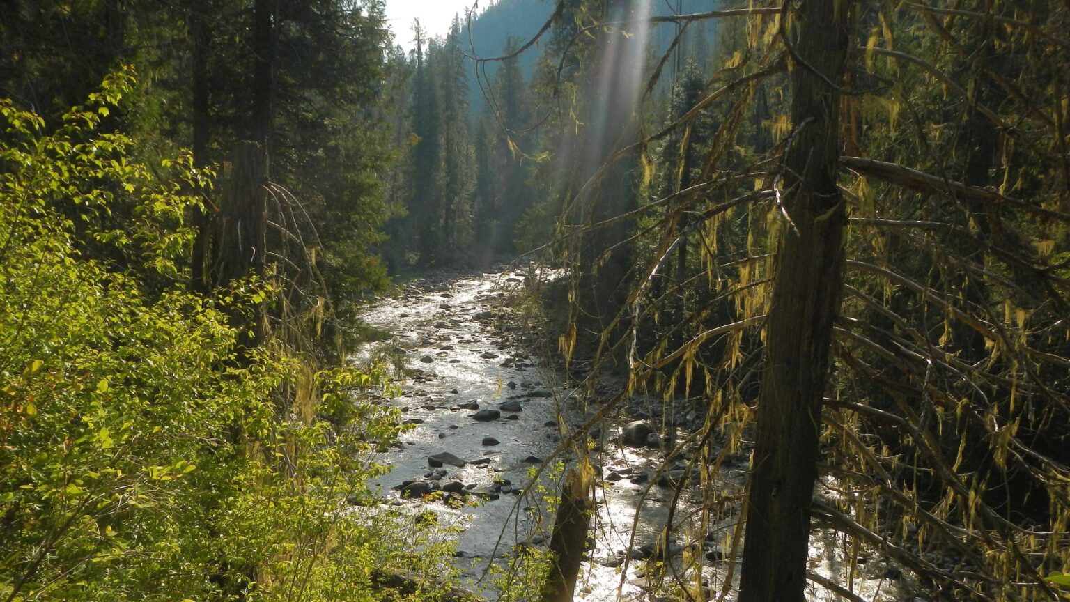
On Magruder Corridor Road, that predated wilderness designations was kept open serving as boundary or as exclusion, with no obstacles we made better time hiking 45 miles from Poet to Indian Creek campgrounds in 3 days—but with relentless winding 5% grades was tiring (road built in 1930s by CCC with limited heavy equipment and incredible skill for long durability). Fire effects dominated as we passed through 10 fire perimeters—several overlapped, killing sapling regrowth; only East Fork Magruder Creek and Selway River offered glimpse of what the towering old-growth forest looked like before fire.
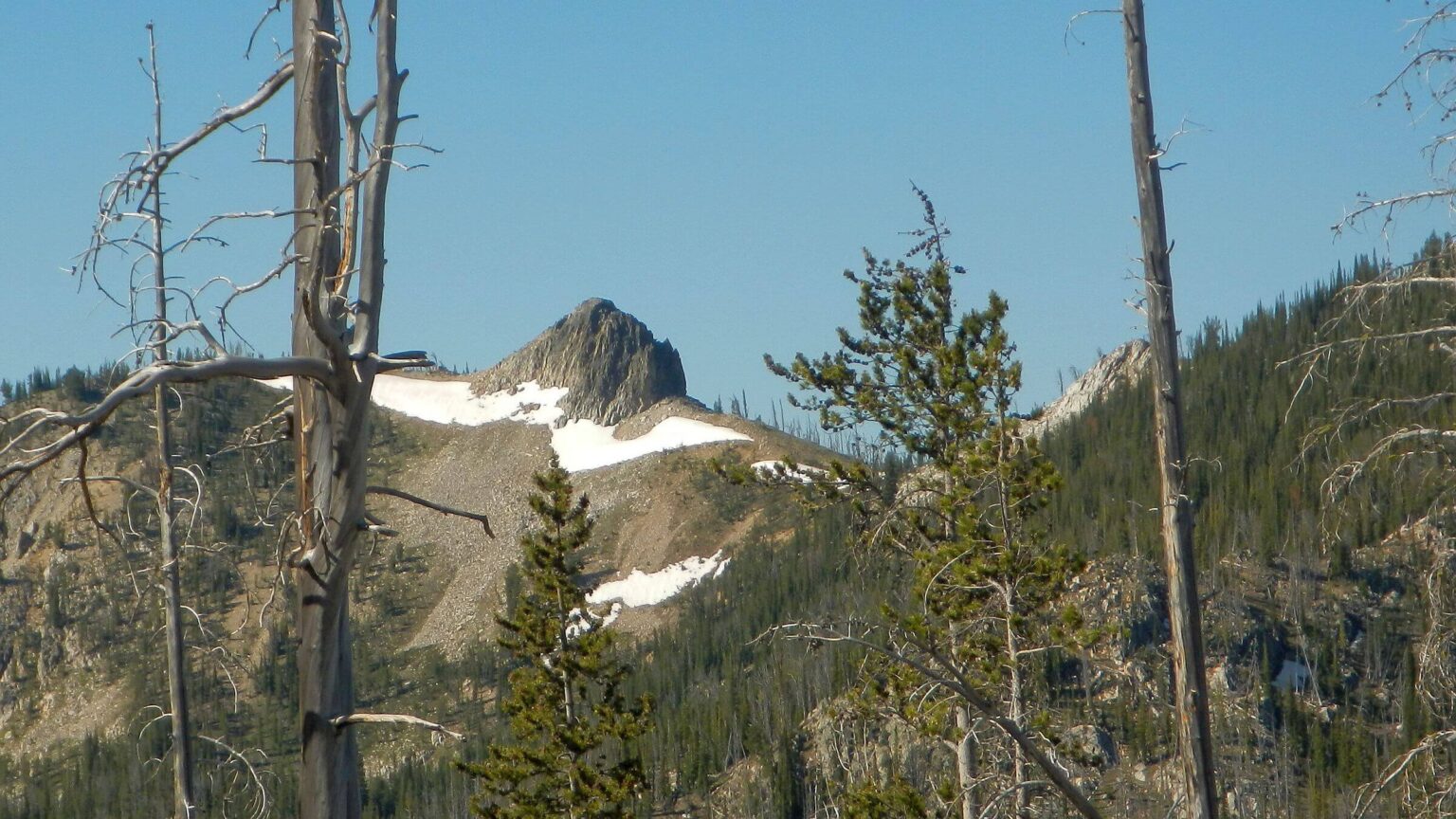
We took brief road break with 3-mile round trip trail to Salmon Peak Lookout; subalpine larch delighted David having not seen it since 1970s. At peak we saw smoke from Big Bear Fire boiling up two drainages. The lookout on duty warned us that winds were changing, and we might encounter smoke as we hiked north into Selway wilderness; but that prediction did not happen.
Selway Creeks Also Brushy
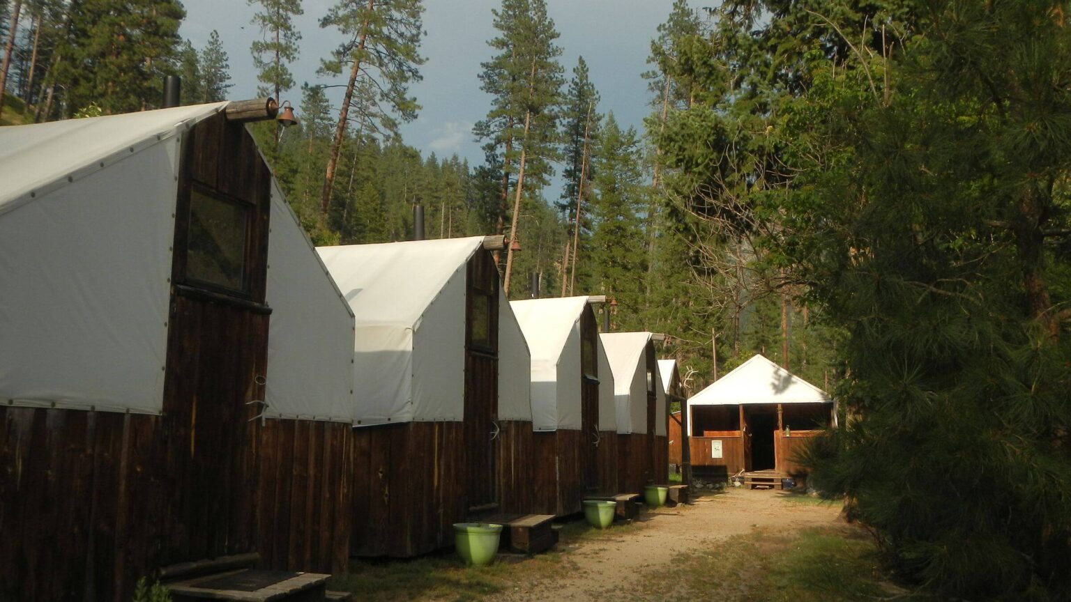
After very welcome break at Cameron Outfitter’s Paradise Camp (glamourous “glamping” in cabins with canvas tops—surprise lunch, a shower, nap, steak dinner, and bacon & eggs breakfast) we continued up White Cap Creek into the Selway wilderness in Montana.First few miles were nice hiking (with little fire effects) and at junction with Canyon Creek Trail we found historic cabin across creek at Cooper Flat. We wandered off trail into what seemed outfitter camp cleared of brush in mixed-conifer. Early for camp so continued on but clouds thickened and darkened while forest canopy thinned from more and more dead trees (perhaps insect mortality) exacerbating shrub growth.
David dropped pack a couple times and stumbled around lumpy decadent forest seeking flat open spot, but we gave up and just hiked in cold rain hoping for another outfitter camp. Two miles later, Voila!, a spur trail. “To an outfitter camp? YES!” Not much shelter in narrow-crowned trees thinned for camp but flat and brush-free. While David set up tent rainfly followed by careful tent body attachment (to keep it dry), I followed spur trail to creek crossing—perhaps another camp on other side or route into hunting area. Warm and dry, we skipped dinner until next day.
Cleared next morning but we wore raingear to slog through waist high wet vegetation. Less than mile up we were met by a small black dog barking frantically; his owner emerged barefoot from small tent pitched in middle of trail (apparently shared our problem of finding flat open tent spot). He was trying to get to “Elk Lake” which I didn’t spot on our map (I did later). We said we had come from Paradise; he thought he might go there. “I haven’t seen it for years.”
We moved on after long break on sunny rock outcrop to dry gear and eat last night’s dinner. Relieved to hit switchbacks out of Whitecap Creek with minimal brush along tumbling creek from basin above. (Earlier, I tripped over a rock hidden in high brush on route around washout and pitched headfirst into the gully—David had to help me detach pack to get back on trail). We camped short of the lakes in a burned basin, threatened by grey clouds and misting showers.
We had breakfast in unburned forest by Triple Lakes (hiked near only 2 but saw 3rd higher lake from ridge boundary into Montana along with stunning view of rugged Bitterroot Mountains). After switchbacks down through open basins, we neared Tin Cup Lake (a big reservoir), where contour trail became very brushy. At the dam, a road offered possible clear passage but became cloaked in brush after half a mile.
Another storm moved in; David used remains of large, rotted log to sort of level area for tent in brushy area (unfortunately his “fly-first” trick did not work so well with steep slope abutting tent, so he used up our paper towels to mostly dry tent floor). We heard loud thunder and lightning right above us for half an hour, then helicopters.
Below camp the road opened up slightly and was easier going. At a crossing of Tin Cup Creek, it looked like both horses and hikers came up this far to see roaring falls. Last 5 miles of trail were fairly good, kept open by all the users. We heard and saw a helicopter shuttling above ridge and puffs of smoke. On down we met a fire crew taking a break from hiking up the trail. They told us the lightning storm had sparked 11 spot fires—they were sent to one above our previous night’s camp.
We had to hike some road to our Vrbo rental near Darby. After a mile, Forest Service truck pulled up and driver offered ride. It was fire crew we met on the trail! Another helitack crew (who rappel onto fire sites from helicopters) had reached fire, ground crew wasn’t needed. They took us to our “zero” stop. Chauffeured to Vrbo in Fire Truck got some neighbors’ attention!
Brush-free finale and missing hiker
We had planned to loop back and forth across Bitterroot Mountains following creeks with trailhead shuttle help. But I was leery about brushy creeks. After our ride to Vrbo we showered and walked 2 miles into town for dinner, and another half mile north of Darby to Sapphire restaurant (our hostess at Paradise outfitter camp said “best in town”). As we looked over map to consider a reroute, we got attention of diners at next table and the waiter staff—all interested in hiking! (We only walked partway back; our kindly landlord got word from a neighbor that his renters were walking so he came and picked us up!)Our new plan made at restaurant, replaced the creek loops with 2 out-&-back backpacks into Carleton and Holloway lake basins with trailheads starting at 6000 feet, since we had encountered worst brush between 4000-6000 ft elevation. Tina, our flexible outfitter driver, was fine with changing our itinerary to drop-offs and pickups at two trailheads.
On our zero day, packing for final leg, I was gathering hanging wash as storm clouds moved in when our landlord stopped by for a chat. He said the sheriff’s office was looking for a lost hiker missing from Tin Cup trailhead with a small black Lab. Oh no! “I think we met him!” I eventually got in touch with the undersheriff leading the search; he came by for a late-night visit. Good thing as we learned that some of the helicopters we heard above Tin Cup were searchers looking in the wrong area!
To our embarrassment we did not have a photo of the guy, nor could we give a good GPS location where we met him without downloading data to computer; although David had a photo of the dog on his camera. The undersheriff said the hiker had planned to follow a locally known route on ridge above Tin Cup Reservoir to Elk Lake and Como Lake in the Rock Creek drainage north of Tin Cup. (Not sure why he hiked over the pass and 12 miles down to where we met him on White Cap Creek; maybe disoriented by rain and thought he was in Rock Creek drainage? At that point, hiking to Elk would have required crossing several ridges!)
As we packed up to meet our outfitter shuttle, I learned that the lost hiker had come out Tin Cup Trailhead the past evening, probably about the time we were talking to the undersheriff! (David noted that we were last people to see the lost hiker so were likely “persons of interest;” no wonder we got a personal interview.) For the rest of the trip, David photographed hikers we met, asking permission and explaining our experience of not being able to help searchers. We also resolved to keep better records!
Ploy paid off to change last leg; although 2017 Lolo Peak Fire had burnt entire area, we had little brush. (But being closer to Missoula, we met a lot more people: day hikers on way to bag Lolo Peak on our way out of Carleton; several dog walking day hikers on Holloway trail, backpackers returning and a gung-ho woman and boys who did most of our 2.5-day backpack trip as an overnight trip; and more day hikers on way out.)
We had to make camp in a severe hailstorm that met us at Carleton Lake (once again the fly-first setup trick somewhat failed due to steep slope but we had acquired more paper towels during the shuttle; helpful for tent floor mop-up!). It rained off and on next day for hike to South One Horse Lake but cleared for hike out, drive to next trailhead, hike up Holloway Trail and camp near ridge. The morning side trip up Sweeny Peak with views of both basins was exquisite. Rain was forecast for following afternoon, so we stopped at Peterson Lake for base camp; day hiked to upper lakes the next morning and were back in camp when afternoon showers arrived. Nestled among big spruce and fir, we hardly noticed.
All that Montana rain must have chased away the threatened smoke from the Big Bear Fire; we had either clear or rainy days, but no smoke!
show less
Google Map
(Click upper-right box above map to “view larger map” and see legend including NAVIGATION INSTRUCTIONS; expand/contract legend by clicking right arrow down/up.)