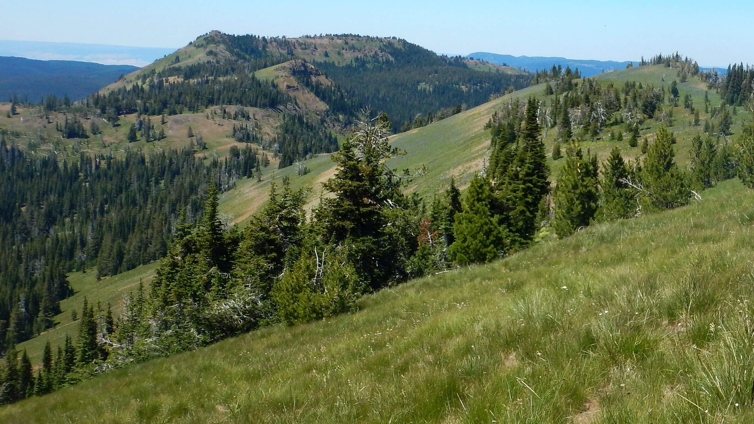
 China Ridge Trail (Day2)
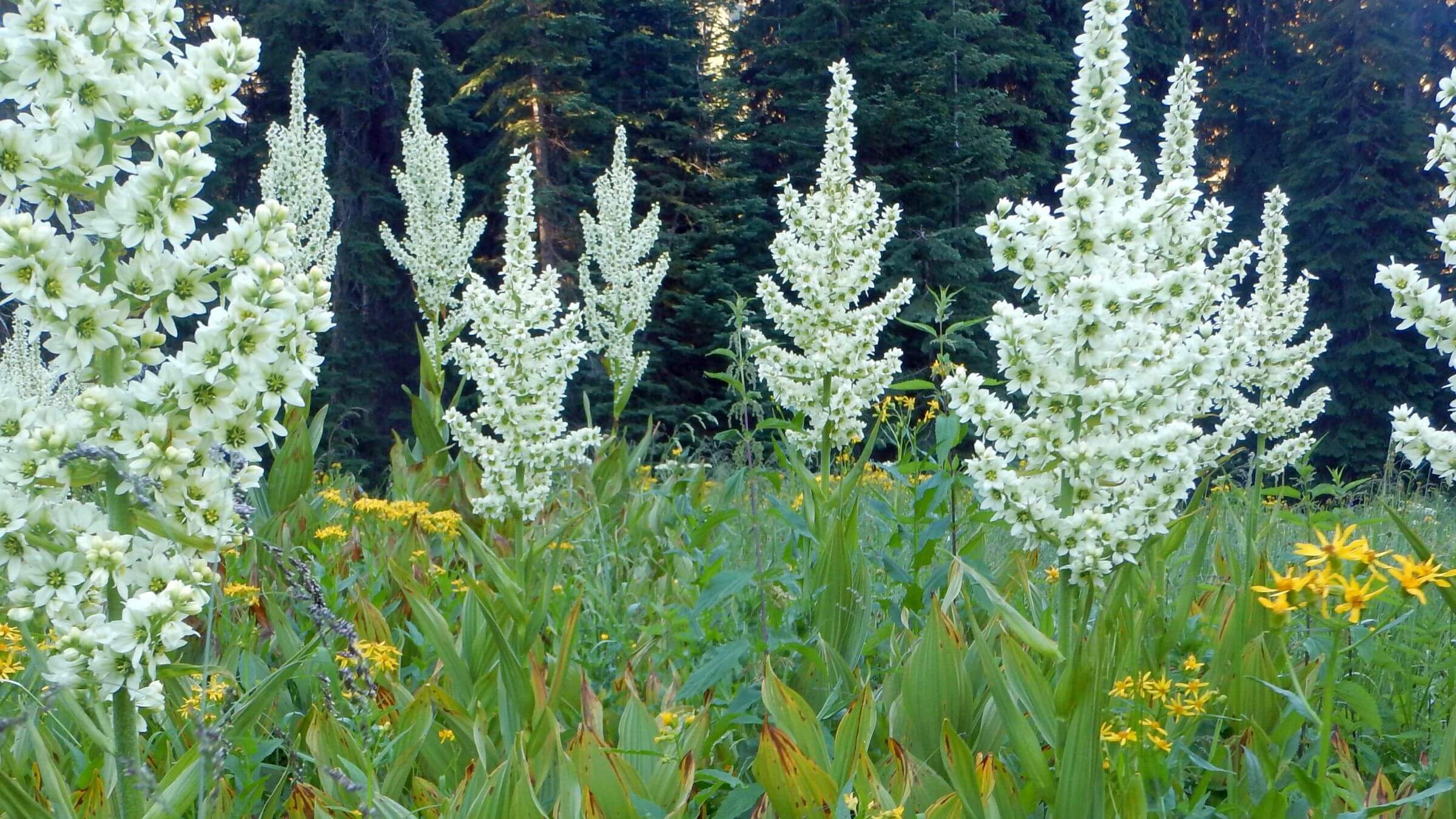 Corn lily flowering (Day2)
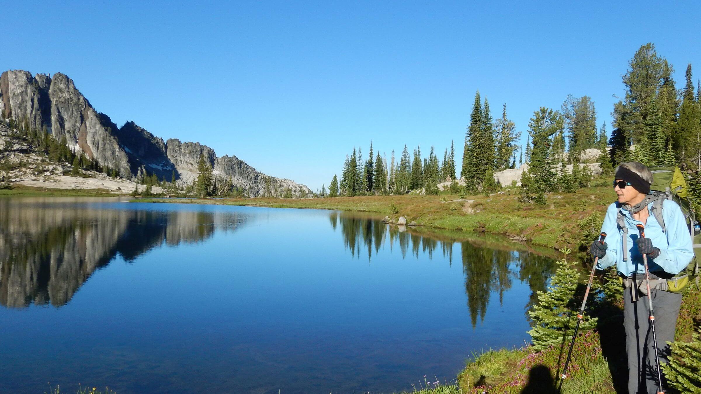 Traverse Lake (Day 4)
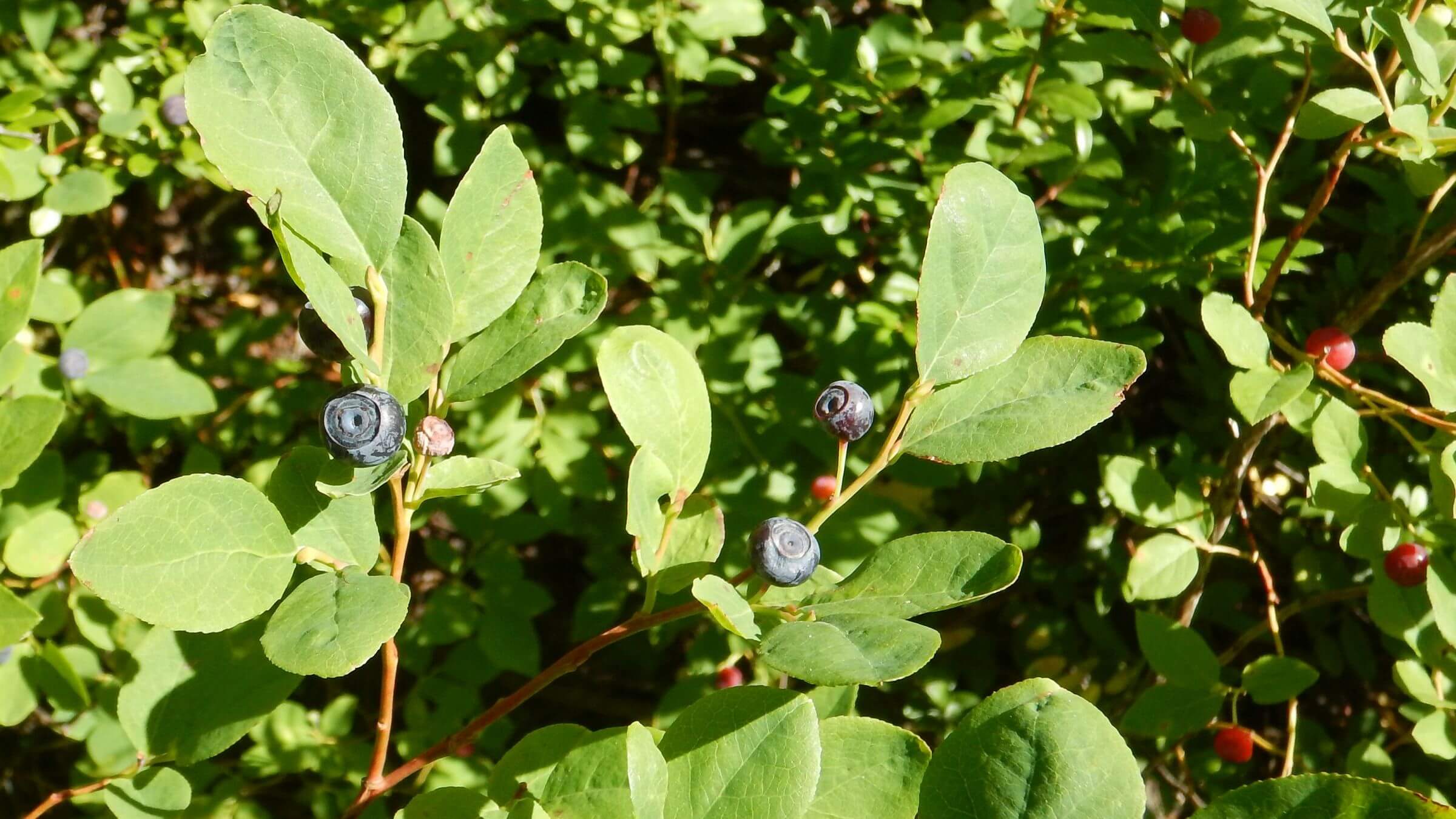 Black huckleberry (Day5)
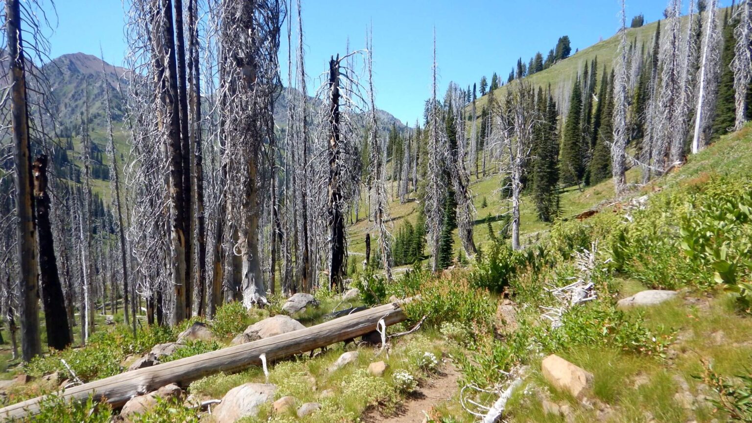 2006 Twin Lakes Complex Fire (Day9)
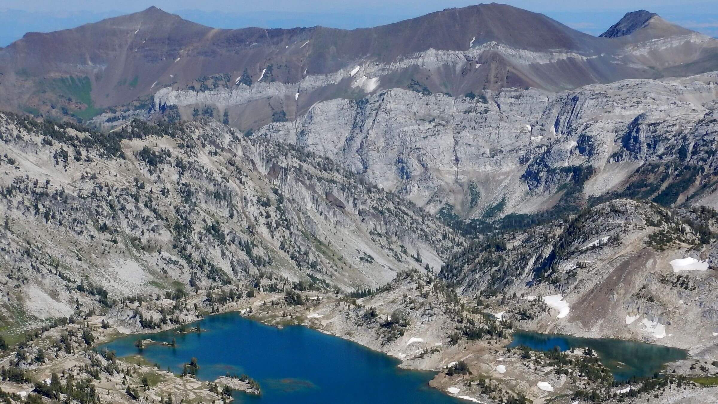 Glacier Lake and Hurwal Divide in background (Day11)
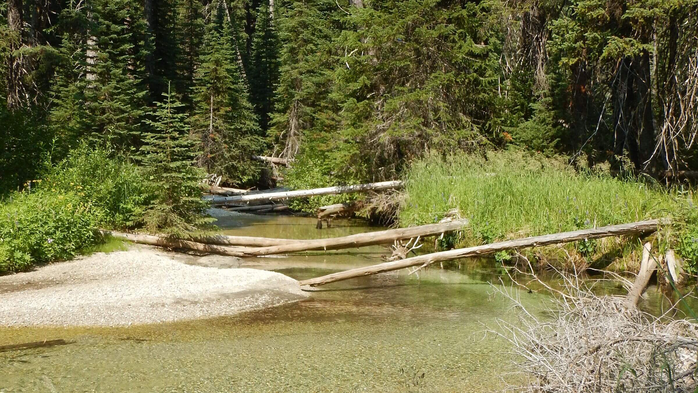 North Minam River (Day14)
Paths Less Traveled In Oregon’s Oldest Wilderness
It seemed like an obscure trailhead, many miles of driving along forest roads. But we saw half a dozen parked vehicles at Moss Creek Trailhead and a couple of horse trailers. After we loaded up our packs and headed down a gentle trail into the Eagle Cap Wilderness, we expected to start seeing people.
We soon met a family group on horseback—two adults and two kids. The horses were tied up and the group had stopped for a break. We passed them, expecting them to pass us later, but they did not. They must have turned back. We met no one else that day.
After a big flat we dropped into a boggy area where we met and turned up along the North Fork Catherine Trail. We were surprised to see evidence of trail work, a lot of logs cut on this trail, several miles from a trailhead.
Other than a few footprints at trail junctions and a handful of lightly used campsites at stunning lakes, the horseback locals and trail work were the only signs of people we saw for our first five days in staggeringly scenic Eagle Cap Wilderness. We had the southeast side with long flower-filled ridge runs, soaring passes and gorgeous lakes almost all to ourselves, hiking well-preserved but little used legacy trails.
The next few days we met a few hikers close to trailheads, most doing a loop from East Eagle Creek to the popular Lakes Basin, but had solitude again for rest of the week.
On the second half of our trip (after a rest stop described below), when we dropped into the South Fork Imnaha River on the northeast side of the wilderness, we had several days of constant company crossing popular loops on overused trails near Eagle Cap Peak.
Interestingly, the lightly used trails on the southwest and southeast Whitman National Forest part of our loop were mostly in excellent shape, but heavily used northeast trails near Eagle Cap Peak on the Wallow National Forest were steep, slippery, and eroded from too much use without any recent trail maintenance.
Eagle Cap Wilderness was first managed as Primitive Area in 1930 and designated wilderness in 1964; now at 355,500 acres, it is Oregon’s largest. In the heart of the Wallowa Mountains, the Eagle Cap offers alpine lakes, bare granite peaks, and thickly forested rivers. Unlike many western forests, it had little 21st century wildfire prior to our visit.
This backpack was out first into this wilderness, but it had been on our bucket list since we lived in western Oregon in the 1970s. (Cindy had day hiked just west of the wilderness once while attending a professional meeting at Wallowa Lake Village.) Eagle Caps did not disappoint.
Solitude was the norm for much of our visit—particularly for the first 8 days on southwest side of wilderness. We only camped near others on Days10-12 when we passed through western side of the popular Lakes Basin Loop.
Trails span about 535 miles throughout the wilderness; the 182 miles that we hiked were mostly in good condition compared to many western wilderness areas where trails management is lacking. Sheepmen and miners built the high quality trails that have not required much maintenance because of minimal wildfire.
Supply stop and overnight stay at Cornucopia Lodge was delightfully accommodating. The Minam River Lodge did not fit our itinerary for another supply stop but we stopped for a spendy but exquisite gourmet “dinner out” the last night, hiking up to a ridge top to camp in wilderness.
Visit statistics: for 16-day backpack included 182 miles, at 1.8 mph, and 400 feet per mile average elevation change.
Go to map below for more information on trailheads, GPS routes, mileages, elevation changes, and photos. (Click on white box in upper right corner to expand map and show legend with NAVIGATION INSTRUCTIONS.)
show more
Wilderness long used by people
The Eagle Caps comprise nearly 360,000 acres of wilderness: U-shaped glaciated valleys, bare granite peaks, alpine lakes and meadows, and dense forest groves along rivers radiating out from Eagle Cap Peak. Rivers include West Fork Wallowa, East Eagle, East and West Fork Lostine, Imnaha and Minam. The Forest Service named this area “primitive” in 1930 and “wilderness” in 1940; Congress included it as one of first 54 U.S. areas designated in the Wilderness Act of 1964.
An indigenous group of people calling themselves Nimi’ipuu (meaning “we the people”) lived on the Columbia River Plateau including the Wallowa Valley for at least 11,500 years. They were named Nez Perce by an interpreter with Lewis and Clark. The Joseph band of the Nez Perce hunted bighorn sheep and deer and gathered huckleberries in the Wallowa mountains and lived there summers. The Nez Perce were peaceable towards white settlers who moved into the area; their leader Old Chief Joseph converted to Christianity and also signed a treaty with the United States in 1855 which retained Nez Perce lands from Wallowa Valley into Washington and Idaho.
When gold was discovered in 1861, miners invaded the region and the U.S. government tried to force a new treaty for a tenth of the original lands. Old Chief Joseph refused to sign the treaty or move. His son Chief Joseph became leader upon Old Joseph’s death in 1871. In 1877 an Army official demanded the band leave the area. The band prepared to move and started its journey, but some young warriors staged a raid on nearby settlements in anger at the forced move. U.S. troops moved in to punish the bands. The tribe journeyed 1400 miles towards Canada fighting Army forces in skirmishes. In October 1877, Chief Joseph surrendered to Colonel Nelson Miles in northern Montana–40 miles from the Canadian border. The Nez Perce were hungry and exhausted, and their leading warriors had died in the final battle.
Chief Joseph gave his famous speech: “I am tired of fighting. My heart is sick and sad… I will fight no more forever.” Today the Nimi’ipuu are scattered across several reservations, none of which are in the Wallowa valley.
In the 19th and 20th century, cattle herders, gold miners and loggers moved into the Eagle Caps. An early 1900s timber sale by the Forest Service sent thousands of logs down the Minam River. Many of the excellent trails we found on southwest end of the range were probably built by miners or herders.
Days1-8: Solitude, Views and Excellent Trails
Our 180-mile trek covered one third of the trail system and much high country. We later learned that most of the traffic at our starting point, Moss Springs on the west side, probably headed north to Minam Lodge, a private luxury resort on the Minam River. We went southeast. Moss Springs is one of several trailheads that attracts people; the others are starting point for one of several loop trips to high lake basins near Eagle Cap in the heart of the wilderness. Many people go up and down a couple of several rivers and their branches radiating south, southeast, and north out from the Eagle Cap.
But only a few hike the south side of the wilderness.
On our second day of the trip, we followed China Ridge through verdant meadows and flowers with views of the higher Eagle Cap range we would circle later in the trip. We hiked over a pass and descended into a dark forested boggy area along a creek where I nixed camping. Instead, we made a moonlight climb up long switchbacks to Tombstone Lake, groping in the dark to find a campsite which turned into a beautiful breakfast spot next morning. We descended 47 switchbacks into West Eagle Creek with footprints at a trail junction but no hikers. We switch backed up hot brushy east slope into another lake basin; neither Echo Lake nor Traverse Lake (where we camped) had much sign of campers. Next morning on a pass above the basin, we apparently “herded” frightened mountain goats whose switchback cuts indicated panicked descent just ahead of us. At trail junction to Eagle Lake, we had a choice of an unknown cross-country “short cut” over a pass above the lake into East Eagle Creek basin, descending trail to make our way on spaghetti forest roads, or descending to Minam River, which might be a deep-water crossing.
We dropped to Minam and were pleasantly surprised to cross the calf deep river. After camp, a very steep trail took us over Frazier Pass into East Eagle Creek basin. The trail down was heavily eroded. We camped on a bank among large trees far above the creek, and on Day 6 descended to a road flanked by informal car camps. A trail register showed many hikers looping from East Eagle into Lake Basin we would visit the next week. Distracted by campers and big horse trailers parked along the road, we missed the trail (route changed from GPS map) for the climb to Crater Lake. We finally found a track that intersected the trail switch-backing along Little Kettle Creek. Upper reaches were cloaked in waist-high ceanothus and cherry. We met one couple coming down who reported another party still at the lake.
Deep blue Crater was ample reward for the 3225-foot climb. A man in large hat and shorts slowly strolled through the neck-deep lake. We dropped packs and descended to a lower lake to clean up and get water from nearby springs. Returning, we found that the wader and maybe friends had left. We had the lake to ourselves. David caught fish to supplement our freeze-dried fare and I hiked around the lake. At a junction for Cliff Creek, a big zip lock bag of campsite trash and note from a volunteer “wilderness crew” requested that someone with horses pack it out. (We later realized this was part of a loop route that descended to Imnaha River, went upriver over passes into Lakes Basin, crossed Horton Pass near Eagle Cap and made its way to Frazier Pass and East Eagle.)
After leaving the loop route, we saw no sign of other hikers on the gentle pass and slow descent to West Pine Lake. The legacy trail contoured through floral fields in a high basin and crossed beneath the spiraling cascades of Pine Creek Falls. A scree section tired my feet. Then a welcome big switchback along forested Middle Fork Pine Creek on soft needle carpet trail before descent to West Pine Creek. A big bridge spanned the torrent.
We camped just before the creek in an old campsite, kicking cow poop aside. Partially covered cranks and trolley cables from Cornucopia mines above littered the area. Next morning, a 3.5-mile road hike took us past cattle, corrals, and horses; then uphill to the Cornucopia Lodge, our rest and resupply stop for the next 24 hours.
Perched above remnants of an old gold mining town with same name, the lodge, built in 2006, offered rustic elegance, great food and friendly service plus rest and a bath. Cornucopia and Pine Valley Lodge in town of Halfway had the same ownership; so, on our way to the Eagle Caps (after Strawberry Wilderness visit) we stayed a night at Pine Valley and left a resupply box which was ferried up to Cornucopia.
Repacking at Cornucopia, we discovered we were one dinner short. David had initially wanted to stay at Minam River Lodge an inholding on our way out, but it did not quite fit the itinerary. So, he took the opportunity to use my cell phone and reserve a pricey dinner at the lodge for our last night in the wilderness.
Days9-16: meeting the masses near Eagle Cap
After Cornucopia break, we clambered up a steep mining road up East Fork Pine Creek; nearly 11 miles later, we camped on a sandbar of South Fork Imnaha River. I was beat. We’d followed steep road (Norway Trail) through old burn and blackened logs (11,000-acre 2006 Twin Lakes Complex Fire—only fire encountered), contoured above a pretty valley to a flat pass (with ditch strategically constructed from Imnaha watershed to bring water through pass south to mines below). We met lost hikers attempting a loop from East Eagle who’d missed the Cliff Creek turnoff to Crater Lake Trail; they would retrace our West Pine route back to Crater for many extra miles. The trail down Blue Creek was rough and obscure; the last part descended to the river in rocky, brushy, eroded switchbacks covered by down logs.
Next day we met hikers—most heading down South Fork Imnaha. After precarious “goat route” over Hawkins Pass and another lake basin we found ourselves sharing limited camps with others at stunning Glacier Lake below snowfields on Eagle Cap Peak (probably highest elevation lake basin accessible with good trail). Next morning more hordes skittering the steep eroded trail as we dropped to Moccasin Lake at top of Lakes Basin. Some young girls said a wilderness ranger made their group of 12 split into two groups. (I’d prefer to see Forest Service wilderness zeal directed to developing a few more campsites in heavy use areas or improving trails by cutting out logs or mitigating trail erosion).
After the heavy trail use and seeing a large stock train and several people hanging out around the lake, we discarded plans for loop around Lake Basin, and climbed pass Mirror Lake to drop packs at little-used High Lake. We took an out-and-back day hike to Eagle Cap on a very steep trail. We met more hikers returning from the summit.
Another couple had found the best campsite in some trees near High Lake. We were up before dawn the next day but the couple had already left. As lakes below glowed in sunrise pink, we crossed a pass and turned off for a short hike up to Blue Lake, where David fished (for trout well aware of biting hazardous colored objects). Back at Minam Lake, dammed on the south end (in early 20th century for Lostine Valley settlers), we passed another loop option to the Minam River; we would get there another way in a few days.
Many backpackers were coming up the dusty East Lostine River trail. We saw several large camps on gorgeous meadows along the river. We chose to troop on up Copper Creek a few miles. Next morning, we met more backpackers and a few riders completing a weekend loop from the Lostine River through Wilson Basin. After a long pass and Swamp Lake (beautiful high lake, not bog as name suggests) we dropped packs for a side trip on steep route down to Long Lake where David found good fishing and I longed for my backpack at a beautiful campsite. Instead, we camped at Steamboat, a very large lake with only a few overused beach campsites. We made do above a boggy meadow on the far west end and noticed one party in a heavily used campsite across the lake.
A big contour and long switchbacks softened the 3000-foot drop to North Minam Meadows. Here we left the loop route from Wilson Basin. The trail along North Fork Minam Creek was lightly used. We heard a sharp bark below us; four brown shapes shot up the opposite hill. Elk, bedded down by the creek, had sounded an alarm.
Only Outfitters on the Minam
Forest on the Minam was decadent and dark with many downed logs, usually with a horse route around them. Large cut logs recalled an era when the Forest Service rode the trails and kept them cleared. Now outfitters clear out only what they need to get stock through (often winding back and forth to trail). We later surmised that outfitters and guests from Minam River Lodge downstream (or elsewhere) were probably main users of this trail. Overgrown forest was so dense that there were few decent campsites (we wondered if this was a product of unmanaged regrowth after heavy logging in early 20th century). Luckily, we found a gorgeous “outfitter lunch stop” (indicated by a tramped down clearing, folded up fence and lawn chairs stashed in the woods) on a sandbar on the river for camp.
After hiking the undulating creek through more dense timber, we reached a large bridge and Red’s Horse Ranch (former guest ranch now owned by the Forest Service), a big pasture and air strip. After stifling heat crossing the meadow, I welcomed the wooded half mile trail to Minam River Lodge. Guests lolled around the deck or inside. One group had just arrived on horseback; two others were about to leave, one by airplane and one on horses. An outfitter transports guests and supplies to the lodge, which also has horses and wranglers on site for guests. As we waited for dinner, a cheery group of backpackers arrived having done the eight-mile trail from Moss Springs.
The old lodge property, built in the 1950s with materials packed in by stock, was bought in an auction by a Portland businessman and former journalist in 2011, who completely refurbished the lodge with materials brought in by helicopter in 2016. It has become a major Destination with rave reviews on the food. We met Isaac, who oversaw rebuilding the lodge and now manages it. He said the regular chef was off and a guest chef from Portland would preside. We dined on beef tenderloin, breaded yellow squash, broiled zucchini with kale au gratin and creamy mashed potatoes; luckily, we got an extra bowl of spuds. After dinner we hiked down the road, passed by the chef and assistant toting fishing poles. We climbed switchbacks two miles on a cool evening colored by smoky sunset (from far off fires). By headlamp we found a flat for our camp.
The trail contoured to the Little Minam River, crossed it on a big bridge, and meandered along the rushing stream several miles. Around 7 a.m., we met probably dad and daughter packing inflatable kayaks, anticipating a float trip on the Minam. A private plane zoomed by us, banking steeply towards the river, no doubt bringing guests for breakfast. After steep scramble up the ridge, we were back at the trailhead. We saw many cars parked besides our dusty vehicle, but we were alone.
show less
Google Map
(Click upper-right box above map to “view larger map” and see legend including NAVIGATION INSTRUCTIONS; expand/contract legend by clicking right arrow down/up.)