Ramsey’s Draft: revisiting an old favorite
It was getting dark and David had lagged behind. But I was determined to find the lovely green flat and chimney remnant from Sexton cabin on Jerry’s Run Creek. Years ago my preteen daughter and I lolled on the greens on a sunny spring day, a rest stop on a long loop through Ramsey’s Draft Wilderness.
I pressed on through raspberry brambles and clambered over more giant hemlock logs. The trail climbed onto the hillside where it was easier going. I broke into a stumbling jog. Neither flat nor chimney were visible in the waning light, only raspberry and mountain laurel below. The ridge loomed ahead; I was almost on top. The flat I remembered was somewhere below but I couldn’t see it.
I turned and trotted back down. Thanks to the hemlock woolly adelgid, the death and fall of the hemlocks, and years without trail maintenance, the brush had taken over Jerry’s Run. In May 2014, the gentle hike through eastern hemlock to an open flat in 2000 was no more.
Virginia Wilderness Project covered visits to 24 Virginia wilderness areas.
Posts on wilderness visits are organized by physiographic region.
This post covers 2 visits to 3 wilderness areas in central Ridge & Valley Region: (1) Ramsey’s Draft and (2) Rich Hole & Rough Mountain in May/June 2014.
Only Ramsey’s Draft has enough trails for overnight backpacking but the other two—2 to 3 miles apart on parallel national forest ridges—could offer backpacking if some trails were constructed and wilderness areas linked.
Visits totaled 5 days to hike 42 miles, and average elevation change was 500 feet per mile.
See map below for detailed routes, mileages, elevation changes, and photos.
show more
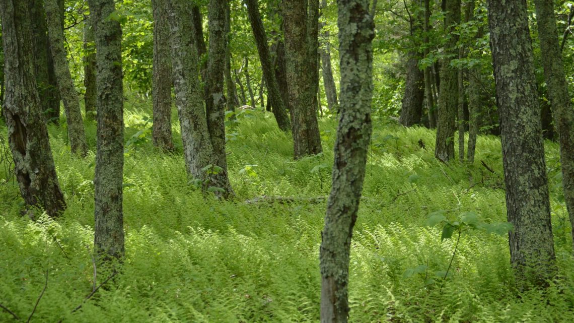
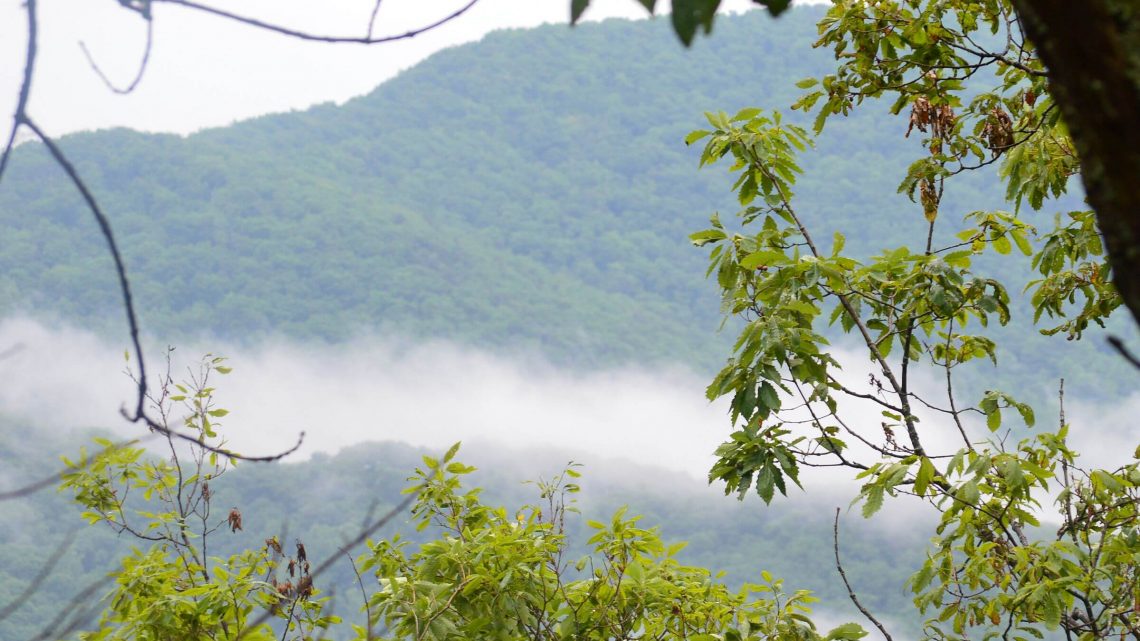
Ramsey’s was a favorite backpack spot during our 17 years in the Washington, DC, area. We hiked along the “draft” (southern word for creek) and all the ridge trails surrounding it. The 6500-acre wilderness has 24 miles of trails within wilderness and more loop hikes available from the adjacent Shenandoah Mountain roadless area. Hiner Spring at the head of Ramsey’s offers good camping. During our visits, we met a few backpackers and day hikers visiting from adjacent trailheads as well as mountain bikers on the edge of the wilderness. In 2000, there were beautiful groves of eastern hemlock; in 2014, a few remnant hemlock remained above 4000 feet. Eastern white pine and understory shrubs (including poison ivy!) were replacing hemlock along the creek.
Our 2000 visit route is also shown on the map below, illustrating some of many options for loop hikes on other trails in this wilderness. Longer backpacks also can utilize extensive adjoining nonwilderness trails such as Wild Oak Trail. Virginia groups have proposed a Shenandoah Mountain Scenic Area to protect roadless areas and allow continued mountain bike access, along with 3 new wilderness areas and doubling the acreage of Ramsey’s Draft. The George Washington National Forest plan revision of 2014 includes much of this recommendation; Congress has not acted on it although a Virginia senator introduced legislation in 2017 and 2019.
Rich Hole & Rough Mountain: close but far
Rich Hole and Rough Mountain wildernesses are less than 3 miles apart, mostly on national forest land—but our June 2014 visit required much driving and route-finding. Each wilderness has only one trail, although a network of trails and roads on their periphery could be linked for an exceptional backpacking experience. At present, Rough Mountain is used only by locals as it is surrounded by private land and the Forest Service has done little for access. Our visit—we found out later—was “technically illegal” although private property is unsigned.
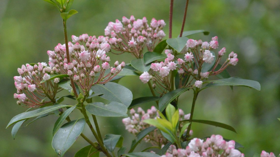
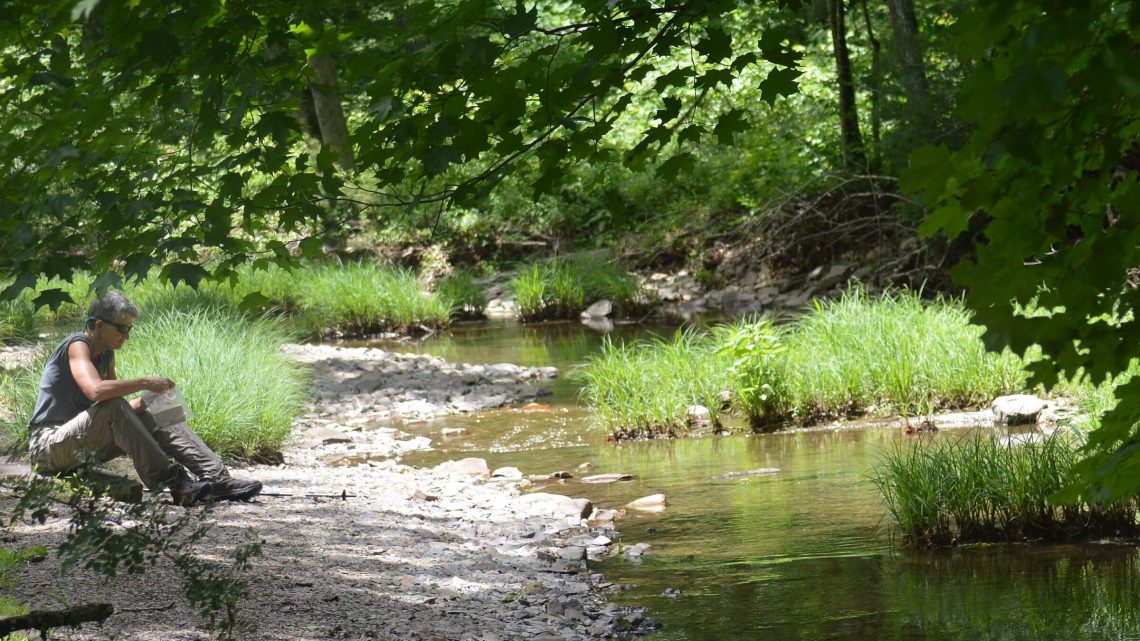
Rich Hole has a nice (although burned) register, sign and small parking lot off a state road just a few miles off Interstate-64. We hiked the “out and back” trail (six miles one way) on an old road and steep trail over Brushy Mountain into beautiful open forest (and unused camp areas at head of Simpson Creek), then down a washed out road with many creek crossings, brushy vegetation and old-growth hemlock logs felled by wooly adelgid. A 2012 fire had pruned up rhododendron and mountain laurel shrubs into large “trees” along creek banks with huge rose and pink blossoms. Near the bottom, the road left the creek and ended at a parking lot and trailhead for White Tower Trail along the southwest wilderness boundary. I wanted to hike out the trailhead road to find where it turned off the state road but we’d used up half the day (five hours) on route finding and crossings. (We should have done this as we did not find the turn-off on the drive out.) A thunderstorm on our return trip made the steep downhill trail muddy and slick; David took a face plant.
We spent the next morning doing detective work trying to find the trailhead for the Crane Trail, the sole trail into Rough Mountain Wilderness. The western boundary is all private land. We tried several roads including one with an alarm system. (We did not trip it.) The national forest map showed the trailhead a mile south of a church so we drove there, backtracked one mile, and found two unsigned roads. One went to a house. We took the other across the creek and uphill to a clearing and a small red cabin. We saw trees with red paint for forest boundary and a wilderness sign, but no trail. Just then, our GPS “found satellites” and kicked in, showing the trail in a drainage. Sure enough, the path dropped into the drainage, then climbed out through oak-hickory-pine forest to a saddle on Rough Mountain.
Two down serviceberry trees probably indicated a black bear after berries beyond their reach. The trail was hardly used but a fire circle indicated some past visitors. Descent was a narrow side slope route buried in deeply piled oak leaves. Near Pads Creek (running in June) the trail widened but was brushy with many down logs. It disappeared near the bottom but we hacked through to an opening and a railroad bridge over Pads Creek, a pond surrounded by sand. We saw a Forest Service kiosk and a sign, “Crane Wilderness Trail, VA 42 3.0.” Our hike took 2 hours down and 1:20 back.
Back on the road, a guy from an adjacent house hailed me. Uh oh. But he just wanted to know how the trail was. He was impressed that we hiked to the railroad and back. “The last time I hiked the whole trail was when my daughter was a kid,” he said. “It was in much better shape then. The Forest Service should do a better job of maintenance.” He said locals also access the east end of Crane from Millsboro, five miles along Pads Creek south fork to a parking area and gate. This is mentioned in deHart’s hiking guide (see Links below) although we did not check it out.
A hiking guide referenced below (Wild Virginia) suggested a “bushwhack hike” in wilderness along the mountain from the northeast end to Griffith Knob at 2,750 feet. You’d have to pack a gallon of water each for this 10.5 mile hike. In the spring, you could pack less water and drop down Crane Trail to camp at the head of Pads Creek.
A trails manager on Warm Springs Ranger District told me in 2014 that there is no legal access on the Crane Trail but that the landowner (of red cabin) allows locals to use it for hunting.
For updated information on Rough Mountain trailhead access contact Warm Springs RD 540-839-2521 and ask for the trails manager.
We see Rich Hole and Rough Mountain as a missed backpacking opportunity.
show less
Google Map
(Click upper-right box above map to “view larger map” and see legend including NAVIGATION INSTRUCTIONS; expand/contract legend by clicking right arrow down/up.)
Downloads
- Google Earth map (kmz)
- No GPS track-data collected