 South Kaibab Trail, mule pack string (Day1)
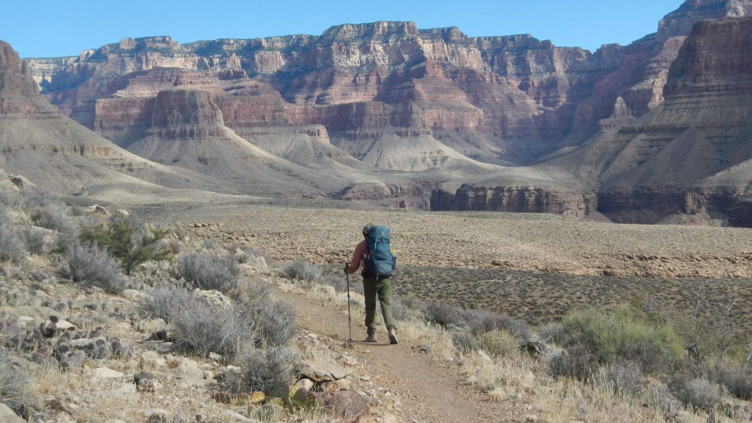 Tonto Platform (Plateau) north & south border river (Day2)
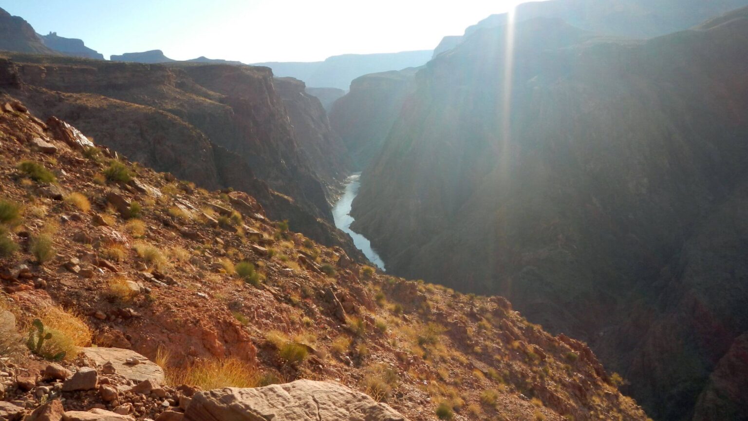 Colorado River (Day2)
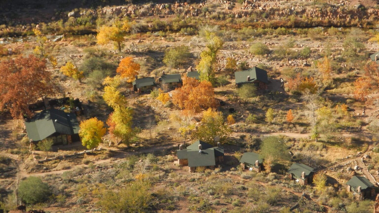 Phantom Ranch (Day3)
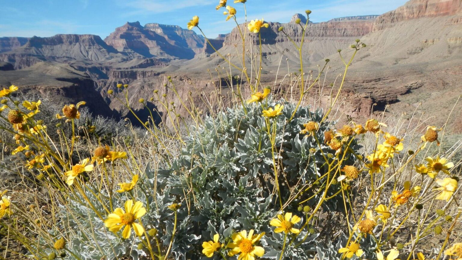 Brittlebush on Tonto Platform (Day4)
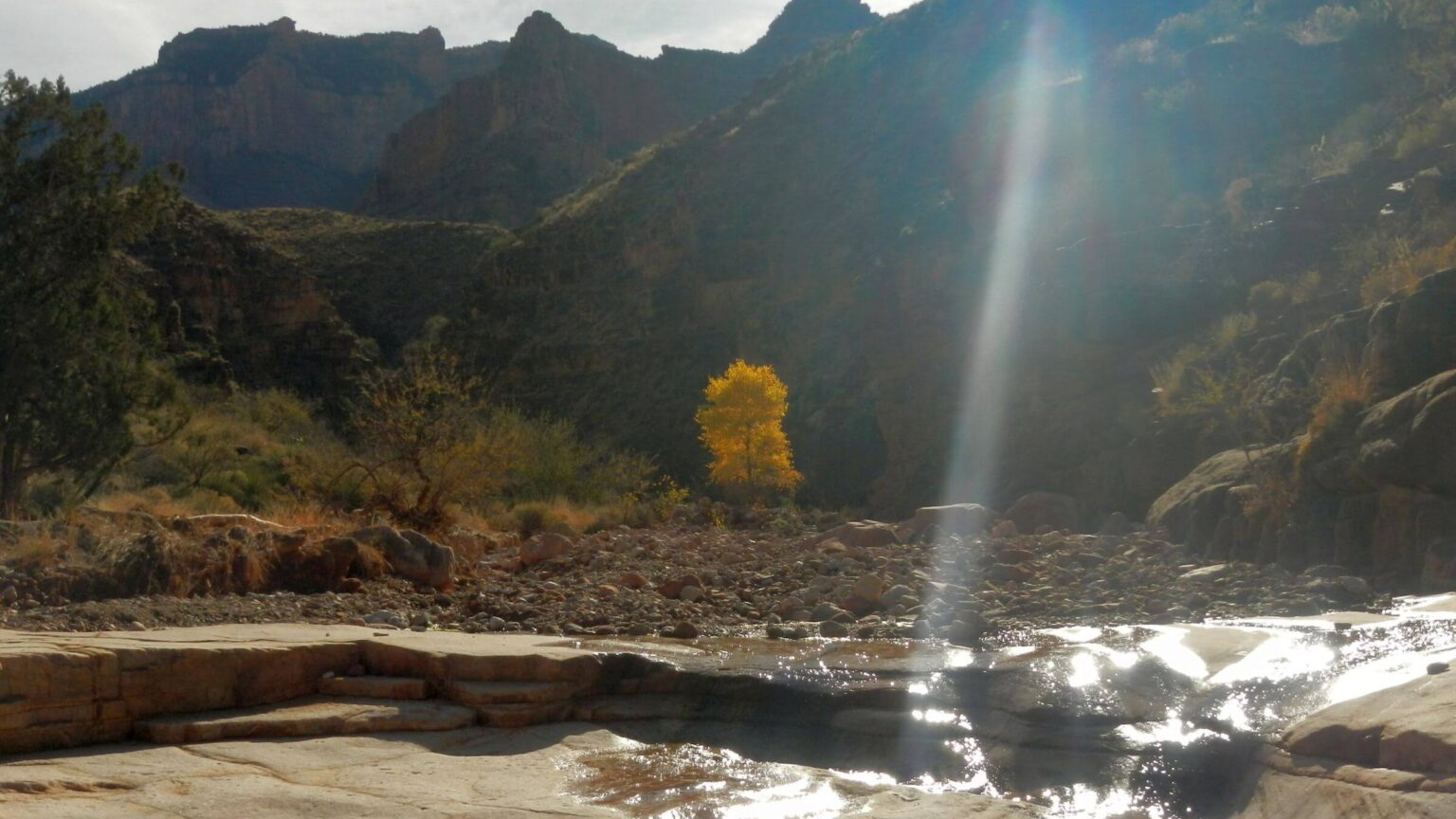 Grapevine Canyon (Day5)
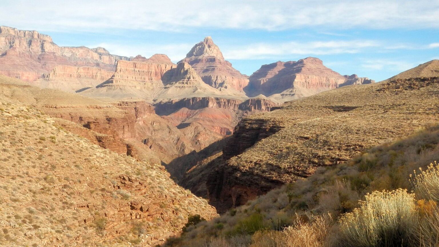 Vishnu Temple (Day6)
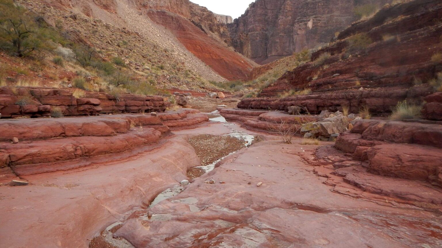 Red Canyon (Day7)
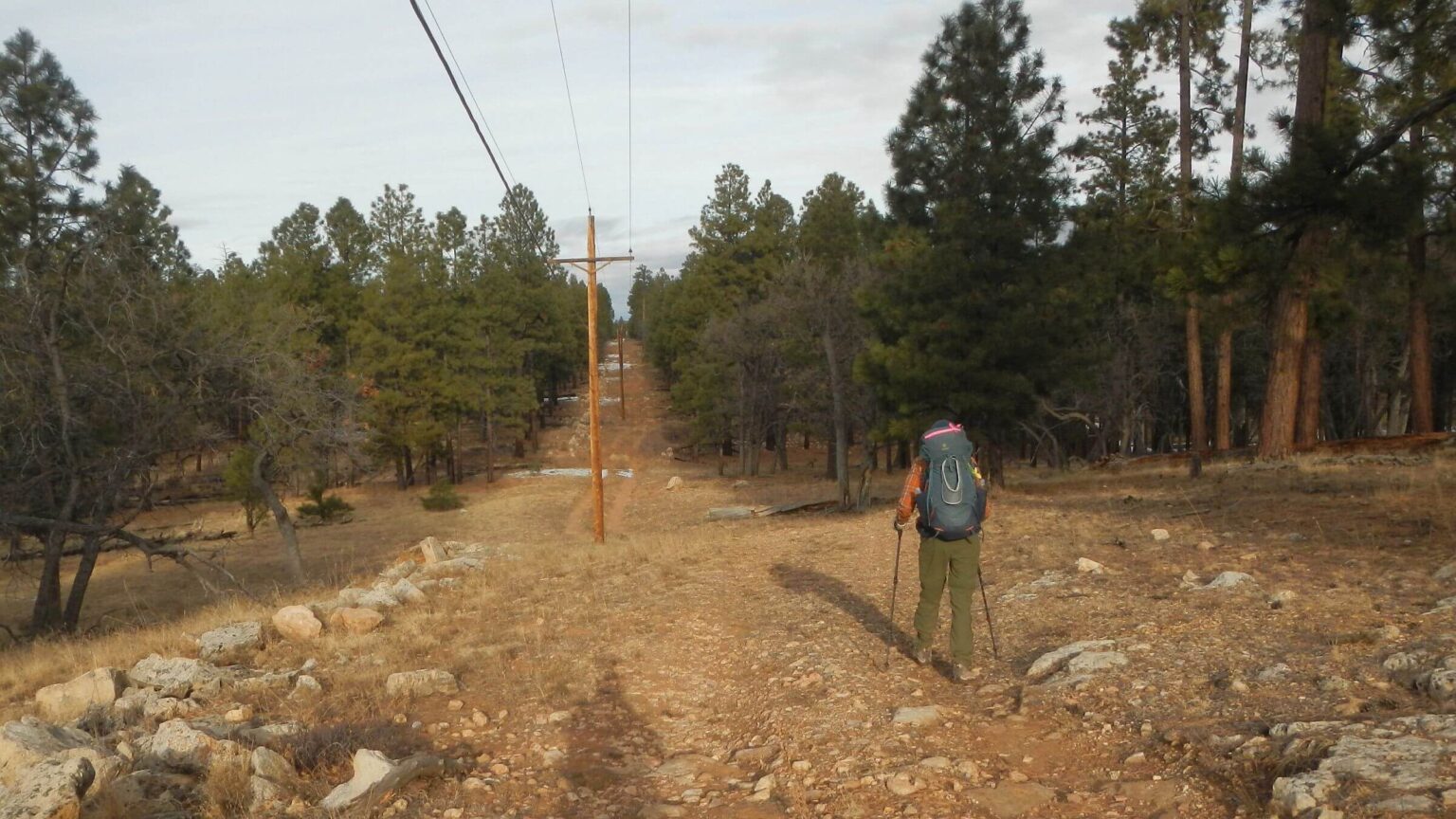 South Rim, “powerline” road (Day8)
Hikers & stock share overused canyon corridor
We shared 8 a.m. shuttle bus with a dozen hikers going to Yavapai Point, start for South Kaibab Trail to the Colorado River. A few who drove joined us and sprinted down trail ahead of the two backpackers slowed by a week’s worth of food and gear. One group stopped at Ooh-Aah Point for photo op on the edge of a 4000-foot drop into the largest canyon in the United States.
We met a cheery National Park Service wilderness ranger in uniform, hurrying up the trail (to get to a 9 a.m. meeting). He had started that morning at 4 a.m. near Phantom Ranch at the canyon bottom. We were soon passed by trail runners and later met some who were trotting back up after trundling down trail with headlamps in predawn dark to the river.
Behind them, Phantom Ranch overnight guests were struggling up, toting day packs; well-warned by National Park Service mantras to allow a day for the strenuous 9-mile, 4,825-foot climb from river to the rim. Most had left soon after 5 a.m. breakfast, hiking by headlamp.
Park Service warnings conveyed on websites, literature, and signs—some graphically showing an overheated hiker barfing—say many overestimate their hiking ability and race to the bottom of the Grand Canyon, then have a tough time making it back up. Most of those warnings are aimed at visitors in the summer when lower canyon temperatures can exceed 100 degrees F. During this December visit, with temperatures at 40 degrees at the rim and 60 degrees at the bottom, heat exhaustion was not a risk. But most left early for the canyon climb anyway.
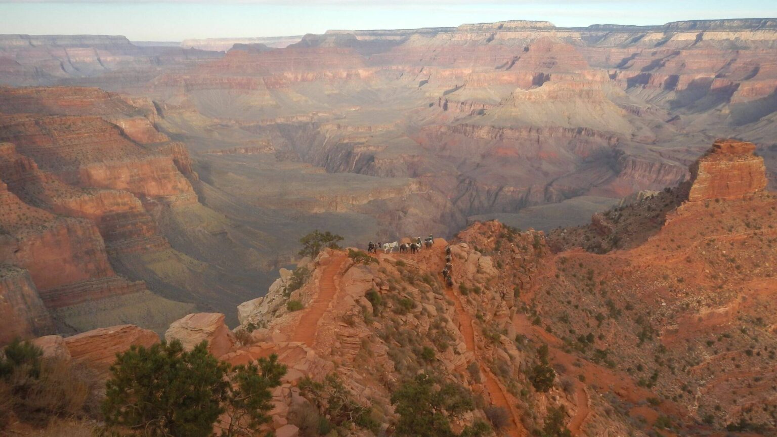
Next, we were overtaken by two pack strings of mules carrying supplies to Phantom Ranch. Shortly after, we joined day hikers waiting on a flat spot above steep switchbacks. Just below them, another pack string of mules was “parked” headed downhill.
A packer had dismounted his horse and was carefully unhitching each mule and turning it around on the narrow trail nose-to-tail. David saw empty saddlebags on mules and one packer kicking rocks. He asked why but just heard a mumble. After re-hitching was complete; we stood by as pack string headed uphill past us. Below, hikers waited, ready to resume their uphill clamber.
Now the pack string delay made sense. We think packers dropped rock cargo from their mules on a steep section of trail (from Park Service quarry we had passed earlier). The trail effort—aimed to offset deep gouging between waterbars (probably from too much mule travel) on the Kaibab—also added more mule traffic.
Normal use was about doubled on Kaibab because Park Service had closed Bright Angel Trail to repair the 60-year-old Transcanyon Waterline that conveys water from Roaring Springs on North Rim to the South Rim. The system follows meandering Bright Angel Trail to rim with rest/water stops along the way. Mule trains and returning hikers generally use Bright Angel.
Phantom Ranch guests, day hikers, backpackers, and overnight visitors—and mule supply trains—were all required to use the shorter, steeper South Kaibab Trail.
Even in the winter off-season, the Grand Canyon “corridor” (Park Service term for heavily used area encompassing Kaibab and Bright Angel trails) was bustling and Kaibab was non-stop conveyor belt of people and stock headed up or down. Before we got to the river we met or were passed by probably 60 hikers, 30 stock, and at least a dozen Park Service employees.
Later in our trip—on backcountry trail outside the corridor—we would only meet three groups over five days, see absolutely no trail work, and camp every night in solitude.
Canyon visits started in university days
Our personal history with the Grand Canyon began with an annual University of Arizona Ramblers Hiking Club tradition in mid-1970s: Thanksgiving backpack trips in the Canyon. Our club reserved group slots on Tonto, Tanner/Escalante, and New Hance; groups planned to meet up the last night at Horseshoe Mesa and leave via Grandview Trail.Grand Canyon needs no introduction as one of the Seven Wonders of the World. It is second most-visited national park in U.S.; it would be Arizona’s largest wilderness if a 1.1-million-acre Park Service proposal is ever legislatively designated by Congress.
Many indigenous peoples have deep spiritual connections to Grand Canyon. However, wilderness not a high priority to these folks.
Colorado River rafters are main canyon users; 76% of 353,000 user nights in 2021 were river camps. (Maybe why river beach camps fraught with pesky mice.) Of 86,000 backpacker nights, about half were in Grand Canyon “corridor” (narrow rim-to-rim area excluded from proposed wilderness including Bright Angel Trail, South Kaibab Trail, and Phantom Ranch). Most backpack trips no more than three nights, and December to February season has fewest visitors. So, expect solitude on longer winter trips on unmaintained trails outside corridor, like our trip (camped alone five nights, met only three groups outside corridor).
Our trip descended South Kaibab Trail to Phantom Ranch and made an out-&-back to Clear Creek, followed by a second night at Bright Angel Campground near Phantom Ranch. We then followed Tonto Trail east to Hance Rapids, exited Canyon on New Hance Trail, and looped back to parking lot near our start on a powerline road (where we had left hanging food and water drops).
Popular Phantom Ranch is worth a visit (with good but understandably expensive meals). The 1920s constructed lodge and 11 cabins are well-maintained. Campground also in good shape with metal bear boxes to keep food from critters (we saw no mice but did not cook in campground). Although ranch reservations are a 15-month lottery odyssey, we had no problem reserving meals a few weeks in advance and learned we could have stayed in cabin our second night at Phantom Ranch (after Clear Creek), had Park Service not closed facility for waterline repairs. (Friendly staff said lodging often available in off-season from cancellations; call Bright Angel Transportation Desk at 928-638-3283, but they will only release reservations a day or so in advance of a cancellation. Therefore, plan for campground but possibly switch to cabin if desired.)
Obtaining backpacking permit was overwhelming process from one-size-fits-all Park Service website, but fortunately, Park Service backcountry office knowledgeable and very responsive to email (grca_bic@nps.gov). Staff gave good water information for planning campsites (main information required on permit). It took two faxed iterations (group leader signature needed for liability reasons) to get permit, but we got exactly what we wanted.
Backpacking Grand Canyon traverses three major features: drop from rim about 3000 ft, extensive Tonto Platform (Plateau), and 2000 ft another drop to Colorado River. Most trails from the rim are Indigenous peoples’ routes, improved by 1800s miners and other early European-American settlers, except for highly engineered (by Park Service) South Kaibab Trail. The Tonto Trail on plateau south of river winds for miles in and out of side canyons, many with water. The plateau eventually drops steeply to Colorado River. A few trails access river but none (except some parts of Escalante route between New Hance and Tanner trails) hike along it.
Vegetation at rim includes shrubs and sparse pinyon and juniper trees down to about 4500 ft elevation. Blackbrush, yuccas, some cactus, a few acacia and mesquite trees, and other desert plants are found on the Tonto Plateau, and little vegetation on black rock cliffs lining Colorado River below plateau. Scattered Fremont cottonwood highlight riparian areas.
Tonto Trail surprisingly good except when along canyons with steep walls where rocks routinely fall; New Hance Trail was worst for rock rubble. Much trail routing minimized grade and maximized natural features for stable trail (e.g., following shelves and benches in terrain)—perhaps route was created by original indigenous canyon users.
Visit statistics: 8 days, 87 miles hiking, at 2.2 mph, and 400 feet per mile of average elevation change.
Go to map below for more information on trailheads, daily routes, mileages, elevation changes, and photos. (Click on white box in upper-right corner to expand map and show legend with NAVIGATION INSTRUCTIONS.)
show more
David, another friend named Richard, and I quickly outdistanced others in our group hiking Tonto from Kaibab to Horseshoe Mesa. The last day we accidentally led part of our group up the wrong mesa—following tracks of feral burros and ending up on an obscure mesa across a drainage from Horseshoe. Ramblers later labeled this feature on their maps “Jackass Mesa.”
The burros—whose ancestors were brought by Spaniards and by 19th century prospectors in the Canyon—were feral. Park Service instigated an elaborate round-up, airlift, and adoption program in the 1980s. We did not see them or their tracks in later visits.
We returned to the Grand Canyon a few times, mostly hiking segments of the 95-mile Tonto Trail, which links several South Rim trailheads along much of the Canyon’s length.
In 2023 we wanted to repeat previous trips by hiking from Boucher Trail east to Grandview Trail. Since Park Service had closed the West Tonto from Hermit’s across Bright Angel Trail for work on a water system, we settled for shorter trip but added a few miles to New Hance Trailhead.
Fall colors, feasts & vandals
Bright Angel Creek was glorious with golden cottonwood turning in December. We found a spot, posted our itinerary in plastic holder, and I hiked a mile to check out the famous Phantom Ranch of sprawling stone cabins. When I returned, the tent was up but our stuff was gone! David found ravens fighting over our packs and put everything in the large box provided by Park Service. Empty packs were hung on a rack.After a day hike up North Kaibab, we returned to Phantom Ranch lodge at 6 p.m., in time for generous steaks, baked potatoes, and salad served family style. Other diners, staying at the ranch, were discussing their hike out the next morning after a 5 a.m. breakfast.
In predawn darkness, I watched lights across the creek as guests started their trek out of the Canyon; much later we started our out-and-back trek to Clear Creek. David had convinced a kindly staff person to keep our extra food, so we had light packs for the good trail climbing out of the canyon.
I later learned that Clear Creek Trail was built by Civilian Conservation Corps in 1930s as a day fishing area for Phantom Ranch guests transported on mules. The wide trail was definitely designed for stock (although no longer used by mules) and good except for a few washouts.
Trail offered scenic views of the river far below (and a small rafters’ camp), Zoroaster Temple, and other formations as we wound around canyons, finishing with long wind around side canyons and into Clear Creek itself. Sadly, descent into the Canyon was not maintained, narrow, and sketchy; I missed a rerouted switchback and skittered straight down washout to a boggy creek.
We had a gorgeous canyon of yellow cottonwood all to ourselves. I followed “social trail” about a mile down the canyon. (The 6-mile route to the river is mentioned in the Clear Creek description along with a 5-mile side trip up the creek to a waterfall.)
Hiking out next morning, we met group of young men surprised to meet seniors and delighted to hear they had Clear Creek to themselves. One stripped off his shirt and bounded down a side canyon, followed by buddies. City pups off the leash! Joining trail at Bright Angel Canyon, we stashed our backpacks in a side canyon and hiked north to kill time before dinner.
When we returned, the top flap on David’s backpack had been unzipped, with gear and our permit thrown on the ground! David thought a zealous wilderness ranger looking for violators had done so in disgust as we had proper reservations for the night, but perhaps had violated a rule against unattended packs in the corridor. (We have met too many NPS wilderness rangers more focused on rules than visitor safety or enjoyment.)
Back at camp we were visited by a friendly ranger. He was cute and engaging; said our permit was marked “aggressive itinerary,” which cues rangers to ensure visitors can handle their planned trip. After discussing previous visits, he thought we were fine. He said some newbies overestimate their capabilities and “we do try to scare the crap out of those people.” I could not believe this friendly soul would vandalize a backpack. (David, setting up sleeping bags and pads in the tent, only heard ranger’s voice, and thought he was lecturing me about rules!)
The next morning, David solved the pack vandal mystery while packing up camp. I had left early. He walked up the trail to the restroom, leaving his packed-up backpack on picnic table. When he returned, ravens were swarming his pack, the top-pocket zipper was open, and stuff was thrown out!
Tonto: Ticket to Solitude
After hearty meal of pancakes, eggs, and sausage at Phantom Ranch, I packed my pack and lumbered up the Kaibab. I was passed by younger backpackers on the river but passed them when they stopped to chat with other hikers. David caught me near Tipoff Point (and told me about raven marauders). We took Tonto Trail east and left crowds. For some time, I could view hikers on South Kaibab Trail—the last people we’d see for next two days.The East Tonto winds around six side canyons—Cremation, Lonetree, Boulder, Grapevine, Cottonwood, and Hance—before it drops to the river at Hance Rapids. A route called the Escalante Trail continues along river to 12-mile Tanner Trail from Desert View, farthest trailhead east in the park. We would follow Tonto to its terminus on New Hance Trail, ascend New Hance up Red Canyon, and loop back to our vehicle on a powerline road that paralleled Highway 64 along the canyon rim.
New Hance, famous as the most difficult Canyon trail, was second trail built by European miner and hotel owner John Hance, who initially had bult “Old Hance Trail” (an improved Havasupai Indian route up Hance Canyon). He built the new route into Red Canyon after first was blocked by landslides. As early as 1904, New Hance Trail was described as “frightful.”
From previous trip, I recalled Tonto as mellow endless winds around long canyons, with steep walls and rims with river views. I knew New Hance only by reputation.
Soon after we left Tipoff Point and dropped into Cremation Canyon, two bucks eyed me curiously. We had seen a lot of deer hanging around Phantom Ranch, but these would be the only wildlife sighted rest of trip (with one small exception).
On other side of Cremation was only bad stretch of entire Tonto: a steep eroded wall that required scrabbling skills. I wondered if Park Service left that section unrepaired to underscore dire warnings about unmaintained trails. Hikers beware!
The rest of the Tonto was quite good until our final drop to the river on the sixth day of our trek. I had forgotten how long some of the side canyons wound in and out—Grapevine was more than 5 miles around. The trail also skittered on the very edge of stupendous cliffs to side canyons below. It was a good trail—just better to not look down!
When we finally crossed each side canyon, we were rewarded with bright yellow cottonwood, juniper trees, pools of water or flowing streams, and nice campsites. Our first night on Tonto we camped on a mesa; the second night beneath a big juniper tree on Cottonwood Creek.
After crossing Hance Canyon, the Tonto rounded a mesa and switchbacked down a side canyon on its way to the river. In the canyon we met a teenager outpacing his father.
Dad said they’d scrambled 10 miles from New Hance Trailhead that morning and were on their way to Grandview Trailhead. With perhaps three hours of light left, they had 10 more miles to hike, including the precarious Page Spring scramble to Horseshoe Mesa. Hope they had headlamps!
After winding above a side canyon, the Tonto crossed flat area between rock formations and a confusing array of “social routes.” We found one making its way toward the river. Next, a series of contours, drops, washes, and finally washed-out mess of trail to river beach. That last half-mile took about an hour—a contrast to the mostly mellow Tonto.
Beach near Hance Rapids had several river rafter camps but was very windy. I lobbied to camp in a nest mesquite trees on the other side of Red Canyon—a wash we would hike up the next morning. It was sheltered and pretty. A route continued along the river through trees and brush—beginning of the Escalante Route linking to Tanner Trail.
We enjoyed camp until sunset, when the mice came out in droves. They were bold, running right at me as I set up my cook stove and pots—apparently habituated to river raft campers. David finally knocked one out with a rock; after this, mice were more cautious. You could raise a rock and they would scurry back. Still, I kept my camp stove running after water was boiled for freeze-dried meal as stove flame kept mice away.
We wanted to hang our food and packs but knew mice could run along the mesquite branches. David settled for a bear bag hanging a few feet below branch. Next morning I found an array of wrappers on the ground below the bag. Mice had indeed invaded the bear bag but were distracted by our stuffed garbage bag on top (Park did not allow fires, preventing our usual practice of periodically burning flammable garbage). They gnawed wrappers but did not find or contaminate our snacks/lunch packed lower in the bag!
Out of Canyon and back along Rim
Unmarked New Hance Trail followed dry Red Canyon wash 2 miles until meeting lovely pools. Trail then appeared as contour, looping around and then up canyon side. Many switchbacks—steep and eroded—climbed up through the Redwall formation. After a plateau with views of river, trail crossed several amphitheaters en route to main drainage; with washouts, this was the worst trail section to creep up and down. David carried my pack through the most slippery ones.At lunch stop before a plunge into the drainage, we met backpackers. We had spied them above but they took 15 minutes to cautiously reach us. With long gray hair, he looked older than the woman. They had big backpacks apparently loaded for camp on flats above Red Canyon tonight; another couple would join them for what sounded like an annual party. Then down to the river. “This trail is for the crazy people,” he proclaimed. It took them four hours to get this far, he said. I hoped the 2-mile climb would not take quite that long for us.
It didn’t.
Trail improved in the drainage with short switchbacks in the trees. We met the other couple coming down—another guy with longish gray hair and a younger woman. Trail to the rim was series of steep switchbacks up the cliff face; only difficulty was occasional large rock fall and too many “social trails” offering alternate routes (some NPS cairn work would keep people on same path and reduce erosion). Not too scary going up. Still, the last flat section was welcome—even though a skiff of snow.
Now we hiked main road cautiously into regular bursts of traffic for ¾ mile where the powerline road met the highway. We hiked almost 3 miles on gravel-dirt road; nice in the pines but hard to navigate by headlamps after sunset. Worst was the half-mile cross country scramble where main road circled back toward highway and we headed into dark forest.
We followed our GPS track off road and over a fence to adjacent national forest land to site we had picked earlier, legal for camping (park is not!). Our bear bag was up in the tree, gallon water jugs undisturbed, and water not frozen. We set up camp in grove of slightly burned pine.
Gray and chilly morning at 7,500 feet. We hurried along hilly powerline road and followed GPS off road to large log for water stash. Our water was undisturbed and hot breakfast—first since Phantom Ranch—was appreciated. We planned breakfast at Hance Creek, but I mistakenly packed two breakfasts (cereal, coffee, nuts, blueberries, dry peanut butter) in the rim “bear bag!”
The 12 miles of rim road went fast. We sometimes heard cars on the parallel highway and saw a high point looming, perhaps above a scenic pull-off. Last half-mile we joined the highway, seeing faces of dazed visitors leaving in cars—mostly internationals. Cold near visitor center, with visitors bundled in down jackets and puffy vests. As we drove away from the Grand Canyon, it started to snow.
show less
Google Map
(Click upper-right box above map to “view larger map” and see legend including NAVIGATION INSTRUCTIONS; expand/contract legend by clicking right arrow down/up.)