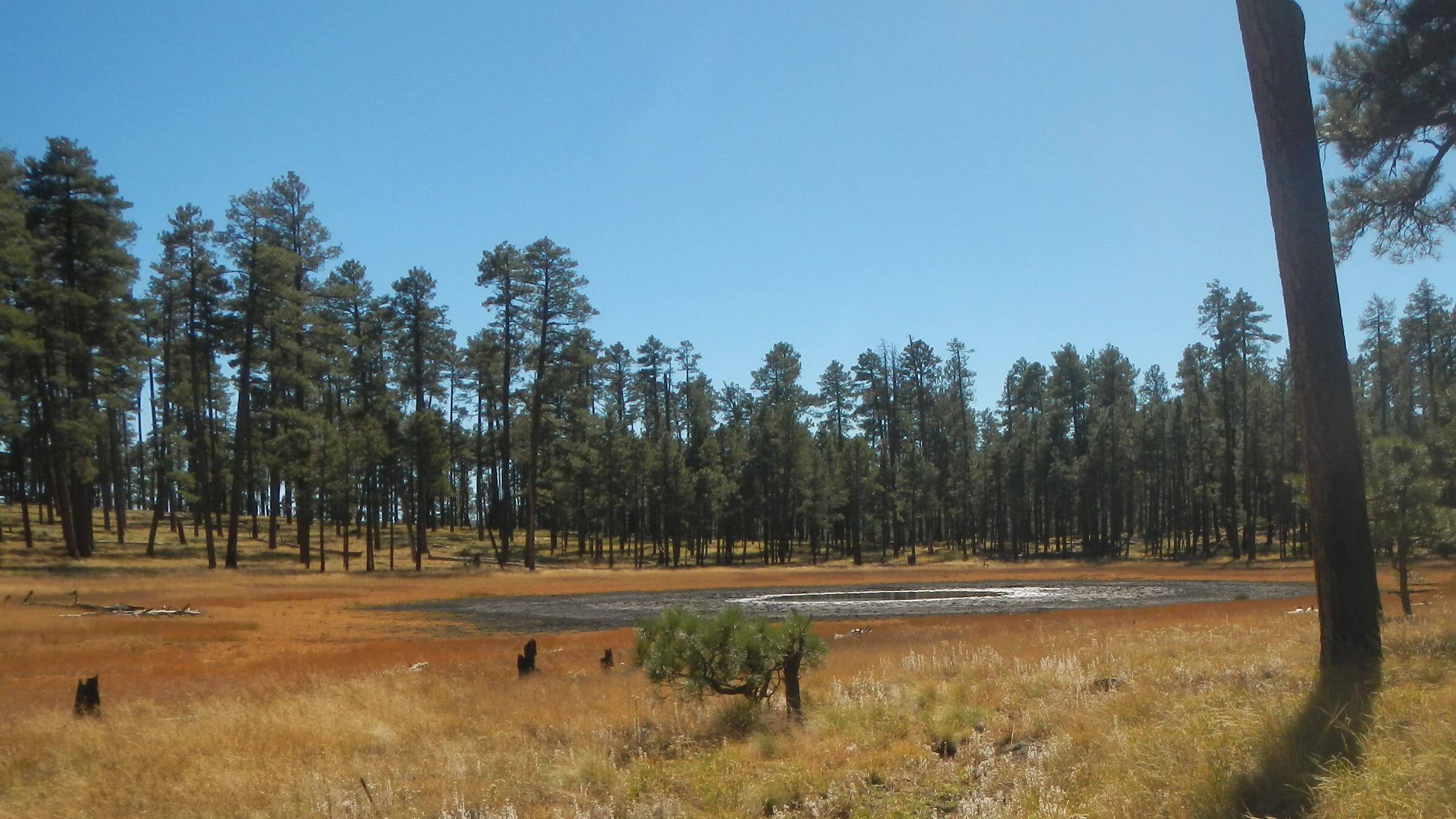
 Iron Creek Lake (Day01)
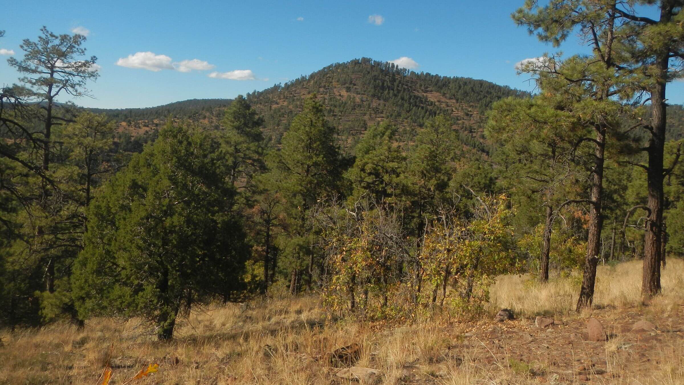 Jerky Mountains (Day02)
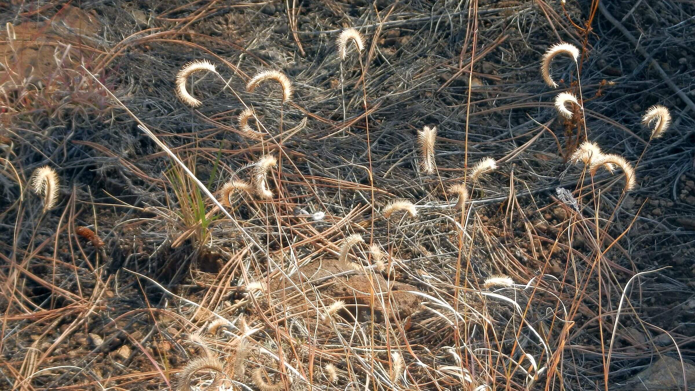 Mature blue grama grass (Day03)
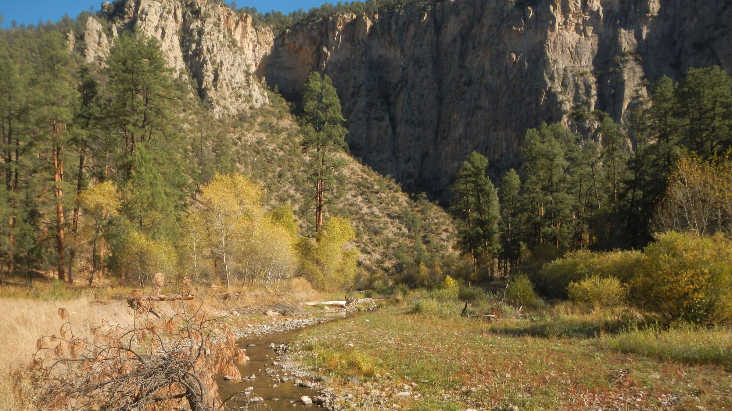 Middle Fork Gila River (Day04)
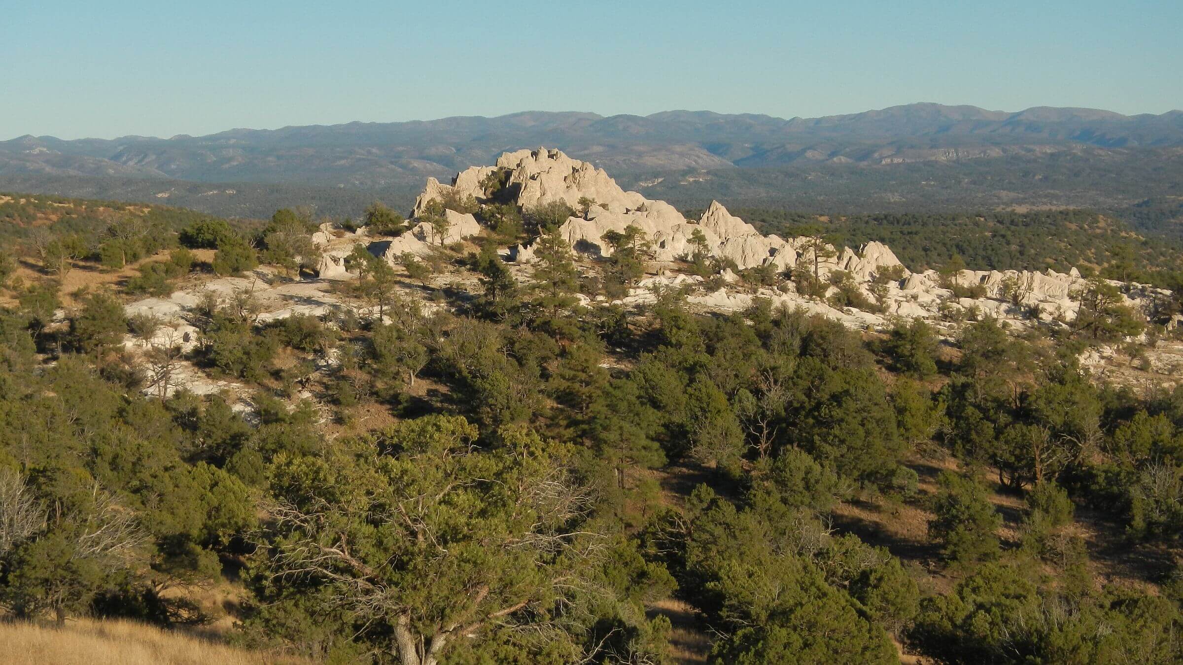 White Rocks (Day05)
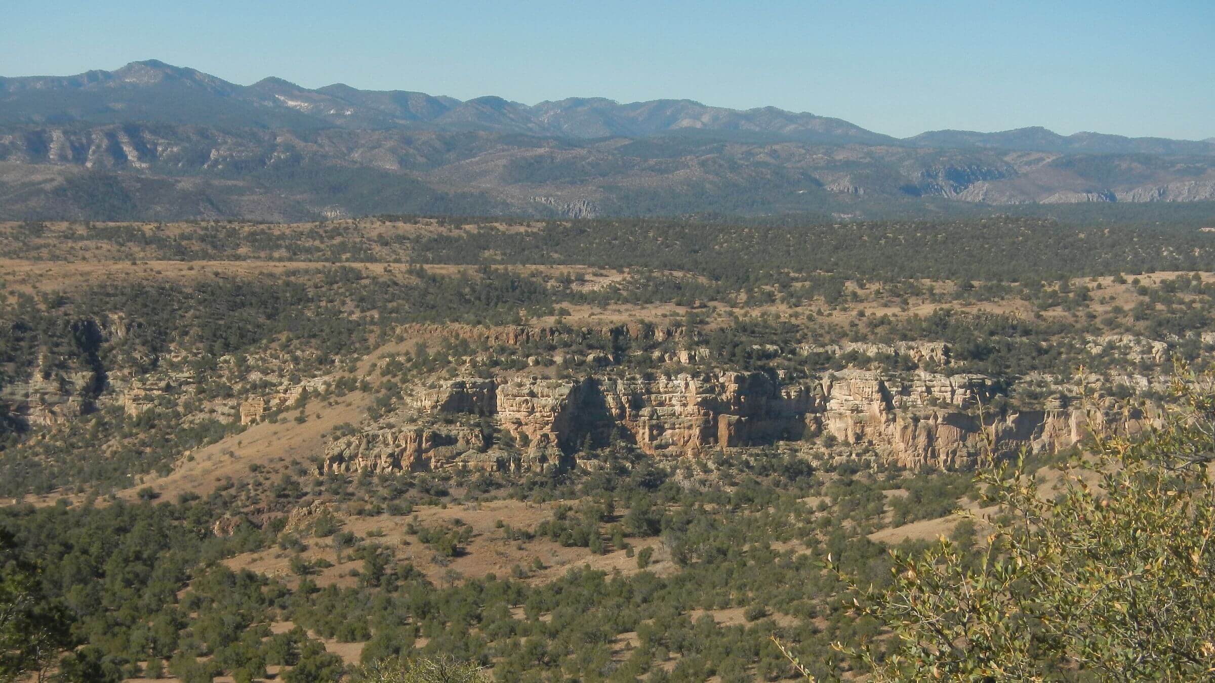 Middle Fork Gila, Mogollon Mountains (Day06)
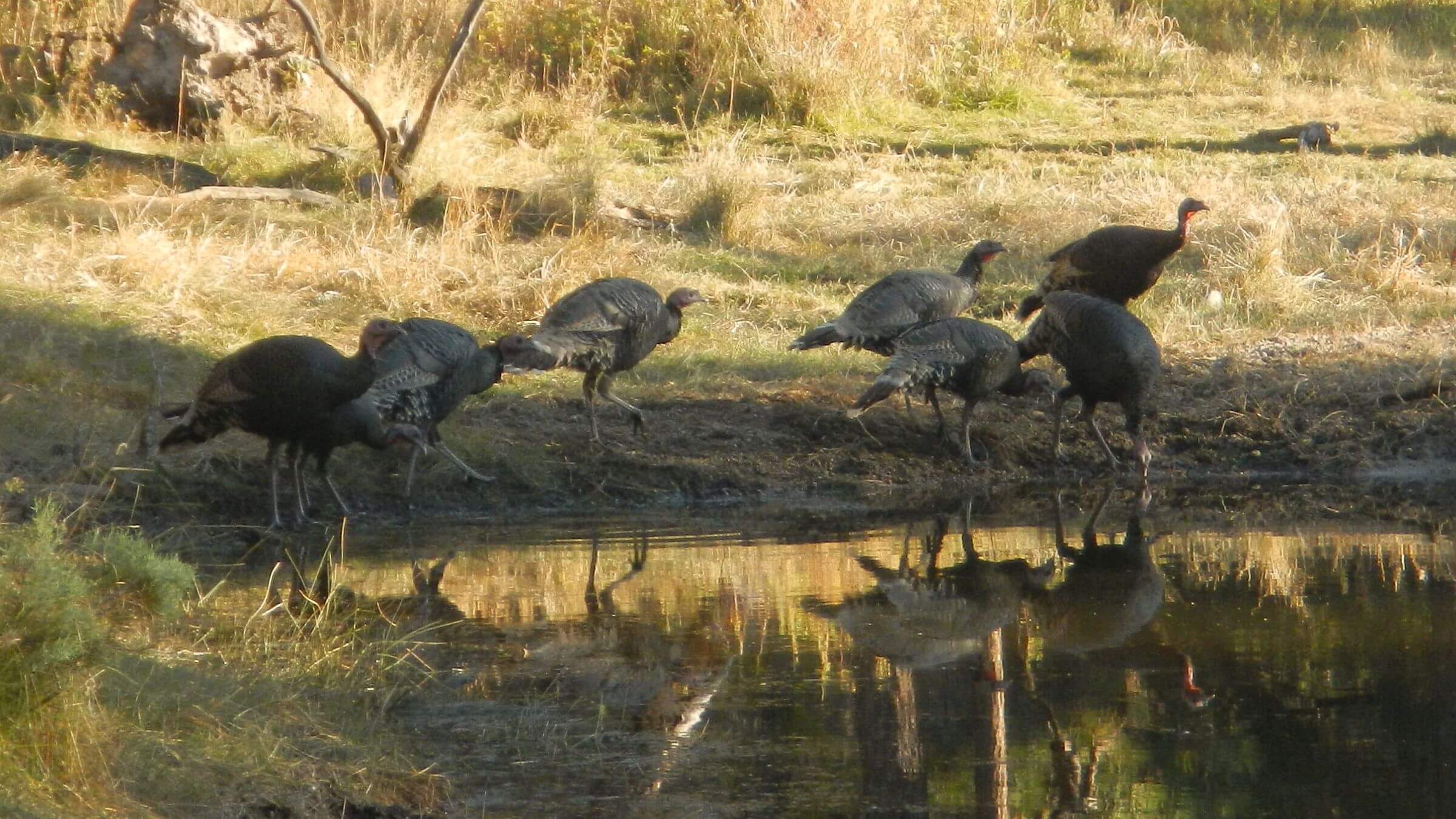 Merriam’s turkey, Miller Spring (Day08)
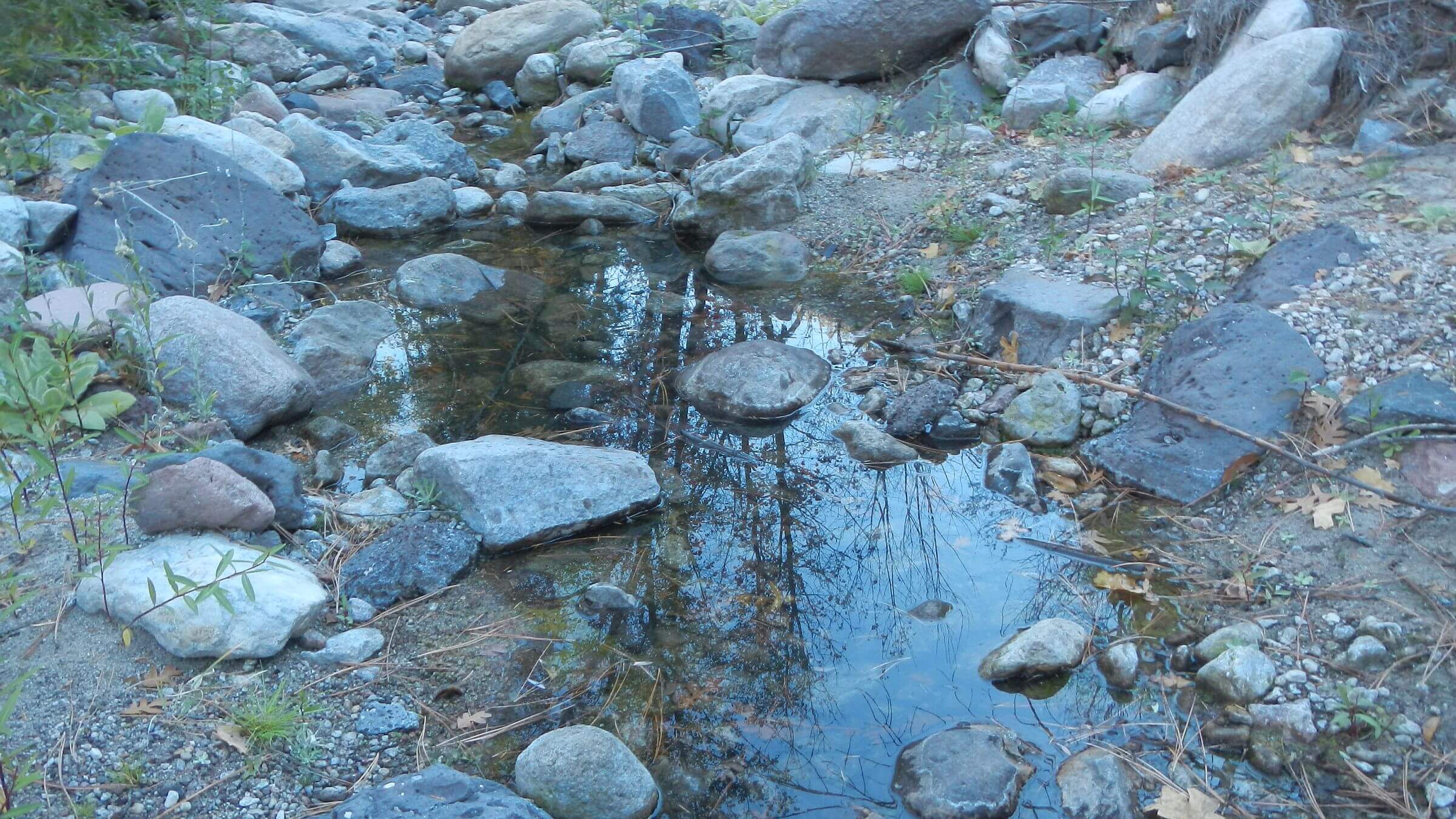 Turkey Creek pools, otherwise dry (Day09)
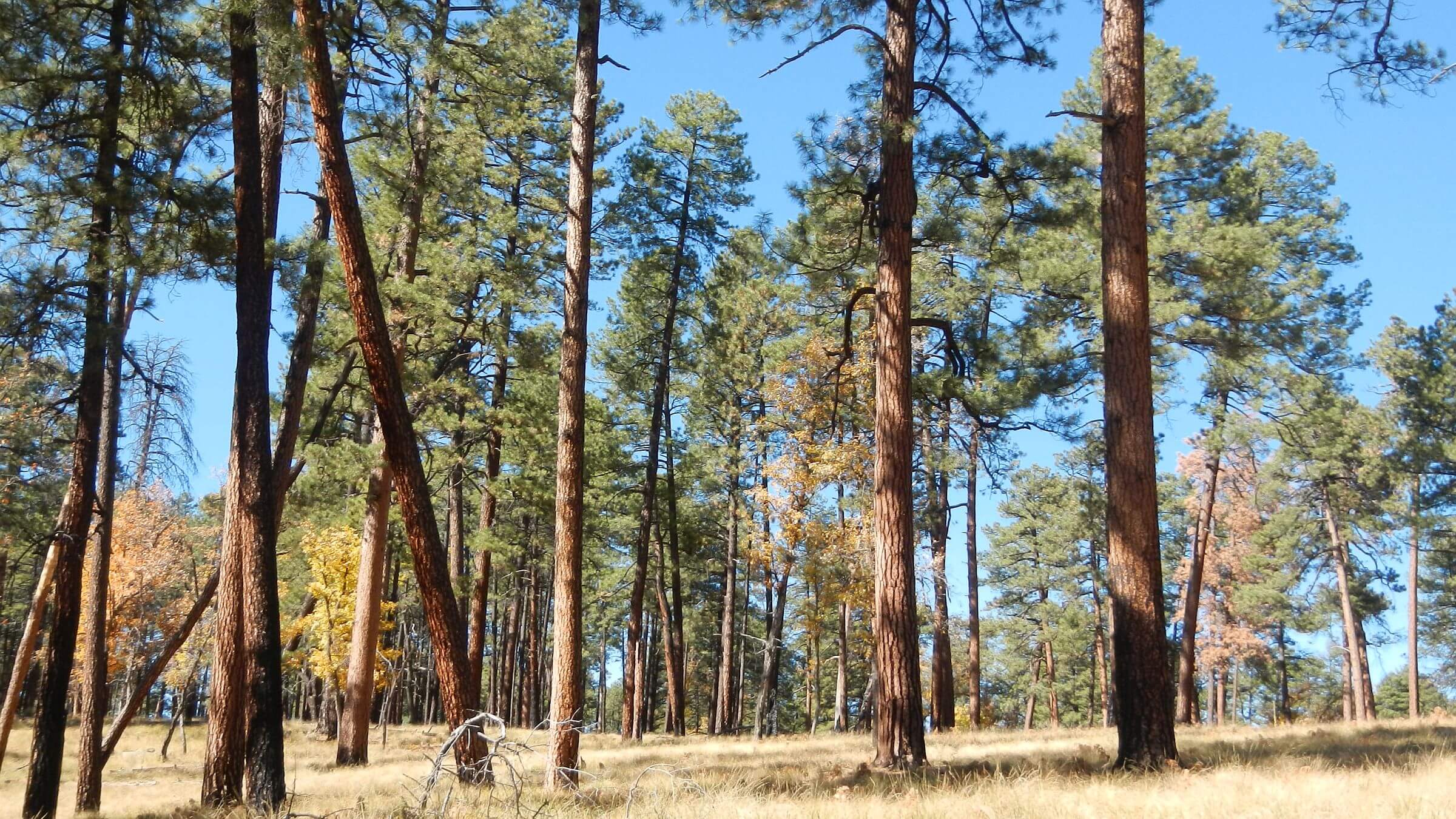 McKenna Park: extensive old-growth ponderosa pine (Day10)
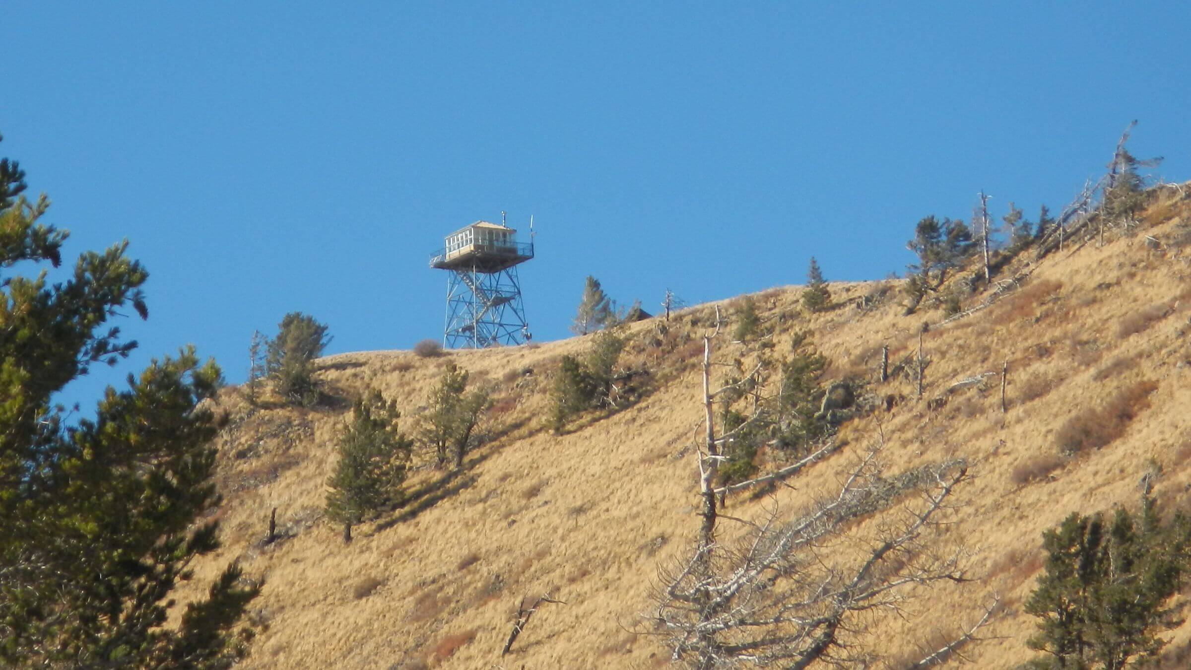 Mogollon Baldy Lookout (Day11)
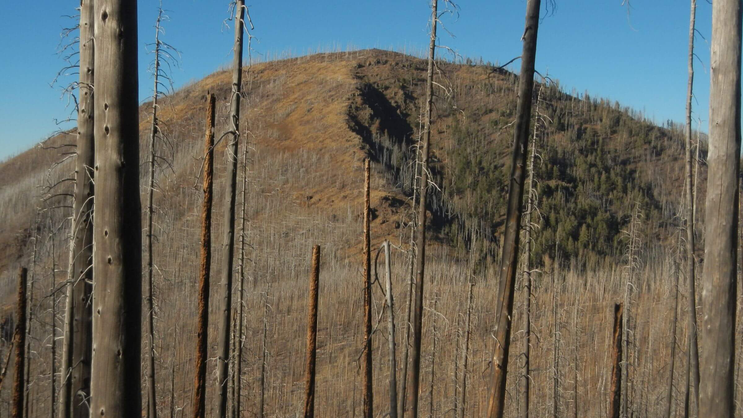 Whitewater Baldy: highest Gila peak, badly burned 2012 (Day12)
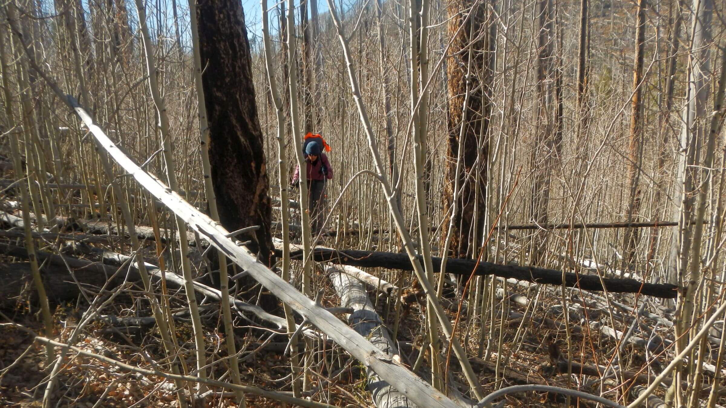 Whitewater Baldy Trail (172): 3 mi overgown (Day13)
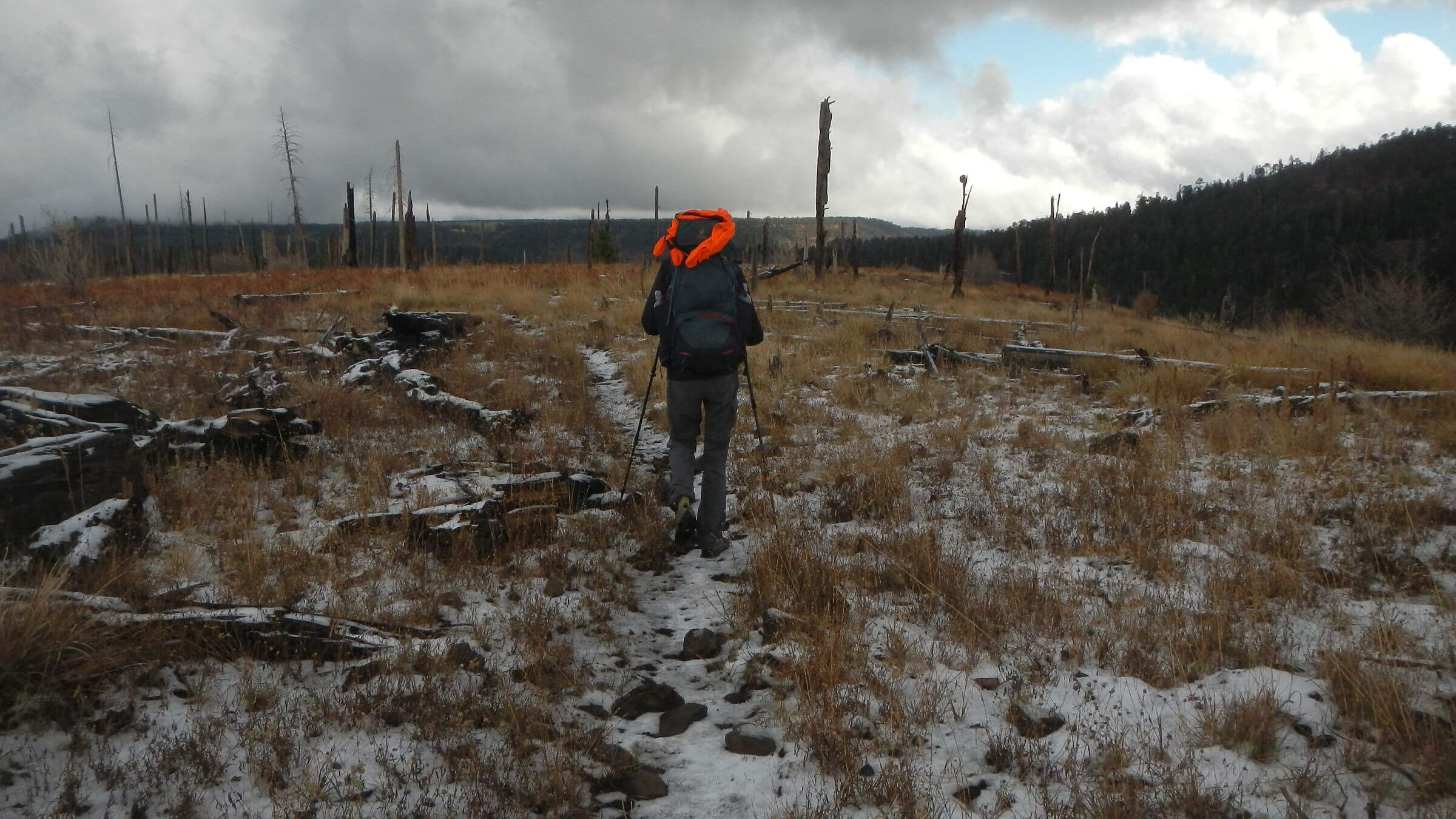 Leaving Gila on snowy morning (Day14)
100+ mile loop marks Gila centennial
Conservationist Aldo Leopold grew up in Iowa and wrote his famous essays published in A Sand County Almanac in Wisconsin, but left his most important legacy in New Mexico.
Leopold, in 1924 a forest supervisor in New Mexico, recommended wilderness for a large area of the Gila National Forest—instead of a proposed road into Gila backcountry for grazing access.
On June 3, 1924, Forest Service set aside 755,000 acres as Gila Wilderness, first wilderness in the world—40 years before Wilderness Act of 1964 created National Wilderness Preservation System and added 54 more areas. It has since been split into two wilderness areas: the Gila (559,688 acres) and the Aldo Leopold (202,016 acres).
We observed centennial early in November 2023, looping through old-growth ponderosa parks, sheer rock Gila River canyons, and somber hills cloaked in gray quills (snags)—the high, severely burned Mogollon Mountains—on the newly designated Gila Centennial Trail.
GCT route configured by Gila National Forest and volunteer trail crews for Gila Centennial in 2024 encompasses about 116 miles (according to our GPS tracks) of legacy trails (in wilderness), looping through all habitats and elevations of this vast area and meeting a specification attributed to Leopold: “large enough for a two-week pack trip.”
We took 12 days, half of them short for various reasons, with added two-day layover/resupply at Gila Hot Springs—4 miles down road from Gila Visitor Center-Middle Fork Trailhead, a GCT access point.
Trip mostly mellow undulating ramble on ridges, piney creeks, and flats with a few rough spots where trail was incomplete, very rocky, indistinct, or uncleared from recent fire impacts.
In late fall following a dry year and minimal summer monsoon, we were pleasantly surprised to find ample water for all but last days in springs, creeks, seeps, or rivers. For last 29 miles after Langstroth Creek to Willow Creek, only reliable water was Hummingbird Spring off the GCT.
We saw horse tracks and hunter camps from fall deer and elk hunting seasons, but only one hunter passed us on horseback. Our trip was between most hunts; check New Mexico hunting regulations for hunt dates (most of Gila Wilderness in “Unit 16B,” with edges in “Unit 16C” & “Unit 22”).
We met just one backpacker the entire trip except near Middle Fork Gila River Trailhead.
Gila Wilderness is big enough to offer a lot of solitude—especially if you minimize time on the West Fork and Middle Fork Gila River, where horse users and warm season hikers like to cool off, with many crossings on flat shady trails, and visit Middle Fork hot springs.
(See Links below for 2024 opportunity to help with trails)
Gila Centennial Trail (GCT) was laid out to circle the Gila Wilderness, span its diversity, and commemorate 1924 wilderness designation by Forest Service—40 years prior to passage of the Wilderness Act. We were asked to hike this trail in October-November 2023 and report on it for 2024 celebration. Before this trip, we had visited the Gila 10 times starting in the 1970s.
GCT was estimated at 100 miles; we GPS-tracked 122.3 miles (adding 6.6 miles out-&-back side trips). Elevation ranges from 5600 to 10,800 ft. Forest vegetation includes pinyon-juniper, evergreen oaks, ponderosa pine, Gambel oak, aspen, and mixed-conifer species (Douglas-fir, white-fir, corkbark fir, and Engelmann spruce). Riparian river and canyon areas include willow, cottonwood, Arizona sycamore, ash, and other species. Gila Wilderness has largest old-growth ponderosa pine forests in the U.S. Gila River forks offer many hot springs.
Fires—more than 50 since 1985—have greatly affected area forests. Only ponderosa pine has fared well through repeated burning. The 2012 Whitewater Baldy Complex Fire decimated most mixed-conifer forests in the Mogollon Mountains, and greatly altered watersheds. Post-fire trails, particularly in mixed-conifer forests, require much maintenance from falling dead trees, erosion, and fire-stimulated growth of thorny New Mexico locust and whitestem gooseberry shrubs.
Chainsaws are used by fire crews within wilderness to reduce fuels and (as shown on lower Whitewater Baldy Trail) to build fireline. We believe Forest Service should drop its double standard—no mechanized equipment to maintain “wilderness purity” but allowed for fire management—and utilize fire crews and chainsaws to quickly clean up fire-damaged trails.
Drought has dominated New Mexico weather for past 22 years, and 2023 had little summer monsoon rain—yet we found ample water each day from at least one spring, creek, or river. Many spring boxes could be improved to increase flow and reduce siltation. Water availability could be estimated by simple association/modeling of water sources to U.S. Geological Survey (USGS) real-time water flow data from West Fork Gila River. For example, 10 to 12 cu ft per sec (cfs) correlated with ample water for our trip (use “Legacy real-time page” on USGS website if still available, easier to navigate). If flow below 10 cfs, seek more water information.
GCT offers “mini” thru-hike: outdoor immersion experience in short loop (instead of 400-2000+ mile thru-trails), all in wilderness, that can be covered on a two-week vacation.
Trail statistics: 14 days (including 1.5 days / 2 nights at Gila Hot Springs) 122 miles at an average of 2 miles per hour, and 400 feet per mile average elevation change.
See map below for detailed daily routes, mileages, elevation changes, and photos.
show more
Gila Human History
Old cabins, fire lookouts (or former sites), dilapidated corrals, stock ponds, and whimsical names reflect the Gila’s history. GCT also contains evidence of much earlier human visitors.Some highlands of the Gila show evidence of hunting by earliest Southwest humans known as Paleo-Indians (9500-6000 BC); later an Archaic culture used plants, animals, and minerals on the Gila River valleys and nomad groups used caves above Cliff Dweller Creek as temporary shelter. In the late 1200s, people of the Mogollon (South Ancestral Pueblo) culture built cliff dwellings near the confluence of the Gila River West and Middle forks. By 1300, this culture had moved on (like the Anasazi to the north), leaving the present walls now preserved as Gila Cliff Dwellings National Monument.
Apaches, nomadic hunters and gatherers, moved into the area in the 16th and 17th centuries. Spanish explorers came in the 1800s and Gila became part of Mexico when it rebelled against Spain in 1821. United States acquired the Gila after war with Mexico and Gadsden Purchase in 1848. After U.S. military pretty much defeated and dispersed the Apaches in the 1880s, miners and ranchers moved into the area.
To protect area from overcutting timber, Gila River Forest Reserve was established in 1899 and transferred to U.S. Forest Service as Gila National Forest in 1906. Forest Service allowed and regulated mining and livestock raising, reporting about 56,000 cattle and horses and about 19,000 sheep and goats grazed by 172 permittees in 1922 on the forest. No figures on how many livestock grazed in the wilderness after designation. Sheep were first brought to New Mexico in late 1500s, and by 1850 New Mexico was home to largest sheep population in West. Gila is still grazed today (from observation, most heavily around ranch inholdings).
On this trip we saw minimal signs of cattle, but we wonder how much of the vegetation and micro-terrain today have been shaped by grazing prior to 1900. For example, the Mogollon Mountain peaks are named “Baldy,” which we found odd in 20th century because—until stand-replacing Whitewater-Baldy Complex Fire—they were cloaked in dense timber. As snags fall from the 2012 fire, Mogollons are again becoming “bald.” Perhaps the dense mixed-conifer that burned severely was not completely a result of fuel buildup from fire control (conventional wisdom); instead, maybe alpine grasses denuded by sheep in 1800s fostered the fertile seedbed for dense mixed-conifer forest that covered the “baldies” in 20th century.
In lower elevations, Gila Wilderness has never been logged like rest of the West’s moderate terrain forests; thus, it boasts the country’s largest area of old-growth ponderosa pine forests. Interestingly, Gila’s ponderosa pine forests are quite different from the species’ largest swath of ponderosa pine covering Arizona’s Mogollon Rim country from northwest of Gila Wilderness on stateline boundary to Grand Canyon. Gila’s ponderosa exhibits little fire-prone dense doghair thickets like those on the Rim, which have inspired the forestry profession’s crusade for fuels treatment (pioneered by Northern Arizona University) to stem recent mega-fires. However, perhaps prior logging contributes something to fuel buildup in ponderosa pine forests not previously considered, because little old-growth forest remains (for study comparison) in northern Arizona, where railroad logging started in late 1800s.
Recent Personal History
Gila Wilderness is a favorite of hikers and hunters for long trips. Our personal history started as University of Arizona students back in the 1970s: only four to five hours from Tucson, Gila offered several-day backpacking trips which we could select from hundreds of miles of trails. My first visit was 10 days and I did not want to leave the Gila!We’ve returned at least every decade, although recent visits to Gila and the neighboring Aldo Leopold Wilderness were marred by effects of large wildfires.
We hoped that new and restoration trail work on the GCT would rekindle the mystique of our earlier Gila visits. Overall, it has done exactly that.
Soft Start & old favorites
We started our trip at Willow Creek Campground on north end of wilderness, one of five trailheads near the GCT, so we could camp with our friend Melissa Green and a group of Gila Back Country Horsemen (BCH) trail volunteers. Just before Iron Lake (small pond is one of Gila’s few natural lakes), we passed unmarked trail junction with Whitewater Baldy Trail and joined the GCT. We dropped into Iron Creek to find the BCH camp nestled among large ponderosa.Trail was good, although washed out in burned area and on climb to junction with Cooper Trail—the volunteers’ current clearing project. From here we followed “social trail” made by outfitter stock to Turkeyfeather Pass area. A new trail segment is planned, Green told us, pending environmental analysis. Not finding junction sign, cairn (stone marker), or tread at Turkeyfeather Pass, we stayed on outfitter route looking for cross trail but eventually turned cross-country to find Lilley Park Trail on GPS. BCH work was evident for next 2 miles: blazes, cairns, and cut logs. Then tread disappeared through badly burned Jerky Mountains; it was better the last time we came through in 2015, when we made GPS track (which kept us on route).
Fair trail resumed along ridge tops and dropped to beautiful Quentin Spring and junction, where Lilley Park Trail turned downstream toward park—large area of high grasses and iris lilies (in spring) where we’ve camped many times. But GCT turned left onto Clear Creek Trail (we recommend adding a few extra miles going through Lilley Park, see brown route on map).
On a saddle near Lilley Mountain, we watched full moon rise from below—amazing sight that camera could not fully capture! We filled up at Upper Marrs Spring, a small dark hole, and were surprised at pools and running water in Clear Creek. Near another junction for Lilley Park (where one would return to GCT after taking side trip to Lilley), we met Blake looping through piney parks above the Middle Fork. He’s from New Hampshire; since he first visited his wife’s family in Albuquerque and discovered the Gila, he has been coming back twice a year!
Jackson Flat boasted bright green grass and orange pine needles singed from 2023 Prior Fire. Spectacular cliffs and gentle descent to Middle Fork Gila; river low enough to hop rocks, but trail was washed out and hardly discernible amid post-fire brush. After camp in unburned pine nook, we barely found Homestead Trail climbing out, then defaulted to cross-country up ridge to where it improved on flats, and followed wide route past Double Springs Ranch on wilderness boundary (lots of cattle trails to ranch-marked private trail). We noticed sign for bypass around the ranch from a public road, rebuilt by BCH to circumvent the inholding blocking public access.
Now we were backtracking a 1982 revisit and recalling hot thirsty day in late May before we finally found water. Was it Sam Martin? We filled up and camped in big lightly burned ponderosa park up the trail. Coveted early sun was blocked by mountains and water bottle froze in the tent—unusually cold for the Gila! We shivered our way a few miles and found unmarked turnoff to Cassidy Spring; trail poorly marked, but wildlife and horse tracks showed the way.
Broken spring box indicated THIS was the spring that saved us on the hot 1982 trip! I recall sitting on the intact spring box cooking dinner and watching light fade to the west.
We passed Whiterocks formation; not in sun-scorching heat I recall from May ’82. Nice camp in oak flat, long stroll across big flats, and steep descent to Middle Fork and the most people we would see, all near trailhead.
Fast-tracking to Miller & McKenna
Our first layover night was very cold (single digits) in Gila Hot Springs Campground; second night much nicer after David snagged one of three rooms at Gila Hot Springs Ranch (heated by hot springs water running under the floor!). We had delicious dinner with friends Melissa and Oliver at their rustic retreat on far side of the river. Oliver gave us an early morning ride (!), so we were at trailhead at 6:30 a.m. As sun rose, a friendly guy rode past us; said he was deer hunting.Granny Mountain Trail of GCT (well-maintained by BCH) offered quick ridge hiking above side canyons of Gila West Fork and crossing old favorites: Little Creek (dry in lower reaches) and Little Turkey Park, where my 20-year-old self once sat and cried, not wanting to end a 10-day visit. Besides a few rough burned spots, trail to Miller Spring was good; big pond yielded camp water and sight of a dozen wild turkeys more intent on drinking than spooked by us. New Mexico Game & Fish’s Miller Springs Cabin needs a cleanup.
I recall wading Turkey Creek in 1975 (seeking hot springs), but now it was mostly dry except for pools David found after being alerted by Montezuma quail flushing across trail from creek canyon. Turkey Creek Trail was pretty good except through a burned area; upper reaches were better, climbing to a pass and dropping to Little Creek. Spring box had water and creek was running. The 2.4-mile side trip to Granite Peak was worth the view; all the lookout buildings I recall from the 1970s are gone.
I was disappointed that GCT only skirted edge of McKenna Park, a huge ponderosa flat above West Fork Gila (see map below for suggested brown route past White Creek Cabin); our route dropped into dry Rawmeat Creek. David found a few pools at a confluence below but nothing like abundant water in previous trips.
Into badly burned Mogollons
Distracted by recent horse use by hunters heading on up creek, we missed trail climbing ridge and cut back cross-country; from this point trail was fair crossing drainages (including Langstroth Creek, which was running very well) but very poor on heavily burned ridges. We abruptly met Mogollon Baldy Trail climbing out of White Creek; quite good through lightly burned pine and worse as we ascended into area reburned by the 2021 Johnson Fire. Curiously, thorny New Mexico locust shrub did not seem as vigorous as it did after first burn in 2015.In 2015 David hacked through aspen and brush to fill up at Snow Park Spring; the 2021 fire not only leveled our tree-sheltered campsite on ridge that year, but much of the aspen and brush were thinned—and now open spring was dry! Very cold and windy; while David surveyed the spring, I huddled on sunny side of a few remaining trees.
Trail climbing crest to Mogollon Baldy lookout was excellent, but we were knocked around by gale-force winds! Coming down crossing ridge, I could not walk with my pack into wind gusts; David shuttled my pack to calmer side slope. But trail continued entirely on west side into wind—only relief came at West Fork Saddle, where we should have camped—but we were low on water and hoped to reach Apache Cabin out of wind and always with good spring in past.
A silty unnamed spring and Hobo Spring gave a little water but further clogged our filter. Crest trail continued good with large downed logs cut out but wind unpleasant into sundown. We got to Center Baldy Saddle junction by headlamp and decided to camp in saddle trail instead of hiking 2 more miles to Apache Cabin. While David set up tent, I walked a ways on contour trail to warm up and saw lights—perhaps Gila Hot Springs?
GCT planners suggested NOT taking side trip on uncleared trail to Apache Cabin, and they were right! But we went anyway because this cabin is a longtime favorite. Mainly used by fire crews and New Mexico Game & Fish, cabin sits on side slope in mixed-conifer grove saved from the Whitewater-Baldy Fire. (Before that fire, a journal in the cabin indicated it was a favorite spot for many others!)
Trail was cleared a mile, then a maze of downed old growth to clamber over. Apache Spring was dry (for first time we can remember), cabin was a wreck (maybe a bear got in?), and tree had fallen on outhouse, which perched on a hillside and once afforded great views. Sad. David got water from small seep above cabin and we returned to backpacks. We missed turnoff for GCT (Whitewater Trail) because sign was down and hiked on to Hummingbird Saddle before we realized it. Just as well—a beautiful campsite, no wind, and spring had best water on the crest! A large camp on saddle (maybe a COVID-19 retreat?) also appeared to have been ravaged by a bear.
We used our Garmin inReach mini to text Melissa, our Gila trail guru, for instructions on finding Whitewater Baldy Trail junction. Trail was cleared or flagged for about a half-mile; then we went on encouragement from Melissa of legible trail at land section 9. We scaled downed trees sometimes stacked three high and flanked by aspen, New Mexico locust, and thorny whitestem gooseberry. We soon gave up on contouring route and headed for most open ridge terrain. Six hours and 3 miles later we saw flagging, then faint trail. Section 9! (If trail not yet cleared for your trip, we recommend “Day13 alternative…” to circumvent this frustration, see brown route on map.)
We spent extra night out on dry ridge, so we were glad we had missed junction and filled up at Hummingbird Spring. Camped in moderately burned Douglas-fir forest and woke to first snow of the season. Trail completing loop to next junction quite good, with some hunter routes taking off and nice views of looming snowy Mogollons and Iron Creek drainage.
Many chainsaw-cut logs neatly lined one side of Whitewater Baldy Trail; apparently fire crews used wilderness trail to aid fireline construction—with nothing to fall across this “fireline,” trail will remain log-free for decades! We wondered why Forest Service could not use this same authority—that allowed fully equipped fire crews to construct fireline in wilderness—to clear trails badly damaged by fire with chainsaw crews.
show less
Google Map
(Click upper-right box above map to “view larger map” and see legend including NAVIGATION INSTRUCTIONS; expand/contract legend by clicking right arrow down/up.)
Downloads
Links
- 2024 opportunity to help with Gila trails
- Our 2019 & 2015 visits
- Popular hiker resupply outlet (accepts mailed boxes)
- Gila Hot Springs Campground (& soak)
- Gila Hot Springs lodging (“Red Barn”)
- Gila Centennial celebration
- Gila Centennial history