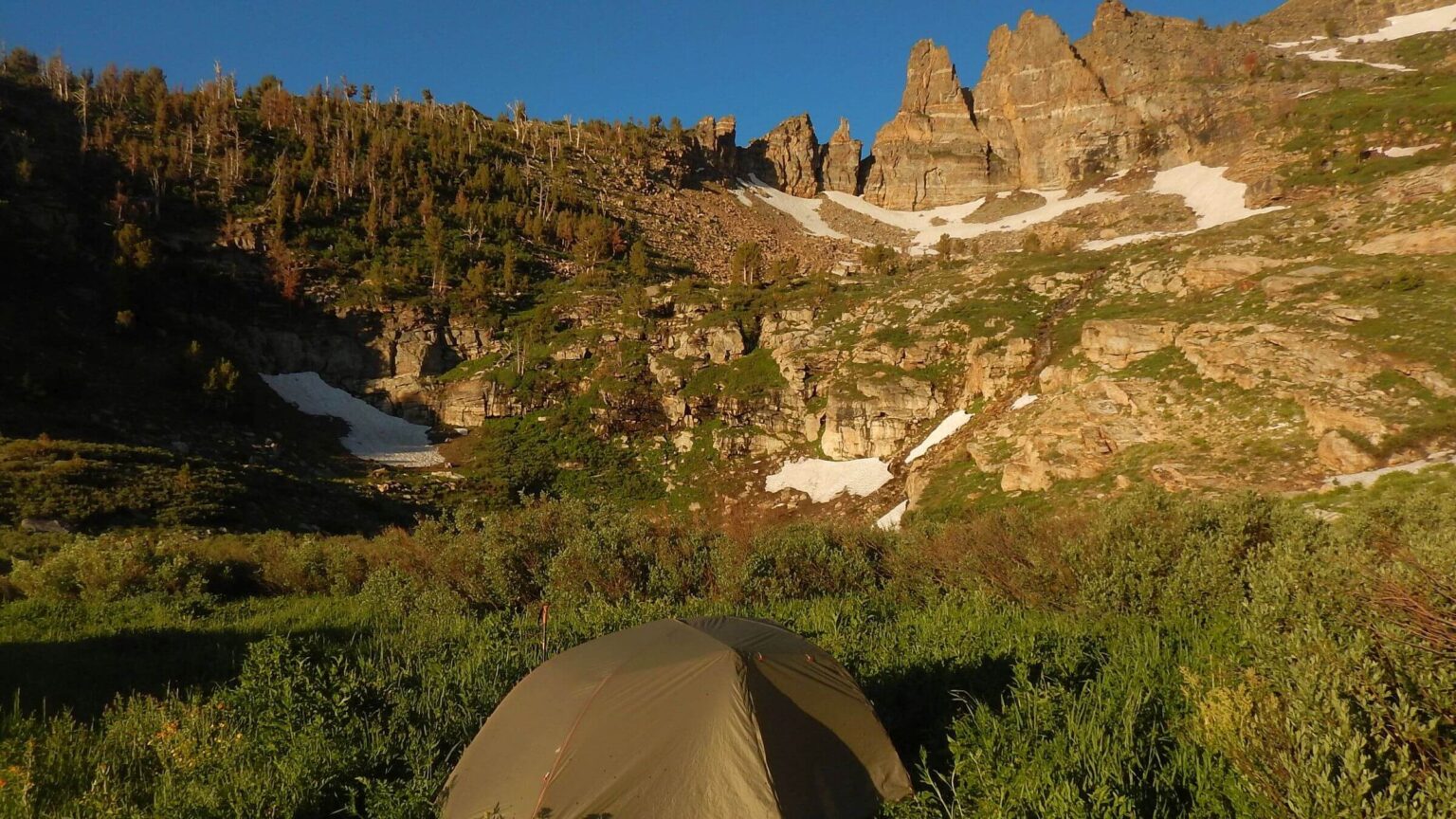
 East Humboldt: Morning sun at Winchell Lake camp (Day02)
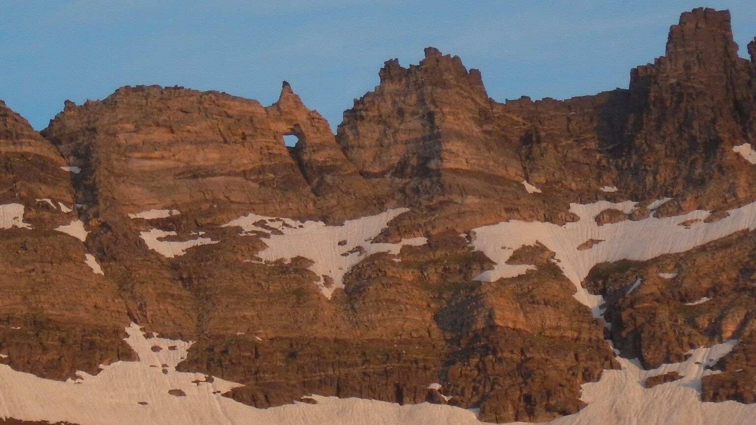 East Humboldt: Hole-in-the-Mountain or Lizzies Window (Day03)
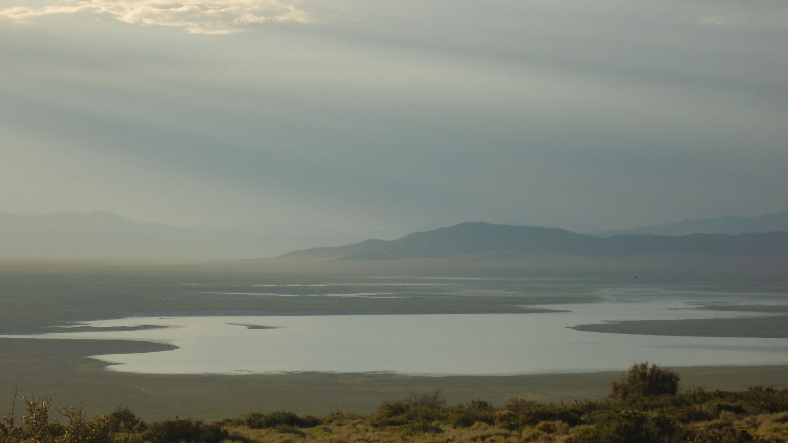 East Humboldt: Snow Water Lake, in valley below (Day04)
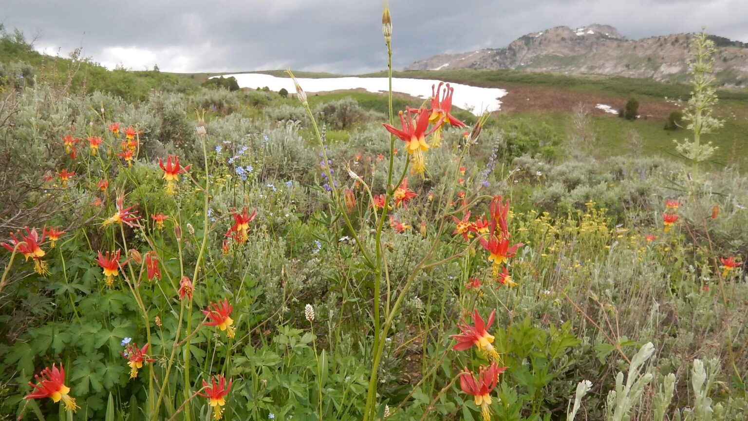 Ruby Mountains: crimson columbine (Day05)
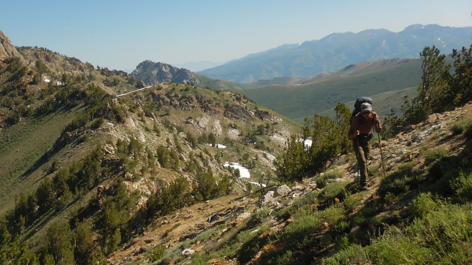 Ruby Mountains: crossing ridge into Middle Fork Cold Creek (Day06)
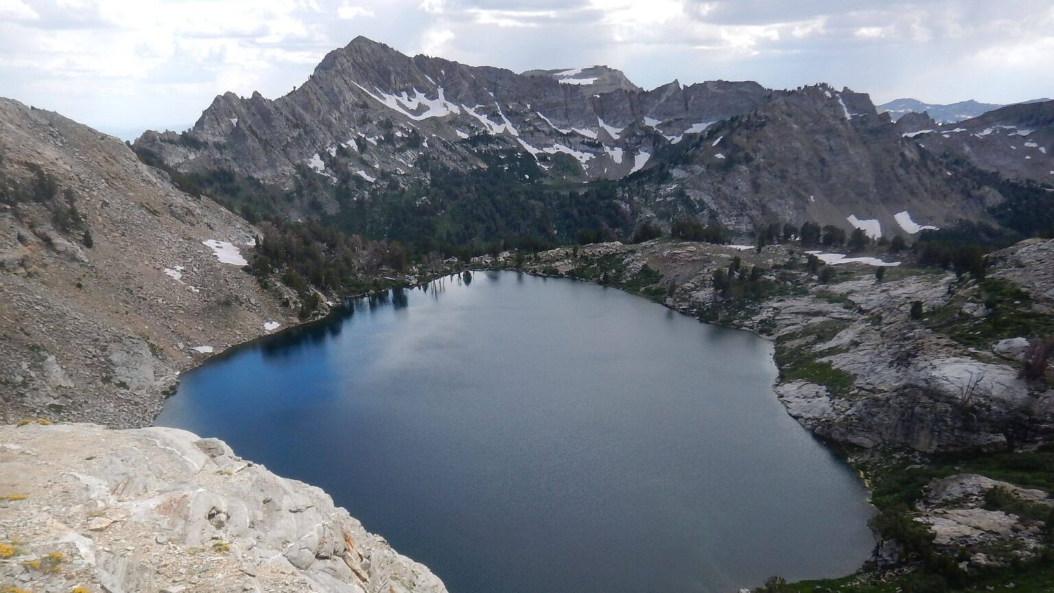 Ruby Mountains: Liberty Lake (Day09)
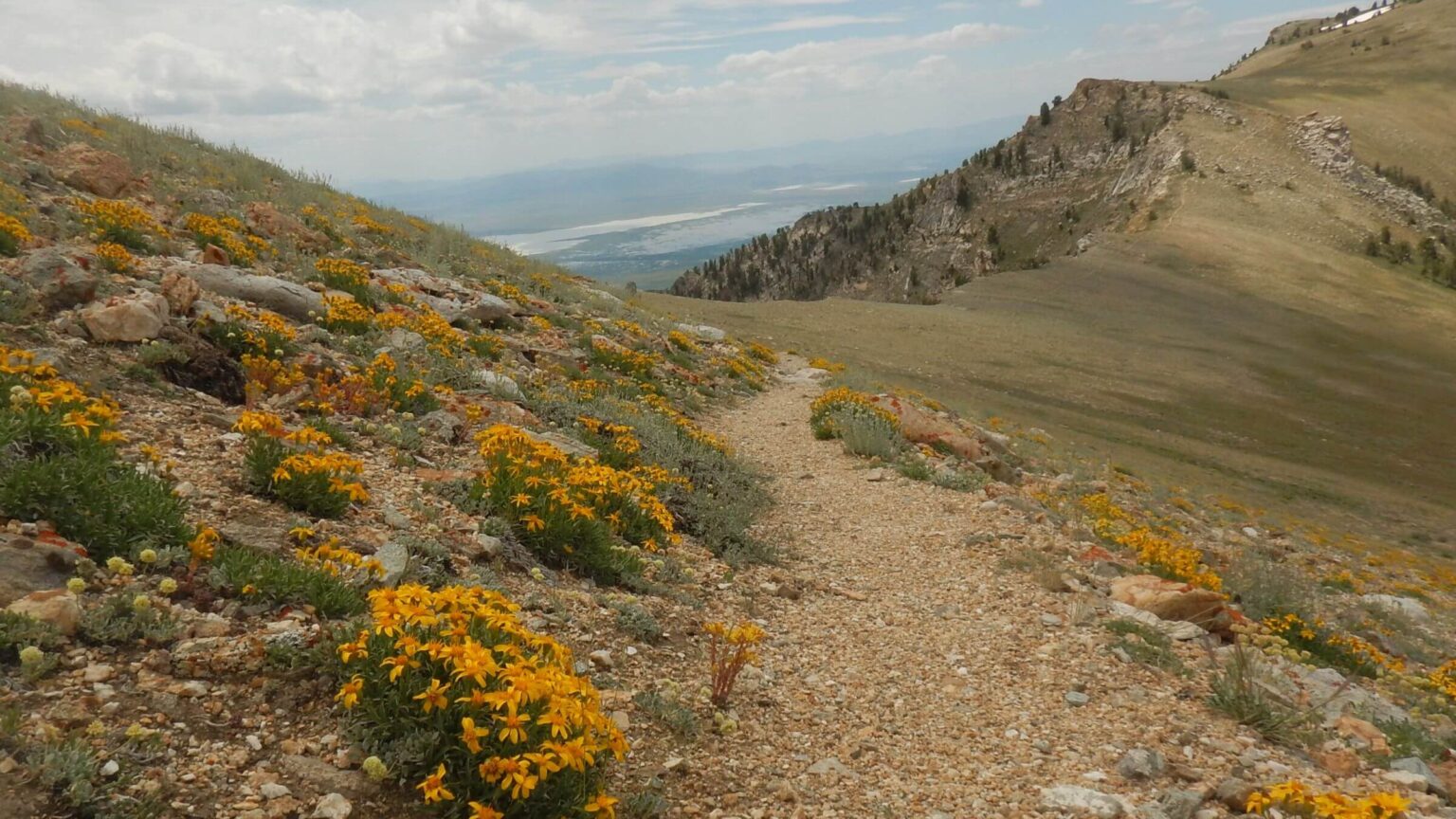 Ruby Mountains: groundsel species, Ruby Crest Trail (Day10)
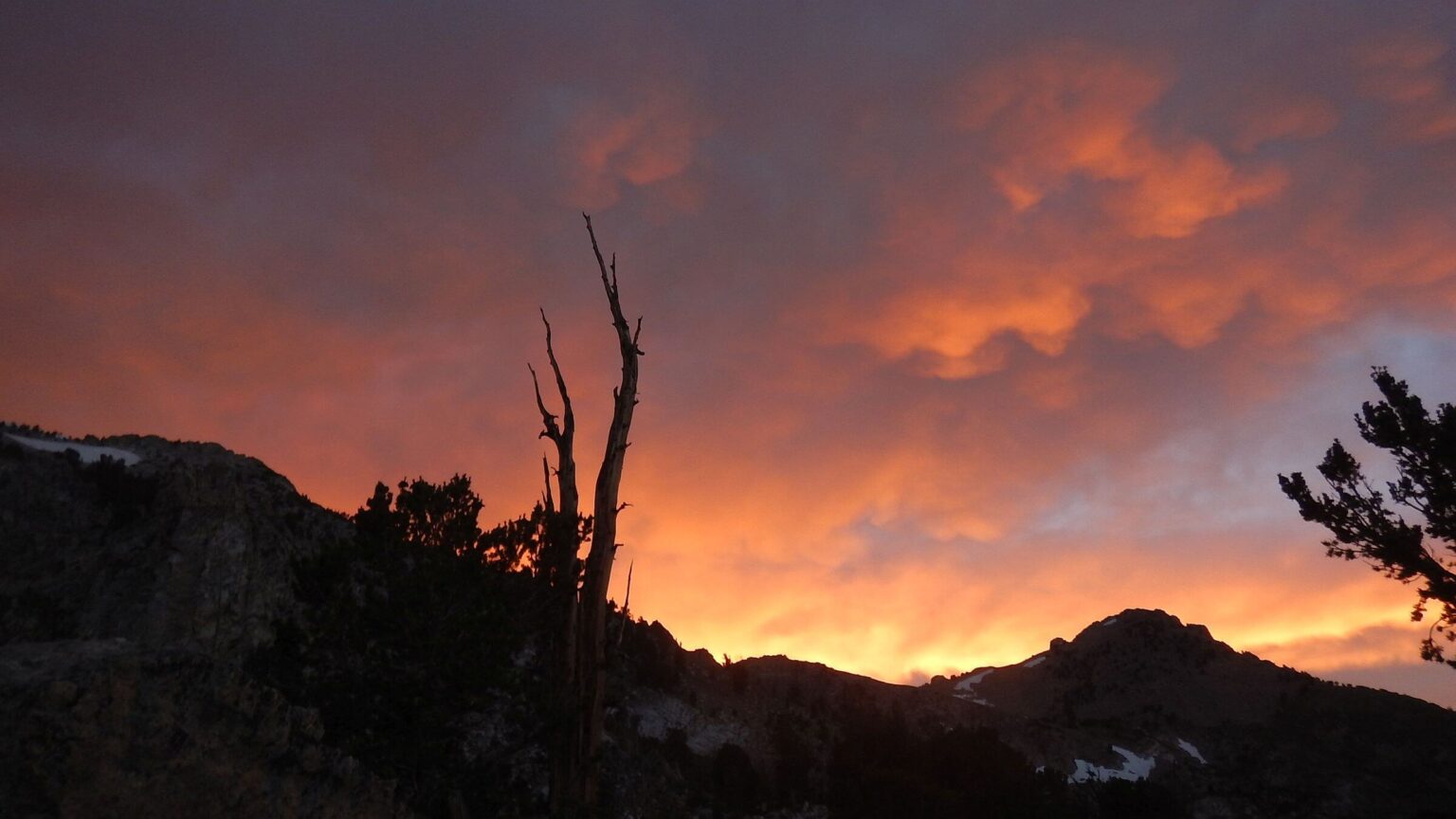 Ruby Mountains: sunset, Overland Lake (Day10)
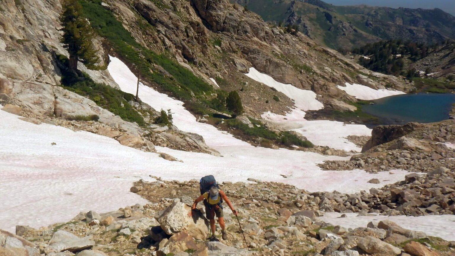 Ruby Mountains: tarn and pass above Overland Lake (Day11)
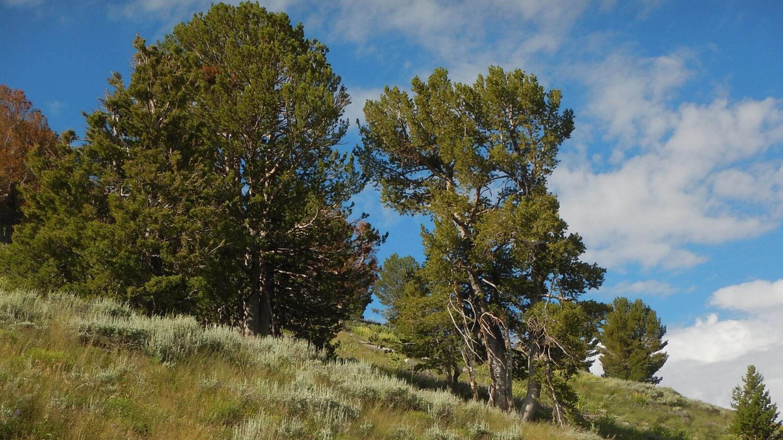 Ruby Mountains: whitebark pine thrive (Day12)
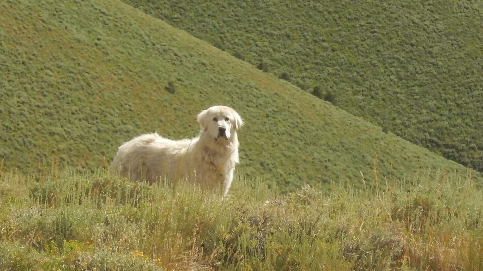 Toiyabe Crest: Great Pyrenees warning to avoid sheep (Day15)
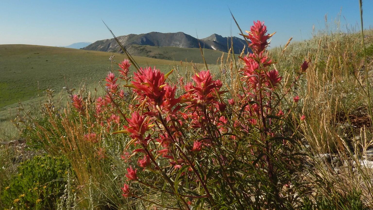 Toiyabe Crest: Indian paintbrush, much treeless ridge (Day16)
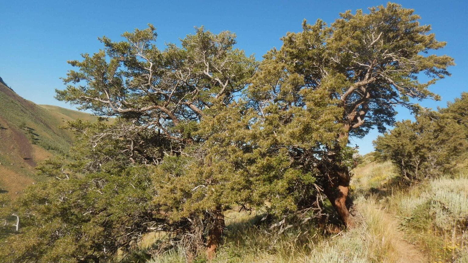 Toiyabe Crest: mountain mahogany abundant (Day17)
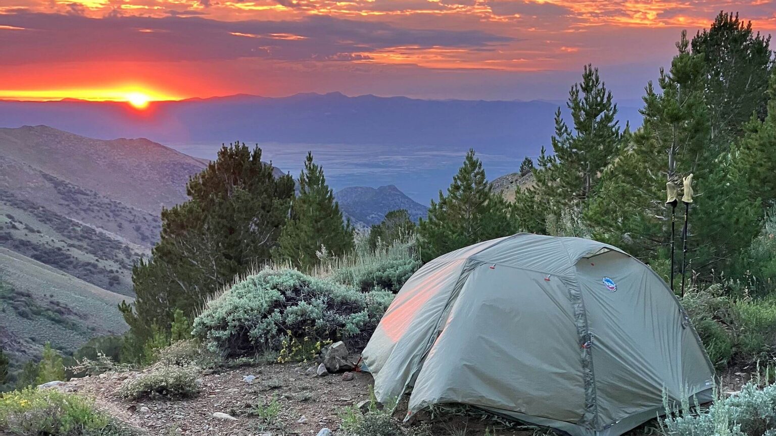 Toiyabe Crest: Ophir Pass camp, sunrise (Day19)
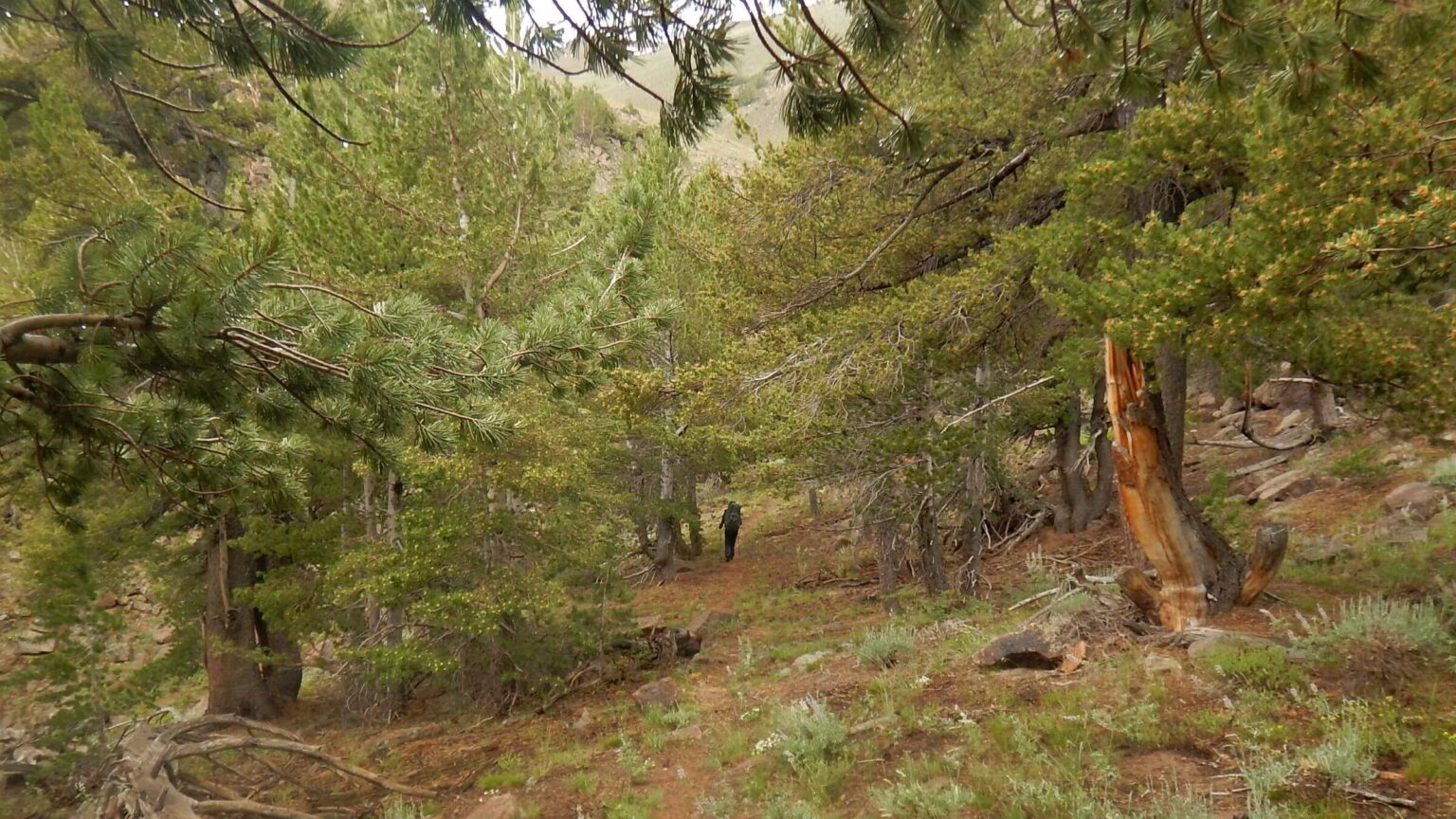 Arc Dome: occasional forested pockets (Day19)
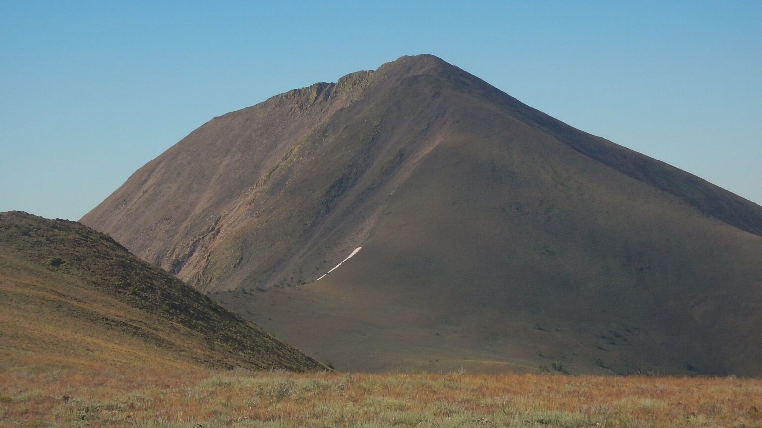 Arc Dome: 12,000-ft elevation peak (Day20)
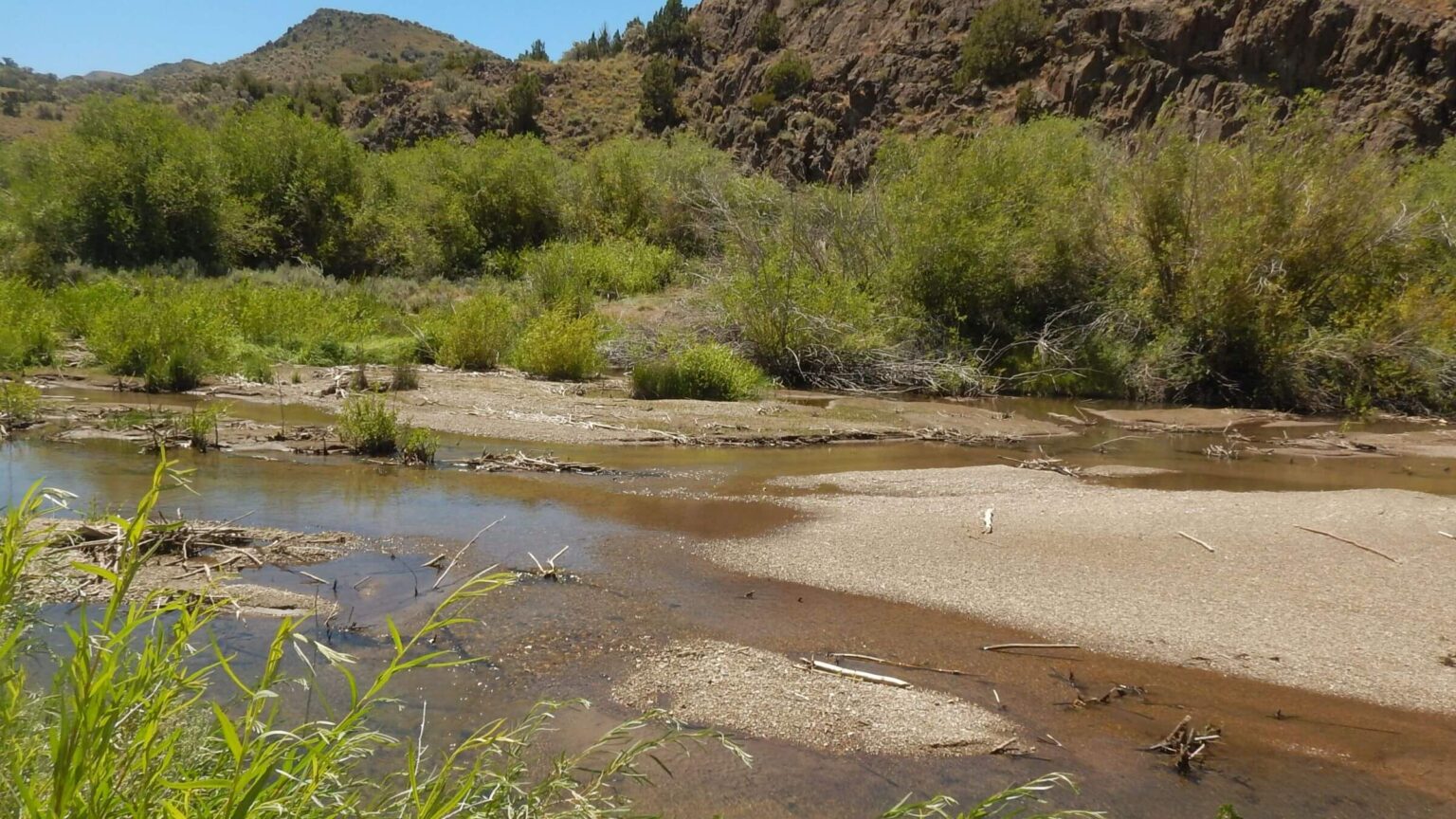 Arc Dome: Reese River (Day21)
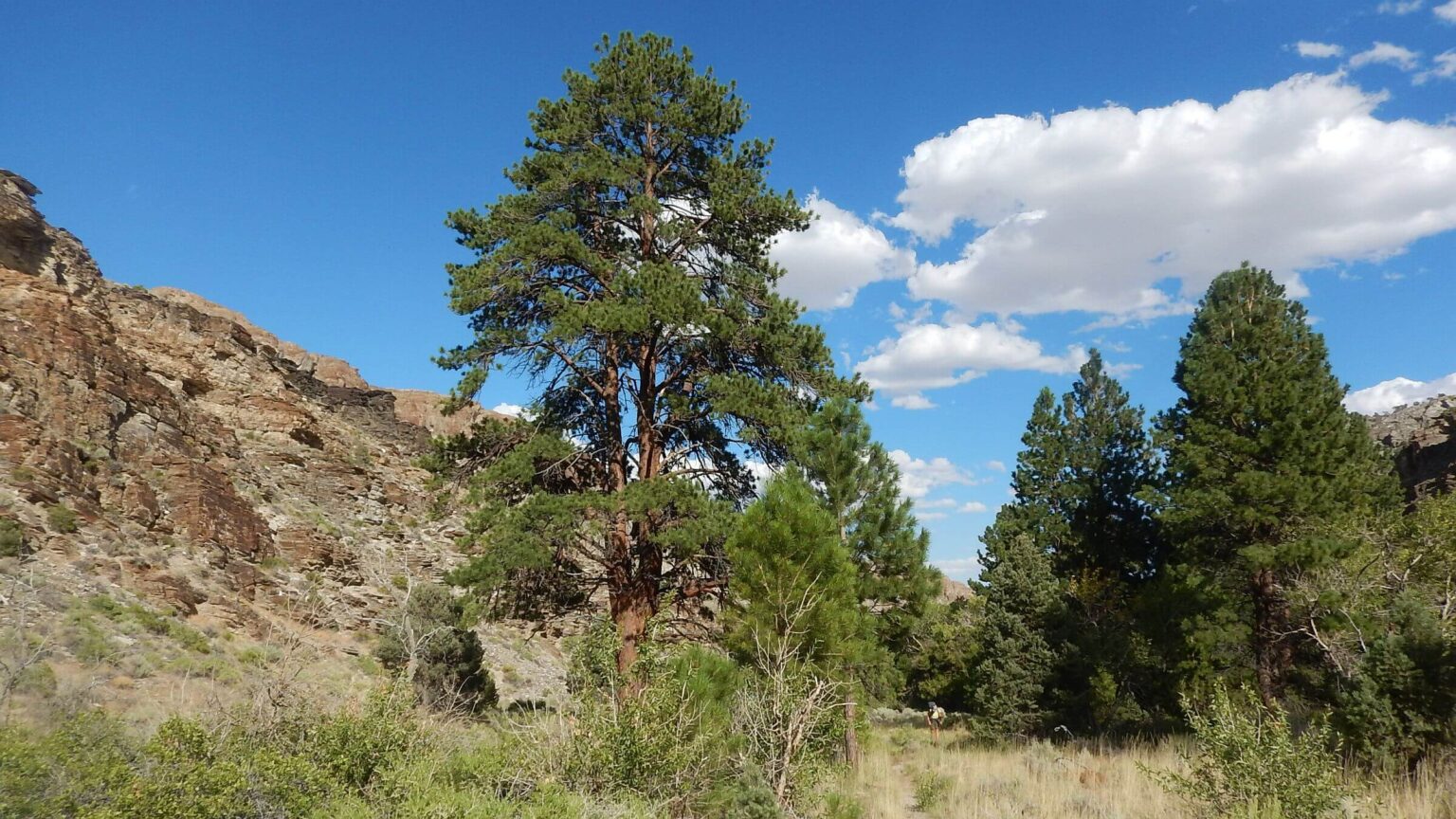 Mt. Moriah: ponderosa pine, Hendrys Creek (Day24)
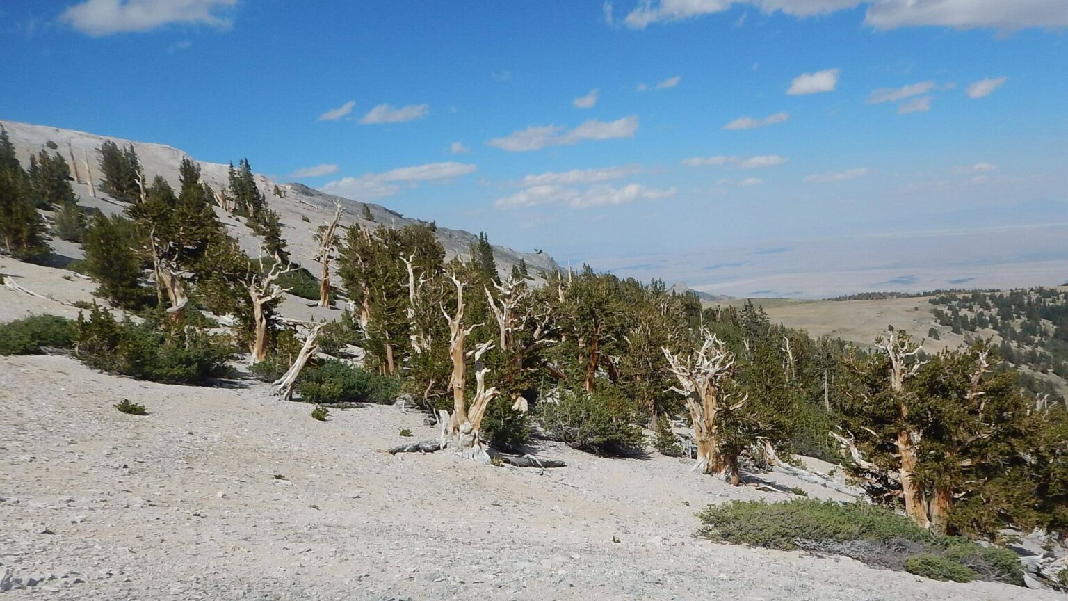 Mt. Moriah: ancient bristlecone pine, eastern flank (Day25)
Cattle Main Users Of Nevada Wilderness
Cattle ranching dominated landscapes around most mountains we visited in summer 2023 during “Basin and Range Trek” (BART) through four central Nevada mountain ranges rising to 11,000-feet elevation. We saw way more cattle—or signs of cattle—than hikers!
Cattle often hampered us camping or trail finding. But in some cases, they “helped!”
In East Humboldt Wilderness, cattle “cleared” several miles of unmaintained trail clogged with beautiful but almost impenetrable waist-to-chest-high snowbrush ceanothus. They were main users of the Winchell Trail from Lizzies Basin to Renshaw Creek.
In northern part of Ruby Mountain Wilderness, contouring cow routes from pass helped us skitter down steep slopes to a trail in Middle Fork Cold Creek basin. But on down Cold Creek we lost trail in spaghetti maze of cow trails and had to “herd” cows rushing ahead of us.
Along Toiyabe Crest Trail, cattle trashed streams, springs, and riparian areas, and covered most flat camping spaces with cowpies. Feral cow routes hid actual trail along Upper Reese River.
Ranchers/outfitters also dominate the Nevada shuttle business, catering fall hunter trips and summer transport for hunter scouting and hikers between hay harvests and other work. We found them friendly, knowledgeable, and expensive. Forest Service indicated prices were set by the outfitter’s organization, not the agency.
We had trouble getting rides in one area because of outfitter and guides association’s spat with a resort in the Northern Rubies. (More about this later!)
In Nevada, national forest wilderness supplies pastures for cattle and irrigation water for the green ranches on their boundaries. Many fenced private lands sport “no trespassing” signs, cutting off forest access.
One might conclude that main purpose of many Nevada wilderness areas is to support cattle ranching. “Visitor use and enjoyment” is at best an afterthought.
Nevada’s Well-Kept Secret
Mention “backpacking in Nevada,” and you may get rolled eyes and comments about barren desert. People often associate Nevada with hot empty landscapes from driving highways across the state. But Nevada is actually one of the most mountainous states in the Lower 48.BART is 203-mile traverse in four Nevada north-south mountain ranges in East Humboldt, Ruby Mountains, proposed Toiyabe Crest, Arc Dome, and Mt. Moriah wilderness. It highlighted higher-elevation portions of the 1090-mile Basin and Range Trail (BRT) loop in east-central Nevada pioneered by hiker Eric Poulin. We used shuttles to avoid long desert valley portions of BRT route.
Trek revisited favorite wilderness we hiked when living in Utah and one new area. Record-breaking winter snowfall delayed trip until mid-July. Route planning difficult because of poor information from public, private, and nonprofit sources.
Trails were fair-to-poor and nonexistent in places—East Humboldt was worst and our “plan B” route was mostly outside wilderness. Vegetative overgrowth was main problem. Cattle tromping “helped” keep trails open in some places but also ravaged potential riparian camping areas.
Solitude was high except near end-points of Ruby Crest Trail. Otherwise, we only met two other backpackers, a sheep herder, and two illegal dirt bikers, all on Toiyabe Crest Trail.
Warmer temperatures from climate change effects may have stimulated shrub growth since our last visits in 1980s and 1990s; we did not recall so much jungle. Fires not an issue but few trees (coupled with warmer temperatures) may have allowed heavy brush like that found in other western forests after severe fire.
Great Basin forests in central Nevada are quite different from other western forests, with no ponderosa pine or spruce-fir and little Douglas-fir—instead mostly sparse stands of curlleaf mountain mahogany, brushy aspen, limber and whitebark pines, and hardwoods in riparian areas. We hiked much treeless area through sagebrush or snowbrush ceanothus—beautiful white blooms but obstructing many trails. Mt. Moriah Wilderness on Utah border was more like Rocky Mountain woodlands: we found diverse forest on Hendrys Creek and exquisite bristlecone pine near Moriah.
Visit statistics: 26 days (including 6 nights at resupply stops), 203 miles hiking, at 1.8 mph, with 475 feet per mile of average elevation change. Roads between trailheads additional 528 miles.
Go to map below for more information on trailheads, daily routes, mileages, elevation changes, and photos. (Click on white box in upper-right corner to expand map and show legend with NAVIGATION INSTRUCTIONS.)
show more
Nevada boasts 300 narrow mountain ranges with 42 named peaks over 11,000 feet, including eight that rise almost 5,000 feet from surrounding valleys. Ten ranges are more than 60 miles long—our trek included three of these: 79-mile Ruby Mountains, 120-mile Toiyabe Range, and 60-mile Snake Range.
Most of this semiarid state is part of the Basin and Range Physiographic Province of southern Arizonia, western New Mexico, and Mexico. In the area we hiked, mountain waters do not flow into river systems but pond in lower valleys in permanent or seasonal lakes. Other than wildlife refuges, there seemed few downstream water users; large ranches around base of the mountains appeared to have “prior appropriation and beneficial use” under Nevada’s water law first passed in 1866.
I did not know I had moved to a mountain state when my family came to Las Vegas in 1965, located in barren Mojave Desert. When I first climbed Mt. Charleston, 40 miles northwest of Las Vegas and at nearly 12,000 feet highest peak in southern Nevada, I was shocked at drop of almost 8,000 feet from high ridge to valley below—fairly typical of Nevada ranges.
Nevada mountains intrigued us when we moved to northern Utah in 1979. In 1980 we hiked Crest Trail in the Ruby Mountains—known as Alps of Nevada—a ways past Overland Lake and back. We later did a loop trip around the Jarbidge Wilderness on Nevada-Idaho border.
We tried the East Humboldt mountains west of Wells in 1981. Starting from Angel Lake at road’s end, we followed trail, which forest map showed contouring on west side of range as far as Boulder Lake basin and terminating on a road to Secret Pass. Trail petered out after a few miles. We camped, then (I think) clambered over the ridge, and made our way back to lake road.
Our Forest Service work in late 80s and 90s involved many Nevada trips. David’s research on pinyon and juniper inventory led to Bureau of Land Management work in obscure Nevada ranges; some later became wilderness. As a legislative coordinator, I worked on the Nevada Wilderness Protection Act of 1989 that created 13 new wilderness areas including Ruby Mountains, East Humboldt, and Mt. Charleston.
I often went to the Nevada national forests (administratively combined into Humboldt-Toiyabe National Forest in 1995), driving lonely roads in shadow of soaring mountains. A map project provided excuse to hike Mt. Moriah and Santa Rosa wilderness. Hearing about pack trips on the 11,000-foot Toiyabe Crest Trail put that range high on my bucket list.
Past Time for a Revisit
I lobbied to revisit Nevada wilderness soon after we returned to the West (from Washington DC area) in 2016. We considered a Nevada wilderness revisit in 2020 but were deterred by COVID-19 from elaborate trip, and instead did single return trip to Jarbidge Wilderness.In late May 2023 we drove through Nevada (on migration from Arizona to Idaho) on scenic Highway 93, beneath snowy mountains along green valley celebrating wet winter. Nevada mountains got 200-300 percent snowpack in 2022-2023 winter; time was right to revisit the often-dry Nevada wilderness. David began planning a Nevada trek, but contacts cautioned against high country until late summer. We started in mid-July, hot for the lower country but fine up high (and often quite wet, as it turned out!).
David was inspired by the 1090-mile Basin and Range Trail (BRT) loop around northern Nevada but did not want to hike hundreds of miles of valley roads and non-wilderness (which is outside our wilderness mission). He talked to several ranchers/outfitters and lined up two shuttles for East Humboldt-Ruby Mountains and Toiyabe Crest trek sections. (Outfitters have permits for a given ranger district so could not offer transport between areas.)
He also planned three layovers and resupply stops: at a backcountry helicopter skiing lodge near north Ruby Mountains, and in towns of Eureka and Tonopah. Last visit to Mt. Moriah was reduced to short out-&-back instead of loop due to dismal report on trail damage from 2014 Hampton Fire.
We revisited three areas previously hiked and added Toiyabe Crest. Trek was planned in four sections between layovers. First section included East Humboldt Wilderness and northern part of Ruby Mountains Wilderness (North Ruby Mountains, hereafter), rest of Ruby Mountains Wilderness (Ruby Crest Trail), proposed Toiyabe Crest and Arc Dome wilderness (Toiyabe Crest Trail), and Mt. Moriah Wilderness.
East Humboldt Wilderness: foiled again
After losing trail on west side of this wilderness in 1981, we tried an eastside trail 42 years later.Our shuttle dropped us at Winchell Trailhead on Angel Lake Road. Map showed trail went as far as Steele Lake. Here we would cross ridge to Third Boulder Lake (encouraged by online post of anglers crossing ridge from west), hike through private land (with permission) to meet State Route 229, and hike across northern Ruby Mountains Wilderness to lodge near Lamoille. We tried to arrange a shuttle from lodge to next trailhead up Lamoille Canyon, but two outfitters (and lodge owner) were reluctant (we learned why later).
Forest Service’s new wilderness coordinator wasn’t sure of East Humboldt trails but had hiked first part of Winchell Trail and thought it was okay. It was at first. Nice kiosk and cleared trail. At 95 degrees, shady vegetation including sweet-smelling ceanothus was welcome. Four miles of steep switchbacks gained Winchell Lake for nice sunset.
Fair trail dropped out of the basin, but in next basin we found chest-high uncleared ceanothus—luxuriant after wet winter. We pushed through and wandered back and forth across basin on elk routes; finally saw what looked like decent trail on Renshaw Creek below us. A herd of cattle (perhaps feral or cattle drive, we saw none) had “cleared” trail between Renshaw and Lizzies Basin. Next 2 miles okay except for a thick aspen forest in one basin, where cattle ducked under branches and we had to climb over.
In Lizzies Basin we found a network of roads, tanks, solar panels, and fences, but no obvious trail out of the basin. We camped in a mountain mahogany grove cow toilet, filled up water in roaring Weeks Creek, and decided on plan B: leave wilderness, drop down to State Route 232, hike along edge of the range, and cross ridge south of East Humboldt Wilderness.
Slidy jeep road down to hot road through private ranch land was actually open to public but well-signed with warnings not to deviate. We talked to a couple ranchers along highway but no ride offers; one asked about our route and warned us creek ahead was dry (likely because he had already removed his cattle), though he did not mention his “no trespassing” signs just ahead. (David had good land ownership information from trip planning, so he easily connected ranchers with land ownership.) Paved road became dirt crossing checkerboard of public/private ownerships with “no trespassing” sign at each private entry. We were glad rancher (who warned of dry creek) didn’t try to stop us; often roads crossing private land to public land are technically open, but perhaps he had just signed his land to discourage visitors. Gordon Creek was indeed dry, but we found water higher up in cow-trampled verdant spring swale and camped among cowpies on a pretty bench dotted with netleaf hackberry and turbinella oak—which in the spring would have been lush with blue iris bloom (and full of bustling cows).
Next day, we deciphered jeep roads, passed more cattle on creeks, partially plugged our water filter from cow-silted stream, and climbed off road over the East Humboldt ridge; then dropped to tangle of jeep roads, more cows, cow-spoiled streams, and diversion ditches, with green expanse of Ruby Valley below us. We got to North Ruby Road, dreading the 5-mile roundabout hike ahead (we decided against direct route across hay and pasture fields and were glad later, as we observed more “no trespassing” signs).
North Ruby Mtns: Ranch Dogs End Road Hike
We passed a modest ranch house before Franklin River. Three large dogs chased a small car backing out of the driveway; they saw us and ran over. Driver stopped and started yelling at her dogs. She got out and talked with us; dogs became friendly. The Belgian Malinois licked my hand and Belgian shepherd offered me “fetching” rocks to toss.The owner was curious. Where were we headed? Did we want some water? Next thing we knew, dogs were locked in the ranch house and Tiffany was driving us to our trailhead! Her parents owned a huge cattle ranch in Spain; her husband (whom she met in the military overseas) and his uncle own most of the valley and run about 7,000 cows. She said Henry Krenka, a rancher/outfitter David had talked to, owned most of the other land. She was heading out to move a dead cow!
We found ourselves “herding” dozens of cattle up narrowly fenced Krenka Creek Road and making camp in heavily grazed area on creek; we got tent up just before some rain hit.
The 100 switchbacks climbing to ridge into North Ruby Mountains are maintained by rancher Krenka, who takes hunters and anglers into the area. More rain for a flower and bush hike to beautiful Hidden Lake, followed by mosquito camp at shallow Robinson Lake. Sign for North Fork Cold Creek Trail pointed to old route to pass; cowpies at 11,000 feet!
Krenka had warned North Fork trail not cleared, so we followed ridge to next basin for Middle Fork Cold Creek, where David had a GPS track. He had planned (from Google Earth imagery) to follow ridge for a ways before dropping down but I nixed that precipitous looking approach. Instead, we slipped and wound down steep slope into basin aided by cow paths and connecting to a washed-out, brushy but discernible trail. More cows at bottom; they herded down the trail and had spoiled the only decent camping spot on South Fork Cold Creek. We kicked aside cowpies and laid down a layer of California corn lily (skunk cabbage) under tent to avoid soiling tarp—and to stifle smell.
On 5-mile slog to Ruby 360 Lodge (for resupply and layover), cows made mud-manure bog of one creek crossing sandwiched between solid brush; David threw down some branches to skate across. We spotted 360 Lodge miles in distance and more or less followed roads and routes through rustling dry mule-ears foliage (yellow foliage carpet would have been amazing in spring!). Planning worked well to pick up our resupply box.
This formerly exclusively heli-skiing resort was in process of expanding to three-season offerings. David, distracted by complex trip planning (and resort’s not yet up-to-date website) did not realize full cost of ritzy summer weekends and four-course dinners that attracted locals, with cocktails and other extras being added to the already hefty pre-paid price tag (which was reason for guest-name identified tables).
Founder Joe Royer explained why outfitters would not give us a ride: his purchase of a key hunting area for a ski yurt was unsuccessfully opposed by local outfitters and relationships never fully reconciled, so they tend to avoid each other’s property and operations (e.g., hikers like us “crossing boundaries” did not fit).
But no worries. The 17-mile walk (on road) to Lamoille Canyon, our next trailhead, went by a historic church; we’d leave Sunday morning with enough time to hike 3.5 miles to arrive for church service and see what happened from there.
Ruby Crest: rain, flowers & folks
We left lodge on time Sunday morning, but 2 miles down road two lodge guests recognized us and offered a ride; plenty of time to stash our backpacks in a back room of the church and check out historic building and grounds. Just before service began, we were recognized again by a Friday night lodge guest—an avid hiker, she immediately offered us a ride to the trailhead! The congregation also provided a delicious potluck brunch; good thing, as there was no restaurant in town for our planned breakfast.We saw 50 cars at Lamoille Trailhead; many belonged to day hikers coming down and others camped at lakes around Liberty Pass. Rain hit on way down to Favre Lake (where we camped) and would plague us the next afternoon on Ruby Crest Trail, a long treeless ridge of peaks and saddles to next lake basin. We met two northbound guys; David and I were first people they saw. We also saw a couple ahead of us coming up from a side canyon but never caught them.
Rain ended as we descended ridge on contour trail clogged with flowering shrubs, passing below waterfalls, and climbing steeply to Overland Lake, finishing 15.6-mile (don’t believe lower map mileage) ridge-run at sunset. Brisk wind kept gnats and mosquitoes at bay. In early morning I heard footsteps; maybe mystery couple returning from a camp at higher lake?
Snowdrifts below the pass; we waited for three women to mince down—cautious in spite of crampons. We met more backpackers plodding up long shrub-covered switchbacks from North Fork Smith Creek; total of 14 including the snow crossers. I guess they all decided to start Ruby Crest Trail the last week of July. After brushy hike down North Fork and around Middle Fork into South Fork Smith Creek, our aspen camp was visited at 7 p.m. by 40-something guy, three girls, and male teen. They had one-day delay when the other adult got sick, so Dad hoped to finish 28.7-mile trek the next day! We said maybe not and suggested camps at Overland and lake basins before Lamoille. Family had not stirred from tents on overcast morning when we left camp.
After steep shrubby scramble to ridge and up and down through burned basin, trail mellowed. We met a gung-ho couple; she said they were making great time and would get to Overland Lake that evening! All the people we met took two days for this shrubby section with 4000+ ft elevation change; we only went 6.1 miles previous day.
We also sped up on the next mostly road section to easily finish 11.4 miles by afternoon, but I disliked steep roller coaster hills past Green Mountain Trailhead. Road not closed but rough; it appeared that everyone had hiked from Harrison Pass.
Toiyabe Crest: stock, machines & rain
Illegal vehicles, sheep, and cows were main players on first leg of 11,000-foot Toiyabe Crest Trail through proposed wilderness; heavy rain and poor or water-damaged trails dominated the second through Arc Dome Wilderness.We parked our vehicle and met friendly outfitter Nick at South Twin Trailhead, far end of crest trail. He dropped us at north end Kingston Trailhead. Trail obscure in tall grass through a marsh; maybe we were lucky that (illegal) motorcycles had forged a path. We climbed along Grove Lake noting boaters and weekend campers; then long switchbacks to ridges and peaks dressed in sage and flowers of purple and blue, some conifer groves, and views of a great salt flat.
Barks from a border collie and a Great Pyrenees guard dog made us move quickly past band of sheep loitering on nearby hillside. On up we dropped packs at a possible flat spot on ridge to camp, noting along the way two animals grazing below. Scrambling up ridge for possible better site, we observed herder’s tent in little basin above with snowdrift (probably best site but we did not wish to barge in). Later, while we ate dinner, he quietly passed us riding a horse with mule trailing. Dogs accompanied; now friendly, the Great Pyrenees stopped by and gave me (or my takeout sandwich) a sniff. I waved at the herder and he waved back.
Cows and machines would dominate next two days—I got briefly confused on intersecting ATV routes; at breakfast on Washington Creek, dirt bikes passed us. (Later learned from ranger he is trying to stop illegal vehicles on this national recreation trail.) Cows had damaged most creeks and wet meadows. We camped both nights among cowpies, along a creek drainage in aspen forest and on a saddle, where big sagebrush provided some shelter from wind and brush clippings reduced aroma under our tent.
Cold icy rain and hail hit us on steep march up and down ridges toward Arc Dome Wilderness boundary. It finally quit at Ophir Pass, the Arc Dome Wilderness trailhead. With no shelter on barren ridge ahead, we dropped down Ophir Road and made camp in a pine grove on an old mining side road. Clouds gave glorious sunrise but were pelting us with rain by late morning.
Trail contoured around big peaks then made slidy drop to a junction. Many tracks here indicated main wilderness users were probably day hikers to Arc Dome from Stewart Creek. After dropping into North Twin Creek basin (where marked shortcut trail departed) we climbed steeply to high plateau. Big manure piles indicated wild horses marking territory. At Arc Dome turnoff (destination for next day), we briefly headed wrong way (toward Dome) because wind had turned the sign around!
We turned back to descend steep jeep road to Sawmill meadow, only area water source. Green meadow was dotted with horse, wild sheep, and cow manure. After filling up at creek, we set up tent—just in time for three thunderstorms lasting almost two hours. When they finally cleared, we got sleeping bags out of our packs, set them up, crawled in, and skipped dinner for the night.
Clear windy day for 8-mile round trip to Arc Dome. Last mile to Dome, steep 1000-foot pitch, but well-built trail after long 3.5-mi climb/drop on ridge. Register had 20 signatures for June-July, confirming theory of popular day hike.
We regained our packs and headed down Sawmill Creek Trail, which deteriorated quickly. We lost it crossing side canyons through brush thickets. After crawling through willow jungle to cross Sawmill twice, we pretty much lost trail and followed wildlife paths. I thought I saw it on other side so we crossed again. David carried my pack across and was knocked back into the creek by willows! We had planned to camp in a nice forested flat farther down, but with such slow going, stopped for camp in a sagebrush opening.
Next day we met two northbound backpackers. They confirmed we were on the trail, which would improve in next mile. An outfitter had cleared it from a hunter camp in aspen (our planned destination for previous night spotted from Google Earth imagery) to junction with Reese River. Good trail on river, except in upper basin where spaghetti cow trails obliterated real one. (Basin overrun by feral cows, we later learned from the ranger.) We camped near Sheep Canyon creek.
To start final day of this leg, we followed most logical cow paths for a while, then bushwhacked up through sage to find trail on hillside as shown on GPS map. After a pass it descended into a large basin (which once had a ranger station according to the map!); trail was fair except for high sage, grass, and flowers.
Then we got to steep narrow cliffy area and trail was gone! Avalanche or spring flooding from heavy snows had destroyed it. We struggled through washouts, clawed through brush, and sloshed down creek running on trail. Farther down it became road and improved—only I took the wrong route (down) when road split and was turned around by David, who had the GPS map, yelling behind me. The right route contoured to high point and long switchbacks down to South Twin Trailhead. From high point, we saw our vehicle and one for the northbound duo.
Mt. Moriah: good trail, trees & peak
Hendrys Creek on eastside of Mt. Moriah Wilderness, accessed by confusing swirl of backroads and offering barren trailhead with obscure sign, was a highlight of the entire Basin and Range Trek! About a mile up the gray shaley canyon—dotted with saltbrush, rabbitbrush, and sagebrush, and looking like barren desert—we encountered first large ponderosa pine. Soon we were in beautiful forest of pine and pinyon-juniper, then adding Douglas-fir, limber pine, white fir, and lush riparian species on the creek. Above were cliffy canyon walls much like southern Utah, except the rock was gray instead of red-orange.Trail crossed creek many times; I plunged in with trail sandals and wool socks while David challenged himself skipping rocks. Few flat areas along slowly climbing road, but we found a nook above creek in scruffy Douglas-fir, spruce, ponderosa pine, and aspen.
Mt. Moriah Wilderness is in the Snake Range near the Utah border (south end is Great Basin National Park with 13,000-foot Wheeler Peak). It is different from the other Nevada mountain ranges visited, more similar to other Rocky Mountain coniferous forests. The trail, an old jeep road, was good except for a few downed trees and erosion at upper end of the basin. Also, a good place for large birds: I flushed two flocks of chukar partridge and a grouse.
Next day we dropped backpacks at campsite in aspen grove and hiked to Mt. Moriah. Trail up creek and across basins was fair to the high flat we had visited in 1991. Before the ridgeline, I met two bull elk—one large and one small—who quickly slipped away. On top we followed stone cairns across Boulder Trail, then turned up flank of the mountain. We followed good contour trail to a saddle. A thin route crawled up and down around Mt. Moriah for scramble up scree to the top. We found large notebook left by a Latter-Day Saints (LDS) Boy Scout troop in 2010 for the “Schell Range 50 miler.” Some Boy Scout troops do 50-mile continuous trek for a badge; this one included Mt. Moriah! Three other groups had signed book this summer. Original Mt. Moriah in Old City Jerusalem is mentioned in the Bible; several LDS scouts wrote about spiritual experiences.
Scary contour easier going back, and we made record time trotting down trail to camp ending with headlamps. Because we camped by creek with existing fire circle, we made a nice fire—only second time in the trip—as we had wood and ample water for extinguishing.
Next morning, encouraged by our day hike pace, I raced down 7.5-mi trail at 2.5 mph—fastest day of entire trip. A very encouraging ending to our 203-mile 26-day (22 days hiking) Nevada BART.
show less
Google Map
(Click upper-right box above map to “view larger map” and see legend including NAVIGATION INSTRUCTIONS; expand/contract legend by clicking right arrow down/up.)
Downloads
Links
- Friends of Nevada Wilderness: Nevada’s designated wilderness and other wild areas
- Basin and Range Trail (BRT)
- Ruby Mountains and East Humboldt lakes (difficult but much good information)
- Ruby Crest Trail