Hiking the Tucson Skyline: 3 times are charm
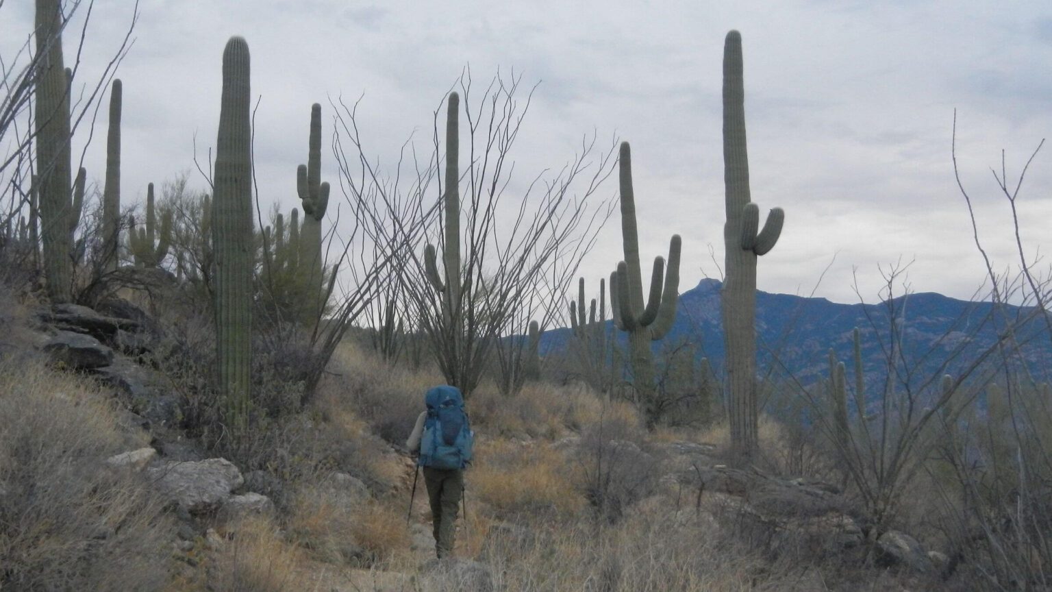
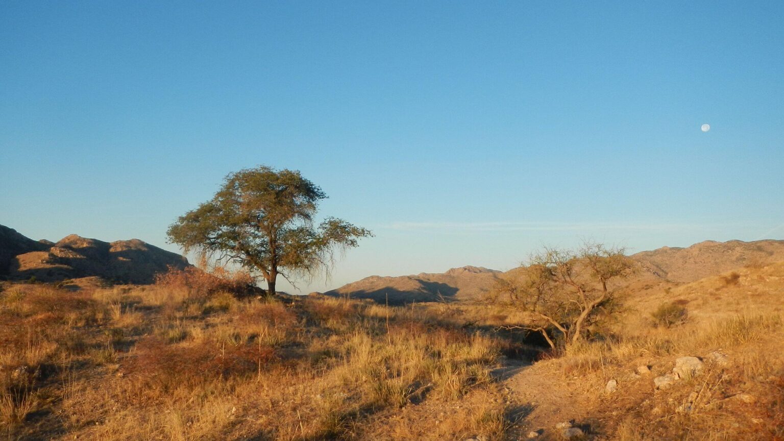
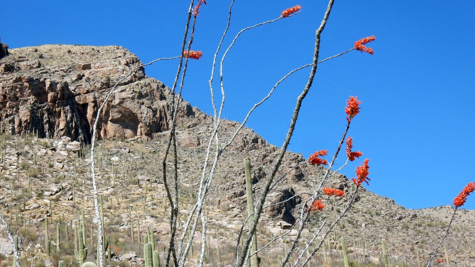
The Santa Catalina and Rincon mountains north and east of Tucson have loomed large in our lives since student days at the University of Arizona in the 1970s. This narrative begins with most recent December 2024 trek through Saguaro, Rincon, and Pusch Ridge wilderness areas within Saguaro National Park and Coronado National Forest.
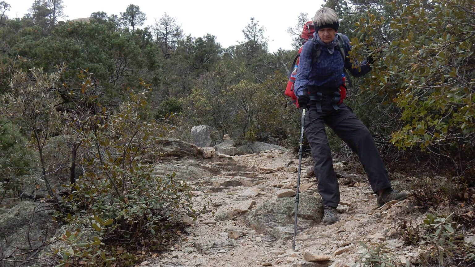
This was our third trek across the two ranges. Our first in 1975 (see below) scampered over and down about 39,000 cumulative feet of elevation gain and loss in only four days aided by excellent trails, youthful bodies, and 17 miles road hitchhiking, and despite snow and a cross-country ridge descent. A 2016 trek (also below) took 10 days due to damaged trails, spring storm, and extra loop to meet Park Service campsite requirements.
The December 2024 trek would reverse earlier trips, starting in Rincons and ending in Pima Canyon so we could take a “zero day” with two nights in Summerhaven towards end of trip.
We wanted to revisit most of 1975 and 2016 treks, get “off the grid” after turbulent 2024 Presidential election, backpack in drought using nearby roads and trails for water drops, and commemorate our first Rincon backpack trip 50 years ago with the late Richard Pekny.
We placed water and/or food by:
- hiking up Miller Canyon in Rincons to backcountry Happy Valley Campground (for Camps1&2), also left food in bear-proof campsite locker),
- driving rugged Reddington Pass Road where AZT crosses to stash water and food in AZT locker (for Camp4), although AZT lockers were amply filled with hiker water,
- hiking just past Gordon Hirabayashi Campground to put water off AZT (for Camp5),
- leaving water off Catalina Highway near Box Camp Trailhead (to minimize packing extra water up that steep trail),
- dropping resupply box in Summerhaven (food for rest of trip) at Mt Lemmon General Store in store—AZT friendly store that accommodates thru-hikers, and
- hiking up Finger Rock Canyon to Pima Canyon junction in the Catalinas (for Camp9).
We got to each campsite/stash as planned (with nothing disturbed); we scattered Richard’s ashes at sites shared in the 70s; and camped in quiet without distracting news. We also had several surprises on this trek—most pleasant but some slightly disastrous.
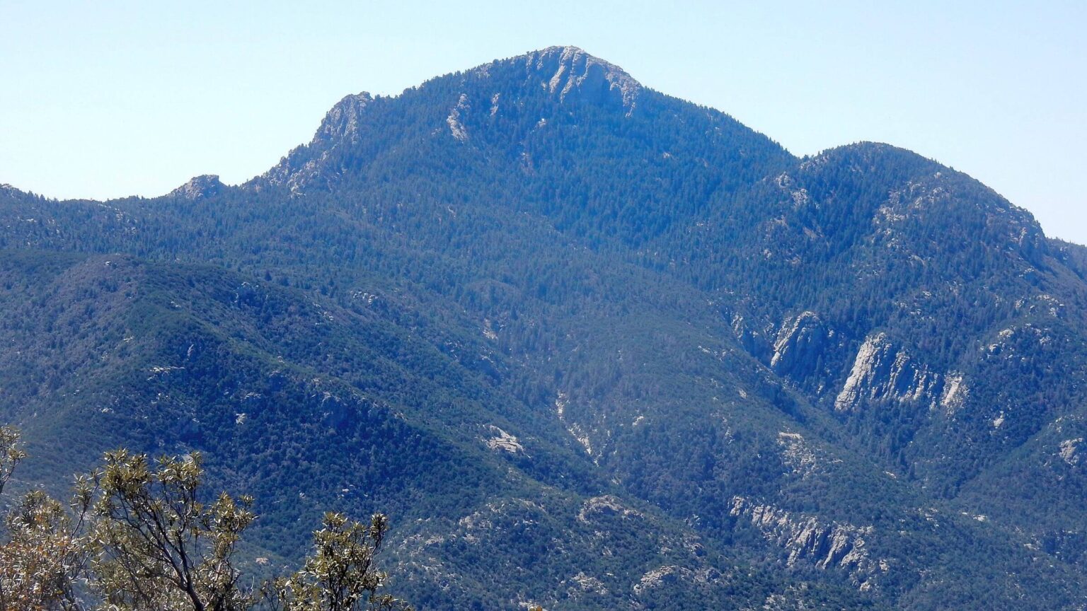
The trek traversed two ranges at the northeast corner of Tucson: the Santa Catalina (Catalinas) and Rincon (Rincons) mountains. Trek was first conceived in 1975 as University of Arizona (UA) students. Most of the area is now wilderness: Pusch Ridge and Rincon Mountain wilderness are managed by the Forest Service, and Saguaro Wilderness is managed by the National Park Service (Park Service).
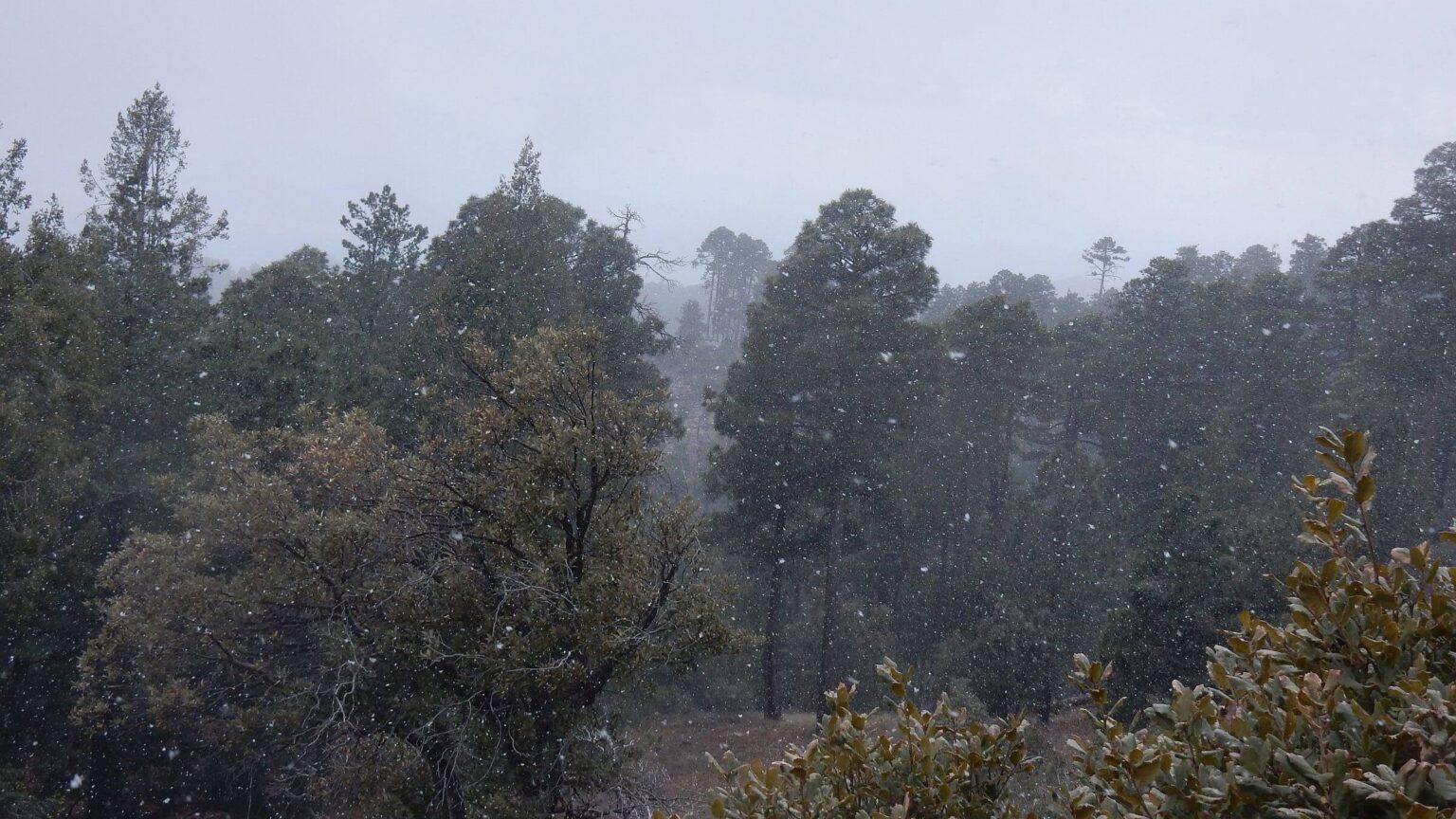
Original 4-day trek in January 1975 was challenged by short days and snow but the trails were great. We covered more than 20 miles first day but one person got hypothermia so we camped early in snow, short of planned Summerhaven destination for steak dinner. Next morning in Summerhaven, all but David and I decided to call for ride back to Tucson. Having lost some time, we shortened the trek by hitching some of Santa Catalina highway and a ranch road to finish in time for spring semester class registration.
Arizona Trail (AZT) now links the Catalinas and Rincons and replaced our 1975 cross-country route between the two ranges. It also added length to trek.
In 2016, we encountered snow and sleet and, later, hot weather, while much trail damage from the 2003 Aspen Fire slowed our pace across the Catalinas. Trails in the Rincons were still good but we had to negotiate Park Service policies to use legal campsites, adding to the trip’s length. We used non-wilderness alternative AZT between mountain ranges (heavily worn by mountain bikes) to follow our original route more closely.
In 2024, we redid trek in reverse, enjoyed recently improved trails, stayed in wilderness as much as possible (did use AZT alternative), and took advantage of hiker friendly Summerhaven for a “zero day.” Also southern Arizona was in severe drought in 2024, so we made 5 water drops along route (see left in narrative for details). Only Manning Camp and Lemmon Creek had reliable water.
Visit statistics for 2024 trek: 10 days, 105 miles, at 1.8 mph, and 550-feet per mile average elevation change. Visit statistics for 2016 trek: 10 days, 114 miles, and 575-feet per mile average elevation change.
Go to map below for more information on trailheads, daily routes, mileages, elevation changes, photos, and fire map. (Click on white box in upper-right corner to expand map and show legend with NAVIGATION INSTRUCTIONS.)
show more
Catalinas & Rincons 50 years ago
We have a long history with these sky islands near Tucson.As a freshman in 1973, I was walking into the Student Union when some flirtatious guys at a table for the UA Ramblers Hiking Club talked me into attending a club meeting to discuss hikes. My first “Ramblers hike” was an August Saturday: 18-mile round trip to Cathedral Rock in the Santa Catalinas. I chickened out on final assault while Jeff and Annie scrambled up a chimney. Jeff thought we could refill water bottles at Bridal Veil Falls on return but falls were dry. I still recall my dry throat in 90-degree desert hiking into sunset.
Many Catalina hikes followed; I loved to look up at the skyline from campus and think: “I was up there.” Trails were good, designed for stock. I once met the district ranger at Sabino Canyon—he told me had just ridden the Pusch Ridge crest trail on horseback.
Next year, November 1974, was my first hike in the Rincons and first backpack trip with future husband David—a trip that made him infamous in Rambler lore. By now, weekend hikes with Ramblers were key part of my life. (My mother claimed I was majoring in hiking, not journalism). Ramblers discussed hikes and planned new ones at a midweek meeting.
At one such meeting, Richard and I proposed a backpacking trip to the Rincons (later to be named Saguaro Wilderness). We’d hike up Miller Canyon, climb Rincon Peak, camp at Happy Valley, hike to Mica Mountain and return to our vehicle on Turkey Creek Trail. Steve could only do 2 days of our 3-day trip. He would take a trail from Reddington Pass and meet us on Mica Mountain.
A new guy, David, John-Denver lookalike, said he’d go with Steve. He asked, “Do you need to bring water?” Whoa! In Arizona? What kind of newbie was coming on our hike?
Richard and I did the Rincon summit and campout without incident. Next day near Mica Mountain I ran into David. Behind him was Steve, looking wide-eyed. “This guy hikes faster uphill!” he gasped. Turns out David spent the summer working for the Forest Service in Idaho, hiking every day. He asked the water question because in those days you just dipped your Sierra cup in the stream in the Idaho mountains he worked in! (That was before climate change related drought, giardia, and need to filter all drinking water).
In early January 1975, Richard led attempted trek across the Santa Catalinas and Rincons. We left David’s Mustang on a back road southwest of the Rincons. In predawn dark we hiked up Pima Canyon, aiming to cross 25-mile range in a day with a steak dinner at Summerhaven near top of Mount Lemmon (now there are no evening restaurants, although there was a bar and grill there in 1975) then somehow make our way to the Rincons.
After 20-mile day that ended slogging snow in Wilderness of Rocks, we camped when one friend got hypothermia. Richard, wearing old Army boots, lost the soles. In Summerhaven, Richard called his brother for a ride a home. Two went with him.
David and I kept going, catching rides for 13 miles on the highway and 5 miles on ranch roads to make up time. We finished the 75-mile trip after dark on the fourth day on southwest side of the Rincons. (To our chagrin we ended up lost on the doorstep of X-9 Ranch, which had closed trails to the public after conflict with users. The mustachioed rancher gave us a lecture but then took us to David’s car—that he had wondered about!)
2024 return: full of surprises!
A friend dropped us off at Loma Alta to start our first 18-mile day by headlamp. As usual I groused about the extra distance circumnavigating X-9 Ranch. Madrona Trail through private land once was main access to Rincons and still used by Park Service. Since a rancher closed public access and left area closed when he sold land for a subdivision, one has to hike big circle on Quilter Trails drop into closed Madrona Ranger Station before going up Rincon Creek (David found a several mile shortcut route but most was cross-country and we were dubious taking it in the dark).I just assumed the owners of big houses below us in the X-9 subdivision did not hike but zealously guarded their free national park access. But when we turned up the Rincon Creek Trail, we met a couple our age busily lopping off brush blocking the trail. They moved here a few years ago and since they hike the trail “we thought we should give back.”
More pleasant surprises as we got to Happy Valley campsite right at sunset: undisturbed food and water in bear-proof locker and no one else there. Surprised again next morning on top of Rincon Peak when a young Swiss guy “Andy” joined us, having hiked 8 miles from Miller Ranch in the time we did 3.5-miles from Happy Valley!
Back down peak near Happy Valley, we met 2 young women from X-9 subdivision who’d hiked over 8 miles from a house and hoped to top Rincon. It was 1:30 p.m. and with 3 miles to Rincon, the 11+ back would mean finishing at dark. Hope they had headlamps. We half expected them to visit our camp and ask for help or lodging!
Another surprise encounter next chilly morning climbing from the saddle—passed by a trail runner up from Miller Canyon. On way to closed Happy Valley lookout, I met him on his way down. David also met backpackers at Devil’s Bathtub (usually running but dry); I had ducked into a sheltered nook below trail to cook breakfast out of the wind. They were returning from Manning Camp, our destination. So we had camp all to ourselves.
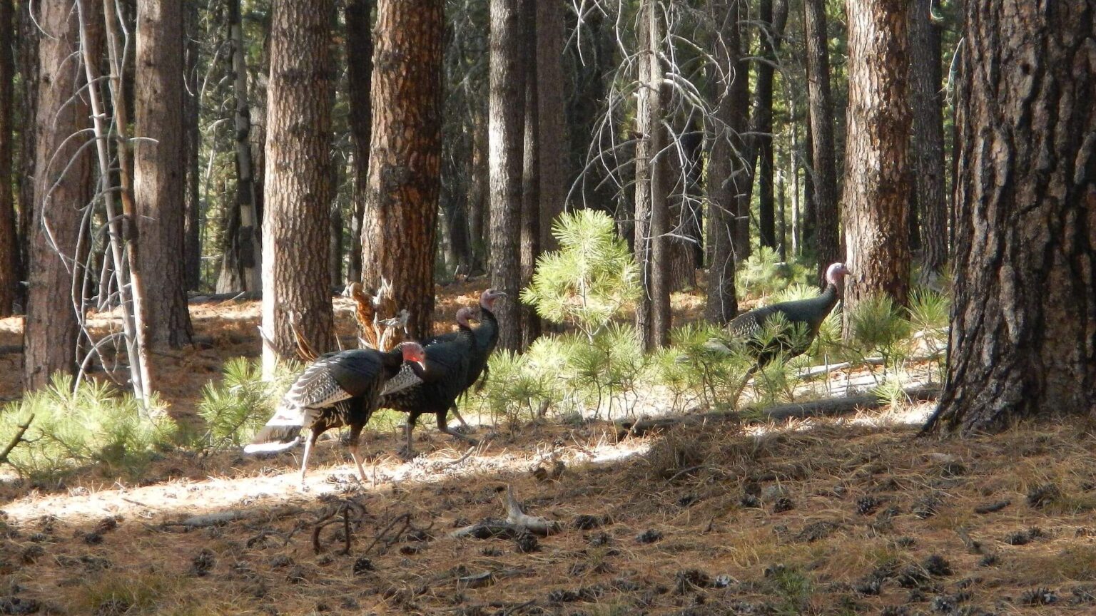
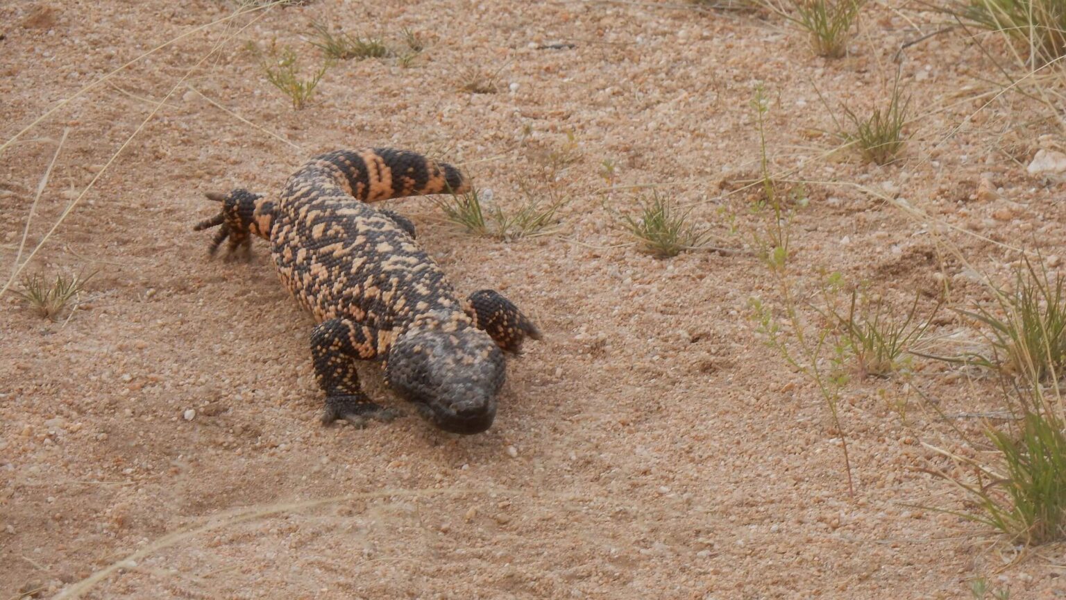
Final pleasant surprises involved wildlife moments—a whitetail buck making his way back from the spring and later three large turkeys near Manning buildings. (This base for summer Park Service field work was buttoned up for winter).
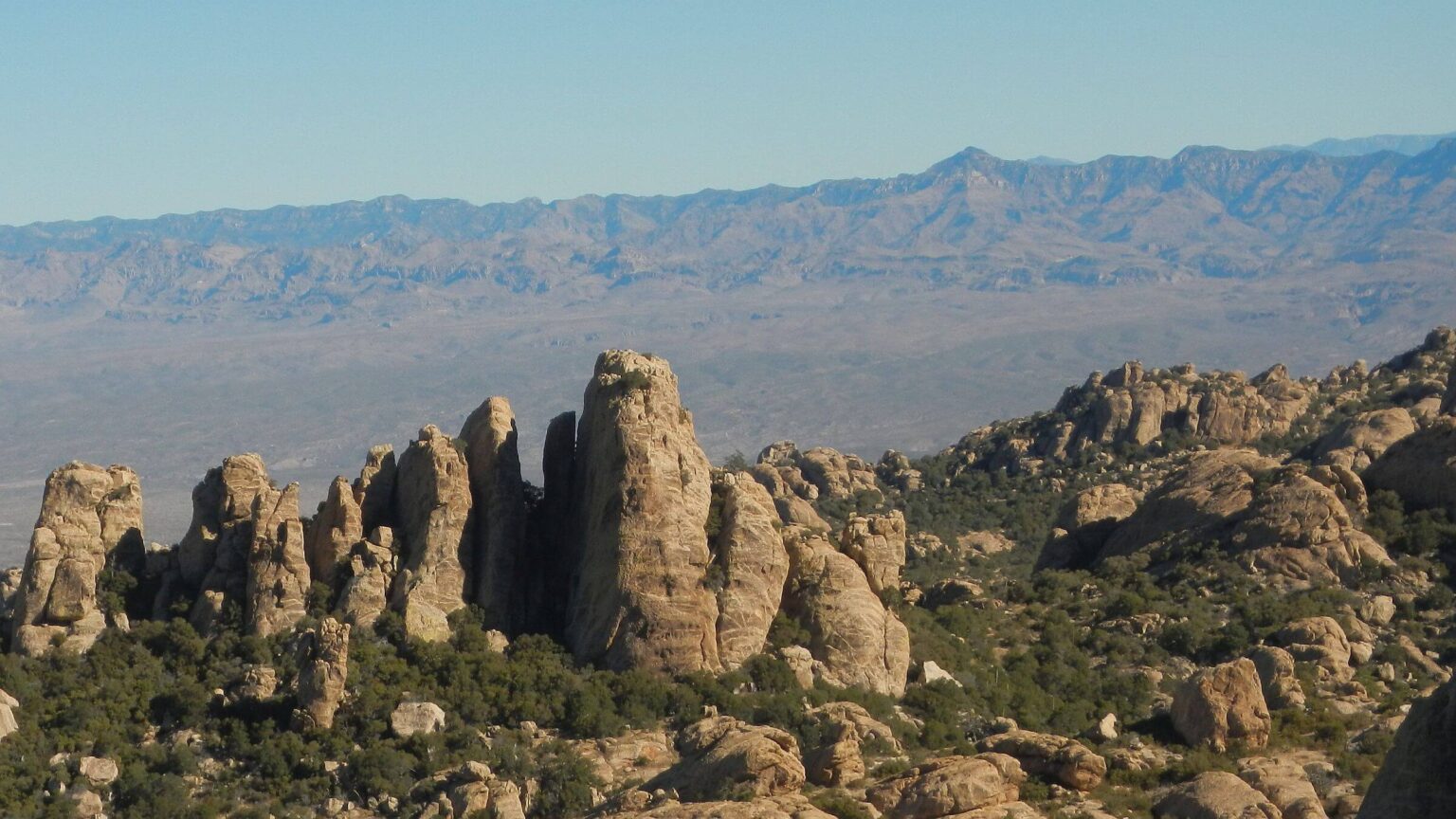
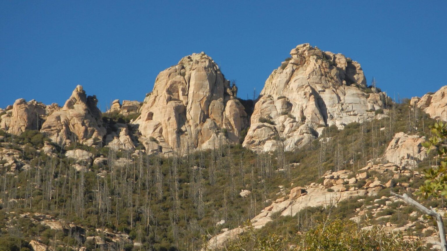
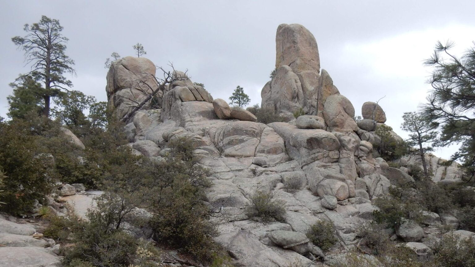
After tent setup, we hiked short loop by many sites visited with Richard and other Ramblers: Duckbill, Man Head, Spud Rock, and Mica Mountain where Steve, David, Richard, and I watched a sunset from the fire tower (dismantled by Park Service many years ago) on our first Rincon visit in 1974.
Our good friend Richard loved river hiking and river running, the kids he helped through the Big Brother organization, travel and visiting friends, his big Catholic family, and telling stories in his basso voice flashing a big white smile. A Vietnam veteran likely exposed to Agent Orange; Richard died in 2019 after a long battle with leukemia. About 350 friends attended his memorial service.
AZT to Catalinas: SOBOs, cow crap & fall colors
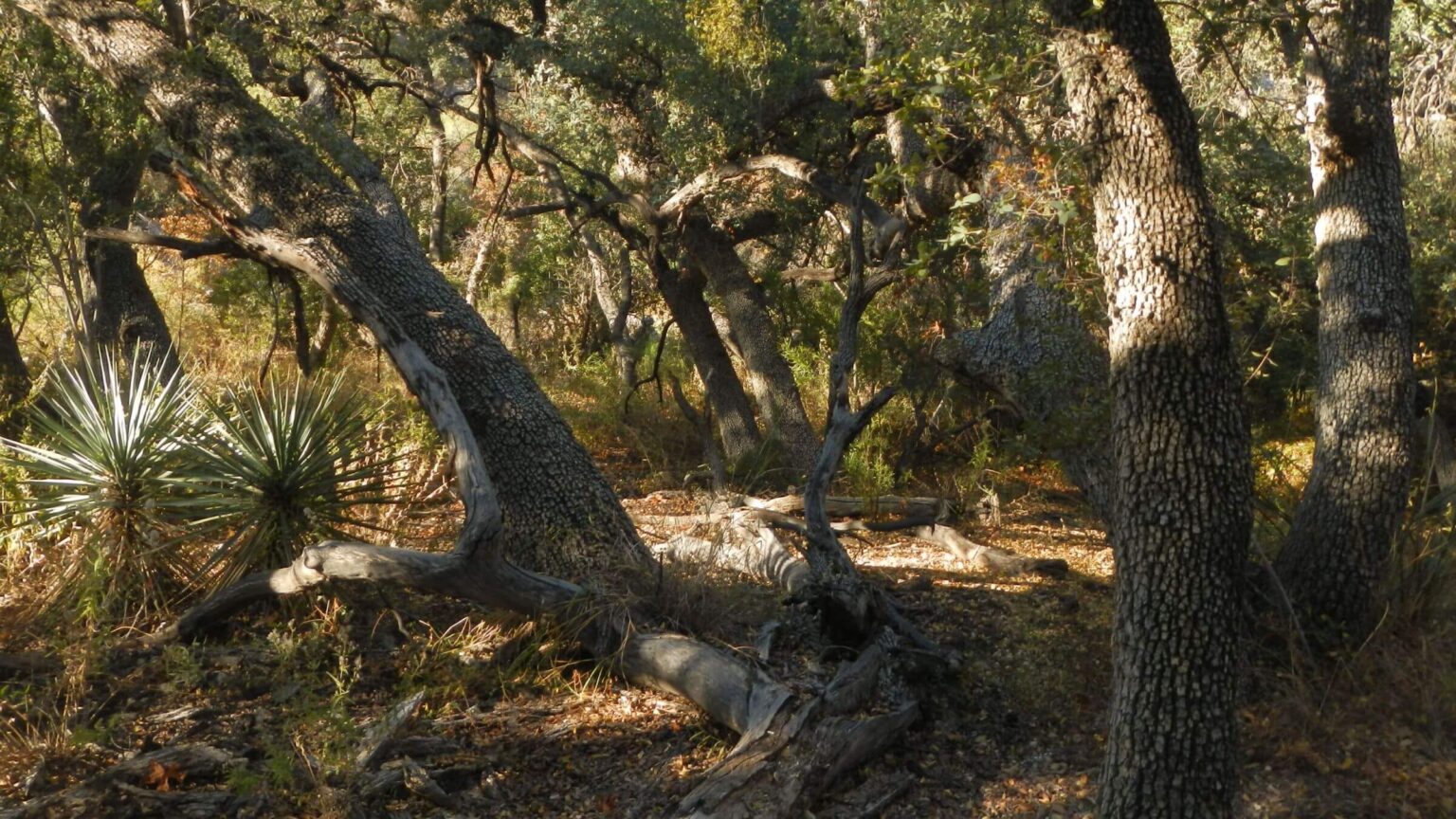
Saguaro section of Italian Ranch/ATZ was nice on north slope with long switchbacks through ponderosa pine stands and great views. Many AZT south bound hikers (SOBOs) had signed park boundary register same day we started trek. If we had gone straight to Manning, we would have met some. Trail on national forest (Rincon Wilderness) was steeper and more washed out.At Reddington Pass our water and food were intact with many gallons stored for AZT users. We soon met 2 women doing AZT by sections and saw signs of other users: cow poop on the trail and in every forested nook. We camped in a cow-free wash enjoying full moon rise.
Next day, poop piles in dry bed of “The Lake” which had water on previous visits. Bellota Ranch Trail (of AZT) was horribly polluted and trampled by cattle; we saw many on hillsides as the trail climbed up and down canyons. At dry West Spring, usually a rest stop, we circled around a big bull lolling in shade of cottonwoods and oaks. I was glad to leave on steep switchbacks to pass above Molino Basin, jumping aside for pair of mountain bikes.
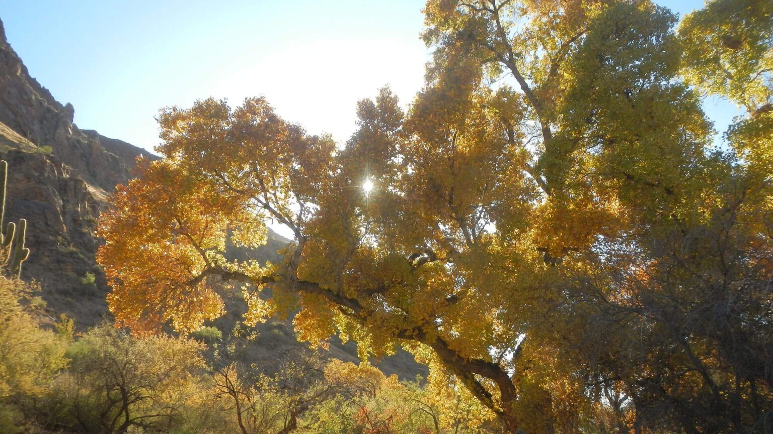
Two more nice surprises: unused group site at Molino Basin where we dumped garbage and took a break in shaded gazebo, and a beautiful campsite near Sycamore Reservoir among red-brown sycamore and bright yellow cottonwood leaves. We crossed knee-deep water here an earlier spring; bone dry now. We had picked up 2 gallons of water just past Gordon Hirabayashi Campground.
Box Camp: steep slow surprise
Canyon Canyon shockingly cold next morning and shaded East Fork Sabino on other side of pass was also chilly; but after turnoff to Box Camp Trail we entered hot sunshine; I shed layers and switched to shorts and t-shirt for the 4000-foot climb to Catalina Highway. In 2023, I had happily bounced down Box Camp’s rock pitches and switchbacks to the creek but was much slower clambering up; pace dropped to about 1 mph.Apache Spring—deep pools our last visit—was dry. But 0.1 mi from trailhead on highway, we had a water drop below the trail.
I waited in low 3:30 pm sunlight for David to retrieve water off trail from his GPS coordinates. He thought we should hike last 3.5 miles on highway and Summerhaven roads instead of planned route (of about same distance) on slower hiking trails. The store which had our resupply box (including food for the night in a cabin) closed at 6.
We put bright yellow t-shirt over long-sleeve cotton and hustled; annoyed but not endangered by frequent racing vehicles. Got to town in ample time (hiking near 3 mph), left packs at our reserved cabin, and picked up box from the friendly store crew. (In 2023 we hiked trail in about 2.5 hrs which would have put us there right at closing time!)
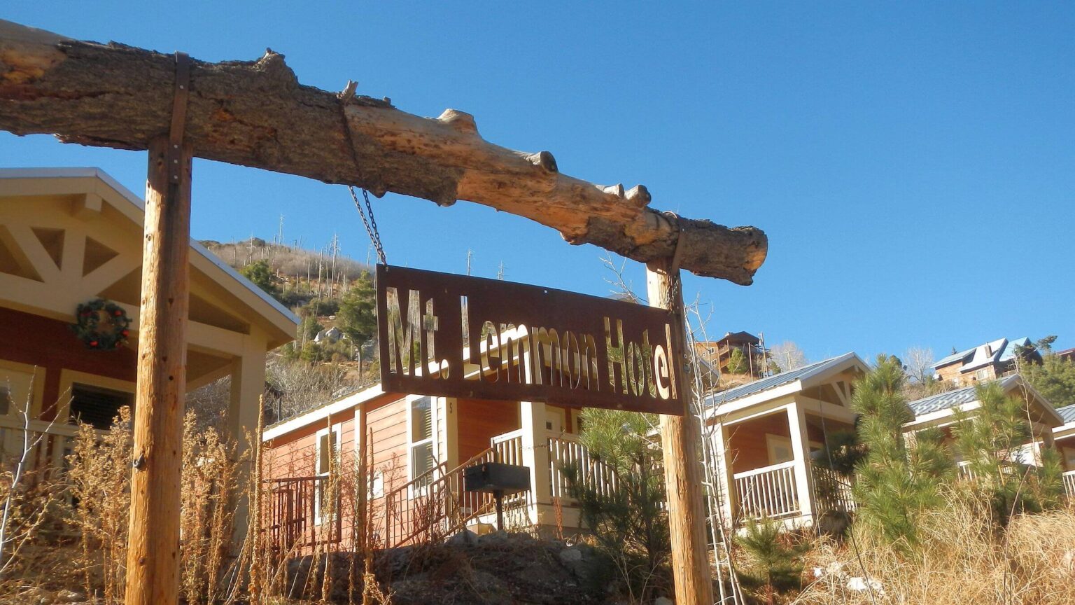
Breakfast next morning at new hotel next door, early burgers for dinner at the only café in town and a day hike through mostly unburned forest to Marshall Gulch in between.
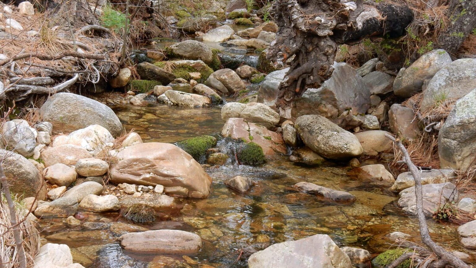
Final surprise: disaster on heavily hiked AZT
Our last 3-day leg took AZT as far as West Fork Sabino where we would follow segments of crest trail to finish down Pima Canyon with camps planned at West Fork and flank of Mount Kimball (near last water drop). We hiked Marshall Gulch road and part of AZT by headlamp; found pools in Lemmon Creek drainage for morning breakfast and water for camp and next day of hiking.I was strolling down undulating Wilderness of Rocks trail when my left foot slipped on slidy surface (dry soil maybe made slicker by hundreds of recent AZT trekkers) and I went down in lunge on right knee. Right ankle hurt.
Yup, a sprain. We wrapped ankle in ace bandage and continued. On the much steeper Mount Lemmon Trail down to Romero Pass, I slipped again. Not sure what I did but ended up headfirst on my left side on steep side slope off trail. My left arm was bleeding—I had sliced off a layer of flesh on the rocks. David, racing ahead to drop his pack at Pass and return for mine, did not hear me yelling.
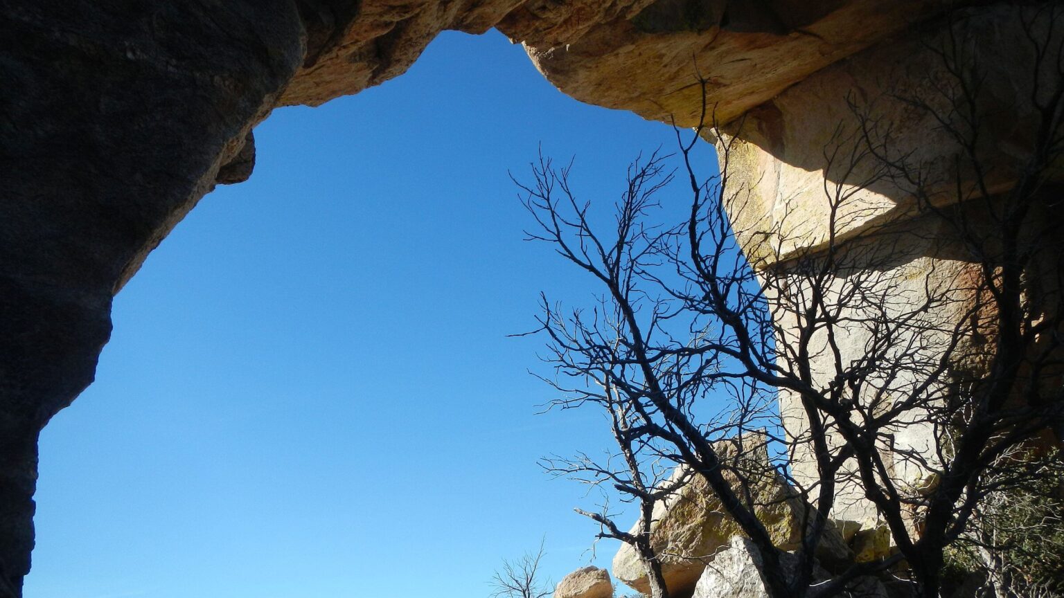
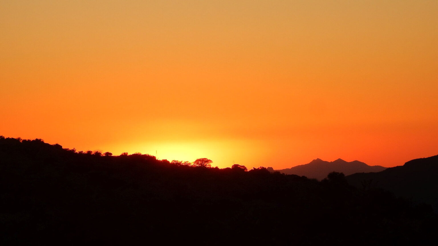
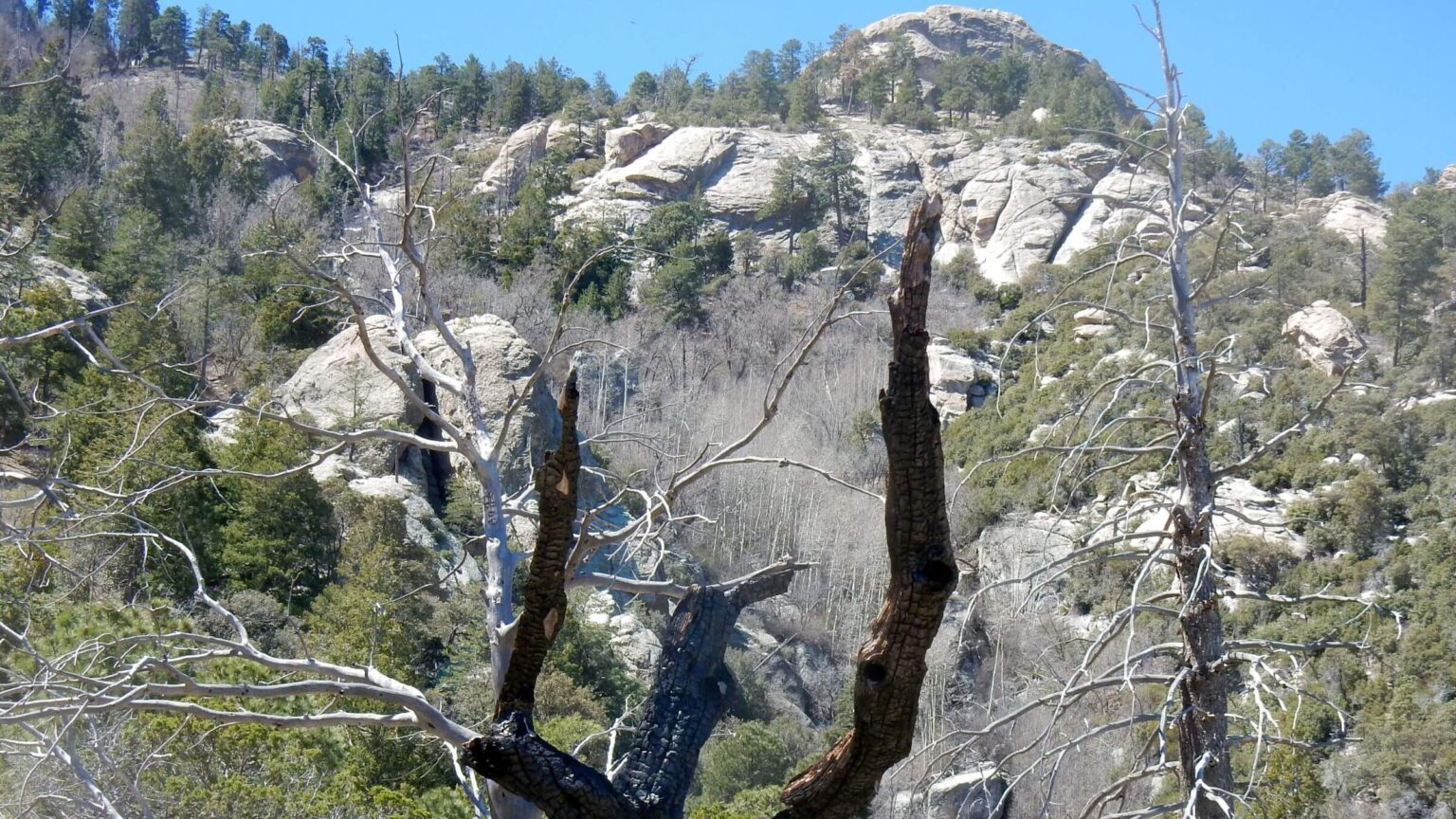
I slipped off my backpack and crawled back onto the trail. Covered wound in big Band-Aids and started down trail, meeting David coming back up. Mellow contour to West Fork felt ok and I made it through evening. Ankle stiff climbing up towards Cathedral Rock ridge but loosened up for the slow 8-mile trek up and down over Cathedral, the Window (where we reminisced about lunch there on our 20-mile trek in 1975) and back up to our water drop/camp below Kimball. Rougher, thinner, eroded trail improved by contractor. Beautiful sunset off the peak and Tucson twinkling to life below in growing darkness.
Slow going getting down incredibly steep Pima Canyon—but I was impressed and surprised as always that a trail had been built in this rugged area. Lots of drama at urgent care but learned I had no broken bones, just an ankle that continued to swell for several months but was fine for a 100-mile backpacking trip six weeks later.
I was distracted by cut on my left arm but it wasn’t the long-term problem. Riding my bike just a few days later, I tried to signal. I could not lift my left my arm. I had damaged muscles in my rotator cuff; several months later I still can’t lift a dish onto a kitchen shelf. The most unpleasant surprise was that injury likely hastened arthritis in my shoulder—I am slated for my second reverse shoulder replacement in November. (Right one was 2023.)
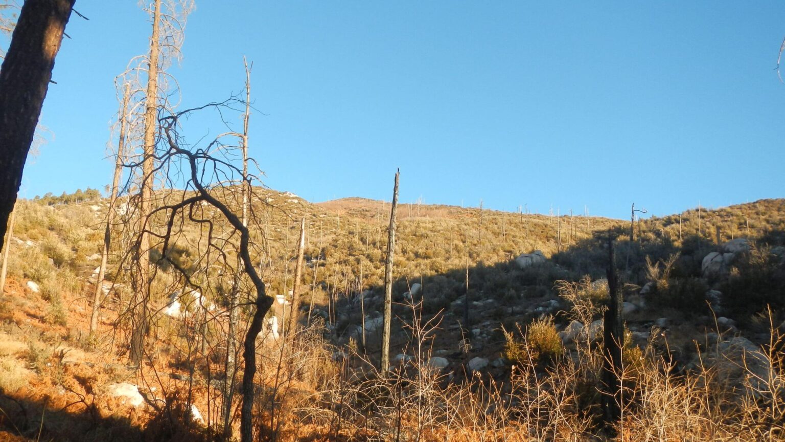
2016 return: fire damaged crest
After meeting in the mountains, David and I had always traveled back to Arizona for December hiking from other places we lived: Oregon, Utah, Colorado, and the Washington DC area. In 2016 we moved back to the West from DC, buying a home in Idaho but spending most of the winter in Phoenix. We decided to come to Tucson to repeat our 1975 Catalina-Rincon trek.We planned the revisit carefully and followed official advice—but came out a day late and, possibly in trouble with the Park Service. Our revisit might be a good metaphor for western wilderness hiking today: climate change, trail damage, and random rules that impact the visitor experience.
Prework & planning succeeded—mostly
We chose the end of March for minimal snow, maximum water, and mild weather. We queried the Forest Service on Catalina trails and water resources and reserved Park Service campsites in the Rincons. Instead of cross country we now had Arizona Trail (AZT) between the two ranges. We left food and water drops along our route in the Catalinas since the Forest Service (wrongly) predicted little water. We rented a car to drop our vehicle at an exit trailhead in Saguaro National Park. Our loop through Saguaro added miles but decreased odds of a vandalized vehicle at unprotected trailhead. The car rental agency (Enterprise on Oracle Road) kindly dropped us off at the Pima Canyon trailhead.Crossing Catalinas took almost three days. Memories of gentle switchbacks between peaks and saddles were displaced as we scrabbled through washouts, off boulders, up steep chimneys and along slidy side slopes on trails eroded by fire damage and summer rains. A cold front met us with ridge winds, fog, and snow flurries. We saw day hikers but no backpackers except cheerful European AZT thru-hiker with light pack in West Fork Sabino Canyon. He raced ahead to his Summerhaven rest stop. Further up the mountain, I was saddened by wind tunnel with downed logs in placed of old-growth Douglas-Fir forest I recalled in Marshall Gulch.
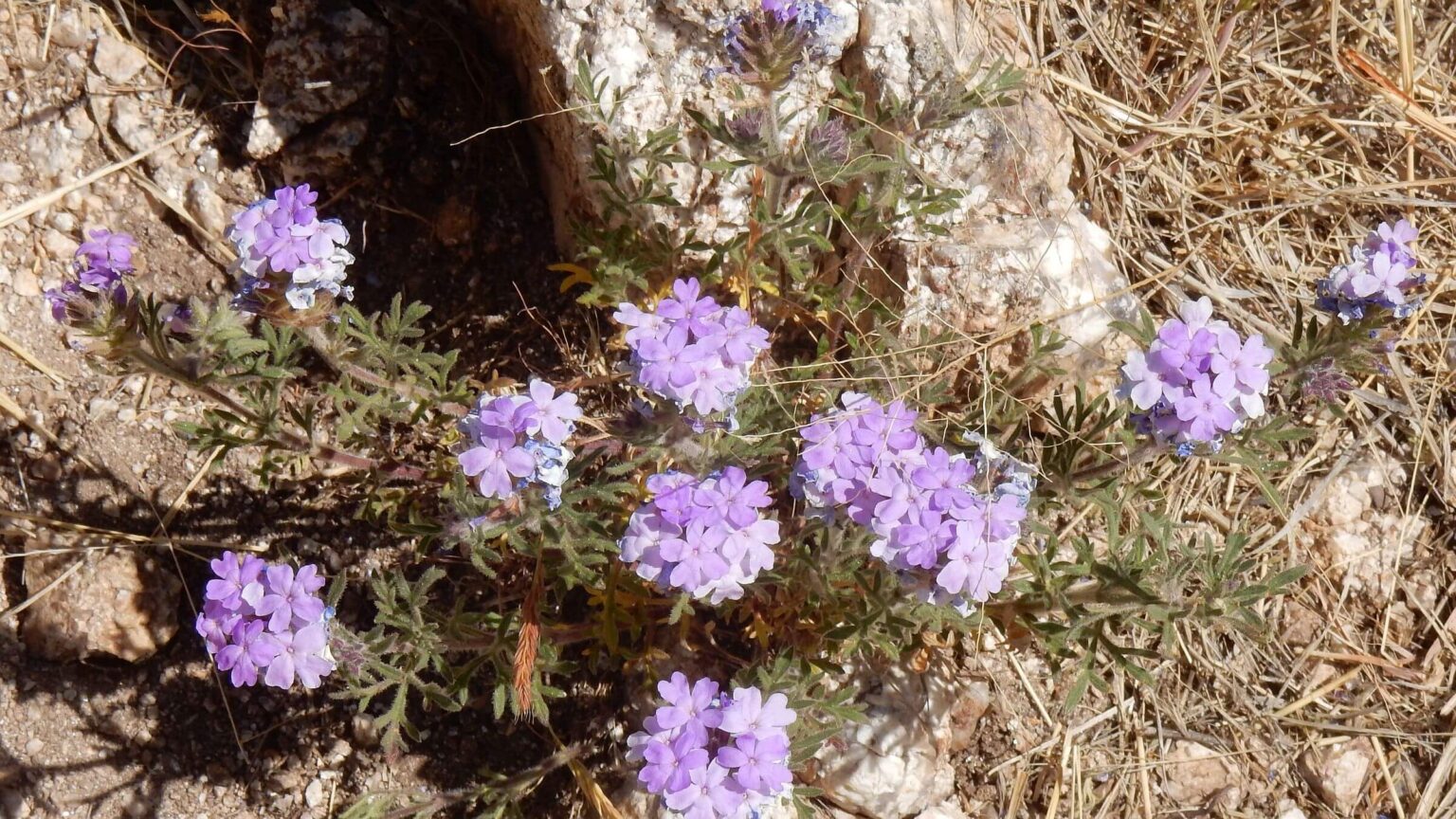
To mimic the 1975 trek, we took Pusch Ridge Wilderness Bypass (mountain-bike and equestrian AZT route) following ridgeline out of the Catalinas. My knees whined at steep “stairs,” and sharp descents designed for mountain bikers. The winding, 10-mile AZT across foothills of Redington Pass offered perfumed fields of Santa Catalina prairie clover and southwestern mock vervain, pools, and serene young northbound AZT hikers.
A day late
On a bony backbone ridge, as late afternoon shadows striped Tucson below, David called the Park Service’s backcountry office. Could we push back our reservations and leave our vehicle another day? After much paper shuffling, we got the okay. Right at dark we made it to the headwaters of the intermittent Tanque Verde wash, which was running well, and camped in the Rincon Wilderness before the Saguaro park/wilderness boundary.We hiked over Mica Mountain, meeting early-morning hikers already returning to Reddington Pass. We saw more hikers on Mica and joined two campers at the popular and historic Manning Camp. We spent an afternoon looping favorite trails around the mountain.
We met more AZT hikers before we left AZT on Heartbreak Ridge to Happy Valley, piney camp all to ourselves. We left packs for a round-trip, steep climb to Rincon Peak. Trail down Rincon Creek was brushy and washed out; hot hike through the desert to closed Madrona Ranger Station surprised us with views of luxury houses below trail on former site of the X-9 Ranch still blocking public access. (see link in 2024 article above). Not surprisingly, the trail was little used until it joined the Quilter Trail (AZT) ascending ridge above Grass Shack. Hiking in near-dark, we heard an Arizona (Mexican) whip-poor-will calling and the welcome sound of running water near the campsites among big oaks and sycamores.
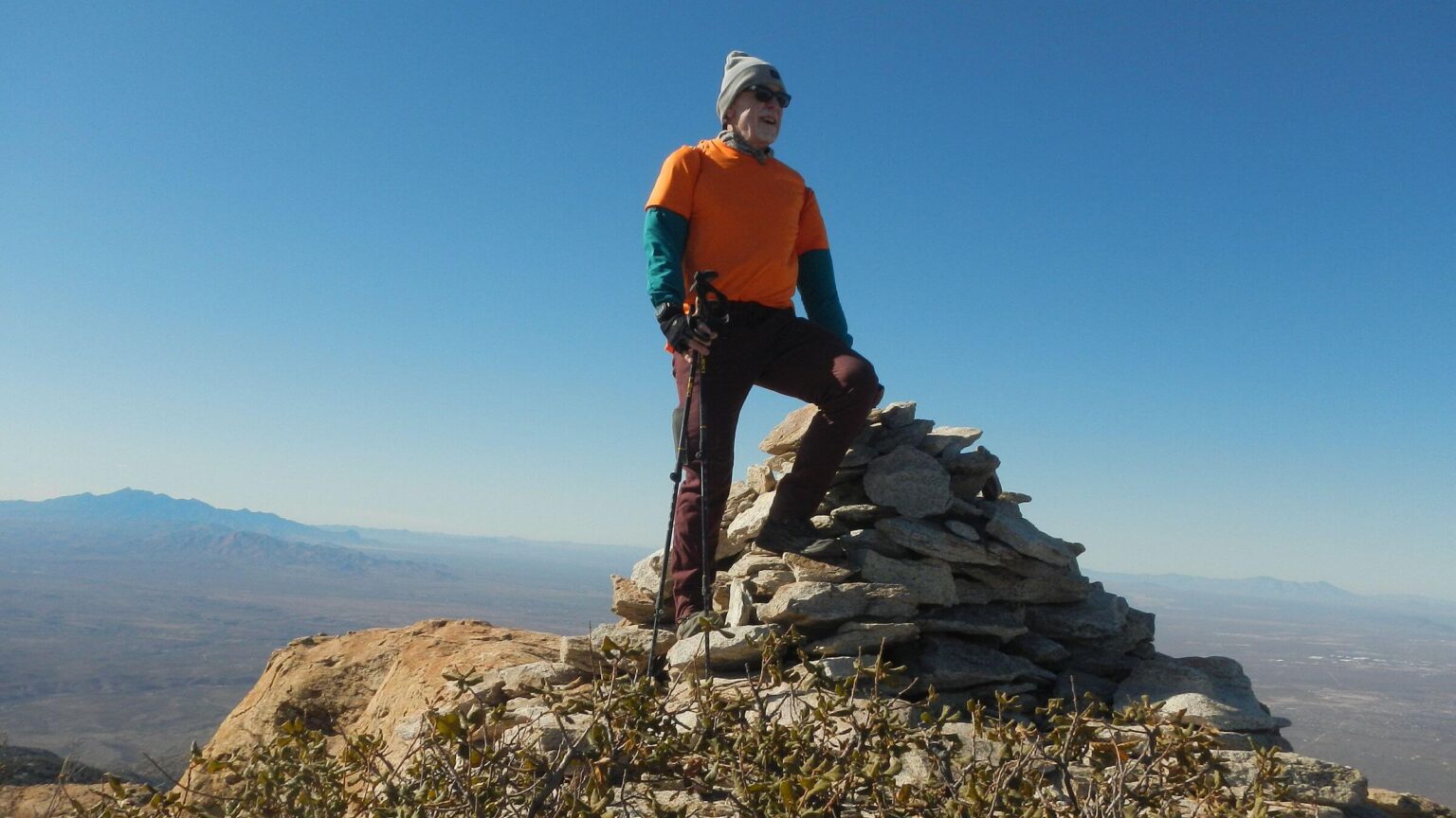
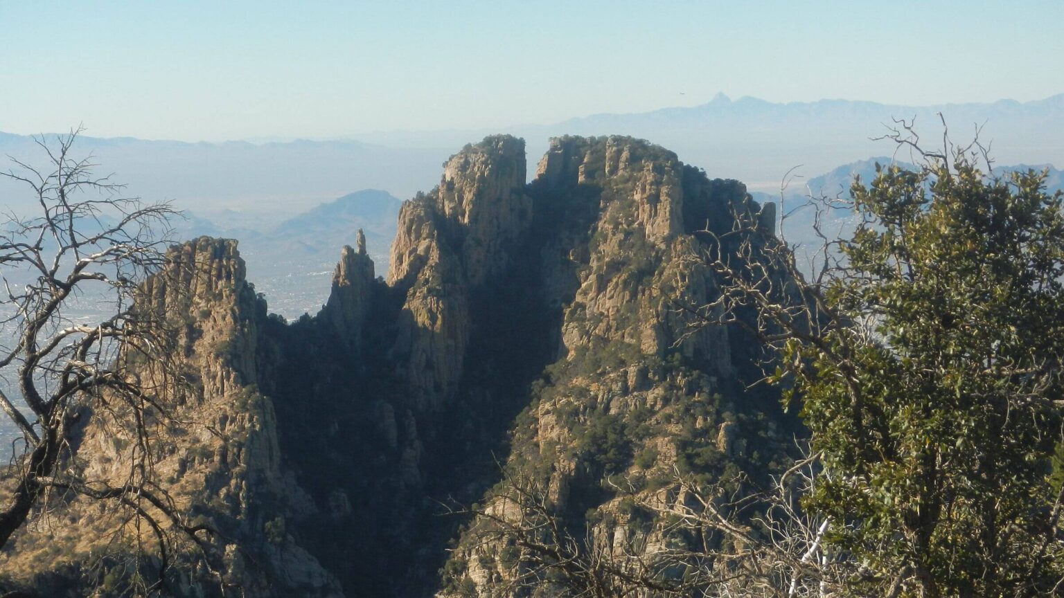
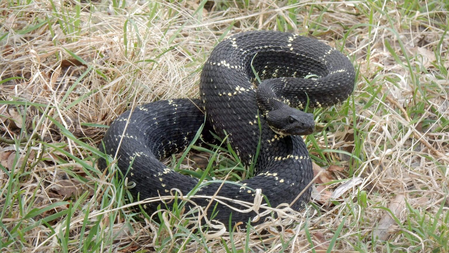
On Day 10, I stood on Tanque Verde Peak for 270-degree panorama of our journey: the rocky, stair-step Catalinas to Mount Lemmon; Mica Mountain and Rincon Peak, our final high point before we dropped 4,000 feet to the hot Sonora Desert, then circled up and back to camp among the oaks at Grass Shack. Now we ambled into Juniper Basin for a brief break in the shade, annoying a black rattlesnake waiting to drink at the canyon pool. Its sudden rattle startled me so much, I fell backwards (away from the snake, luckily).
We descended ridges towards a green flow of mesquite parkland where subdivisions stopped. The hot sun and spring resumed: purple blooms sprouted from the hedgehog cacti; yellow blossoms appeared on prickly pear; tiny pink buttons smiled on scraggy Manzanita. At the trailhead, the GPS marked 114 miles and a 32,000-feet ascent and similar descent (or 575 feet average elevation change per mile).
The Park Service allows overnight parking at the Javelina Picnic Area for the Tanque Verde Ridge Trailhead if you have campsite reservations in the wilderness as we did. So I was surprised to find an orange violation sticker on the window of our vehicle. I turned on my cell phone for a message from my sister: “Could you call the Park Service? They are worried about you.”
We called. Law enforcement was about to launch a lost hiker search. Our updated paper permit somehow did not make it from the backcountry office to law enforcement. However, we were not in trouble and the search was called off once we explained the situation.
Almost all AZT thru-hikers we met had hiked straight through the Saguaro Wilderness in one day to avoid Park Service campsites (which require advance reservations for Park Service convenience but are difficult to plan in advance for a multi-day backpack trip). Park Service in 2024 added a thru-hiker permit allowing camp at Grass Shak or a Manning Camp group site without additional reservations.
Publishing Our Success—40 Years Later
For the 1975 trek, I wanted to combine my skills as a journalism major with my passion for the outdoors. I pitched an article on our trek to the new (1973 startup) Backpacker magazine. I sent in a double-spaced, typed manuscript with David’s photos and one of me perched on a hill with my backpack. The article was rejected. In 1980, I sold Backpacker an article on backpacking and cooking and got a check. The article was never published.In May, after finishing the 2016 trek, I queried Backpacker by email. An editor suggested a 500-word version for the “Life List” section. I wrote and revised it several times at her request, then lost touch with her. In 2017, a different Backpacker editor contacted me. He wanted a 700-word essay. The final version, which ran in the September 2017 edition, seemed more about the young editor’s notions on senior hiking memories, but it was well-written and paid me $500. Success at last!
show less
Google Map
(Click upper-right box above map to “view larger map” and see legend including NAVIGATION INSTRUCTIONS; expand/contract legend by clicking right arrow down/up.)
Downloads
Links
- Pusch Ridge Wilderness
- Rincon Mountain Wilderness
- Saguaro Wilderness
- AZT Passages 9, 10, 11 & 11e
- AZT trail stewards (for current trail info)
- UA Ramblers hiking club