Binomial peak visit offers irony
Our inspiration to visit Black Elk Wilderness came from its original occupants, the Lakota people who consider the area their homeland and sacred.
We were attending WILD12, an international wilderness meeting in Rapid City, South Dakota. Emphasis was indigenous wilderness management. Cohosts were the Ogala Lakota whose lands included Rapid City and the Black Hills National Forest north of us. On a field trip to Wind Cave National Park, where Lakota people believed their ancestors emerged, we learned about Black Elk Peak, center of a wilderness on the forest.
Until 2016, the peak was named for a U.S. Army general who massacred Lakota Indians, our hosts explained. Learning this, we decided we needed to see this infamous peak. We ditched the last morning of our wilderness meeting and headed for a hike in Black Elk Wilderness.
We found the entire day tinged with irony.
Rising early, we left Rapid City, small town with many restaurants and huge convention center that caters to the thousands of tourists visiting Mount Rushmore National Monument, where faces of four U.S. presidents are carved into a granite mountain face in the Black Hills south of town. We drove through winding pine country sacred to the Lakota people but now occupied by lodges, breweries, stores, and cabins.
Below Mount Rushmore, we took photos of the impressive granite faces. But a quick morning pass through giant parking areas for tourist buses and hundreds of cars convinced us not to stop. We turned off on national forest road and stopped at Willow Creek trailhead to start our hike.
After finishing our Black Elk hike, we paid $40 donation to visit Crazy Horse Memorial partly done large mountain carving of Lakota warrior Crazy Horse. An Ogala chief was refused by Rushmore sculptor but got assistant to start project funded by private foundation of Native American sympathizers and visitors.
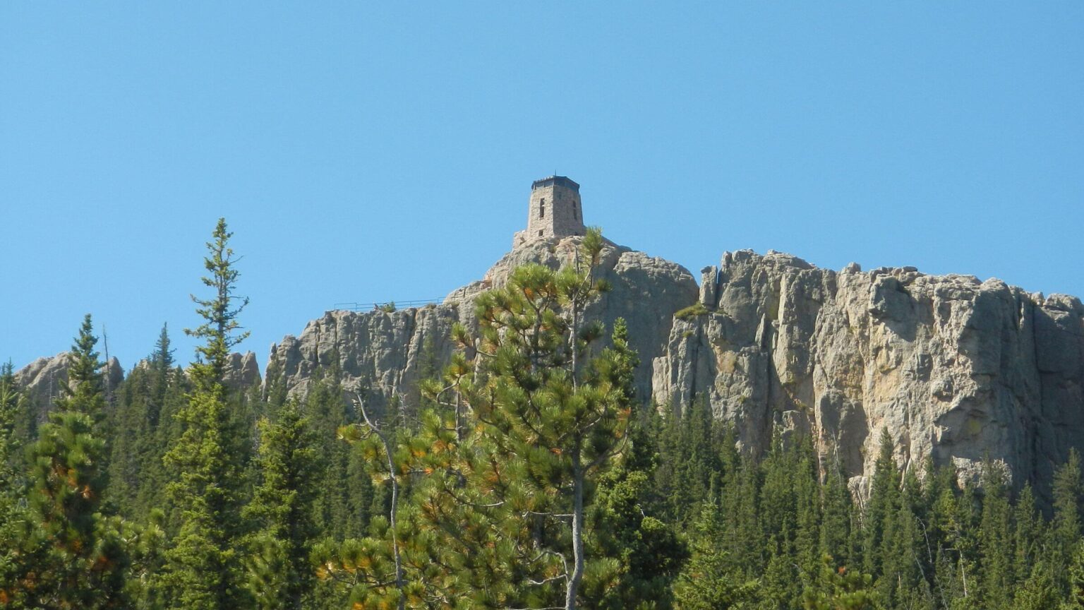
Between the two monuments we hiked a loop through Black Elk Wilderness, mostly alone until we reached Black Elk Peak and found many people and more irony. Although peak has been renamed, trail sign (click outside photo to return) and fire tower placard still acknowledge Harney. The giant stone building on the peak is visible for miles and visited by thousands.
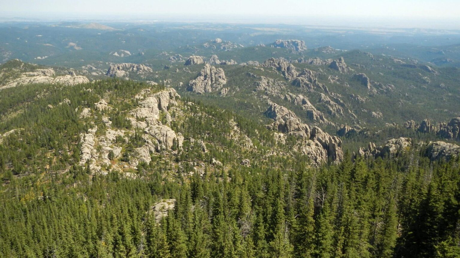
Black Elk Wilderness in South Dakota, designated in 1980 and encompassing 13,534 acres, is only wilderness in the Black Hills National Forest and one of two in the state (other is Badlands Wilderness in Badlands National Park). “Black Hills” comes from the Lakota words Paha Sapa, “hills that are black” because this is how these tall pine-covered mountains appear from a distance.
Black Elk was a traditional healer and holy man of the Ogala Lakota. This branch of the Sioux Nation occupied the Great Plains region between the Missouri River and the Rocky Mountains, and believed the Black Hills sacred. Black Elk’s visions were captured in a 1932 book Black Elk Speaks.
Black Elk Peak—at 7,242 feet the highest peak in South Dakota and highest summit east of the Colorado Rockies—is controversial. In 1855, the South Dakota governor named it Harney Peak to honor William S. Harney, an American calvary officer who was infamous for brutality and massacred Lakota women and children in retaliation for raids. Lakota people call Harney “Killer” and “Mad Bear.” After the Lakota petitioned for many years, the U.S. Board of Geographic Names changed peak name to Black Elk in 2016, opposed by then Governor Dennis Daugaard, Senator John Thune, and several state department officials.
Harney Fire Tower, stone building on top of peak visible for miles and completed in 1939 by U.S. Civilian Conservation Corps (CCC), still bears Harney name on stone plaque and on peak trail sign. Forest Service staffed tower until 1965. Thousands visit every year, most via 3-mile trail from Sylvan Lake in Custer State Park.
Our 15-mile loop day hike included both parts of Willow Creek loop trail north of wilderness, Black Elk Peak Trail, and Lost Cabin Trail. We saw a trail runner, three day-hikers doing peak from Willow, two on Lost Cabin Trail, and then dozens doing short out-&-back to peak.
Visit statistics: 15.0 mi distance at 2.1 mph with average elevation change of 425 ft per mi (ascending 3100 ft and descending 3100 ft).
Go to map below for more information on trailheads, daily routes, mileages, elevation changes, and photos. (Click on white box in upper-right corner to expand map and show legend with NAVIGATION INSTRUCTIONS.)
show more
Rock pillars, solitude & crowds on peak
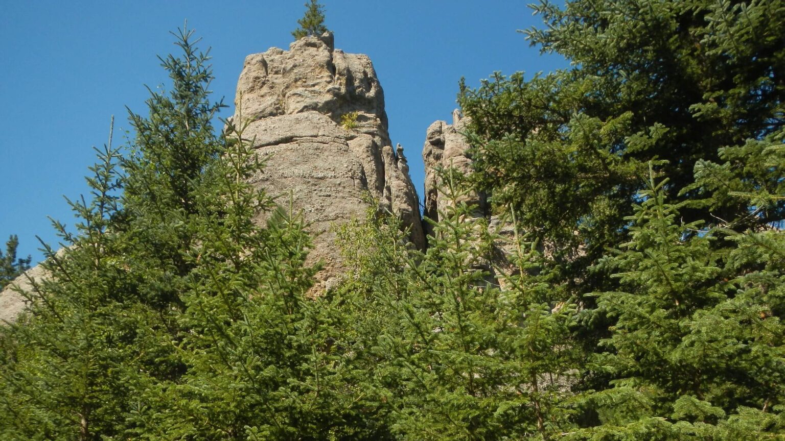
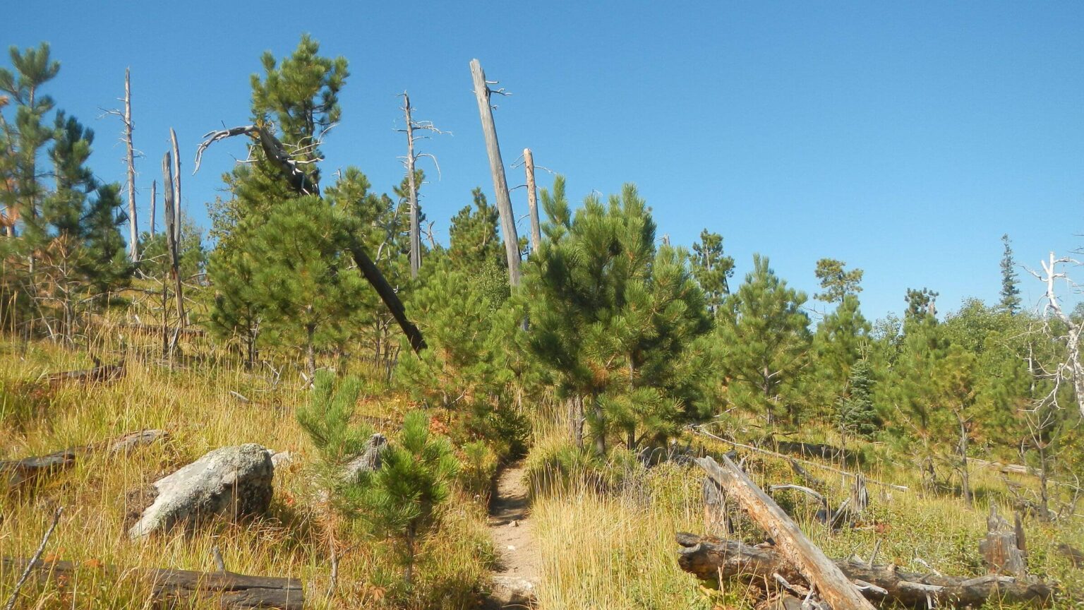
We started and ended our pilgrimage at Willow Creek Horse Camp on north end of wilderness right off Highway 87, a beautiful campground in tall trees. We went along part of Willow Creek loop trail through green meadows, young pine, aspen and brush. After a junction, Black Elk Peak Trail was rocky climb winding through basins of scabby forest with stunning rock monuments on ridge line. We switch backed up to barren ridge robbed of most trees either by fire or blowdown.Far ahead I saw the peak with giant rock top; as we got closer, I saw fire lookout made of stone. We met three separate day hikers, all returning from the peak. “A lot of people,” one warned.
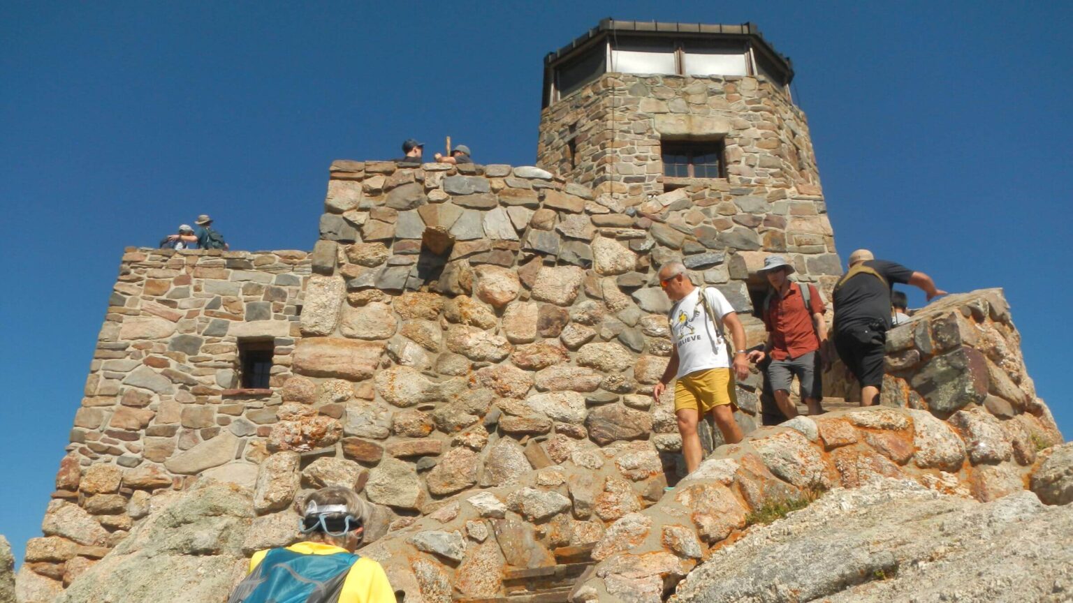
He wasn’t kidding. At the spur trail to peak we met young hikers, moms and dads toting babies, kids, teens, and older folks. We joined hikers on curving stairway leading to tower flanked by rock banisters. Near tower entrance snags were decorated with multi-colored prayer flags and a large pole supported effigy of an Indian—perhaps Black Elk?
I followed line up winding steps within tower. After view of sprawling Black Elk country from open patio, I headed down; we took lazy switchbacks down Black Elk Trail, continually meeting hikers. I wanted to visit Custer State Park for short side trip to Little Devils Tower but David nixed extra four miles since we wanted to reach town of Custer in time for dinner.
The town, county and state park are named for George Armstrong Custer, Army officer famous in Civil War who battled American Indians and also discovered gold in Black Hills. This launched gold rush drawing white Europeans to take over the area. Crazy Horse and other Lakota Sioux killed Custer at Battle of Little Bighorn.
We lost crowd after turnoff on Lost Cabin Trail through trees and grottoes, a drop down small canyon then following boggy creek and climbing to ridge adorned with stone pillars. Near the top we met a mom and daughter taking a break in a side canyon—the last hikers for the day.
Trail contoured on ridge then left wilderness on long switchbacks into the Palmer Creek drainage. Grass brush and dead trees indicated fire but found no records in the federal government fire database; perhaps the fires were too small to be recorded.
Trail finally contoured around head of the creek, climbed a small ridge, and then dropped to follow and cross a small creek and return to the trailhead.
David felt sick and tested positive for COVID-19 the next morning—either from a WILD12 meeting attendee or maybe during travel to meeting after our Colorado venture. I was tempted to blame the hordes on Black Elk Peak, but too soon—it takes 2 days to show symptoms after exposure.
We would like to return to Black Elk Wilderness, perhaps for a backpacking trip exploring east side on section of the state’s Centennial Trail, Grizzly Creek and Norbeck Trails with a loop through Custer State Park. We expect solitude except near well-trammeled Black Elk Peak.
show less
Google Map
(Click upper-right box above map to “view larger map” and see legend including NAVIGATION INSTRUCTIONS; expand/contract legend by clicking right arrow down/up.)