
(Click slider photo to see caption)
I wanted to celebrate my 71st birthday backpacking through San Rafael and Dick Smith Wilderness areas near Santa Barbara, CA. The previous year, a 70th birthday hike in same area almost got me drowned(!) but it was not on any of the forest managed by “my” ranger district.
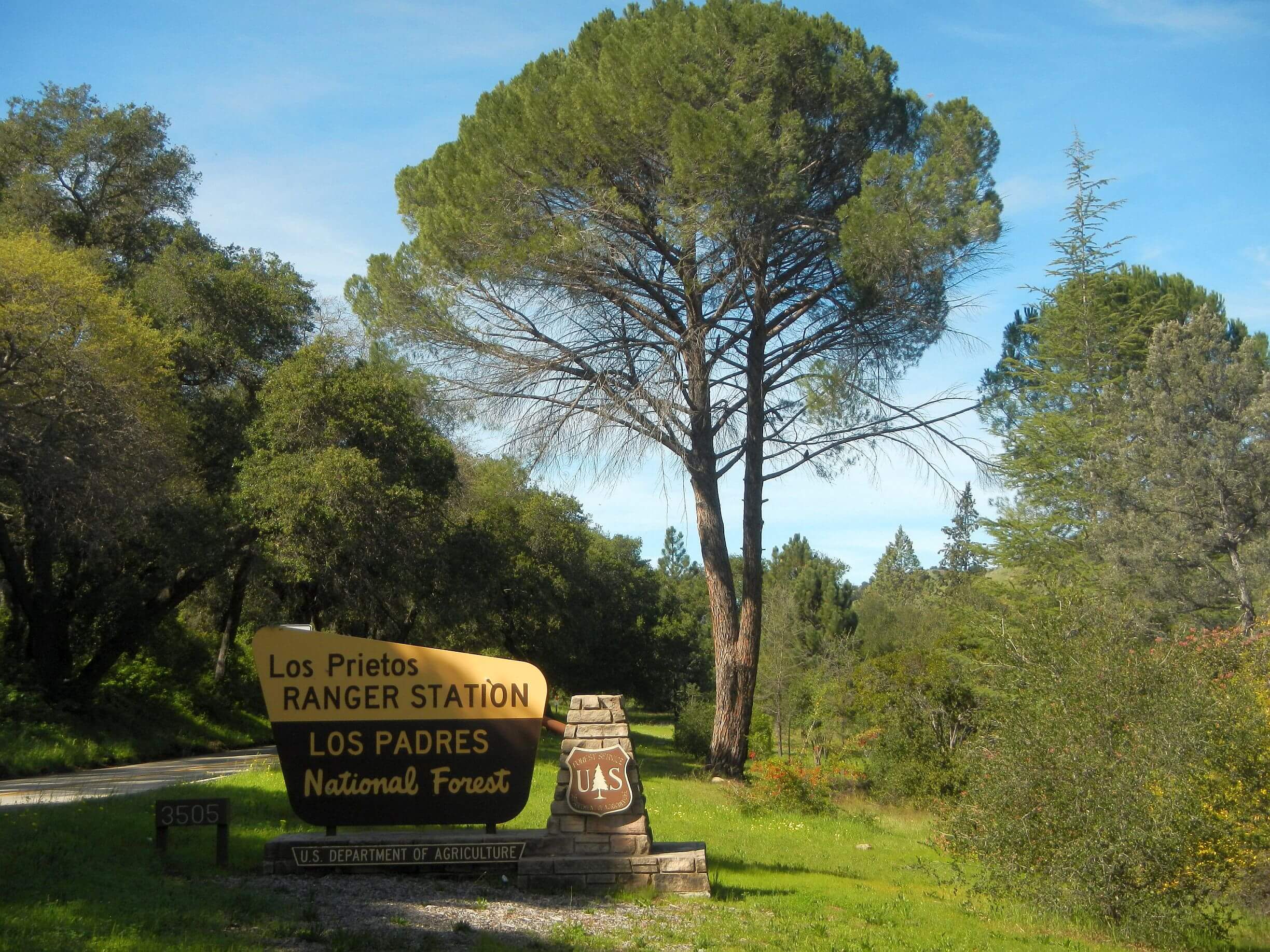
Seventeen years ago I was District Ranger on Santa Barbara Ranger District (SBRD) of the Los Padres National Forest (LPF), driving back roads with my crews and trying to help rebuild some of our trail system, badly damaged by the Zaca Fire of 2007.
When I came to California, I immediately collected all the LPF maps and starting planning hiking trips, enticed by this extensive forest stretching from Monterrey to Santa Clarita along the South Coast of California. LPF had 10 wilderness areas and in the 1970s backpacking heyday had seasonal wilderness rangers who patrolled, camps with picnic tables, trail registers and incredible winding trails designed for stock (horses). One of my Forest Service friends had started her career as a wilderness ranger on the SBRD.
As it turned out, I only did one brief backpack trip on the LFP during my tenure there, checking out the Zaca burn scar (see story below). Most of my time as a ranger was administration, public/media relations, training, and overseeing two more fires—Gap Fire and Tea Fire both in summer 2008, small violent front range fires that threatened the communities of Goleta and Montecito.
Los Padres: Wilderness legacy, fire impacts
When I arrived, much of my district backcountry was closed to recreation. I started as ranger in fall 2007, the day after the Zaca Fire was declared contained after burning most of the summer and consuming 240,000 acres—overall 13th largest in California history. Started by a chainsaw spark on a ranch adjacent to the LPF, the Zaca destroyed high country pines, trails, and camps. The Forest Service (FS) typically closes large areas for many months after a fire, and/or posts “burned area” warning signs for years without much restoration work. The Zaca burn area was closed for a year and was only reopened because the Santa Lucia ranger and I lobbied the Forest Leadership Team, arguing that there were no safety problems and we were getting angry visits from members of the public tired of being “locked out” of favorite camping or fishing or hiking areas.
Through much of 2008, I was placating water officials who were worried that Santa Barbara and Montecito cities’ water supply, Gibraltar Reservoir, might fill with sediment although it did not. I was constantly asked “why didn’t Forest Service put out the fire?” (Answer: because fire burned on steep slopes in wilderness and it was hard/dangerous to directly attack with field crews and the few existing roads/dozer fire lines that were cleared did not halt the fire. Hundreds of firefighters spent late summer in a big fire camp on the Santa Ynez river, “monitoring” the fire. Fire managers feared the Zaca would jump the coast range and threaten cities on the other side, although it never did that.
First visit: Delay launches embarrassing search
I wanted to see the burned backcountry and planned a backpacking trip in February 2008. Closure meant trip had to be official—I signed up David, newly retired from the Forest Service, as a volunteer! The LPF had strict safety protocols including required check-in by radio with Dispatch (a call center which coordinates resources for emergencies and keeps track of personnel in the field) for entering and leaving the field. For overnight stays, one call needed for morning and another for evening. That policy got me into trouble.
We planned an overnight loop starting on Manzana Creek, climbing to Hurricane Deck, a rocky white ridge between Manzana and the Sisquoc River, descending to camp at Manzana Schoolhouse where the two waterways met, then returning on Lower Manzana.
We clambered up sketchy Portrero Trail on blackened soil dotted with dead yucca (looking like burned pineapples) although Deck was burned clean of the usual brush, so old well-built trail was in fair shape. Before heading to Manzana Schoolhouse, we hiked Deck a few miles the other way because I wanted to see a formation called White Ledge (Ironically, further than I thought and didn’t get to see it).
Bad idea. We were still on the Deck that evening; with brushy obscure route down (not burned like most brush on the Deck). I radioed Dispatch, said we’d camp on Deck and be out following afternoon. Only 10 miles; no problem!
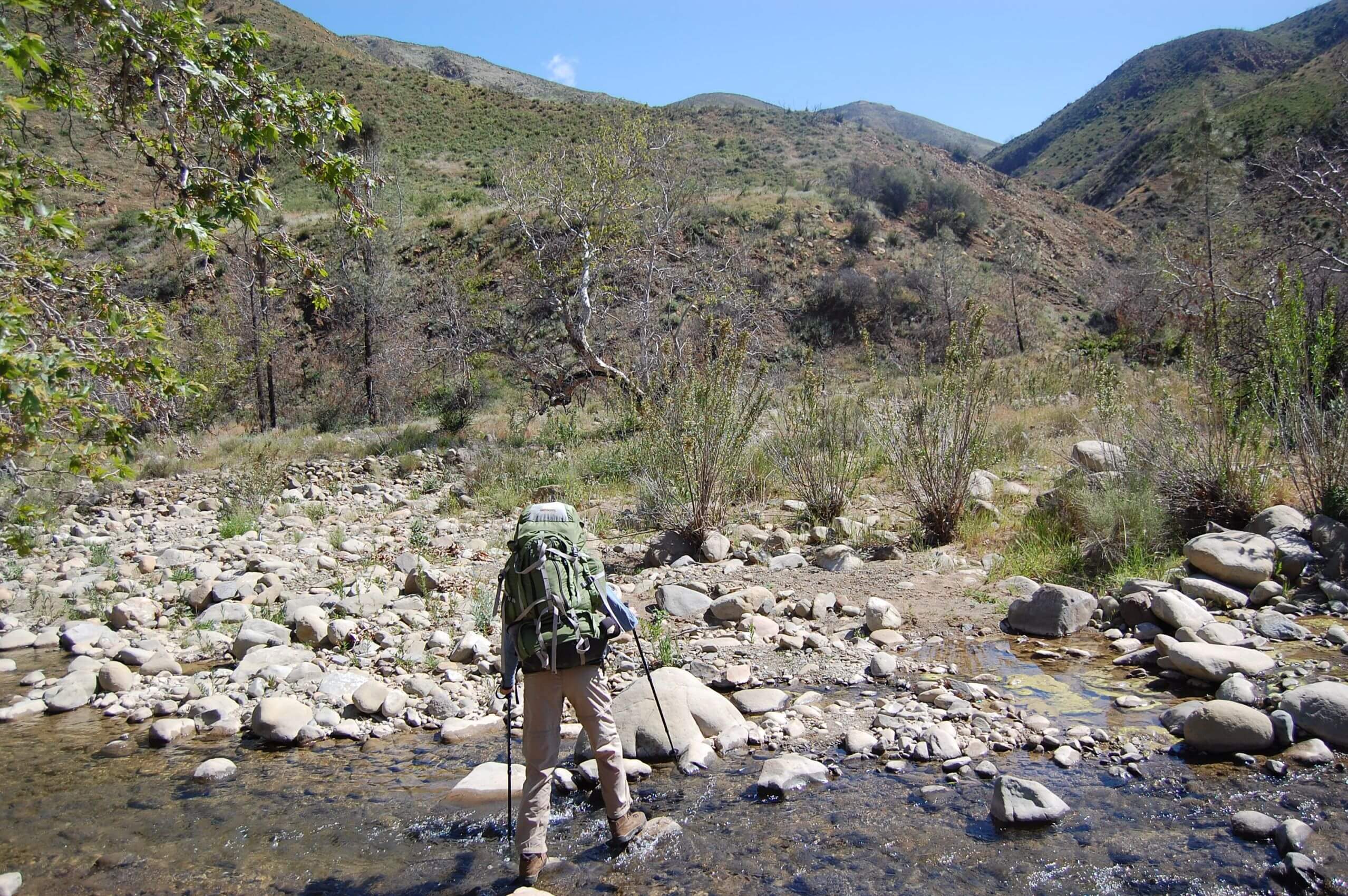
Brushy bushwhack was slow going next morning; once on Manzana we kept losing the damaged trail. David forgot to bring sandals for the 25 creek crossings! For each he had to sit down, remove boots, cross barefoot, dry feet and put on boots. At dark we were still in the canyon.
I tried to radio Dispatch, but no coverage in steep canyon. Crawling up on a ridge I made contact, but my garbled message did not convey “we’re okay just delayed” as I hoped.
I found that out next morning as we hiked the last 2 miles. I heard a helicopter overhead. Uh oh.
At the trailhead we met large party with dogs led by some of my firefighters. My incoherent call to Dispatch was misinterpreted. Word went out that the Ranger was lost—and was emailed throughout the organization! Morning search was launched.
My bosses were annoyed but many field people came to me and shared their own stories of Dispatch disasters in our steep canyon country.
Good memories: Community support, trail volunteers
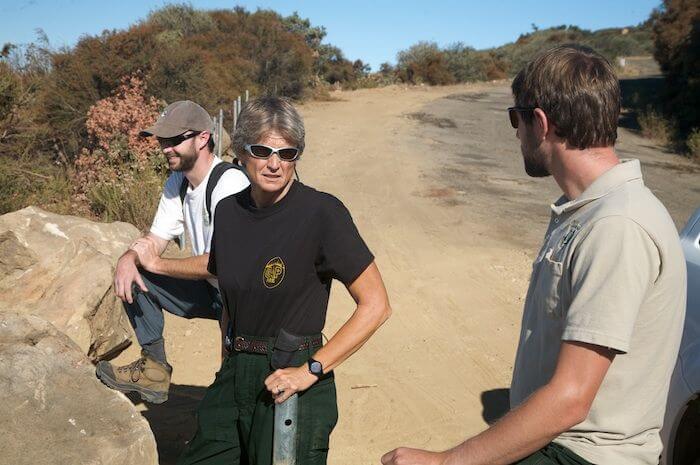
Our too-small staff was augmented with volunteers. We had stock (horses and mules) used for packing in trail crews and other field work. The Wranglers, a volunteer group of equestrians with their own horses, took care of our stock, helped with pack trips, and even showed them off in the August Fiesta Parade, Santa Barbara’s largest event featuring up to 400 horses and many floats.
The Los Padres Forest Association (LPFA) had gung-ho trail volunteers. (They still are the major trail workers and information source today!). My trail manager Kerry Kellogg treated LPFA like staff; they used our vehicles, gear, and buildings.
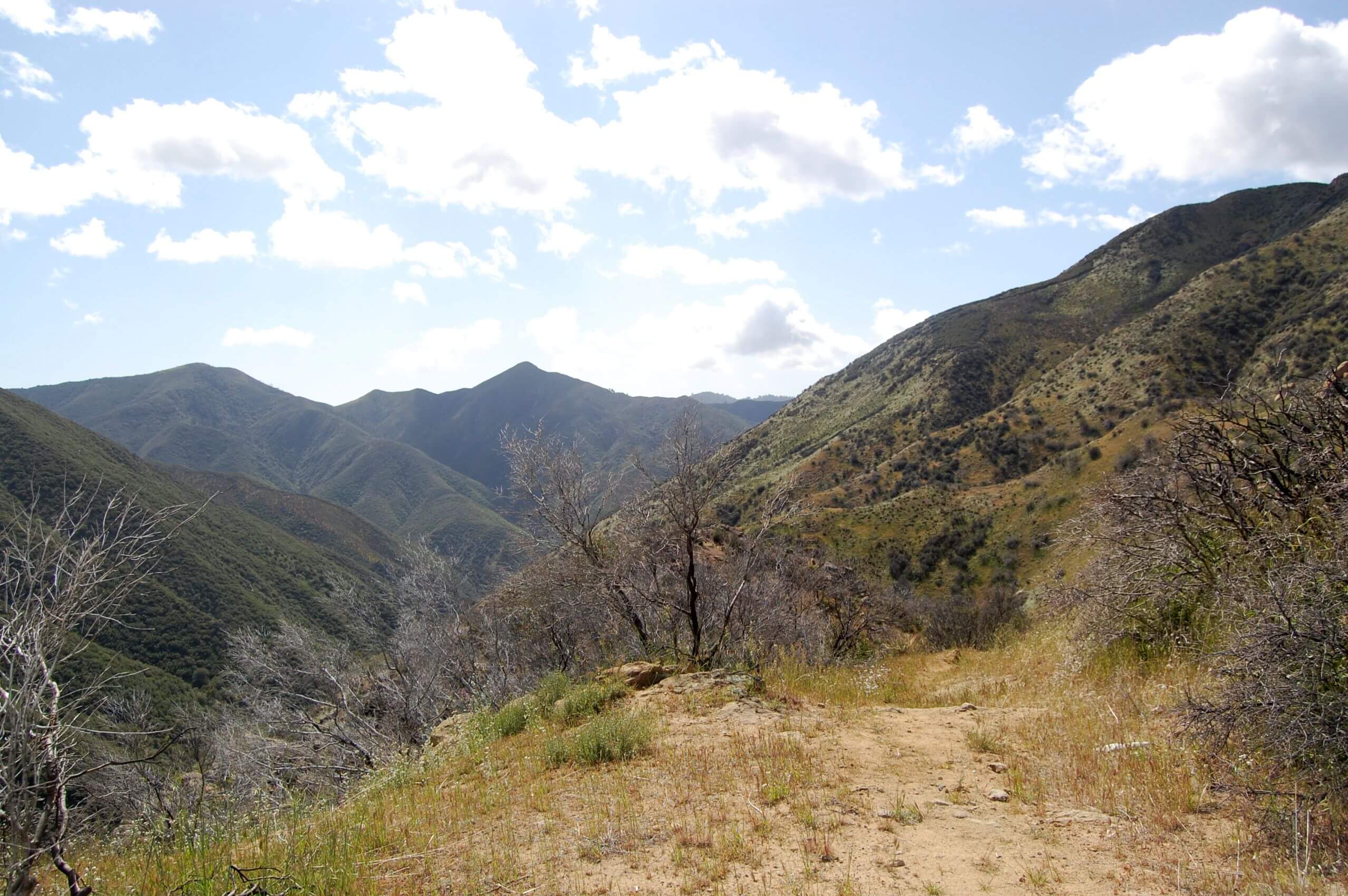
LPF is fire-adapted landscape that burns frequently and rapidly revegetates with chaparral; a major challenge to keep trails open. Zaca denuded our high-country pine forests and eroded steep canyons, severely damaging our premier trail into the backcountry, the Santa Cruz National Recreation Trail. (The lower section which contours around several side canyons known as “40 Mile Wall” continues to be a brushy eroded nightmare for those who attempt it).
I was contacted by the head of a local non-profit that worked with underserved youth in Santa Barbara—he had a $1 million grant for restoration work in the Zaca Burn! Kerry hired a trails professional from another forest to oversee a project to rebuild upper Santa Cruz. The big red headed guy did fine with our diverse teen crew. We housed them in the Santa Cruz Guard Station, and they rebuilt trail from the cabin to Flores Flat. A highlight for me was bumping down the Santa Cruz fire road in a big truck with Kerry and others to the cabin, then hiking up that section. Area was still blackened from Zaca but a beautiful trail 3-feet wide trail had emerged.
Second visit: Red rock, waterfalls & blackened forest
I regretfully left my ranger job in February 2009 due to personal reasons and forest management that seem to thwart efforts to build and encourage a public service-oriented staff.
Soon after I left that job, David and I flew back from the East Coast for a 70-mile, 5-day “burn reconnaissance” trip in April 2009. We think we went up Manzana Creek from Nira campground, toward White Ledge to South Fork Guard Station and Sisquoc River, up Buckhorn Road to Big Pine Mountain, then back through burned pines on Mission Pine Trail and down Bigcone Spruce Trail to return down Manzana Narrows. We deciphered this route from first day photos and memories of canyons and burned pine forests (David, with his first digital camera, unknowingly started trip with nearly filled small capacity SD camera, so no photos after first day!)
Third visit: 16 years later, swept away!
When we moved back to the West from East Coast in 2016, revisiting Santa Barbara was on my bucket list. In 2025 we had drought in Arizona, our winter home, but Southern California got ample winter rain—too much. Our 2025 trek followed part of the Condor Trail (hoping it would be a nice way to see area on reasonable trail) but none of trip was on my district! I wrote another blog about being swept off my feet on that trip by the flooded Sisquoc River and being happy on my 70th (milestone) birthday to be alive!
Fourth visit: Ominous rain forecast, changed plans on-the-fly
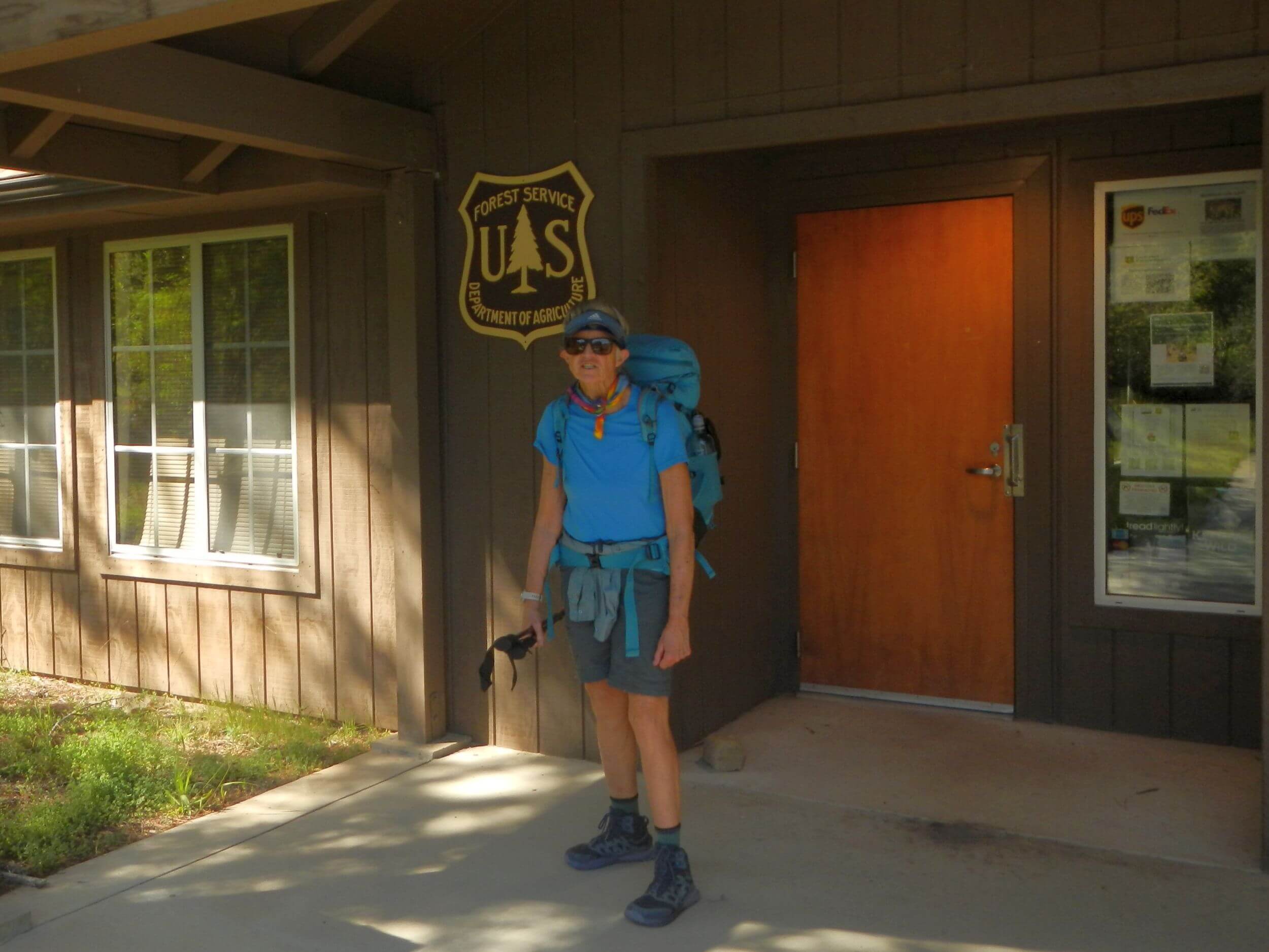
For my 71st birthday in 2026, I insisted on another California hike—this time on “my” ranger district! Our planned route was traverse of pine country (San Rafael Wilderness) then loop (Dick Smith Wilderness) that included Buckhorn Road—a “cherry stem” (legal within wilderness) road. I recall driving that road for work in 2008 although it was closed to public vehicles. In 2026 Buckhorn Road on SBRD side was not usable by vehicles after storm damage in 2023.
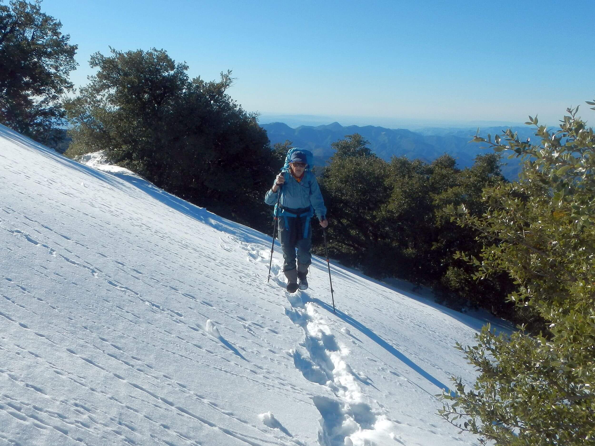
The 2026 visit looked almost as ominous as 2025. Spring and fall rains in southern California had Santa Barbara at well over 100 percent of “normal rainfall” by January 2026. Another storm was due right before our visit! But unlike 2025 (when storm came in the middle of our hike) forecast called for sunny weather by the time we started hiking with two weeks clear weather ahead. Driving from Tucson we hit heavy rain in San Bernardino that persisted rest of the day; driving north on I-215 I saw high peaks on the Angeles National Forest cloaked in snow! But of course, they were 10,000 feet high; we only were going to 6000 feet! So we started our trip as planned but deep snow altered our final route.
Wild wind, snow slog and thorns!
Our eventful Santa Barbara return included:
- Gale winds that came roaring up the valley below our first camp on Cachuma Road; the 40+ mph crosswind gusts flattened my side of the tent on top of me! David got tent stabilized but blowing dust ruined tent and sleeping bag zippers.
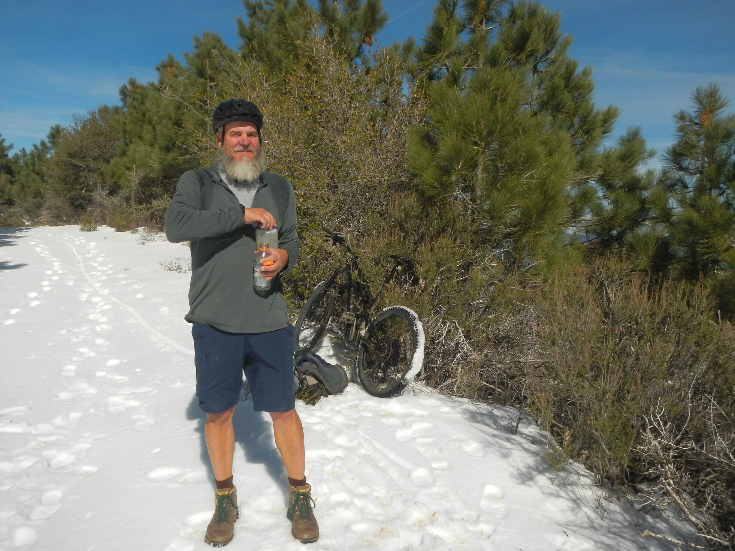
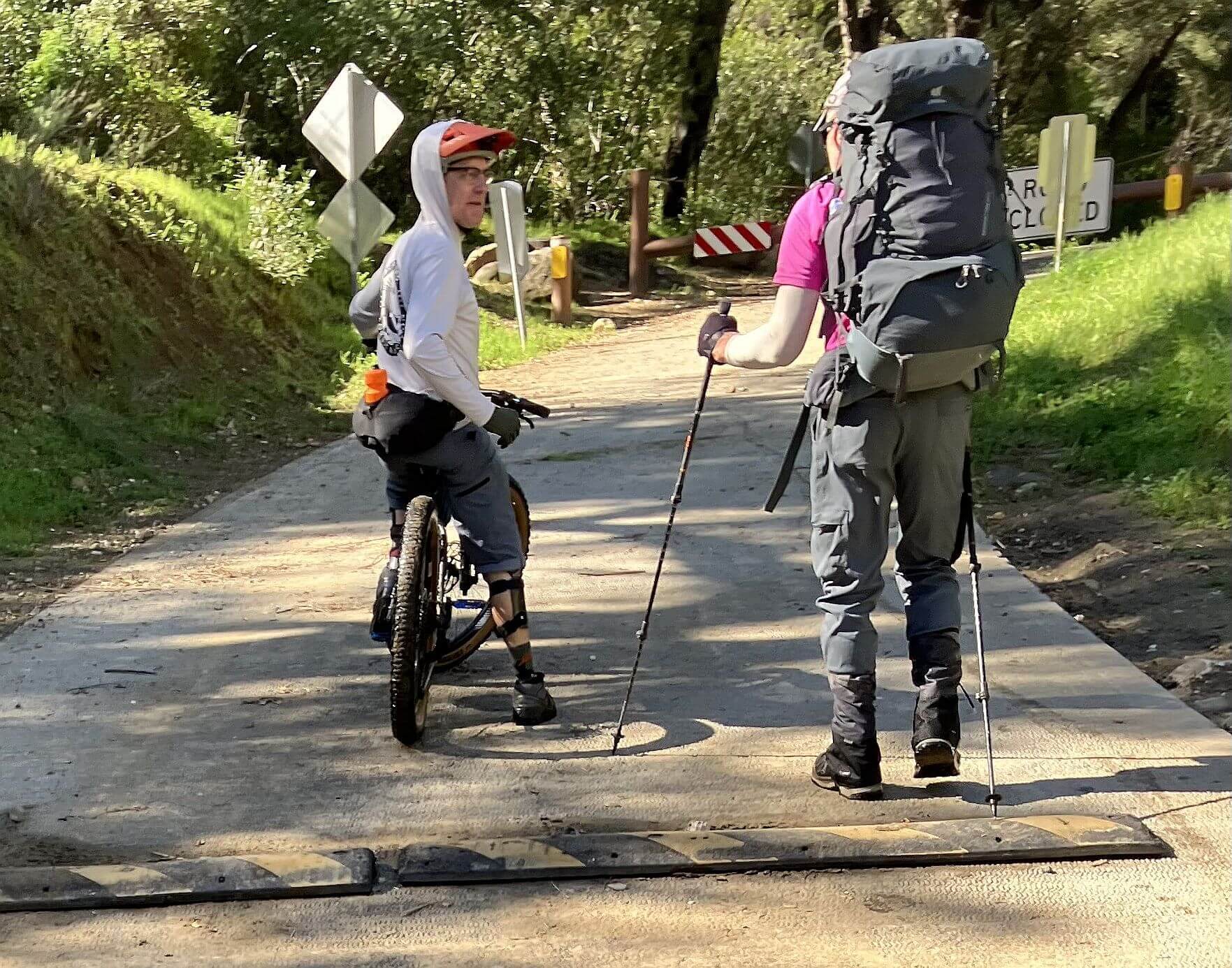
- Mincing through icy thawed and refrozen north slope snow about a mile above camp. The good thing was a reunion! A big guy pushing a mountain bike moving more confidently than I caught up with me. He went ahead to an open area and stopped to check his phone. I passed him and David stopped to visit. A few minutes later, they both were running after me! It was Jason Beckstrand, president of the LPFA—he remembered my Ranger days. He’d asked David, “what brings you here?” and he said, “my wife used to work here.” Jason said, “Cindy Chojnacky” and took off to catch up with me!
- We gave up on our visit to pine country after two very slow snow days—6 and 5 miles, both days camping in snow short of official campsites. Instead, we dropped down Santa Cruz Trail from Mission Pine camp—doing the “second half” of our planned trip first.
- We soon got out of the snow but spent 3 hours face first into the forest’s notorious head high thorny chapparal which clogged switchbacks after first mile, tearing pants and shirt sleeves. The upper trail apparently had not been cleared since Zaca Fire, although lower trail was in better shape.
Impromptu return triggers memories
Our snow-escape sent us through part of SBRD. Memories were stirred at beautiful Kellogg camp—named for my legendary trails supervisor who retired in 2011. The fire grate was filled with dirt and area unused for years, but we enjoyed early camp in small meadow surrounded by huge oaks.
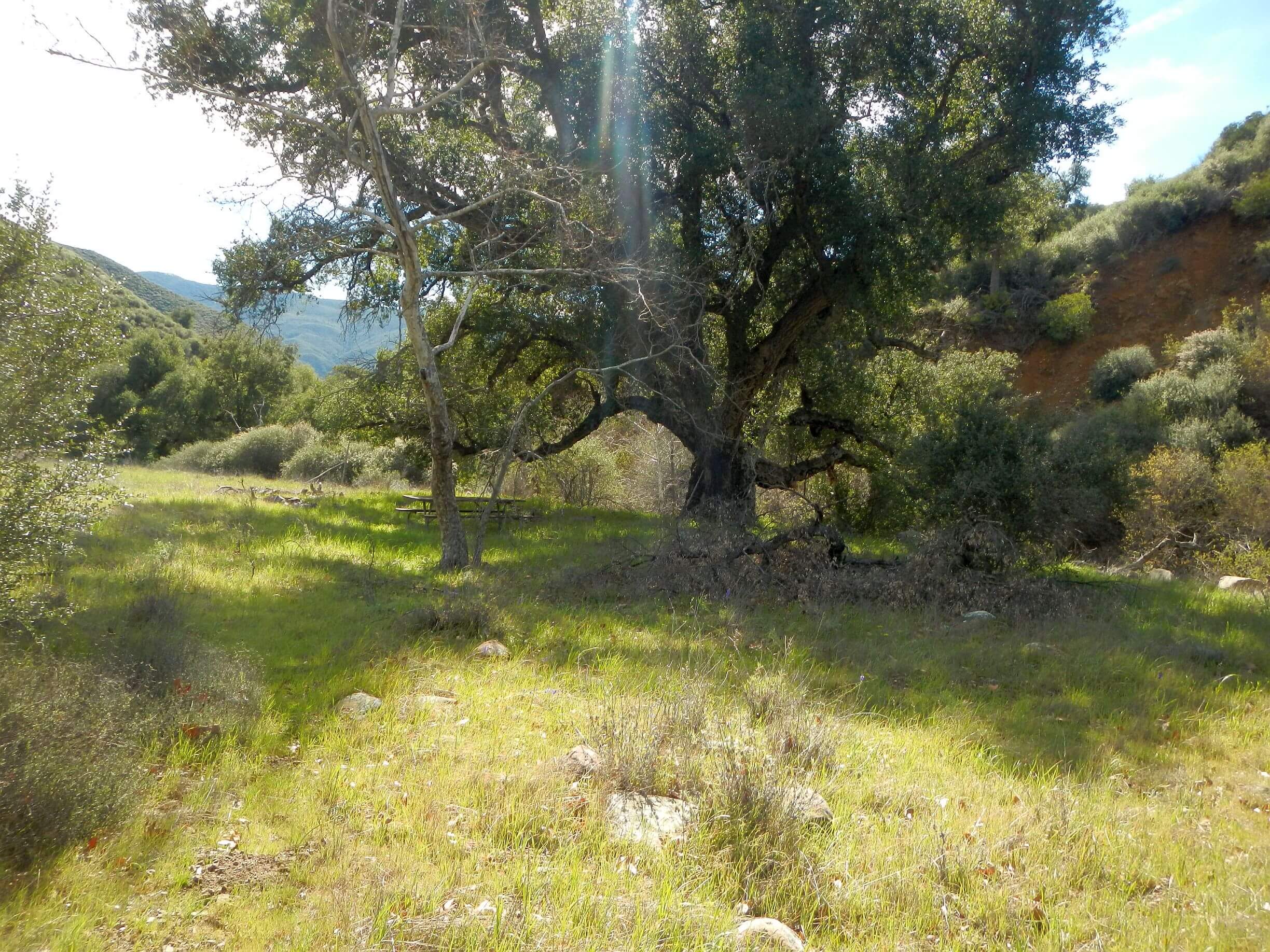
Trail much nicer along creek with several moderate crossings. A pleasant surprise was Flores Flat, which I had visited in 2008 to inspect my young crew’s work on the Santa Cruz Trail. The flat was all black then; now it was a beautiful green pasture with a few big oaks that survived fire. My teen crew’s trail was passable but not the super-highway I remembered from 17 years ago. After climb to a ridge, we descended rolling hills bright green from grasses delighted with all the rainfall.
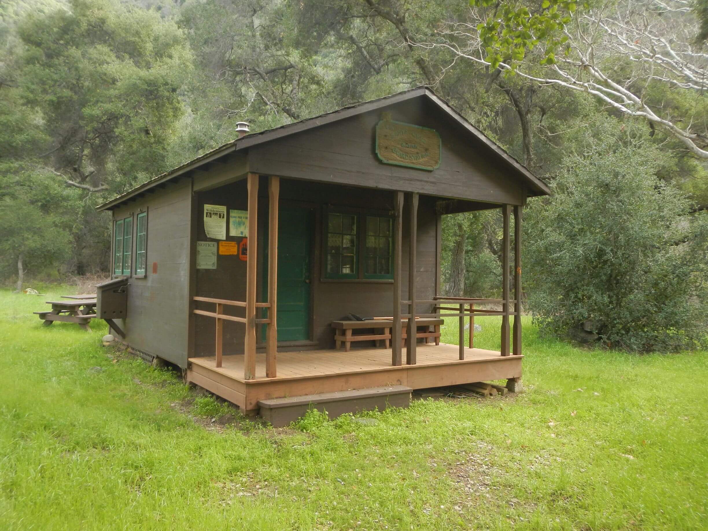
David called early camp by lovely and recently repainted Santa Cruz guard station as it was only reasonable campsite for next few miles and offered the chance for lower morning crossing of Santa Cruz Creek. The cabin and toilet closet were locked. (I have a Forest Service key hanging on my bulletin board in Tucson that would have been helpful). From windows the cabin looked tidy inside.
We walked down to see where road forded Santa Cruz Creek—two tributaries met there and as expected the combined creek ran high (velocity partly from waterfall a mile up one tributary). The Santa Cruz Jeep Way my staff and I bumped down in 2008 had not been driven in years and the crossing was blocked by big rocks and down logs.
Next morning, David crossed the roaring creek first; at deep spot near end, he faltered slightly. Observing this, I accepted his offer to return and transport my pack. I followed him; when I hit thigh-deep rushing water, I could not move my pole against the current! Not wanting to repeat last year’s float trip, I grabbed back of my pack and was towed by pack animal David across the high rushing water to shore. He said he didn’t even notice his hitchhiker.
The trip out via Buckhorn brought memories of visiting Happy Hollow Camp (once a guard station surrounded by thick pine forest burned in Zaca Fire). David got water at the big rain cistern at turnoff.
Upper Oso Campground near bottom of the road (also closed from flood damage) was familiar from after-work trail jogging the Aliso Loop Trail between Oso and Sagehill campgrounds—evening thunderstorms made slippery clay.
We stopped after slogging knee-deep Santa Ynez River at First Crossing; a mountain biker slowly pedaled the river and caught us. Another LPFA leader, Chris Orr, also remembered me!
We passed small private housing (called “recreation residences” by the Forest Service and used as a cheaper alternative to expensive Santa Barbara by a few lucky folks who own private primitive cabins on national forest land under FS regulations) and the remnants of trailer court where many of my fire seasonals and families used to live. Only one permanent trailer now and a few portables. (A hasty new housing policy pushed by a forest official forced my employees out of this park by limiting tenure and requiring owners to move permanent trailers or sell them to others—a financial hardship. Employees sued but lost to FS management. A bitter memory).
We saw a few run-down houses owned by the district. One was nicely fixed up. (I later learned that current ranger’s wife works in Los Angles, so they have home there, but ranger also uses district quarters). The district office was closed on Friday! (A contact at the forest said district was “short staffed” and had tough time remaining open. When planning the trip, David talked with an LPFA volunteer who staffs the office some days.)
During my brief ranger tenure, I had wanted to eventually live part time in the “quarters” and keep the district office open on Saturdays! I also wanted to fill our large work yard with seasonal employees again! Well, the seasonal fire crew was back on duty, and the yard was in good shape. Some of the crew was also bustling around the district office, cleaning up with weed cutters and leaf blowers. Not having a fire to fight, they were killing time doing yardwork.
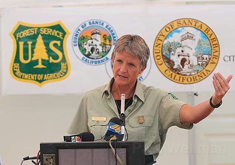
I also had hoped to enlist my firefighters (I had up to 100 including seasonals) on trail work when they weren’t fighting fires. Those guys know how to work! In the weird Forest Service organization, fire and law enforcement did not work for the ranger although my fire managers and law enforcement officer checked in with me on everything and I was theoretically “in charge” of fires on my district, required to show up for all fire camp briefings and sign the daily fire management plan as the agency administrator representative (AAR). My public affairs/journalism background came in handy as I often had to speak at public and media briefings and was soon known as the “TV ranger.”
Using fire crews for wilderness trials might have also required battling the “wilderness purists” on the Washington Office wilderness staff, who didn’t understand why we needed to use chainsaws in wilderness to combat rapidly invading post-fire chaparral. Since firefighters often were given exceptions to the Forest Service’s “primitive tool” rule to combat fire in wilderness, it seemed reasonable to use the same exception to combat post-fire vegetation. However, reasonable is not the word I would use to describe Forest Service management practices. One of many reasons Forest Service ended David’s and my careers earlier than planned.